I. Drier and Cooler Air Returns: A cold front will pass this evening and allow a much less humid and cooler air mass to return to the state. Dew points will fall into the 50s by Monday morning and highs should only reach the upper 70s to around 80 Monday afternoon. Refreshing air will remain in place through the day Tuesday.
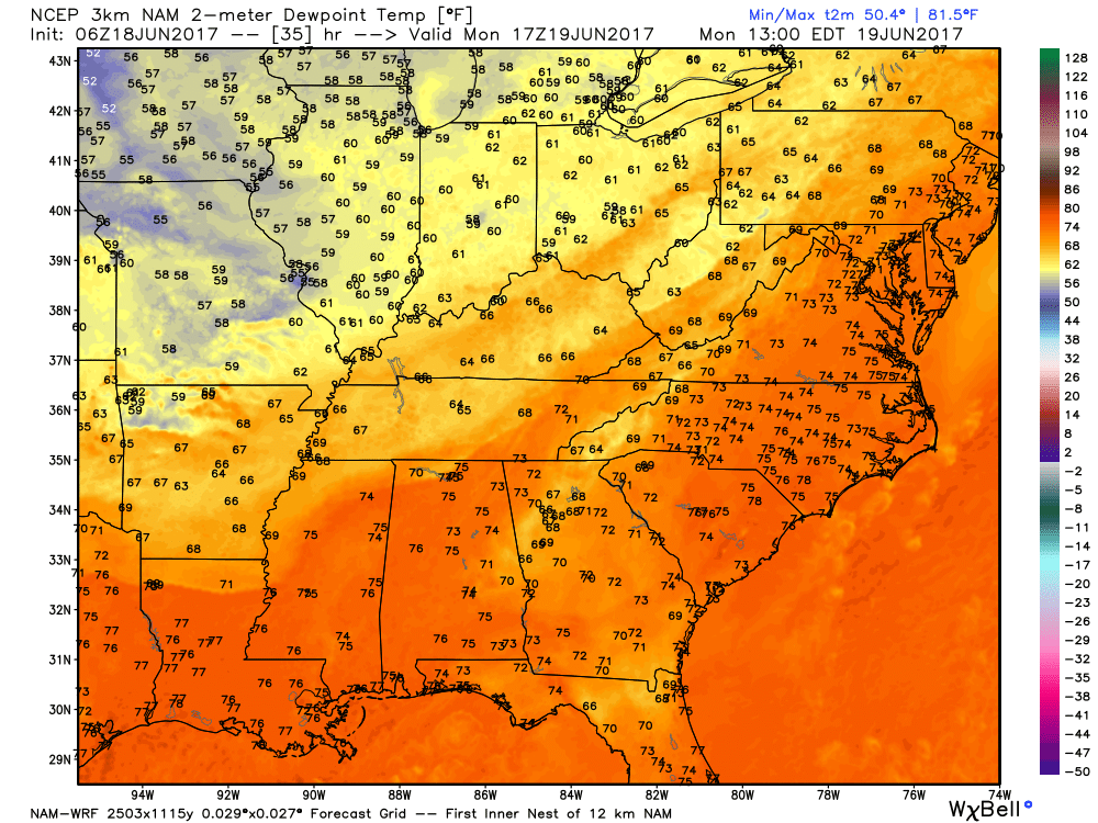
A much less humid air mass will arrive to open the work week.
II. Watching the Gulf: All eyes will be on the Gulf of Mexico this week as it tries to breed early season tropical “mischief.” There are many more questions than answers right now concerning the all-important details (ultimate track and strength), but confidence is high on a depression or storm forming in the Gulf by middle to latter portions of the week. Early thinking would place more emphasis on this being a big inland rain event across portions of the southeast, as opposed to this thing ramping up fast enough to be a big wind/ surge problem, but stay tuned.
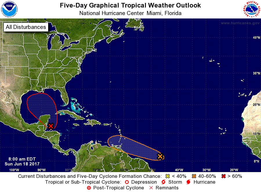
Confidence is high on early season tropical development this week in the Gulf of Mexico.
III. Unsettled Weather Returns: A storm system will approach the region by the latter portions of the work week, including the weekend. As a result, a warmer and increasingly moist air mass will return and help spawn showers and thunderstorms. Unfortunately, timing isn’t our friend as numerous showers and thunderstorms are forecast Friday-Sunday. Locally heavy rain is also a good bet.

Heavy rain and storm chances increase late week.
IV. June Ends On A Cool Note: Once we get rid of the significant storm next weekend, an unseasonably cool air mass will build in over the Great Lakes and Ohio Valley in the 8-10 day time period. How do highs in the upper 60s to lower 70s sound and lows in the middle 50s?
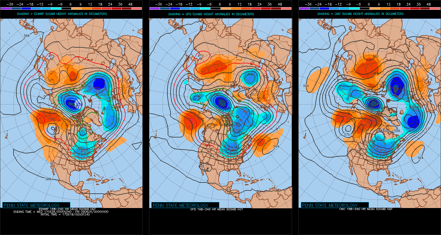
Models agree on an unseasonably cool close to June.

 Week 2:
 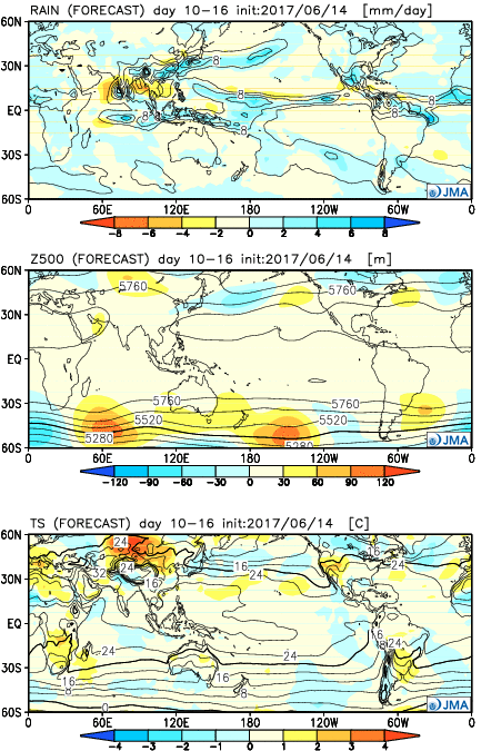 Weeks 3-4:
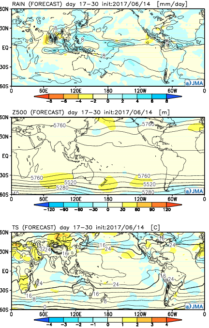
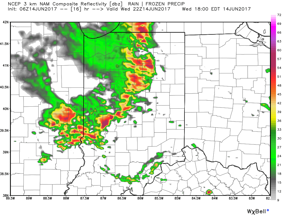
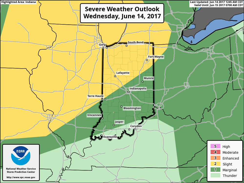 Similar to Tuesday, any storms that develop will be capable of locally heavy rain and flash flooding. While storms should move in a quicker fashion today, precipitable water values (PWATs) remain downright tropical and will exceed 2″ later this afternoon.
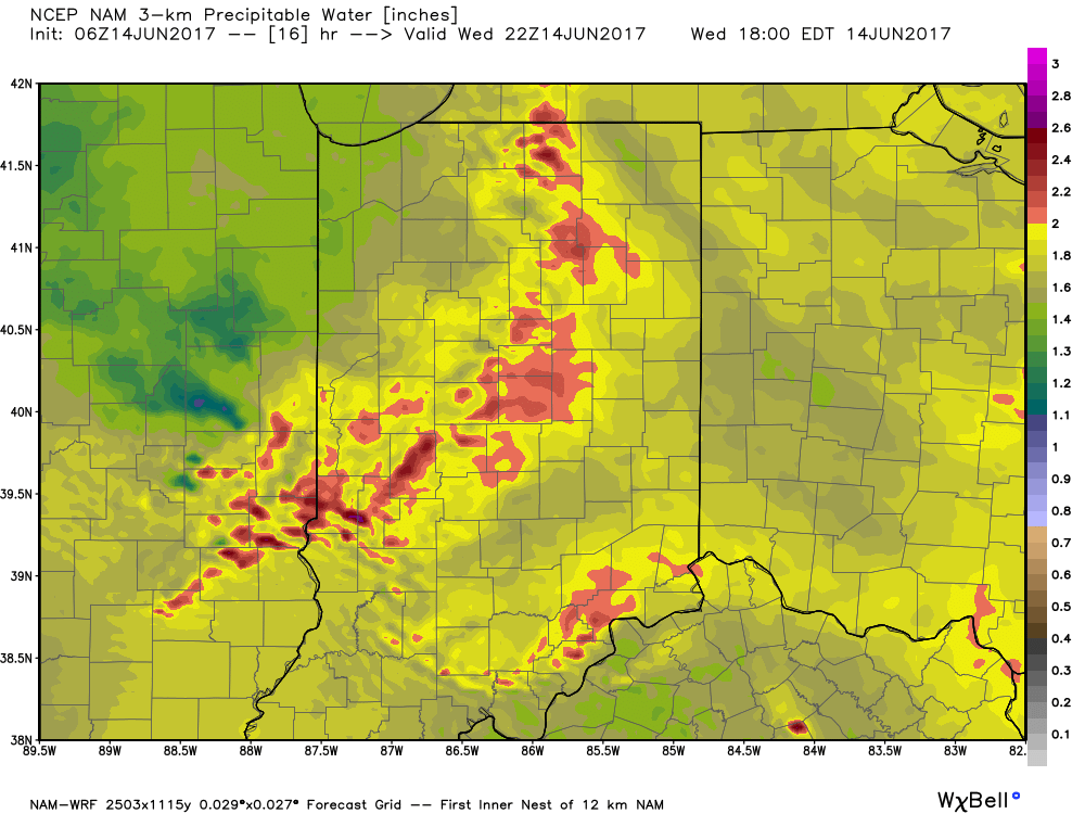 Overall storm coverage should become more widespread as we push into the afternoon and evening hours. Here’s what the radar may look like during the 4p, 6p, and 10p time frames:
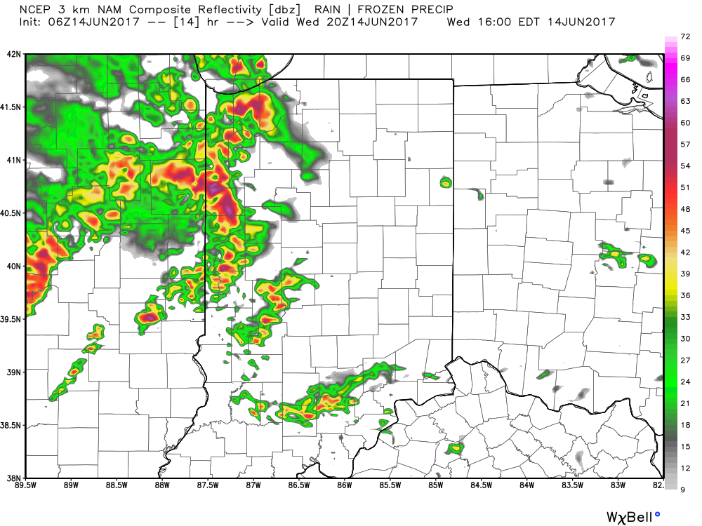
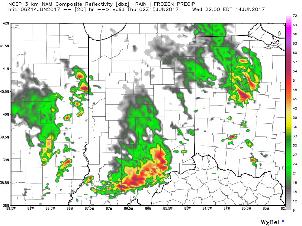 From a severe perspective, the biggest concern is damaging straight line winds with stronger storms. Remain weather-aware later today, friends!