Sunday Afternoon Video: More Like March Than May Over The Next Couple Weeks…
You must be logged in to view this content. Click Here to become a member of IndyWX.com for full access. Already a member of IndyWx.com All-Access? Log-in here.
You must be logged in to view this content. Click Here to become a member of IndyWX.com for full access. Already a member of IndyWx.com All-Access? Log-in here.
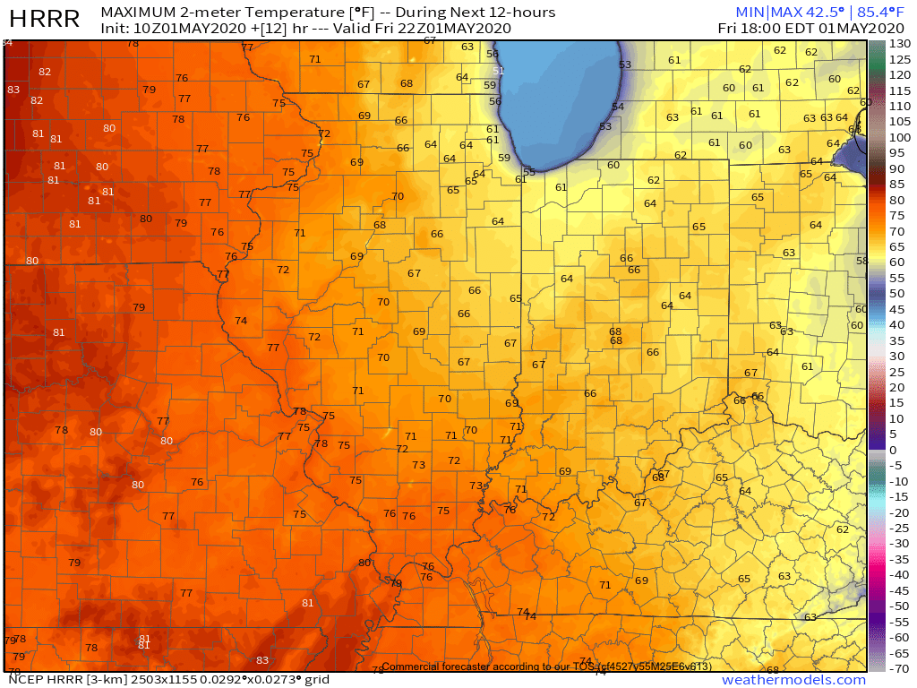
A gorgeous Friday is dialed up complete with plentiful sunshine and temperatures warming quickly from the mid and upper 30s into the mid and upper 60s.
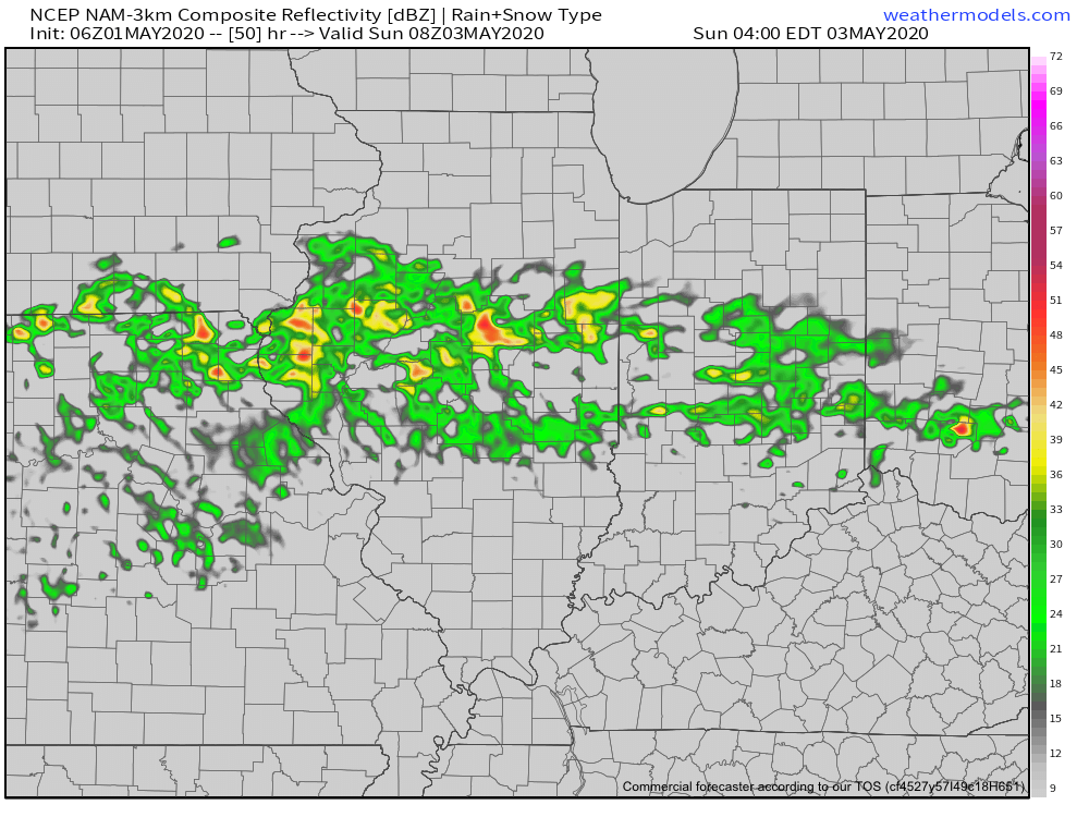
A couple weak impulses of energy will scoot through the Ohio Valley over the next 24 hours and while they will spark a few showers/ embedded thunder predawn Saturday and again Saturday night, most of the daytime hours Saturday will also feature dry conditions.
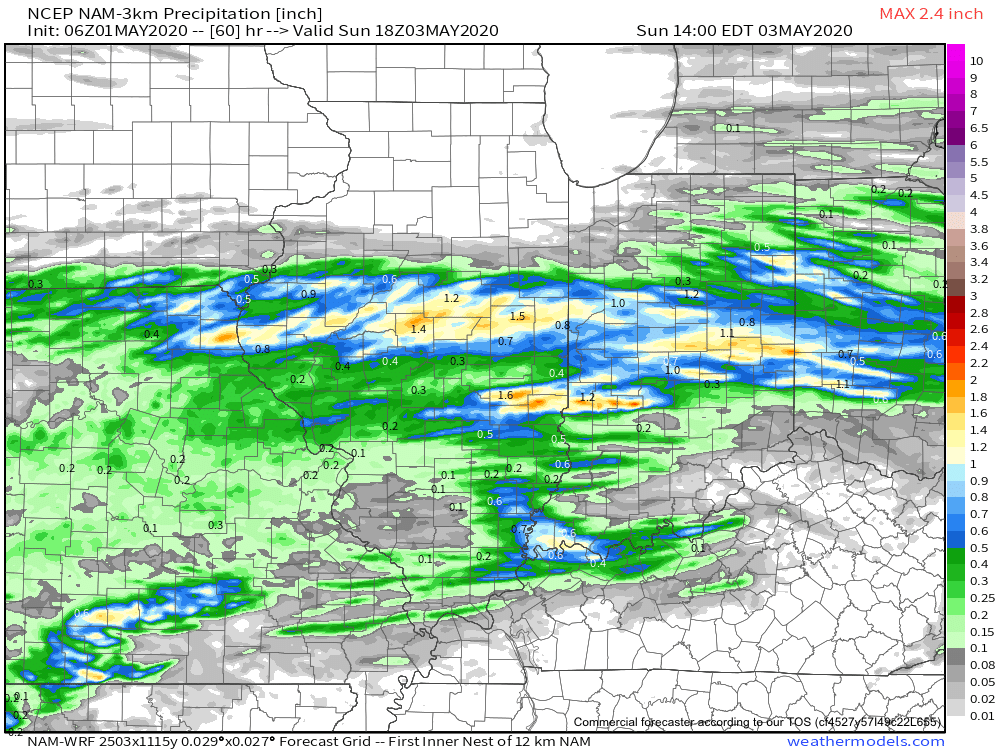
That begins to change Sunday as widespread showers and thunderstorms are expected to rumble across central Indiana, especially during the morning hours. Locally heavy downpours are likely.
A quick 1”-1.25” is a good bet across the heart of the state with this system Sunday morning.
Dry conditions will quickly return Sunday evening into Monday thanks to high pressure briefly building back into the region. This will lead to a pleasant open to the work week with highs topping out in the middle 60s.
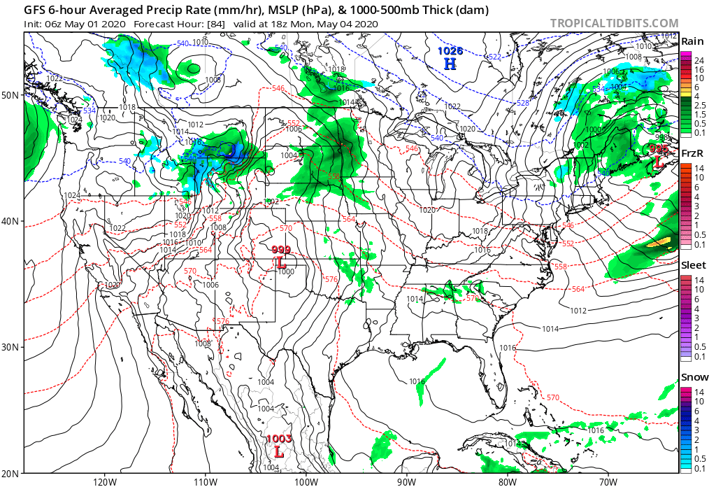
Unsettled weather returns as early as Tuesday with increased chances of showers and thunderstorms ahead of a strong cold front.

Though we’ll certainly turn cooler for the middle to latter part of the week, this will only be a precursor to what lies ahead behind yet another strong cold front late next week.
The air will likely challenge records into the Week 2 time frame (May 8th-14th), including the threat and increased likelihood of late season frost/ freezes. We also likely haven’t seen the last of the snow flakes for the season either…
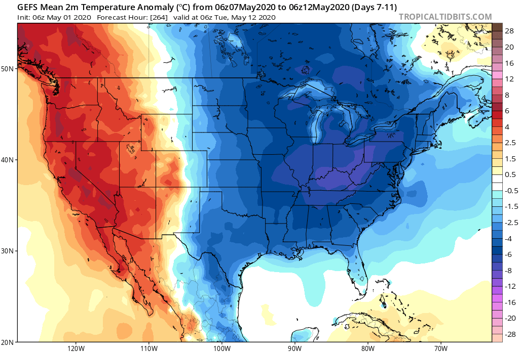
You must be logged in to view this content. Click Here to become a member of IndyWX.com for full access. Already a member of IndyWx.com All-Access? Log-in here.
You must be logged in to view this content. Click Here to become a member of IndyWX.com for full access. Already a member of IndyWx.com All-Access? Log-in here.
We may only have a few days left in April, but widespread frost is being reported across north-central into east-central Indiana (yet again) with most across the region in the lower to middle 30s this morning.
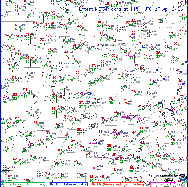
Sunshine will dominate to start our Monday before mid and high level clouds increase this afternoon into the evening hours. Eventually these clouds will produce scattered showers by evening (targeting a 6p-7p arrival into central Indiana).
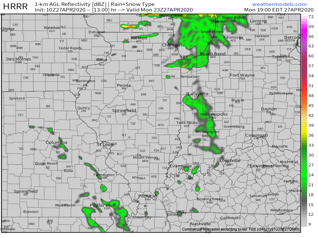
Initially these showers should be very light and scattered in nature, but heavier rain and embedded thunder will develop during the overnight hours.
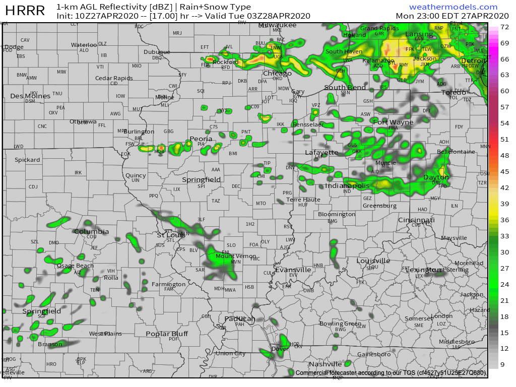
Showers and embedded thunder will exit Tuesday morning and most of the day will be rain-free, including a return of sunshine. This will help boost high temperatures into the lower 70s Tuesday! Unfortunately, an approaching cold front will lead to a return of storms Tuesday evening and much cooler air by midweek. A few of the storms could reach strong to severe status Tuesday night with the primary concern being damaging wind and large hail.
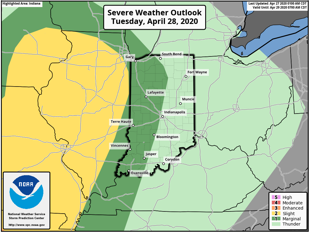
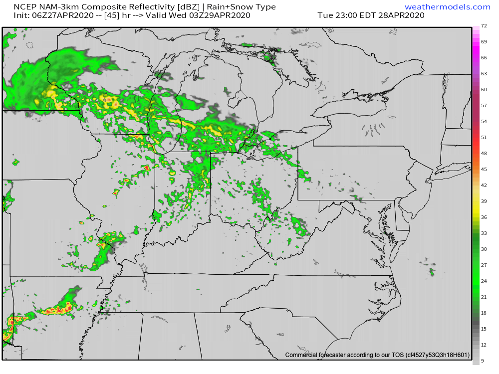
The cold front will sweep through the area Wednesday followed by a cut off upper low “wobbling” around the Ohio Valley Wednesday night into Thursday. This will lead to windy, showery, and much cooler conditions for midweek. In fact, temperatures Thursday will likely fall into the 40s during the daytime.
By the time all is said and done, we think most central Indiana communities can expect between 1.25″ and 1.75″ of rain, but there will be some locally heavier amounts in excess of 2″.
Major improvements are ahead as we get set to close the work week. High pressure will briefly build into the area, supplying plentiful sunshine and warmer conditions Friday.
The warmth will persist into the weekend and this morning’s video update dives into the longer range.