VIDEO: Cut Off Upper Low And Late-May Thoughts…
You must be logged in to view this content. Click Here to become a member of IndyWX.com for full access. Already a member of IndyWx.com All-Access? Log-in here.
You must be logged in to view this content. Click Here to become a member of IndyWX.com for full access. Already a member of IndyWx.com All-Access? Log-in here.
You must be logged in to view this content. Click Here to become a member of IndyWX.com for full access. Already a member of IndyWx.com All-Access? Log-in here.
You must be logged in to view this content. Click Here to become a member of IndyWX.com for full access. Already a member of IndyWx.com All-Access? Log-in here.
A band of light showers is falling across southern Indiana this morning, but these are expected to diminish before pushing into central Indiana. Most of the remainder of our Wednesday should be rain-free.
The quiet times will give way to a couple of rounds of storms during the overnight and into Friday. Most notably for central Indiana, we think storm chances will increase significantly after midnight and through the predawn hours Thursday. Locally heavy rain and vivid lightning is expected with the stronger storms.
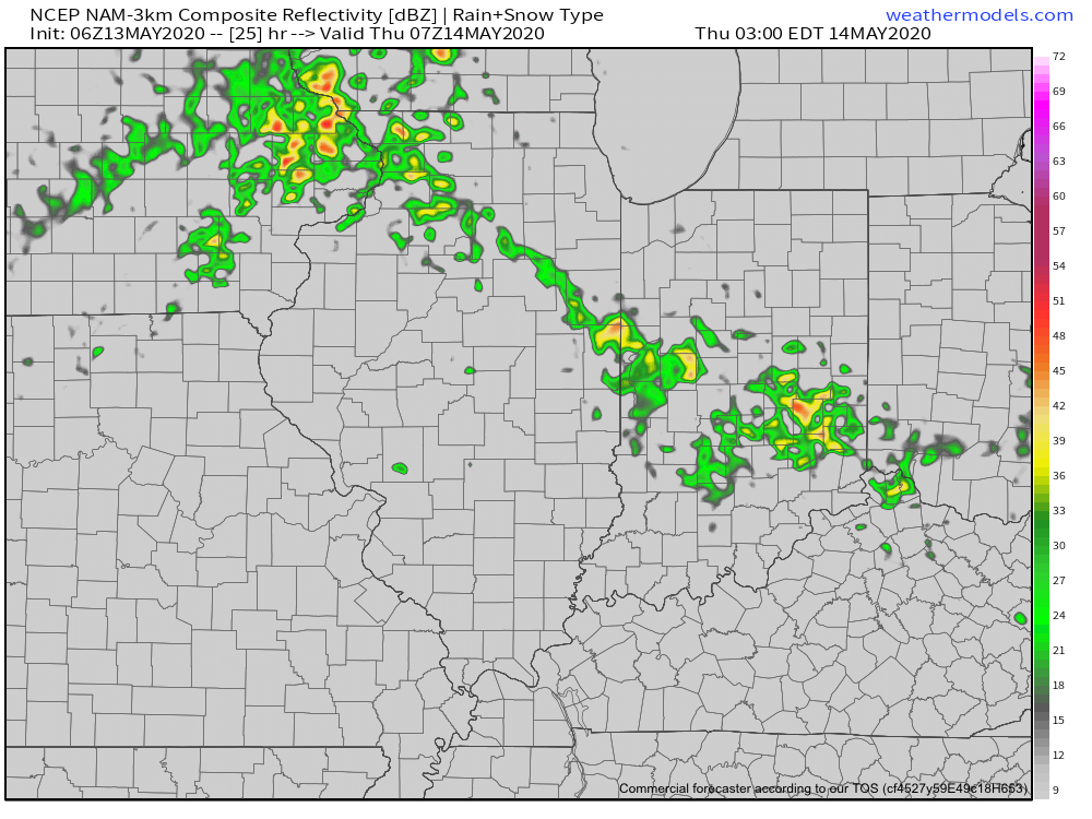
These storms are in association with a warm front lifting north through the state. Speaking of warm, we’ll certainly notice a difference in air masses between today (still relatively cool and dry) and tomorrow (much warmer and more humid). In fact, highs Thursday will flirt with 80° across most of central Indiana.
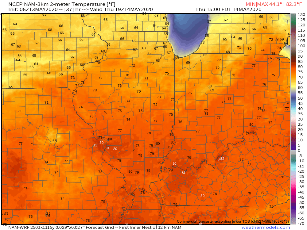
Once we get rid of the early morning storms, most of the remainder of our Thursday will be dry and feature a return of the sun.
Another round of storms is expected Thursday night into Friday, but most of these will remain well north of our area. A few of these could become severe across northwestern Indiana during this period.
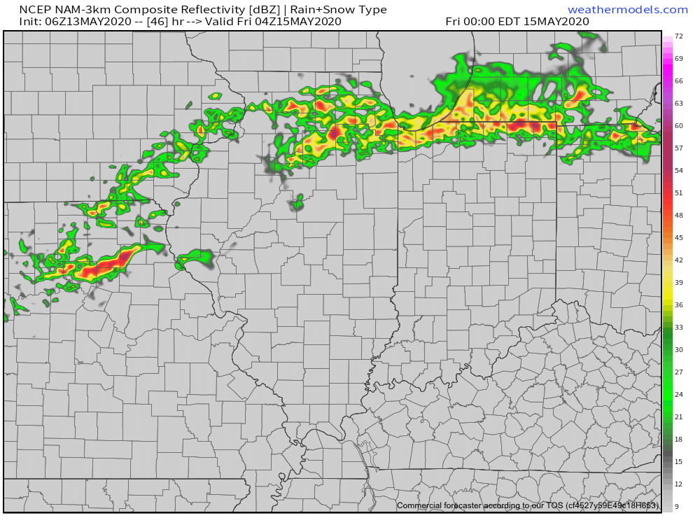
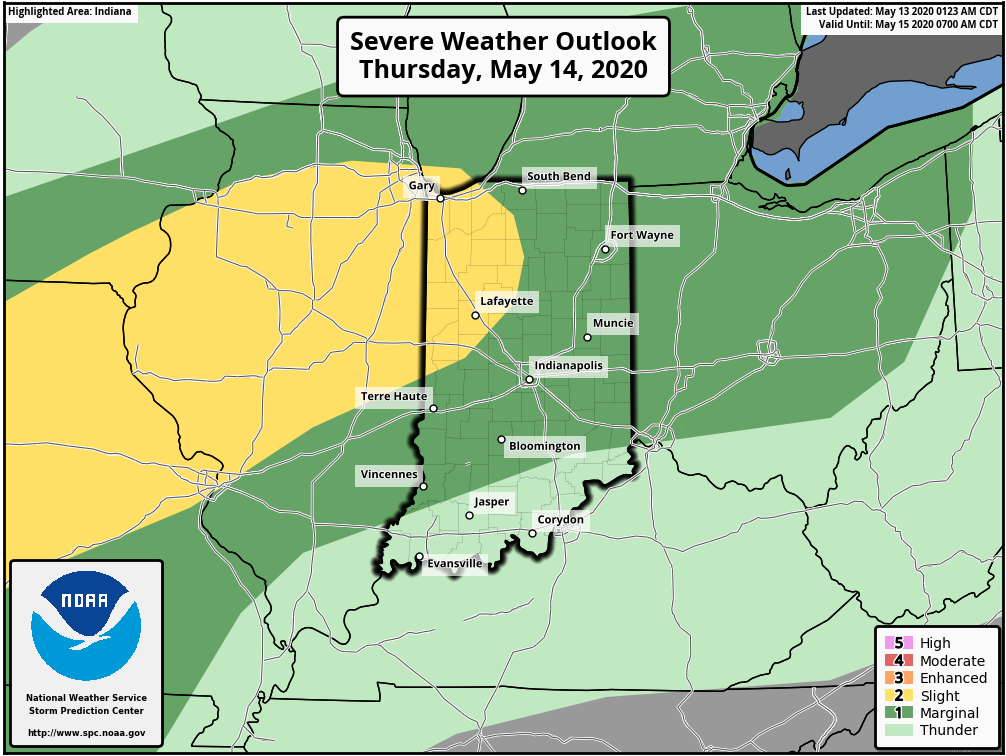
Rain and storm chances will increase once again during the day Friday across central Indiana. A few strong storms will be possible.
As we look ahead to the weekend, it appears we’ll be able to enjoy a mostly dry day Saturday (widely scattered storm possible) before more widespread storms return Sunday. Warm and humid conditions will prevail. A cold front will move through the area early next week which will allow for briefly cooler, drier air to move in during the 1st half of next week. Before that takes place, rainfall amounts between tonight and Sunday are expected to range from 1.5” – 2” with locally heavier totals across central Indiana. Heavier rainfall amounts can be expected across northern Indiana (widespread 3” to 4” amounts during the same period).
Indianapolis is running a whopping 8° below normal month-to-date. We’ve set new daily and all-time records already this month for the cold. Note the vast nature of this May chill.
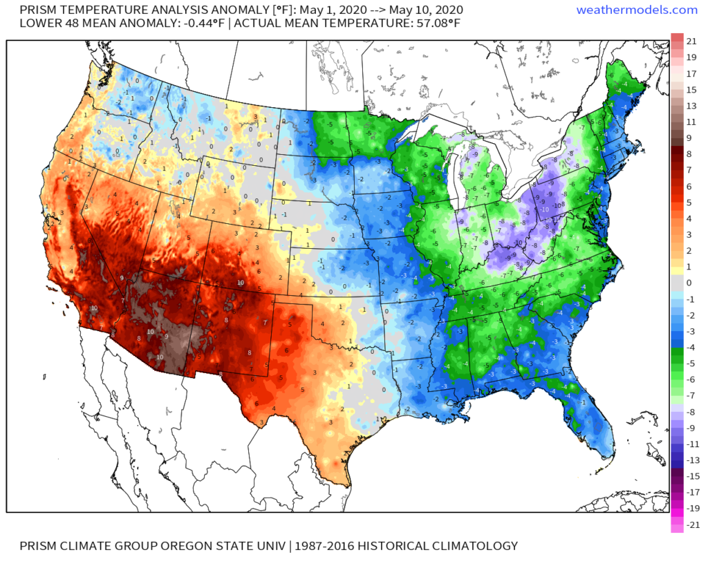
If you’re not a fan of the late season chill, hang in there, as a major flip in the pattern awaits. We alluded to this possibility in our May Outlook and it continues to look like a rather abrupt change is a couple of days away. While we’re dealing with frost this morning in spots across east-central Indiana, it’s looking more and more likely that the first true summer-like surge of air for the season arrives Thursday into the weekend. Warmth will be accompanied by a significant uptick in humidity levels.
The Week 2 period looks warmest, relative to average, and should feature at least a couple of days with highs approaching the 85°-90° mark.
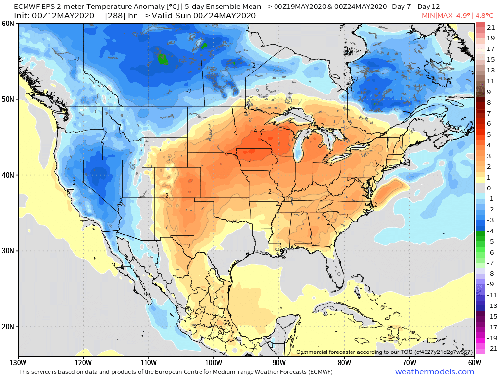
While most data maintains a warmer pattern to close the month, there are a couple of items to pay close attention to as we try and understand the longevity of said warmth.
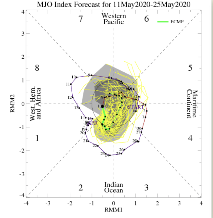
2. The PNA is forecast to take a negative dip which supports the coming flip to warm. However, recent ensemble data is bullish on a move towards a positive (some data shows even strongly so) state around or just after Memorial Day. This would suggest the window of warmth may be limited in duration. Simply based on looking at the chart below, one could build a case for a cool open to meteorological summer.

Finally, on the precipitation front, a wetter pattern is anticipated to accompany the warm change, but longer range data points towards this being only a temporary wetter regime. In fact, recent models are beginning to agree on a dry close to May/ open to June.
Much more later!