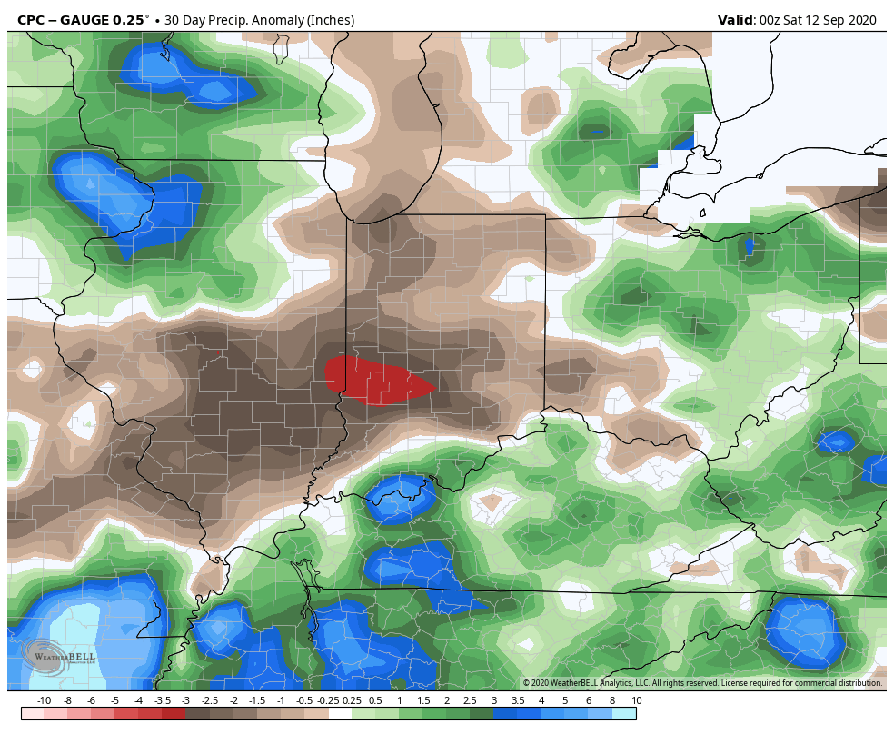
Another Problem Brought On By Dry Ground…
The upcoming (10) days will offer little, if any, relief from the recent dry stretch. Note the expanding (albeit still localized in the grand scheme of things) area of dry over the past (30) days:
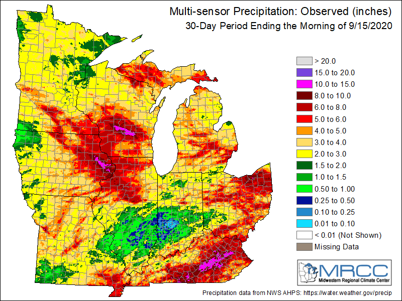
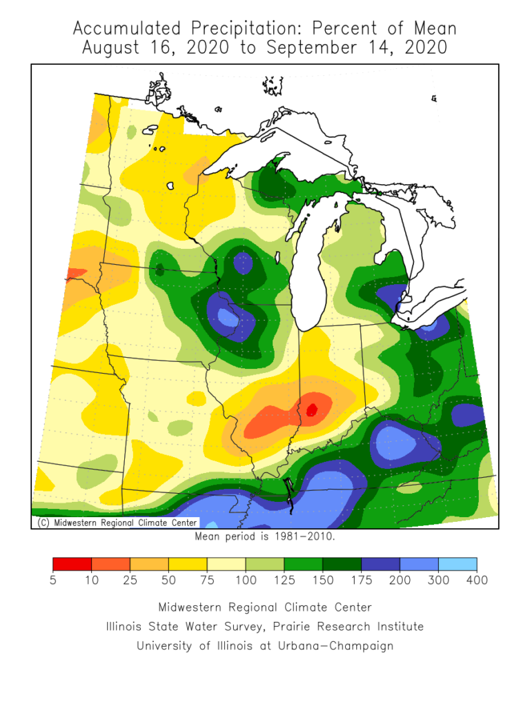
Some areas from south-central IL into central IN have only seen 0.10” to 0.50” over the past month.
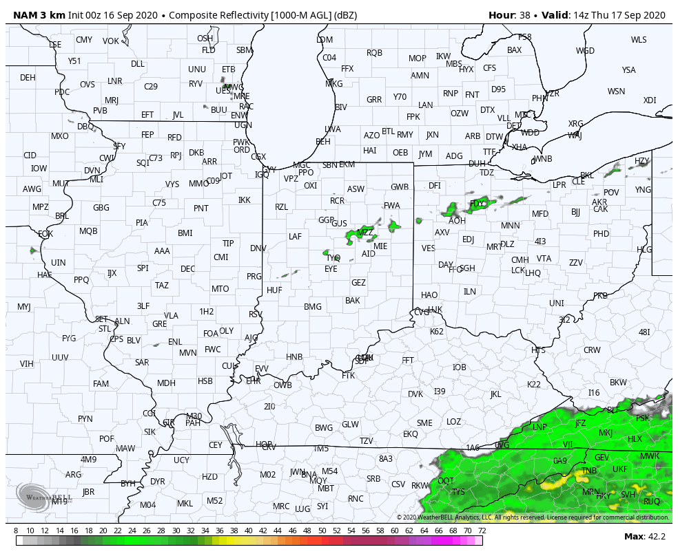
While a cold front will slip through the state Thursday, only isolated, weak showers are expected. Most will avoid any rain (best chance of seeing a passing shower will be across northern IN but even these won’t amount to much).
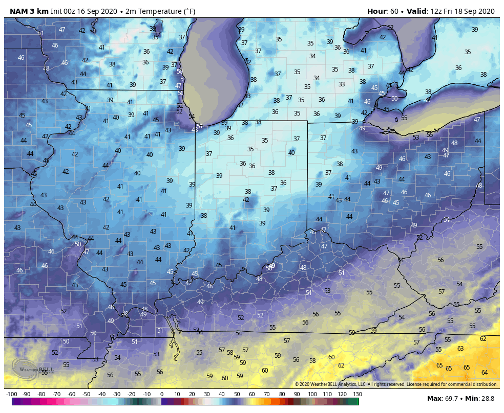
Of more interest will be the true jab of fall air behind the boundary. The dry ground will aid in allowing temperatures to fall to lower levels than if we had recently been dealing with wet conditions. In fact, outlying areas across central and northern parts of the state can expect the first frost of the season (2-3 weeks earlier than average) this weekend into early next week with overnight lows falling into the mid to upper 30s.
Quick follow up: Many have asked, and we are safe along the beaches of Walton Co. here in the Florida panhandle. Sally (now a category 2, 100 MPH hurricane) is making landfall near Gulf Shores, AL- 150 mi. to our west. We’ve accumulated over 15” of rain since 12a Tuesday and torrential downpours continue. Early this morning winds have gusted over 60 MPH and water spouts have been observed just off the coast of where we’re staying. As long as we maintain power, we’ll have a fresh video post later today.