Updated 03.19.21 @ 7:52a
The past week has dealt the region a couple of nasty storm systems. We had to deal with freezing rain to open up the work week. If that wasn’t enough, the big rain and wind storm yesterday led to flooding in low spots along with some downed trees across central Indiana (top wind gusts I’ve seen were in the 50-60 MPH) range. Given the saturated soils, it’s really a wonder we didn’t deal with more significant tree damage.
As low pressure departs to our southeast, high pressure will build overhead and support plenty-o-sun throughout the weekend. The pressure gradient will remain tight during this transfer of “power” today. Accordingly, ENE winds will continue to be quite gusty before diminishing by evening.
A couple gusts over 35 MPH will be likely through at least early afternoon.
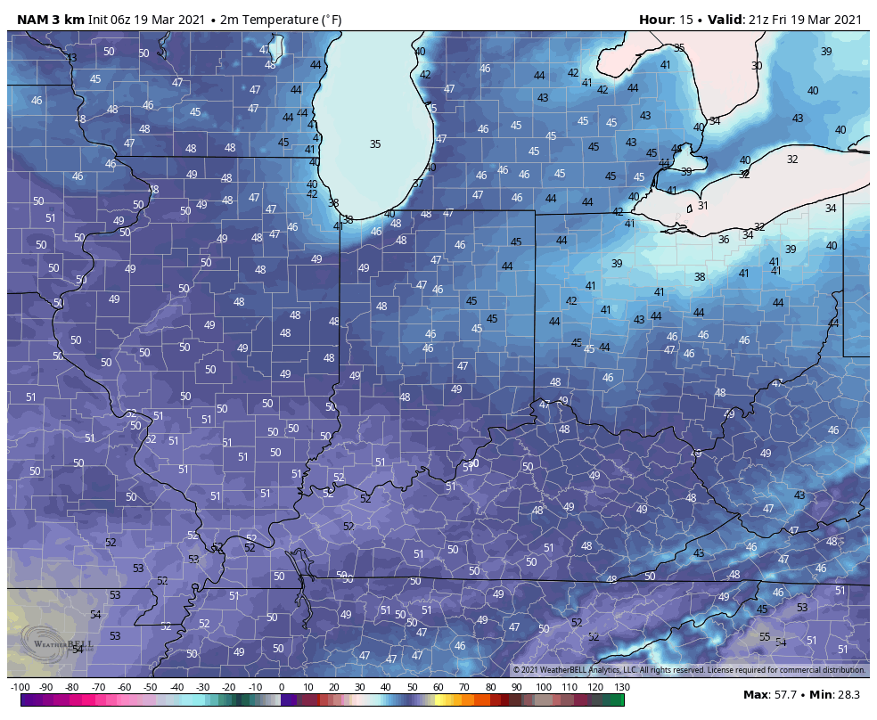
Highs today will top out in the upper 40s for most with mostly sunny skies.
High pressure will dominate straight through the weekend and to open the new work week. Consequently, expect an extended stretch of sunshine along with moderating temperatures. We’ll top out in the lower to middle 60s by Sunday!
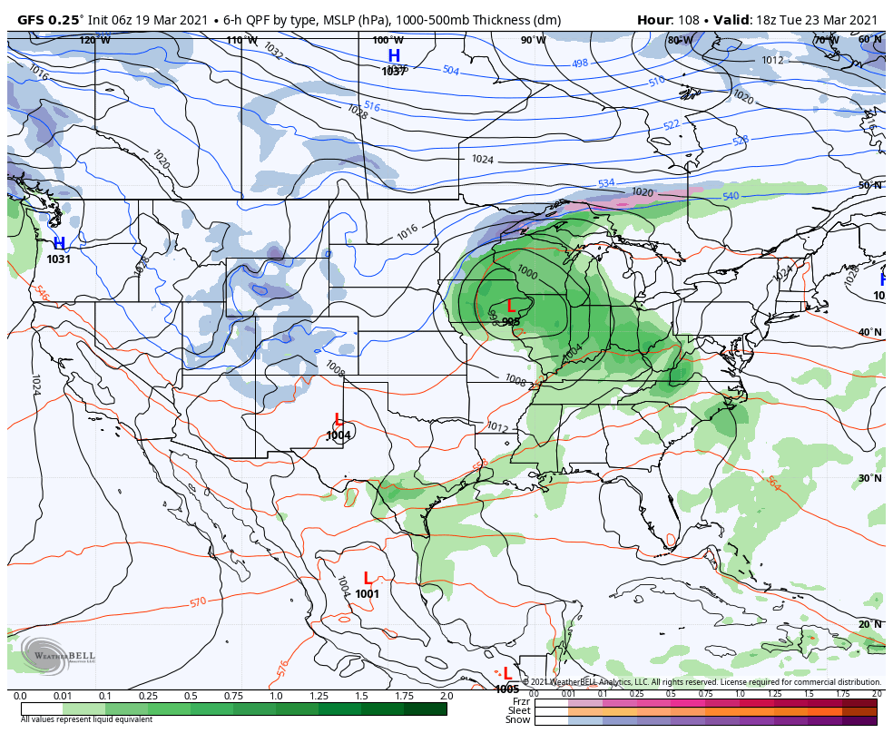
Our next storm system will arrive during the day Tuesday with thunderstorm potential. More on this throughout the weekend…