Welcome To December: Things Begin To Grow More Interesting With Each Passing Day…
Updated 12.01.21 @ 7:40a
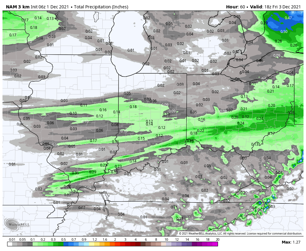
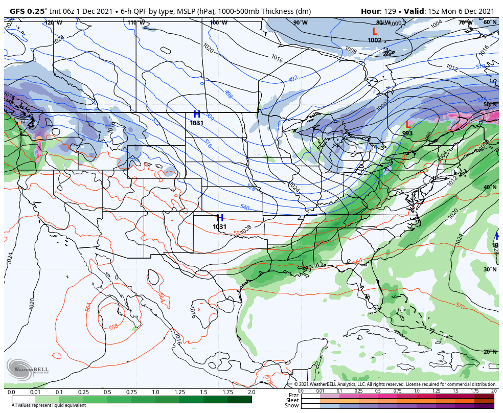
In the short-term, we have to deal with a fast moving system that will deliver rain to central parts of the state through the 1st half of the day. Most of the measurable rain will be off to our southeast after lunchtime.
A breezy warm-up will take place Thursday, helping boost temperature all the way into the lower 60s for several central Indiana neighborhoods- not bad at all for December 2nd, huh?!
Mostly dry weather will prevail across immediate central Indiana into the 1st half of the weekend. Similar to last week, we’ll note systems flying by to our north, but most, if not all, of these features will remain just to our north.
Moisture will return by Sunday as a rather widespread rain builds into the state ahead of a cold front. Behind the front, a punch of colder air will flow into the Ohio Valley as we open the work week.
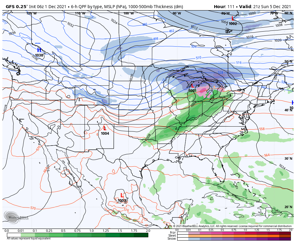
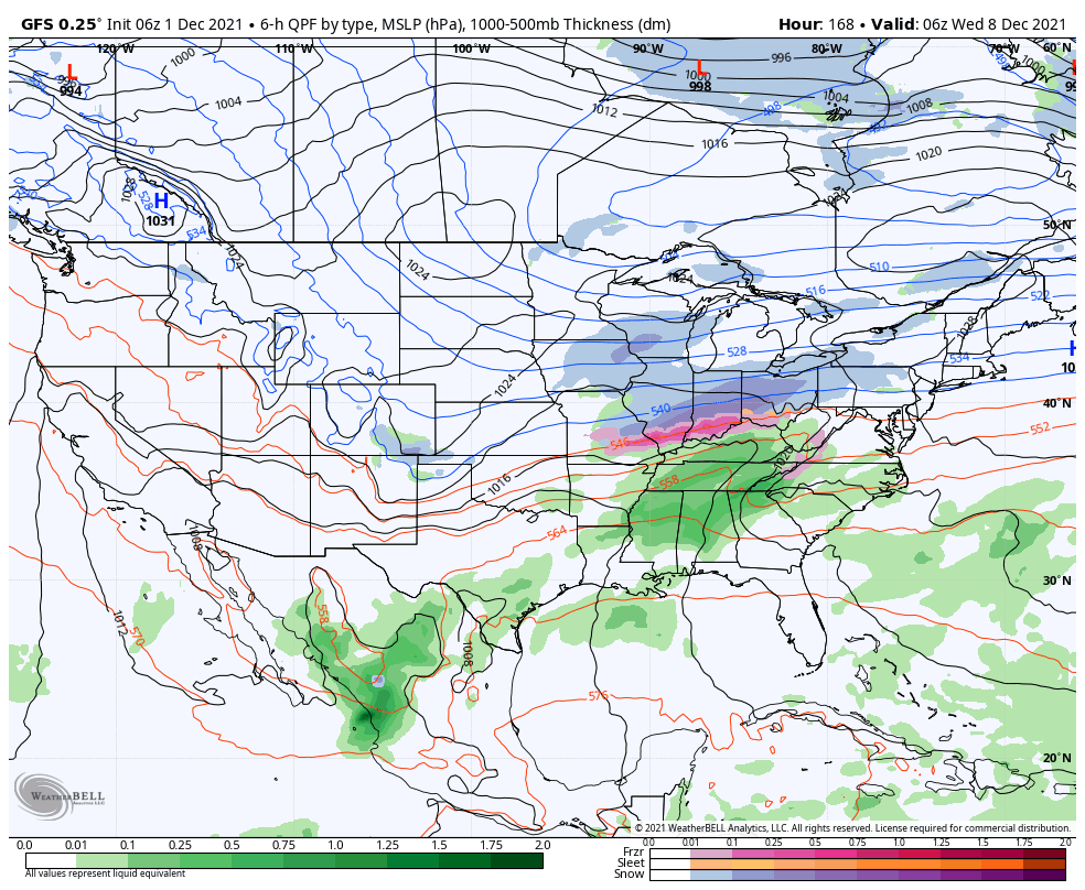
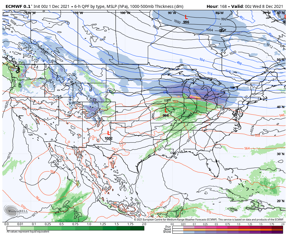
That will then potentially set us up for more interesting times from a wintry perspective for the next system (targeting next Tuesday). We note, to no surprise, 6 days out, differences with the model guidance. Things range from a healthy winter storm (GFS solution) to an all rain event (European solution). We will keep close eyes. Timing will have to be perfect for the system to take advantage of the colder airmass flowing into the region early next week behind the front, especially without a favorable position from the high to our north (that would be able to continue funneling in colder air as the low pressure system moves through the region). Stay tuned.
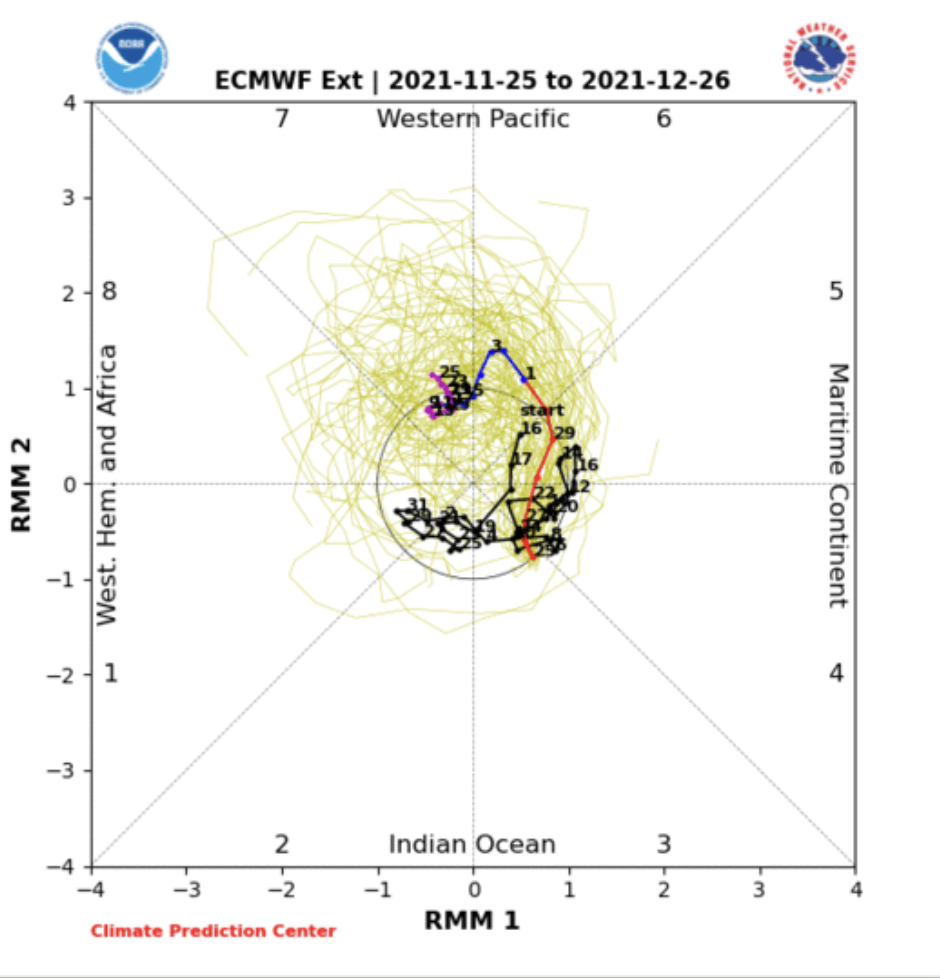
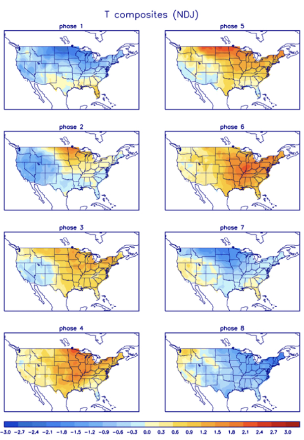
If that wasn’t enough to keep us busy over the coming several days, the Madden Julian Oscillation (MJO) is once again trying to show some life. Note how the amplitude carries things into Phase 6 and 7 towards mid-month. While Phase 6 is a very warm phase (compared to normal), major changes take place with Phase 7 as more widespread and meaningful cold air takes hold.
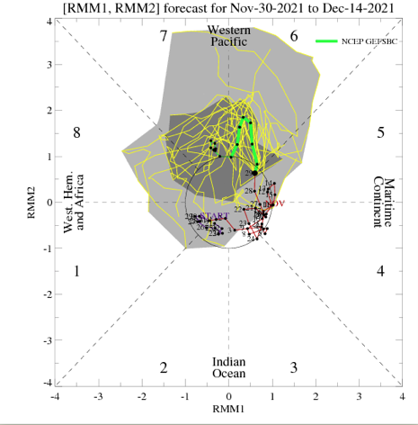

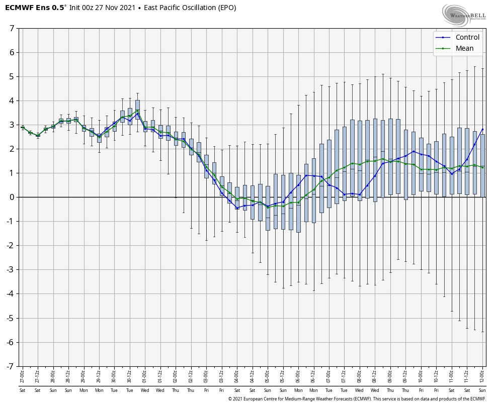
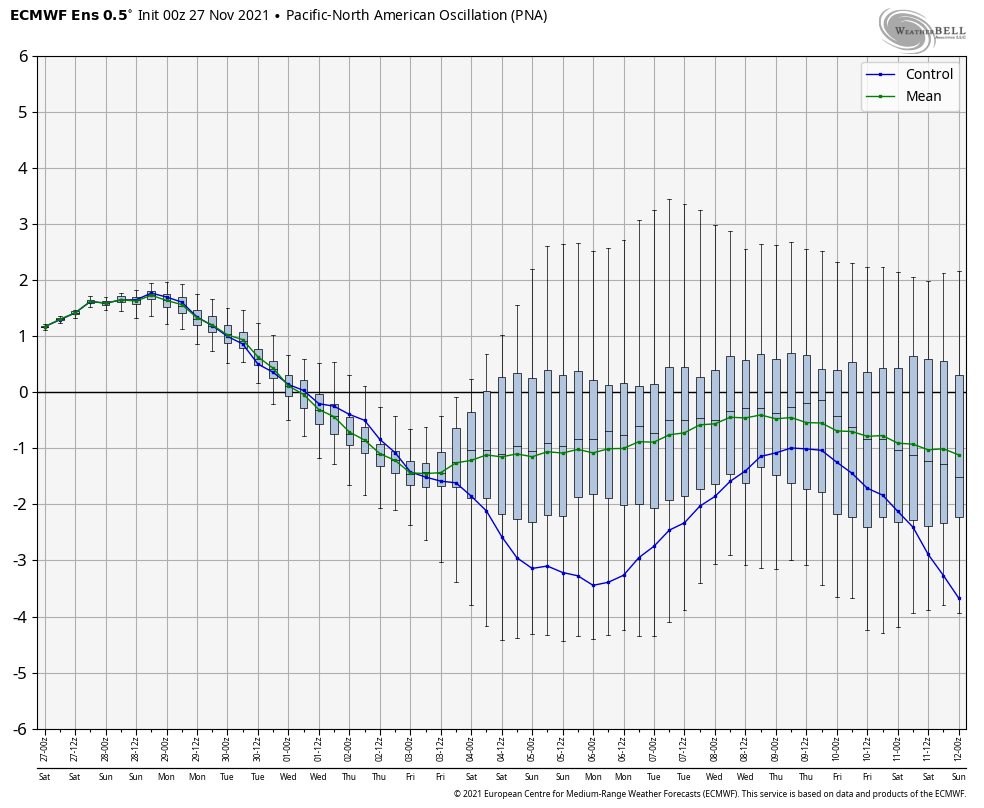
There’s no denying the warmth associated with Phase 6 and unfavorable teleconnections in the short-term (shown below), but it’ll be mighty interesting to see if data starts trending colder towards mid-month if we can get things into Phase 7.