Category: Forecast Models

Busy Winter Weather…

February has been a brutally cold month and there’s no let-up in sight during the upcoming 7-10 days.

ncep_cfsr_noram_t2m_anomThe snowpack has expanded over the past few days.
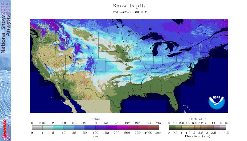
nsm_depth_2015022305_NationalThe arctic air is very hard to move and forecast models can struggle mightily in the mid range when arctic air is involved.  Add in a vast snowpack over the TN Valley and Ohio Valley and I wouldn’t buy full force into the warm, mostly liquid precipitation solutions as depicted by some European and GFS runs as of late.  More on that later.

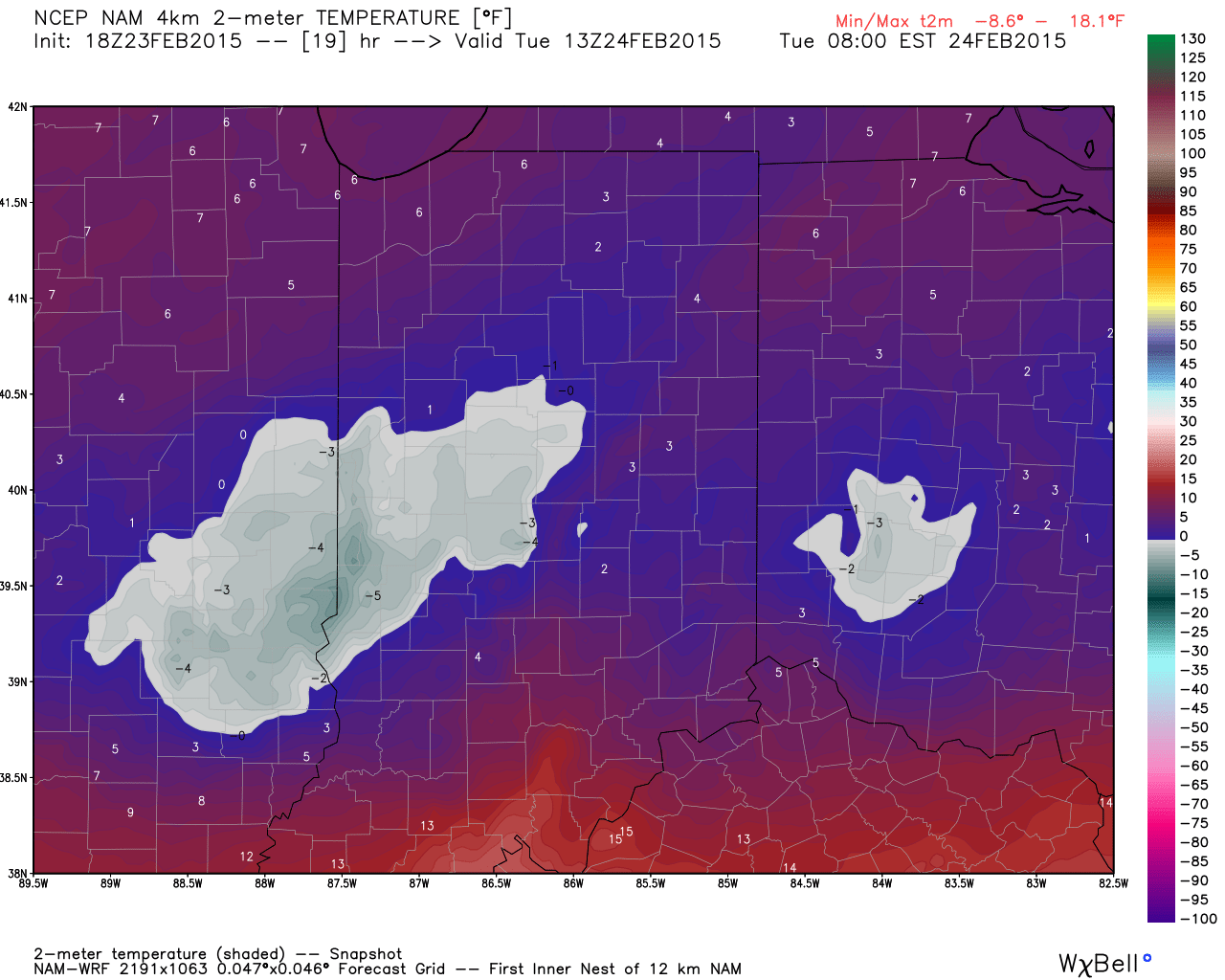
Arctic air is the story in the short-term along with a gusty wind that will precede very light snow Tuesday afternoon/ evening.
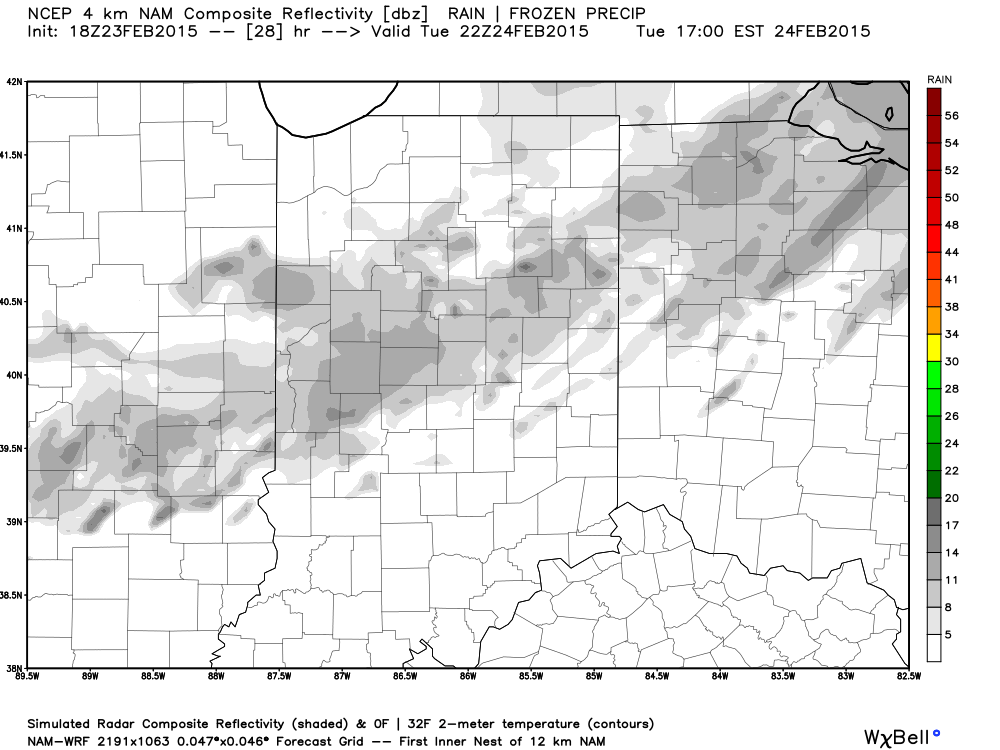
hires_t2m_indy_20


hires_ref_indy_29More bitterly cold, arctic air will be with us as we wrap up the work week and head into the weekend.  Additional records will fall.

Snow may also be with us.  We’re keeping a close eye on a clipper system that could deliver accumulating snow prospects around these parts Wednesday night/ Thursday.  The latest RGEM solution (below) depicts a more easterly track.  We also note the latest GFS delivers light snow in here Wednesday night and Thursday, as well.  We’ll keep a close eye on things.

rgem_precip_mslp_mw_17Late weekend into early next week features another complicated and very complex event.  We believe it’s far too early to buy into any one particular solution provided by the various forecast models, but certainly have to “raise an eyebrow” to the mostly wet, warmer solutions.  There’s an awful lot of dense arctic air around and with a widespread snowpack we have to wonder if modeling may be overdoing the warming (where have we seen this before ;-)).

A wavy front may lead to more wintry “mischief” Sunday into early next week.  Again- far too early for specifics, but additional wintry weather is certainly possible.

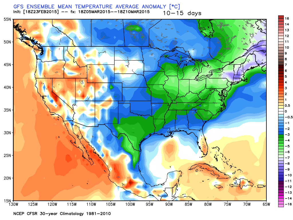
gfs_ptype_slp_conus2_29In the longer term, there’s just no let up in sight from the colder than normal conditions.  Sure we may see a couple of days of milder air (we are heading into March, after all), but, as a whole, the majority of the upcoming couple weeks look MUCH colder than normal.

gefs_t2m_mean_conus_d0_7


gefs_t2m_mean_conus_d10_15

Permanent link to this article: https://indywx.com/2015/02/23/busy-winter-weather/

Brutally Cold Week…

Screen Shot 2015-02-23 at 7.30.55 AMBundle Up…A series of arctic highs will build south and result in an absolutely frigid week across a large portion of the country, including here on the home front.  Several cold records will fall this week.

For the most part, we’re looking at a dry week, but a skinny band of light snow may blow through the area Tuesday afternoon/ evening- not a big deal.

Models are struggling on the details with our next storm system.  It’s possible we’ll have to add a wintry mix of rain and snow into your Sunday forecast, but prefer to wait another set of runs before doing so.  Timing and track remain big questions at this point- common from a Day 6+ event.  The GFS and European lean towards a milder, wetter event while the Canadian is colder and more suppressed.  Much more on this later.

Upcoming 7-Day Precipitation Forecast:

  • 7-Day Snowfall Forecast: Dusting
  • 7-Day Rainfall Forecast: 0.00″

Permanent link to this article: https://indywx.com/2015/02/23/brutally-cold-week/

Winter Storm Video Brief

You must be logged in to view this content. Click Here to become a member of IndyWX.com for full access.  Already a member of IndyWx.com All-Access?  Log-in here.

Permanent link to this article: https://indywx.com/2015/02/20/winter-storm-video-brief/

Winter Storm Tonight-Saturday

Good morning and happy Friday, friends!  Boy, Old Man Winter is really beginning to turn some minds around from thinking this was an easy winter to one that’s quite impressive, especially from a cold standpoint.  By the way, there’s MUCH more from where this came from!  Essentially we remain on “lock down” for more brutally cold and wintry conditions for the upcoming 7-10 day period.  More on that later.

Here’s a look at our initial snowfall forecast map for tonight and Saturday:

2201522115SnowMapForecast radar shows heavy wet snow encompassing central Indiana Saturday morning:

hires_ref_indy_29Bullet point highlights you need to know:

  • Snow will overspread central Indiana from the southwest between 10p-1a
  • Snow will become heavy at times between 3a-7a
  • Sleet and freezing rain will accumulate significantly downstate
  • Most of the snow will be east of the area by 3p Saturday
  • You’ll want to plow and clean snow up Saturday night as cold air quickly returns Sunday
  • Arctic outbreak next week likely will feature record cold, and colder than this week has been
  • No let-up in sight from this unrelenting winter pattern

Permanent link to this article: https://indywx.com/2015/02/20/winter-storm-tonight-saturday/

Sunday Night From The Road…

I apologize for the late post this evening. I’ll be on the road through Monday so posts will be off schedule really until Tuesday. There’s not a lot today that’s…

You must be logged in to view this content. Click Here to become a member of IndyWX.com for full access.  Already a member of IndyWx.com All-Access?  Log-in here.

Permanent link to this article: https://indywx.com/2015/02/15/sunday-night-from-the-road/

Keeping A Close Eye On Monday…

Just a quick update this evening to let you know we continue to closely monitor Monday for accumulating snow prospects across southern and central Indiana. Today’s forecast models have continued…

You must be logged in to view this content. Click Here to become a member of IndyWX.com for full access.  Already a member of IndyWx.com All-Access?  Log-in here.

Permanent link to this article: https://indywx.com/2015/02/14/keeping-a-close-eye-on-monday/

Tuesday Evening Video Update: Cold And Opportunities For Snow…

The well-advertised one-two shot of bitterly cold arctic air will arrive mid week into the weekend.  Dangerous wind chills and snow squalls will accompany each surge of arctic air. As…

You must be logged in to view this content. Click Here to become a member of IndyWX.com for full access.  Already a member of IndyWx.com All-Access?  Log-in here.

Permanent link to this article: https://indywx.com/2015/02/10/tuesday-evening-video-update-cold-and-opportunities-for-snow/

1-2 Punch Of Arctic Air This Week; Watching The Southern Branch Next Week…

A one-two punch of arctic air will drive through central Indiana in the Wednesday night through Saturday time frame. Snow showers and embedded squalls will be possible with both and…

You must be logged in to view this content. Click Here to become a member of IndyWX.com for full access.  Already a member of IndyWx.com All-Access?  Log-in here.

Permanent link to this article: https://indywx.com/2015/02/10/1-2-punch-of-arctic-air-this-week-watching-the-southern-branch-next-week/

Enjoy Today; Cold Week Coming…

Another mild day is on tap with a southwest flow ahead of a frontal boundary that slips through this evening with light showers. Note the sharp temperature gradient this evening.…

You must be logged in to view this content. Click Here to become a member of IndyWX.com for full access.  Already a member of IndyWx.com All-Access?  Log-in here.

Permanent link to this article: https://indywx.com/2015/02/08/enjoy-today-cold-week-coming/

Period Of Snow Moving In…

As mentioned below, bust potential was/ is high with today’s forecast.  The further north trends in the NAM and GFS will ultimately trump the normally reliable Canadian and European solutions.  As such, slushy snowfall accumulations will be light (1″-2″) for the city, itself, increasing to between 2″-5″ for northern Indianapolis suburbs (Zionsville, Carmel, Westfield, Noblesville, etc.).  Double digit totals will fall across the northern third of the state.

For the most part, snowfall accumulations will come from this area of precipitation moving through the region.

Screen Shot 2015-02-01 at 9.30.06 AM


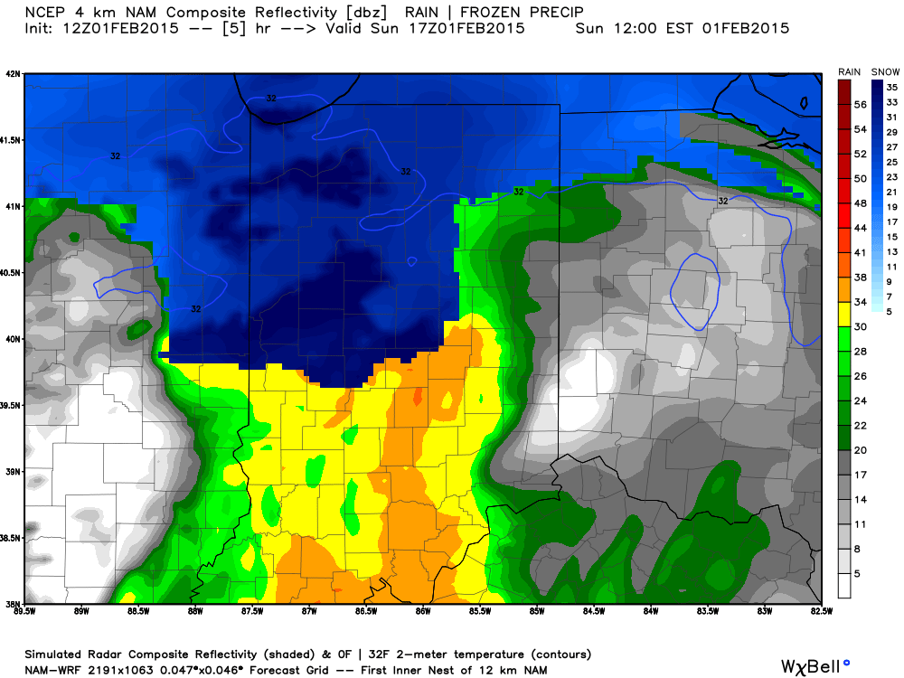
Heavy wet snow will likely fall for a period of time, especially from northern portions of Indianapolis and points north late morning into the early afternoon.

hires_ref_indy_6


Temperatures will then likely creep up a few degrees through the mid afternoon hours before falling this evening.  Snow will mix with, or change to, snow across central regions this afternoon with the northward track of the low.  Note the stark temperature contrast across the region this evening.

hrrr_t2m_indy_16


The week will get off to a cold start as highs Monday only top out in the lower 20s.  Enjoy your Super Bowl Sunday and keep the reports coming!

Permanent link to this article: https://indywx.com/2015/02/01/period-of-snow-moving-in/

IndyWx.com