Category: Forecast Models

Closer Look At Halloween Weather…

As we scan the latest computer models this morning we really see no reason to deviate from our forecast already out there on Halloween. While it shouldn’t be a complete…

You must be logged in to view this content. Click Here to become a member of IndyWX.com for full access.  Already a member of IndyWx.com All-Access?  Log-in here.

Permanent link to this article: https://indywx.com/2015/10/30/closer-look-at-halloween-weather/

Contradiction In Model World…

After the wet, windy, and chilly spell of weather this week, we have contradicting signals in model world for what lies ahead as we flip the page into November. With so much “noise,” we don’t think it’s wise buying whole-heartedly into any paticular idea for November just yet.

Here’s the plot line…

The PNA trends negative in the mid range and would argue for eastern ridging, and associated warmth.

NegativePNA

Sure enough, we see model data (GFS ensembles shown here, courtesy of Weatherbell) going towards what a negative PNA should promote- eastern ridging and an associated warmer than normal time.


BUT…not so fast, as the latest MJO forecast keeps things in Phase 2 for a while and doesn’t show near the amplitude it did only a week ago in moving into Phase 3.


As shown above, Phase 2 argues for chill across our neck of the woods, with Phase 3 being much milder.

Let’s watch things unfold this week and revisit this post a bit later as a follow-up with what lies ahead. There’s never a dull moment in this business.

Permanent link to this article: https://indywx.com/2015/10/26/contradiction-in-model-world/

Heavy Rain Then Colder…

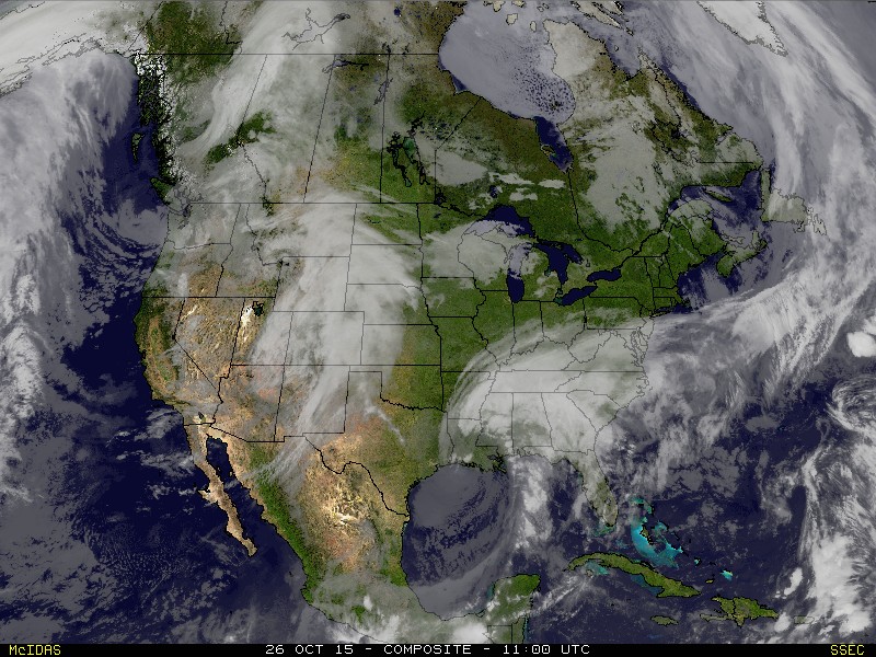
Today can be labeled as the so called “calm before the storm,” as sunny skies greet us out the door.  It’ll be a very pleasant Monday with highs in the middle 60s.  Sunny skies this morning will turn increasingly cloudy later in the day as moisture continues to stream north associated with Patricia’s remnants.

This morning’s satellite picture:

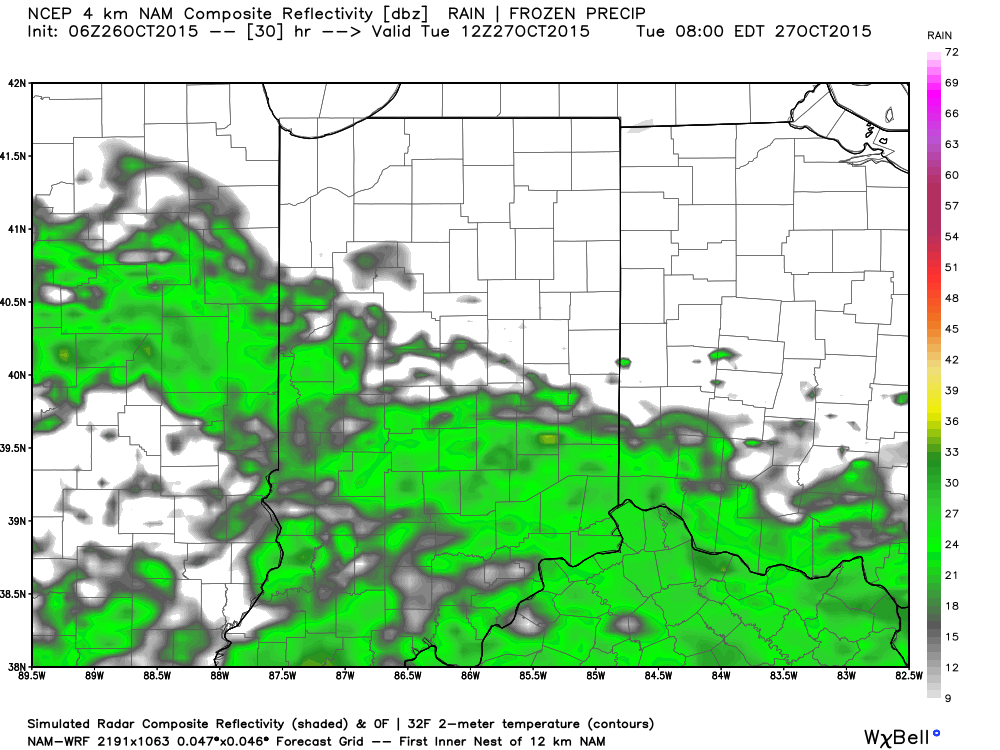
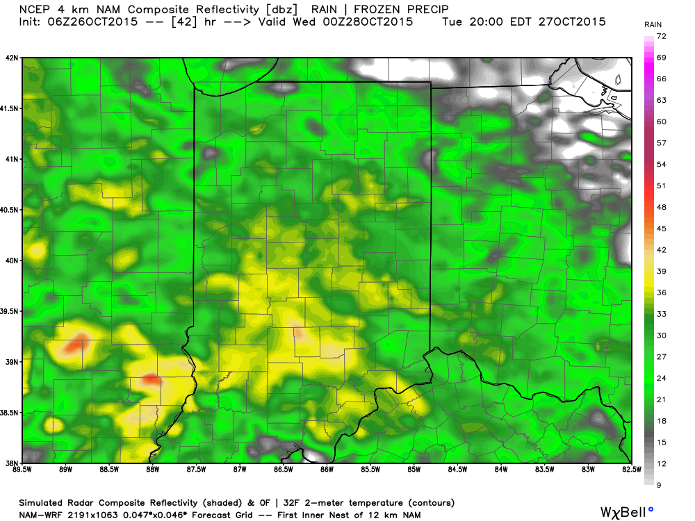
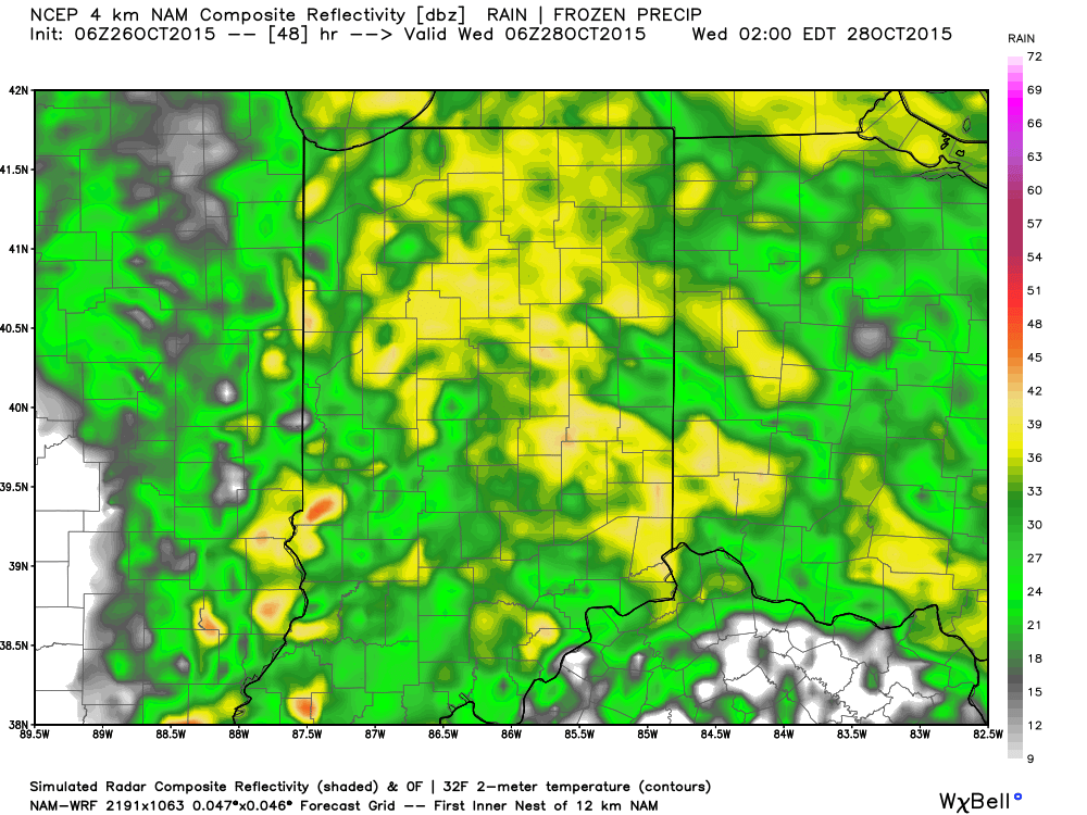
image7When we look at the weather picture tomorrow we note the remnant moisture of Patricia continuing to lift north while a cold front approaches from the west.  The “squeeze play” that will ensue over the region will be just what the doctor ordered as widespread rain develops during the daytime Tuesday before growing heavy Tuesday night.

8a Tuesday Futurecast

8am

8p Tuesday Futurecast

8pOvernight Tuesday-Wednesday morning Futurecast

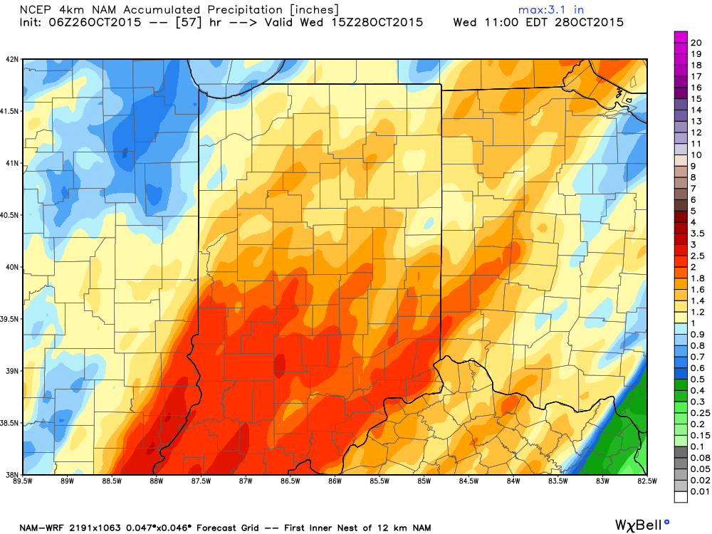
overnightLocally heavy rainfall can be expected.  When you average (5) computer models at this point then you get the idea rainfall totals will be somewhere in the range of 1.5″-2″ inches, with locally heavier totals.

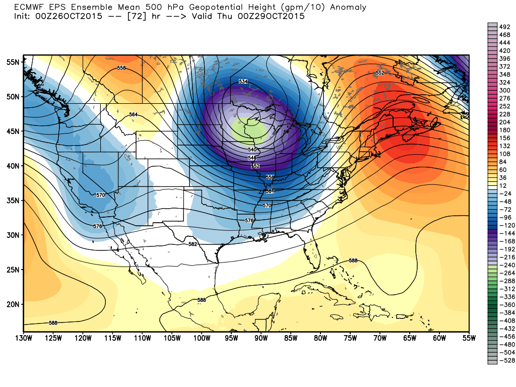
Modeled rainfall totals by Wednesday morning3The story after the big rain storm moves away?  A very windy and much cooler feel as a strong trough moves into the eastern portion of the country.  This will keep temperatures significantly below normal for the 2nd half of the week on into the weekend.

500mb

Permanent link to this article: https://indywx.com/2015/10/26/heavy-rain-then-colder/

Nice Today, But Colder Air On The Doorstep…

*Our annual Winter Outlook will be posted Saturday.* After a chilly start this morning (patchy frost has been reported), sunshine and a gusty SW wind will help temperatures recover into…

You must be logged in to view this content. Click Here to become a member of IndyWX.com for full access.  Already a member of IndyWx.com All-Access?  Log-in here.

Permanent link to this article: https://indywx.com/2015/10/15/nice-today-but-colder-air-on-the-doorstep/

Another Shot Of Cool Air Coming; Longer Range Talk…

You must be logged in to view this content. Click Here to become a member of IndyWX.com for full access.  Already a member of IndyWx.com All-Access?  Log-in here.

Permanent link to this article: https://indywx.com/2015/10/13/another-shot-of-cool-air-coming-longer-range-talk/

Colder Air Arrives Late Week…

A tranquil and warm start to the week (today and Monday) will take a bit of a hit for mid week as the first of two waves of cooler air…

You must be logged in to view this content. Click Here to become a member of IndyWX.com for full access.  Already a member of IndyWx.com All-Access?  Log-in here.

Permanent link to this article: https://indywx.com/2015/10/11/colder-air-arrives-late-week/

Friday Weather Notebook…

A cold front will pass through central IN early this afternoon. As expected, most of the region will experience a dry frontal passage (FROPA). Latest high resolution short term model…

You must be logged in to view this content. Click Here to become a member of IndyWX.com for full access.  Already a member of IndyWx.com All-Access?  Log-in here.

Permanent link to this article: https://indywx.com/2015/10/09/friday-weather-notebook-2/

Monday Weather Notebook…

October has started off on a dry, cool note. Note the 200%+ anomalies along the eastern seaboard in association with the Nor Easter.     Our thoughts and prayers remain with…

You must be logged in to view this content. Click Here to become a member of IndyWX.com for full access.  Already a member of IndyWx.com All-Access?  Log-in here.

Permanent link to this article: https://indywx.com/2015/10/05/monday-weather-notebook-3/

Saturday Afternoon Video Update…

You must be logged in to view this content. Click Here to become a member of IndyWX.com for full access.  Already a member of IndyWx.com All-Access?  Log-in here.

Permanent link to this article: https://indywx.com/2015/10/03/saturday-afternoon-video-update/

Thursday Weather Notebook…

Good morning and happy Thursday! Your updated 7-day will arrive on-site this evening. Major hurricane Joaquin remains the big focal item across the weather community this morning, but there’ve been…

You must be logged in to view this content. Click Here to become a member of IndyWX.com for full access.  Already a member of IndyWx.com All-Access?  Log-in here.

Permanent link to this article: https://indywx.com/2015/10/01/thursday-weather-notebook-4/

IndyWx.com