You must be logged in to view this content. Click Here to become a member of IndyWX.com for full access. Already a member of IndyWx.com All-Access? Log-in here.
Category: Forecast Models
Permanent link to this article: https://indywx.com/2016/06/16/thursday-evening-video-update-4/
Jun 13
Some Thoughts Into Late June…
The first (12) days of June are in the books and we’re running drier and warmer than average, month-to-date. Officially, IND reports a temperature departure of 3 degrees above normal and a rainfall deficit approaching 1″.
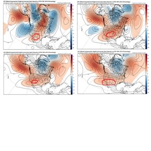
As we look ahead, the pattern is one that seems to favor the most sustained hot dome (mean ridge) position across the 4 Corners region and Southwest states. This morning’s European ensemble data shows this well:
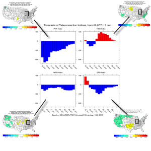
 The teleconnections aren’t much help in trying to generate longer term thoughts. They would favor more of a “normal” period temperature-wise, locally. (BTW, thanks to the fine folks at MAD US Weather and ESRL for the data below).
On another note, there are different times through the year when the respected positive and negative phases of the teleconnections below have more of an impact on our weather, particularly during the fall through spring months.
 Looking at some of the model data, the general consensus is for a warm look to go through the back half of the month, but we caution that we can’t simply “broad brush” the forecast through the EOM as warm and relatively quiet (a note on that in a moment).
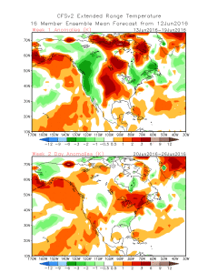
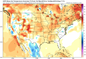
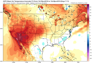 As mentioned above, despite an overall warm look on the models there will likely be periods of cooler “jabs” and it sure looks like a rather transient pattern to us across the Mid West and Ohio Valley, featuring more of the sustained heat across the Southwest region. Transient patterns usually also yield for potential wetness and we note the GFS Ensembles trending in that direction to wrap up the month.
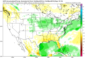 In the shorter term, there will also be localized heavy downpours, but it’s a continued case of “haves and have nots.” There won’t be any particular rhyme or reason to the specific placement of heavy, gully-washer type showers and storms mid week.
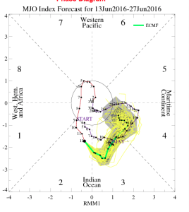
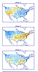
Finally, to close, perhaps the MJO shows the pattern best over the next couple weeks. Best word to describe the MJO’s idea? Transient. 🙂
Permanent link to this article: https://indywx.com/2016/06/13/some-thoughts-into-late-june/
Jun 04
Video Update: Rainy, Stormy Saturday…
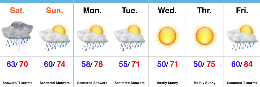 Upcoming 7-Day Precipitation Forecast:
- Snowfall: 0.00″
- Rainfall: 0.75″-1.50″ (locally heavier amounts)
Permanent link to this article: https://indywx.com/2016/06/04/video-update-rainy-stormy-saturday/
Jun 03
Wet Saturday On Deck…
It’s been a nice Friday across central IN, including filtered sunshine and lower humidity levels. Unfortunately, the pleasant weather won’t last as we welcome in the weekend.
A warm front will lift north late tonight and should help moisten things up enough to allow rain to reach the surface across most of central IN during the overnight into the predawn Saturday.
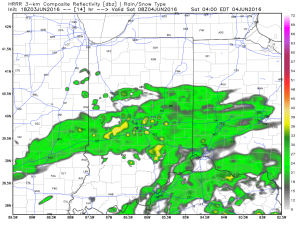 Steady rain and embedded thunderstorms will continue through the morning hours and into the afternoon.
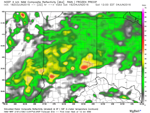
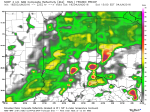 Eventually, a cold front will sweep through the state Saturday night and help “slosh” the widespread rain shield east of the region. By the time this happens, we expect widespread rainfall totals between 0.50″ and 1.00″ across central IN (with locally heavier totals).
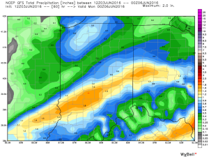
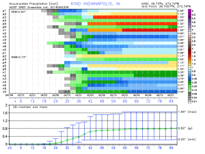 Cooler weather will push in this weekend and continue into early and middle parts of next week. While the widespread rain will come to an end, upper level energy will remain and could help ignite scattered showers at times (particularly during the afternoon and evening hours) into early next week.
Permanent link to this article: https://indywx.com/2016/06/03/wet-saturday-on-deck/
May 25
Indy 500 And Memorial Day Weekend Video Update…
You must be logged in to view this content. Click Here to become a member of IndyWX.com for full access. Already a member of IndyWx.com All-Access? Log-in here.
Permanent link to this article: https://indywx.com/2016/05/25/indy-500-and-memorial-day-weekend-video-update/
May 23
Protected: June Outlook…
This content is password protected. To view it please enter your password below: Password:
You must be logged in to view this content. Click Here to become a member of IndyWX.com for full access. Already a member of IndyWx.com All-Access? Log-in here.
Permanent link to this article: https://indywx.com/2016/05/23/june-outlook/
May 21
Busy Week Ahead Turns Active In The Weather Department…
After a damp and chilly open to the weekend, drier air began to infiltrate the region this afternoon and led to a brighter/ warmer finish to the day. We’ll add more sunshine and tack on a few degrees to the afternoon high on Sunday. It’ll be a phenomenal weather day across central IN, thanks to high pressure. Get out and enjoy it!
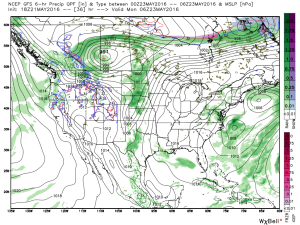 Dry and sunny weather will greet us to open the new work week, along with temperatures that will approach the 80 degree mark by Tuesday. Have yard work to get caught up on? Take advantage of the early week weather.
Things will begin to change towards an unsettled regime as early as Tuesday evening/ Wednesday as the region gets into an increasingly moist southwesterly air flow.
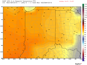
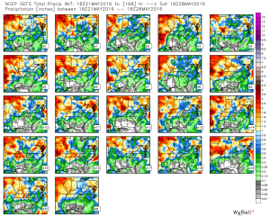
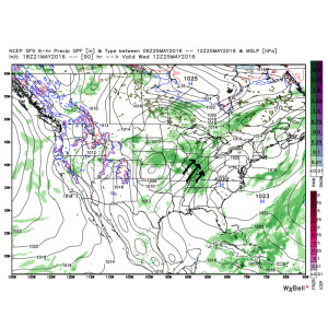 As such, we’ll increase the chances of showers and thunderstorms in our mid week forecast. It’ll also be a much more humid feel of things (really for the first time this year) as surface dew points surge into the upper 60s to lower 70s. (In other words, “oppressive”).
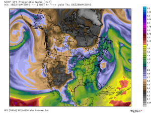
 Factor in PWATs (precipitable water values) zooming to 1.5″-1.8″ and the threat is there for localized heavy downpours around mid week.
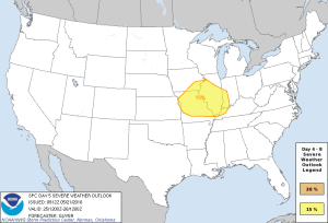
 Additionally, we also note the Storm Prediction Center (SPC) has placed western sections of our forecast area in a risk of severe weather Wednesday. We’ll keep a close eye on things.
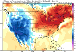
 As we progress into the late week period and on into the long holiday/ race weekend, a warm, humid, and unsettled time of things is expected to continue. It’s tough to pinpoint specifics from this distance, but just keep note of the threat of thunderstorms into and through the upcoming busy weekend, along with warm (highs in the lower to middle 80s; lows in the upper 60s) and humid conditions.
Permanent link to this article: https://indywx.com/2016/05/21/busy-week-ahead-turns-active-in-the-weather-department/
May 16
Monday Evening Update…
Through the first half of May, temperatures are running more than 2 degrees below average at IND. We’re in the middle of a rather large area of below normal temperatures from the SW into the NE region.
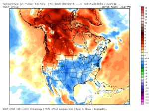 We’ll remain below average through the upcoming week, but temperatures will begin to moderate over the weekend into next week.
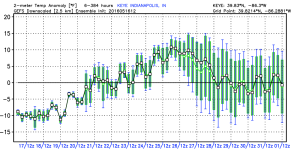 In general, we agree with the temperature anomalies above, courtesy of the GEFS. As noted, the cool start to the period will moderate and turn warmer next week. Unfortunately, that warmer trend won’t last and it’s likely we trend cooler around the Memorial Day weekend.
In the shorter range, light rain will spread into central IN late tonight into Tuesday. Rainfall amounts won’t be significant, and should be generally around 0.25″, or less.
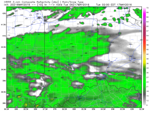 Drier air is still expected for mid week, as high pressure builds into the region. Needed sunshine and pleasant conditions can be expected.
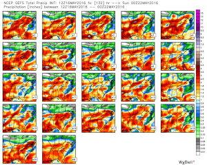
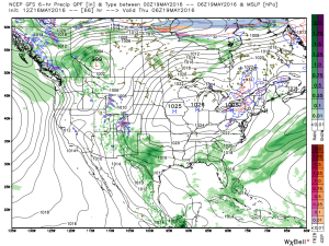 As we look forward to the weekend, modeling is still at odds with one another. The European remains consistent on the idea of heavy rain while the GFS remains consistent on a drier solution (rain, but much lighter amounts). That said, we note the consensus of the GFS ensemble members is more aggressive and reflects the idea of the European. We’ll remain firm on the idea of potentially heavy rain building in Friday into Saturday.
Permanent link to this article: https://indywx.com/2016/05/16/monday-evening-update/
May 10
Tuesday Morning Rambles…
1.) The month of May has gotten off to a chilly start and given the period of unseasonably chilly air that looms later this week, it’s safe to say these cool anomalies will grow even cooler.
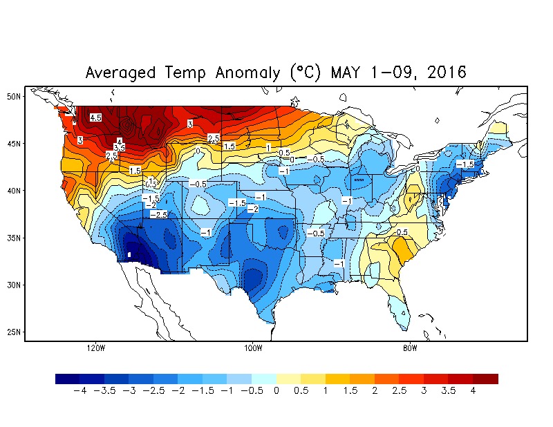 The coolest day looks to be Saturday with highs only in the mid 50s.

2.) In the shorter term, we’re keeping an eye on strong-severe thunderstorm potential this afternoon and evening across southern and central parts of the state. Large hail and damaging straight line winds are of greatest concern, but a quick spin-up tornado can’t be ruled out.
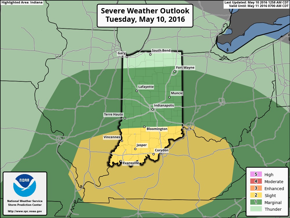

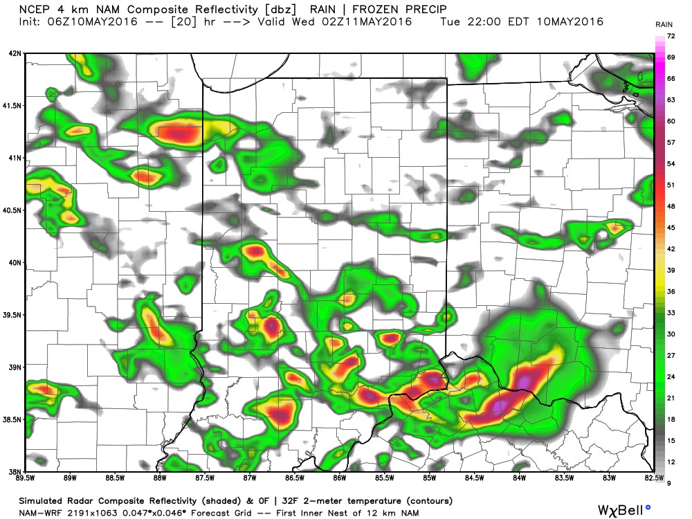
Not everyone will see heavy rain amounts today, but a few neighborhoods may deal with localized flooding issues as slow moving heavy storms potentially train over communities. Where this happens, 2″+ rain totals are a good bet by midnight.

3.) Forecast models remain in a state of disagreement concerning late this weekend into early next week. The GFS is particularly bullish on the idea of wet (heavy rain threat), chilly times whereas the European is much drier (and warmer). We’ll keep an eye on things and hope for consistency this afternoon. Speaking of this afternoon, we’ll have our updated 7-day posted later today! Make it a great Tuesday.
Permanent link to this article: https://indywx.com/2016/05/10/tuesday-morning-rambles-3/
May 09
Monday Morning Video Update: Strong Storms Tuesday; Much Colder End To The Week…
An unsettled week ahead will feature periods of more widespread rain and stronger storms at times between now and Wednesday. We’re focused on Tuesday for the potential of strong to…
You must be logged in to view this content. Click Here to become a member of IndyWX.com for full access. Already a member of IndyWx.com All-Access? Log-in here.
Permanent link to this article: https://indywx.com/2016/05/09/monday-morning-video-update-strong-storms-tuesday-much-colder-end-to-the-week/
