The short-term weather pattern will continue to be dominated by rather “boring” conditions for this time of year, along with much milder than normal air. A weak frontal system will swing through here Thursday and while a light shower is possible, that’s really the only significant (if you want to call it that) weather feature through the upcoming 7-10 days.
In addition to the rather quiet weather, relative warmth will dominate as we open December. When “normals” feature lows in the upper 20s and highs in the lower 40s, actual overnight lows will only fall into the low-mid 30s and highs will reach the middle to upper 50s.
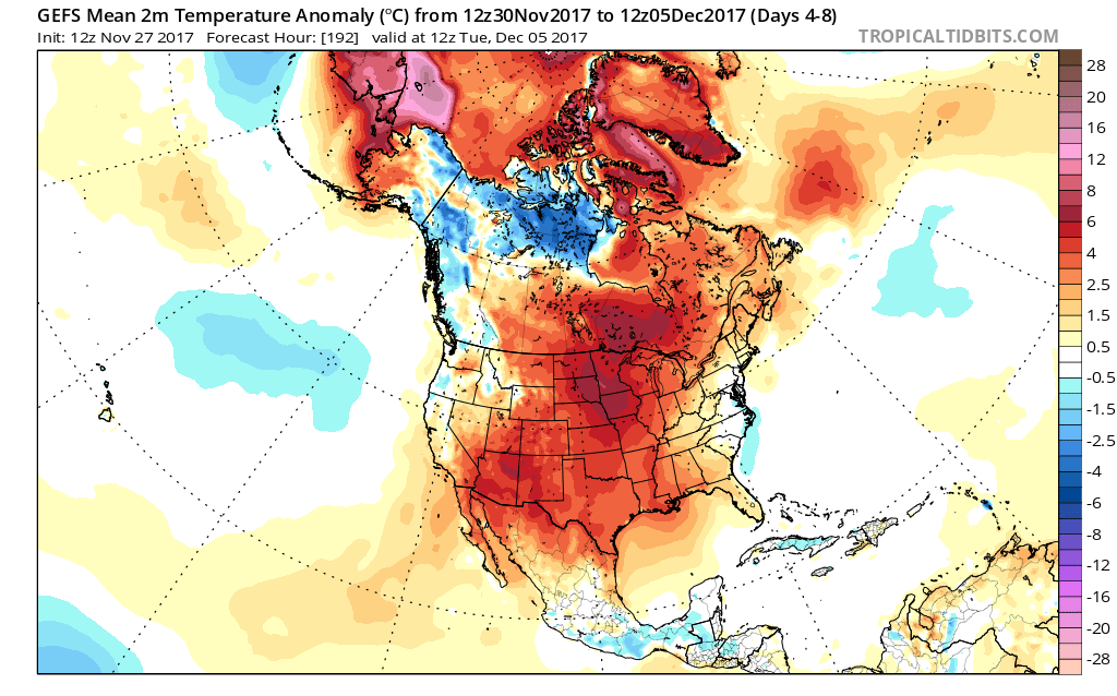 When we look ahead, the shelf life of this warmth is certainly limited. The GEFS showcases this shift in the pattern from a warm open to the month towards a much colder pattern very nicely. The GEFS has other model support, as well.
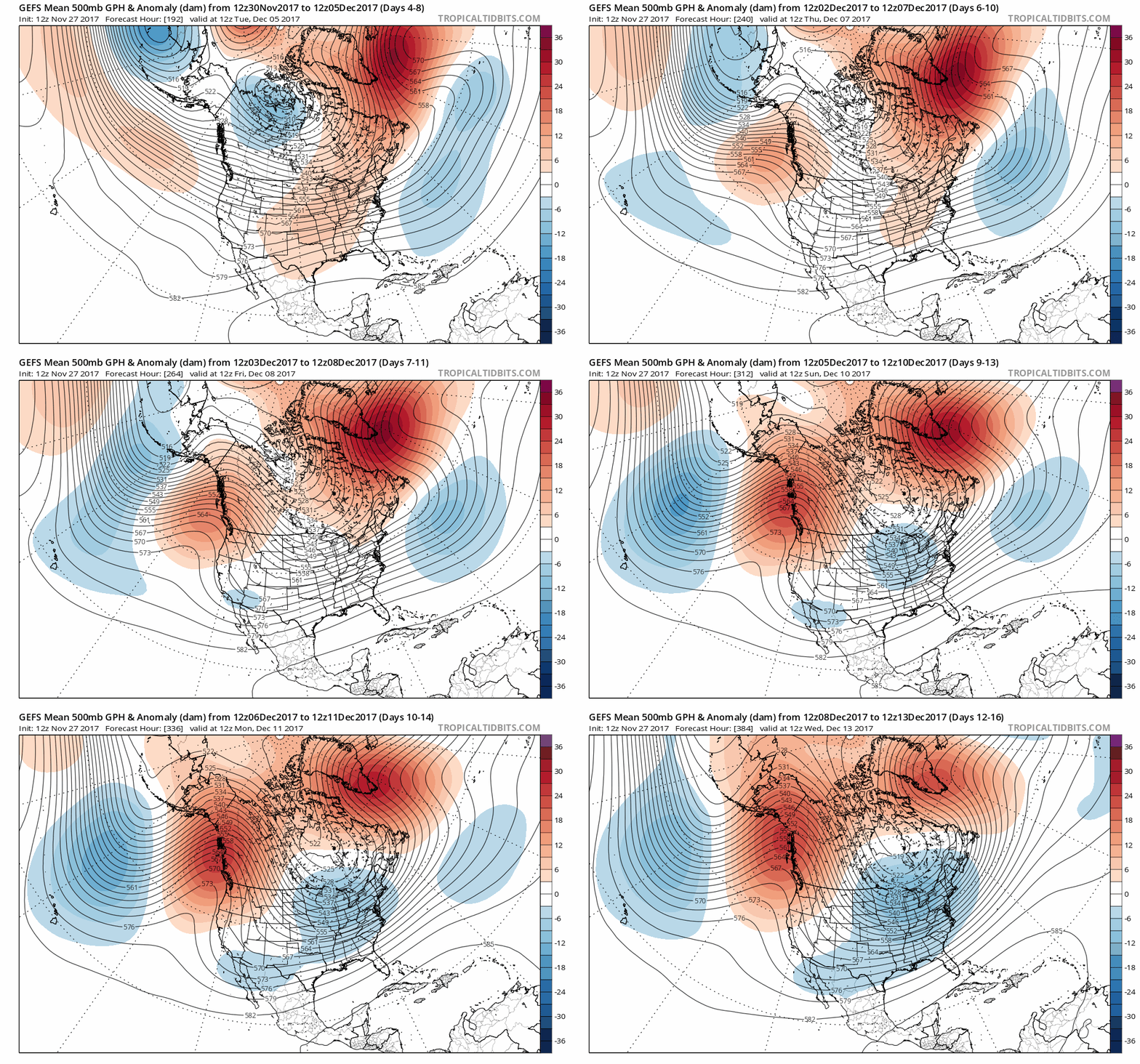 This is the type of dramatic shift in the overall pattern that not only threatens to “lock in” a colder than average regime, but potentially lead to plenty of wintry mischief to boot, and just in time for the holiday season.
There’s teleconnection support for the wintry shift, as well, leading to further confidence of a significant move towards cold, and potentially snowy/ icy, conditions as the true holiday and Christmas season approaches.
 To summarize, while unseasonably quiet and mild conditions will rule in the short-term, Mother Nature sure seems to have an attitude of making up for “lost time” in the medium to longer range. This is the type pattern that we’ll have to monitor the potential of some sort of leader-follower scenario as the transition from warm to cold takes place, and given the blocky nature of the pattern, it sure seems like we’re heading into a busy time of things from a wintry perspective mid and late month.
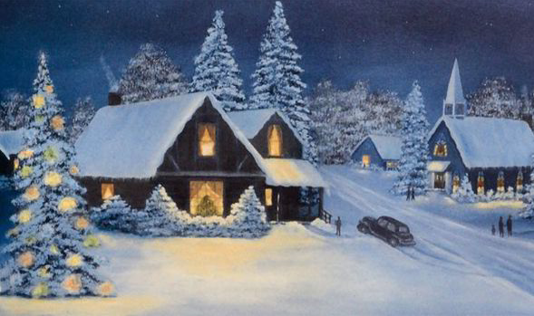
Perhaps this will be the scene as Christmas time nears across the Mid West, including central Indiana? Time will tell…


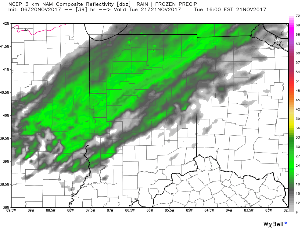

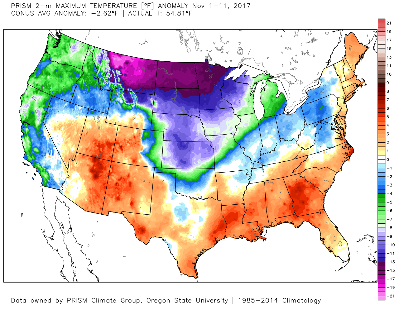 Despite an active weather week ahead, the open to the new work week will be rather uneventful. Weak high pressure will keep us dry today and Tuesday. Fog and low clouds should give way to an increasingly bright sky by this afternoon (still more clouds than sun today) and partly cloudy skies Tuesday.
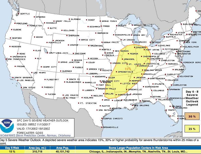
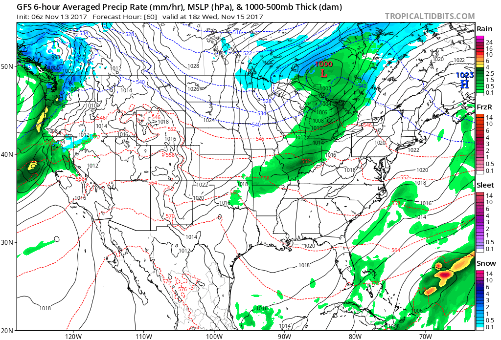 A stronger storm will impact the region as we close out the work week. Strengthening low pressure will track into the Great Lakes and drag a trailing cold front through our region Friday evening. A briefly milder southwesterly air flow will push temperatures close to 60° Friday afternoon/ evening before the sharply colder push of air blows into town for the weekend. The transition may include strong to severe thunderstorms Friday PM, and the Storm Prediction Center (SPC) has outlined a large portion of the region under a severe risk Friday. It’ll be important to stay tuned to future updates. Even outside of potentially damaging thunderstorm gusts, non-t-storm winds will gust over 40 MPH Friday.
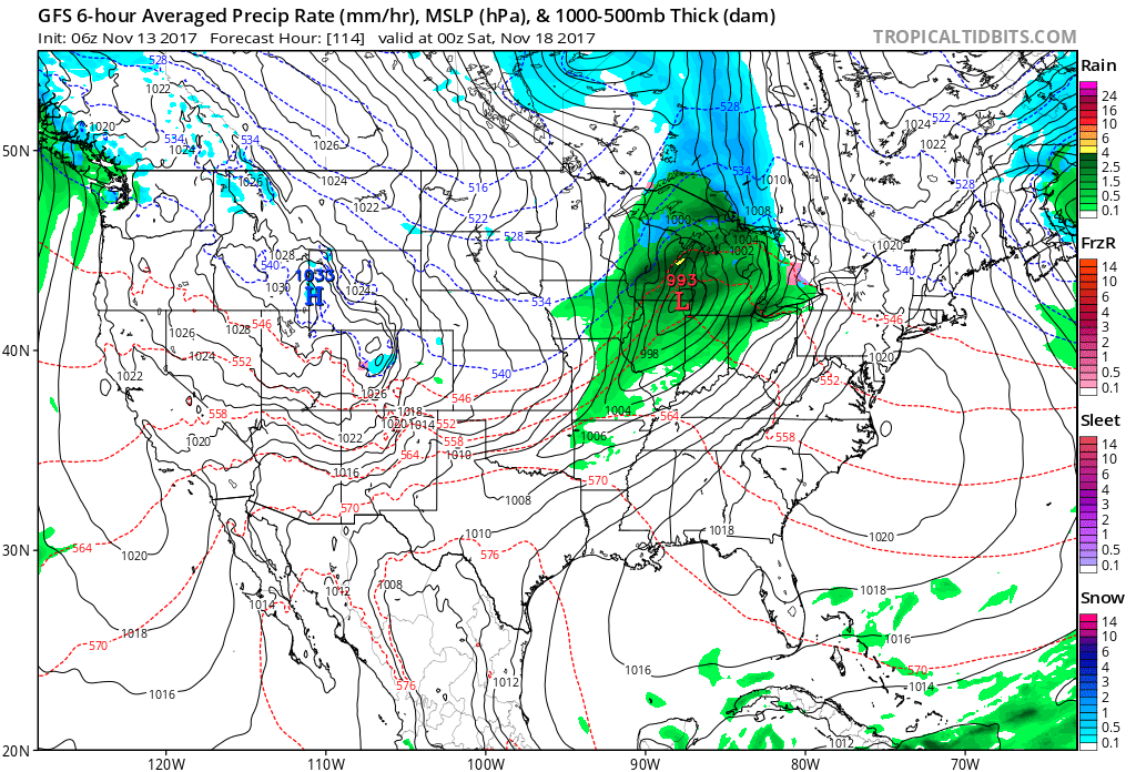
 Once the cold front sweeps through the region, a sharply colder air mass will plunge into the Ohio Valley for the weekend. Overnight data has trended even colder and would suggest falling Saturday temperatures (most of the day will be spent in the 30s) and highs only in the lower to middle 30s Sunday.
 Speaking of cold, Thanksgiving week is looking unseasonably cold, and there’s also the potential of early-season snow (far too early for specifics).