Category: Forecast Discussion

The Roller Coaster Ride Continues: 1-2 Punch Dialed Up Late Next Week…

Updated 10.08.22 @ 4:57a

September 24th, that’s the date we have to go all the way back to to find the last drop of measurable rain (0.34”) at IND. While there were a few scattered light showers around Thursday, these were of little to no fanfare for most neighborhoods across central Indiana.

Dating back to early September, most of the region is running anywhere from 10% to 50% normal rainfall as shown below (courtesy of the fine folks at the Midwestern Regional Climate Center).

Looking ahead, we’ll note a more significant return of moisture (certainly when compared to the past few weeks) ahead of the first of (2) frontal passages late next week. Long term, however, there’s no significant change in the overall dry regime as a whole when compared to normal over the upcoming couple weeks.

As we center ourselves closer to the immediate term, the first front will crash an unseasonably warm party (making the push for 80° territory Wednesday) with shower chances (maybe a couple storms to boot) increasing Wednesday evening into the predawn hours Thursday. Early data into the forecast office suggests this frontal passage delivers anywhere between 0.25” and 0.50” to the region and we’ll have to firm up those numbers as we get into the new week.

A sharp cool down is on tap Friday with highs at November-like levels (low-mid 50s).

A secondary front follows and is focused on reminding us winter is just around the corner. The first lake effect and higher elevation (looking at you east TN and western NC mountains) snow of the season is on the table early Week 2 behind the passage of this front, along with a hard freeze for the rest of us.

Permanent link to this article: https://indywx.com/2022/10/08/the-roller-coaster-ride-continues-1-2-punch-dialed-up-late-next-week/

VIDEO: First Widespread Frost And Freeze This Weekend; Tracking A Stronger Storm System Late Next Week…

Updated 10.07.22 @ 7:48a

You must be logged in to view this content. Click Here to become a member of IndyWX.com for full access.  Already a member of IndyWx.com All-Access?  Log-in here.

Permanent link to this article: https://indywx.com/2022/10/07/video-first-widespread-frost-and-freeze-this-weekend-tracking-a-stronger-storm-system-late-next-week/

Long Range Disco: Colder October Changes…

Updated 10.06.22 @ 9:57p

Without question, October is going to end up cooler to much cooler than I originally anticipated. Note the JMA Weeklies going right to a persistent chill as we go through the remainder of the month:

Week 1
Week 2
Weeks 3-4
Upcoming 4 weeks as a whole

Originally, the thought here is that we would end up slightly warmer than normal for October but that isn’t going to be the case. Don’t get us wrong, there will still be warmer than normal days, but these will be fleeting and likely take place a day or two before a fresh batch of cooler air takes hold behind frontal passages.

The latest ensemble guidance is going right to the cool look, too.

The pattern does look like it’ll continue to run drier than normal, but there should be a more significant return of moisture ahead of mid and late month fronts that will at least help make up for the unusually dry early part of October. Those mid October fronts will ignite the lake effect snow for the first time this year across the traditional snow belt areas of MI, OH, northern IN and into the high elevations of the Appalachians.

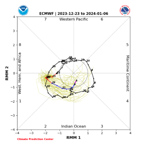
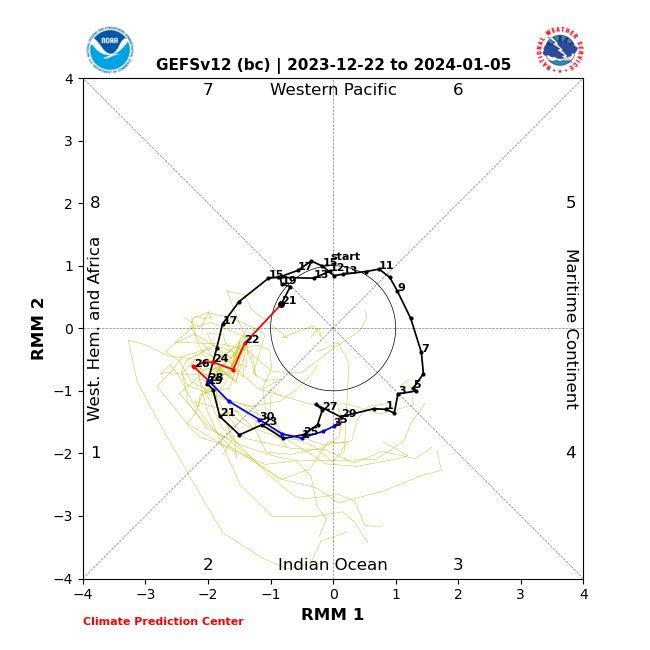
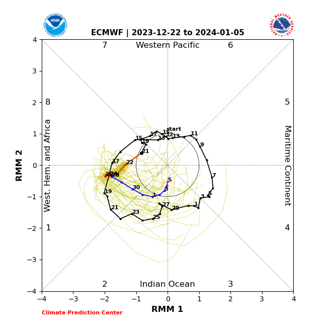
As the MJO rolls into Phase 6, this should only mean the trough reinforces itself over the eastern 1/3 of the country that much more come mid October.

Of course the cooler October trends bring us to the next question, should we continue to ride this cooler trend into November or be worried that the idea of a colder, more wintry, regime taking hold in November (emphasis on the 2nd half of the month) is up for debate?

Stay tuned.

Permanent link to this article: https://indywx.com/2022/10/06/long-range-disco-colder-october-changes/

VIDEO: “Ups” And “Downs” Of October…

Updated 10.06.22 @ 7:32a

You must be logged in to view this content. Click Here to become a member of IndyWX.com for full access.  Already a member of IndyWx.com All-Access?  Log-in here.

Permanent link to this article: https://indywx.com/2022/10/06/video-ups-and-downs-of-october/

VIDEO: Additional Winter Thoughts On This Gorgeous October Evening…

Updated 10.05.22 @ 6:19p

You must be logged in to view this content. Click Here to become a member of IndyWX.com for full access.  Already a member of IndyWx.com All-Access?  Log-in here.

Permanent link to this article: https://indywx.com/2022/10/05/video-additional-winter-thoughts-on-this-gorgeous-october-evening/

VIDEO: Rain Chances Return Thursday Morning; Transitional Pattern Over The Next Couple Weeks…

Updated 10.05.22 @ 7:27a

You must be logged in to view this content. Click Here to become a member of IndyWX.com for full access.  Already a member of IndyWx.com All-Access?  Log-in here.

Permanent link to this article: https://indywx.com/2022/10/05/video-rain-chances-return-thursday-morning-transitional-pattern-over-the-next-couple-weeks/

VIDEO: “Up And Down” Pattern Over The Next Couple Of Weeks…

Updated 10.04.22 @ 7:50a

You must be logged in to view this content. Click Here to become a member of IndyWX.com for full access.  Already a member of IndyWx.com All-Access?  Log-in here.

Permanent link to this article: https://indywx.com/2022/10/04/video-up-and-down-pattern-over-the-next-couple-of-weeks/

Something’s Got To Give…

Updated 10.03.22 @ 5:32p

The NEW European Weeklies are in and continue to paint an intriguing picture as we look ahead to November. Remember, we’re of the belief that the pattern may, indeed, get off to a fast start to the winter season (for a change) this year.

At any rate, note the evolution at 500mb continues to up the ante that this idea may be right as we rumble into mid-November.

However, at the surface, the European doesn’t display the type of cooling one would imagine given the upper air pattern look.

My hunch is that we’ll see the trough “tuck in” further west to include a good portion of the central and east as we move forward and zone in on that mid-November time frame. That will likely force the surface temperature anomalies above to cool (significantly so if this idea is correct) for that time period.

It’ll be interesting to see what the update European seasonal product says in a couple of days. We’ll include that in Thursday’s long range update.

Permanent link to this article: https://indywx.com/2022/10/03/somethings-got-to-give/

VIDEO: No Measurable Rain In Sight; Cooler Air Flows In This Weekend…

Updated 10.03.22 @ 7:27a

You must be logged in to view this content. Click Here to become a member of IndyWX.com for full access.  Already a member of IndyWx.com All-Access?  Log-in here.

Permanent link to this article: https://indywx.com/2022/10/03/video-no-measurable-rain-in-sight-cooler-air-flows-in-this-weekend/

VIDEO: Dry Time Continues; First Widespread Frost Of The Season On Deck Saturday Morning…

Updated 10.02.22 @ 1:14p

You must be logged in to view this content. Click Here to become a member of IndyWX.com for full access.  Already a member of IndyWx.com All-Access?  Log-in here.

Permanent link to this article: https://indywx.com/2022/10/02/video-dry-time-continues-first-widespread-frost-of-the-season-on-deck-saturday-morning/

IndyWx.com