We’re going to begin writing an overview on the weekends (Saturday or Sunday depending on what time allows) of the upcoming week ahead. This won’t serve as a substitute for…
You must be logged in to view this content. Click Here to become a member of IndyWX.com for full access. Already a member of IndyWx.com All-Access? Log-in here.
The stage is set for a stormy evening across central Indiana. The Storm Prediction Center (SPC) has issued a Tornado Watch for all of central Indiana until 9pm. We covered…
You must be logged in to view this content. Click Here to become a member of IndyWX.com for full access. Already a member of IndyWx.com All-Access? Log-in here.
A strong fall cold front will slice into an increasingly warm and muggy air mass across our region tonight. Associated surface low pressure will track into the Great Lakes region.…
You must be logged in to view this content. Click Here to become a member of IndyWX.com for full access. Already a member of IndyWx.com All-Access? Log-in here.
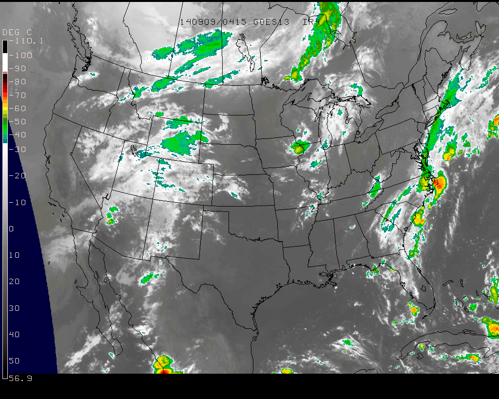
Storms To Our Northwest This Morning…A complex of showers and embedded thunderstorms is moving into extreme northwest portions of the state this morning. We have a very dry and stable air mass in place locally and these storms will weaken as they continue to sag southeast. Most will remain rain-free today, but some light rain will be possible across northwestern and north-central portions of the state later this morning. (NOT a big deal).
Severe; Heavy Rain Threat Wednesday…A strong cold front will push into central Indiana Wednesday night. A warm and humid air mass will be in place and as the front moves through the region, widespread showers and thunderstorms will move over the area. Locally heavy rainfall will be likely and embedded strong to severe thunderstorms will be possible. Damaging wind and hail is our biggest concern, but a quick spin-up tornado can’t be ruled out. We target Wednesday evening and nighttime for greatest chances of thunderstorms across our immediate area.
MUCH Cooler…An October-like air mass will filter into the region late week and as we go into the weekend. A reinforcing shot of cool air will arrive Saturday with a passing shower possible. Hope you’re ready for some true fall-like weather!
7-Day Precipitation Forecast:
7-Day Rainfall Forecast: 1.50″ – 2″
7-Day Snowfall Forecast: 0.00″
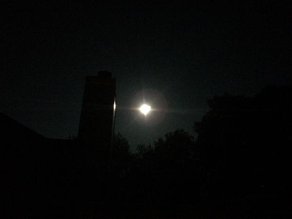
Hopefully you had a chance to see the last ‘super moon’ of the year last night. John Salewicz and Brian Jessen caught the super moon in Zionsville (top) and Brownsburg (bottom). Thanks, guys!
Blow off clouds will move into central and northern portions of the state this morning as a weakening area of showers and thunderstorms pushes closer.
The Storm Prediction Center continues to outline our region for severe potential Wednesday. Early indications suggest we’re eyeing another evening and nighttime storm threat, but there remain questions in regards…
You must be logged in to view this content. Click Here to become a member of IndyWX.com for full access. Already a member of IndyWx.com All-Access? Log-in here.