
The new JMA Weeklies paint a wet and active picture for Week 1, but begin to suggest we get into a milder, drier pattern as we push into the middle and latter portions of May…
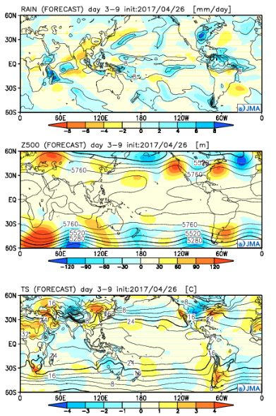
Week 1:
The “mean” upper air pattern places coastal ridges with a cool trough settling into the central. The end result will be a wet and active regime, locally, this weekend into next week. Though we’ll see a “spike” in temperatures Sunday, the overall theme is a chilly one as we open the month of May. In fact, temperatures will trend significantly cooler than average as we push into next week.
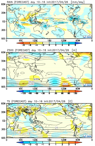
 Week 2:
While it still looks chilly (compared to average), the JMA Weeklies suggest a “calmer” weather pattern moving in. Wet anomalies are noted through the Rockies and Central, but a drier trend across the east, including the Ohio Valley.
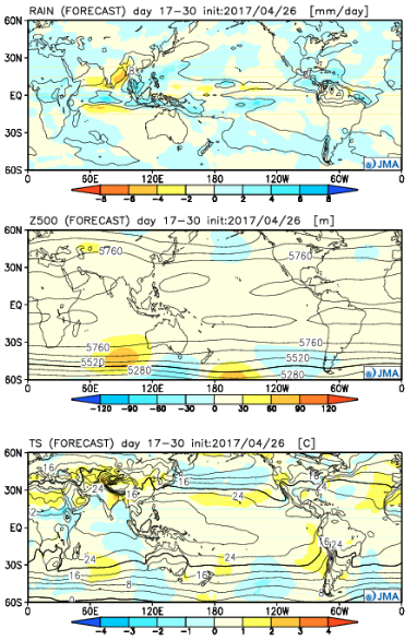
 Weeks 3-4:
Wet times remain across the Central and spread into more of the southern tier, as well. Slightly cooler than normal temperatures are also forecast across the Southeast. Budding warmth seems to develop over the West.
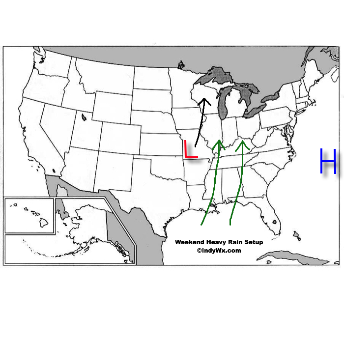 An area of high pressure will be located off the Mid Atlantic coast while surface low pressure develops in the southern Plains and tracks north over the weekend. The combination of these two ingredients will help pull abundant Gulf of Mexico moisture northward into the Ohio Valley. With a true Gulf connection, moisture-rich air will overspread the region this weekend. In addition to feeling truly muggy for the first time this year, this will also aid in periods of heavy rain this weekend.
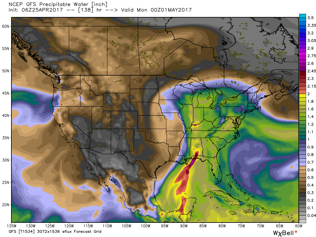 From this distance, it appears like widespread 2″ to 3″ of rain will fall over the weekend, but localized heavier totals are expected where thunderstorms “train” over the same areas. While it won’t rain the entire weekend, times of wet weather will outnumber dry hours and if you live near a creek or stream, keep abreast of this developing weather situation as significant water rise is expected over the weekend.

 Finally, after Saturday morning thunder, we think the majority of next weekend is dry before a cold front brings a return to widespread showers and thunderstorms late Sunday.
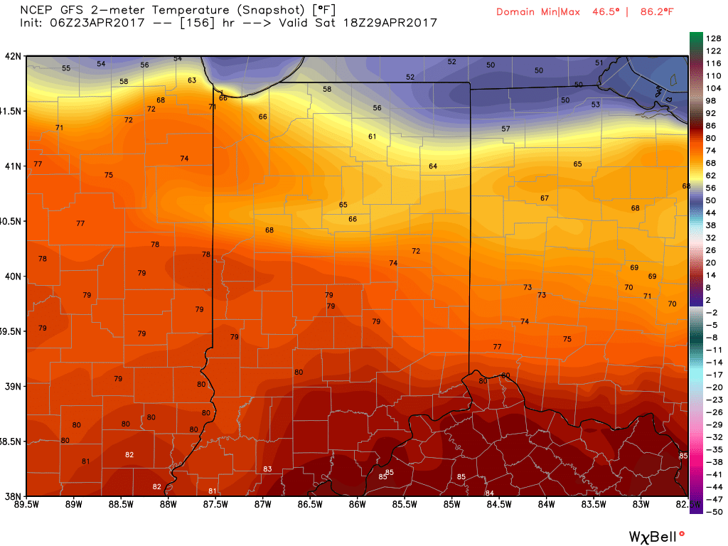
 As a cold front slices into the summer-like warmth (highs will approach 80° Wednesday afternoon), scattered showers and thunderstorms will develop late Wednesday into Thursday.
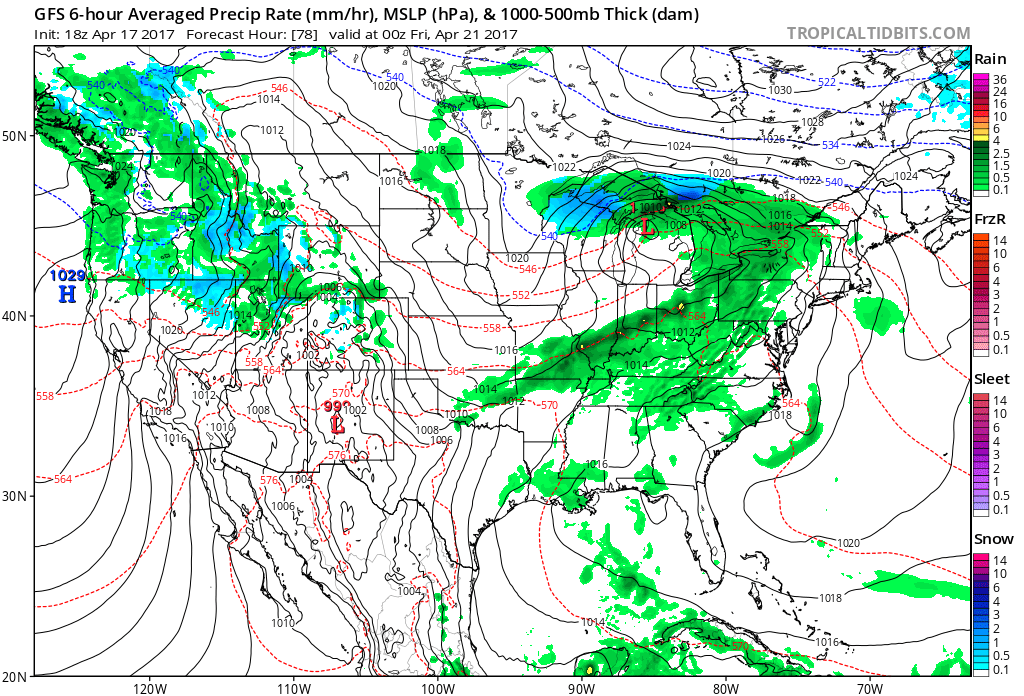 We then will shift gears rather abruptly as we move through the latter portions of the work week and on into the weekend with well below normal chill. In fact, if current data comes to fruition, most of the weekend will be spent in the 40s.
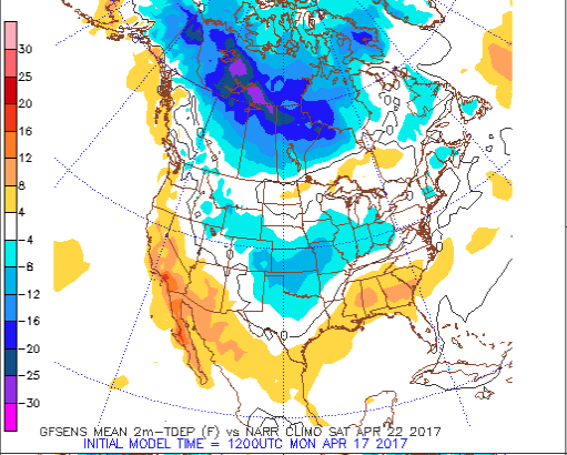 Factor in a stiff northeast wind and periods of rain, we have the makings for a downright “raw” weekend. We suggest having indoor activities planned this weekend as an extended period of damp, blustery, and unseasonably cool weather awaits.
 We still have a few days to continue watching the data, but early indications suggest locally heavy rainfall is possible (1″-2″) across the region…