Category: Forecast Discussion

VIDEO: Severe Potential Tonight, October-Like Chill, And Irma…

The Storm Prediction Center includes an Enhanced Risk of severe weather across north-central parts of the state this evening.  Damaging winds are of greatest concern with the stronger storms embedded in a squall line that will move from north to south this evening (generally between 6p-midnight).

MUCH cooler air will descend into the region as we progress through the week.  Temperatures will be so cool, it’ll feel more like October rather than September, including multiple nights with lows settling into the 40s and highs not making it out of the 60s.

Permanent link to this article: https://indywx.com/video-severe-potential-tonight-october-like-chill-and-irma/

Strong Cold Front Delivers Storms And Another Surge Of October-Like Air…

Today will be dry and pleasant and most of Labor Day, itself, will follow suit.  We’ll notice an increasingly gusty southwest wind by afternoon and this will help boost temperatures into the upper 80s Monday afternoon.

However, once to Labor Day evening, attention will shift off to our north as a line of thunderstorms approaches.  A few embedded storms within this line may reach strong-to-severe levels.  Damaging straight line winds are of greatest concern with the stronger storms.  The Storm Prediction Center has included the region in a Slight Risk of severe weather Monday evening.

After a mostly dry and warm Labor Day, we’ll focus on the evening hours (bracketing 6p-10p) for storms to rumble in.  As mentioned, a couple of these could reach strong to severe levels.

6p forecast radar

8p forecast radar

9p forecast radar

10p forecast radar

Once the front blows through, our winds will shift to the northwest and help usher in a much cooler air mass.  Average highs in the upper 60s and lows in the upper 40s don’t occur until early-October.  We’ll be around 30 days ahead of schedule throughout the majority of the upcoming week, as overnight lows in the upper 40s to around 50 and highs in the upper 60s to around 70 will be common.


Permanent link to this article: https://indywx.com/strong-cold-front-delivers-storms-and-another-surge-of-october-like-air/

VIDEO: Windy & Unseasonably Cool Close To The Work Week…

You must be logged in to view this content. Click Here to become a member of IndyWX.com for full access.  Already a member of IndyWx.com All-Access?  Log-in here.

Permanent link to this article: https://indywx.com/video-windy-unseasonably-cool-close-to-the-work-week/

Pleasant Now; Very Cool, Wet (For Some), And Windy Close To The Week…

Highlights:

  • Pleasant stretch of midweek weather
  • Harvey’s remnants impact the region
  • Gearing up for a strong cold front just after Labor Day

Calm Before The Storm…Weak high pressure will control our midweek weather.  Patchy fog will eventually burn off to partly cloudy conditions this afternoon.  A backdoor cold front will, uneventfully, slip through the state Thursday.  An isolated shower or thunderstorm is possible Thursday afternoon, but most neighborhoods should remain rain-free.

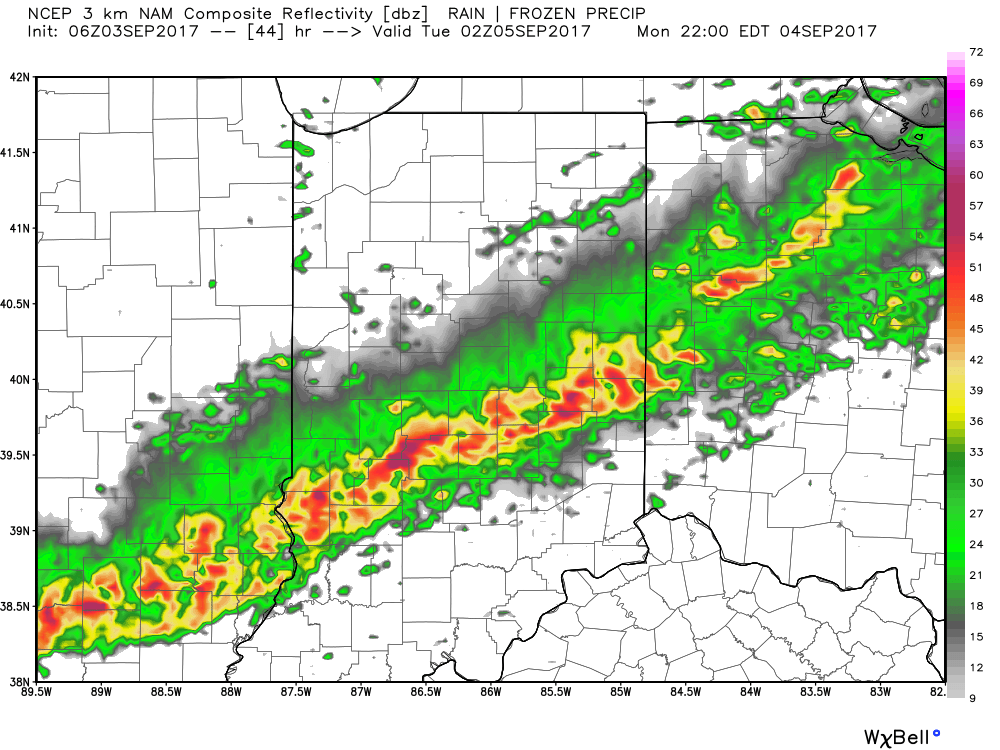
Then our attention turns to Harvey’s remnants.  The greatest impact on central Indiana will be unseasonably cool temperatures and strong and gusty easterly winds.  While the precipitation shield should encompass all of central Indiana, we still believe this will be more “showery” in nature for the city and points north, including north-central parts of the state.  Steadier and heavier rains are likely across southern and southeastern portions of the state (where the axis of 2″+ totals will be likely).  The combination of high pressure located to our northeast and Harvey’s circulation passing along the Ohio River will result in a very stiff easterly flow Friday.  Expect temperatures in the 50s most of the day with gusts over 30 MPH at times.  Have the jackets and sweaters ready.

Moisture will begin to pull east of the region Saturday, but we’ll include the chance of morning showers.

We’ll be in between storms Sunday and Labor Day, itself.  Dry and pleasant conditions can be expected before a strong cold front moves through the state Tuesday.  Scattered showers and a possible thunderstorm will accompany this frontal passage, followed by the coolest air since last spring by the middle of next week.  Get set for an October-like feel…

Upcoming 7-Day Precipitation Forecast:

  • Snowfall: 0.00″
  • Rainfall:  0.30″ – 1.00″
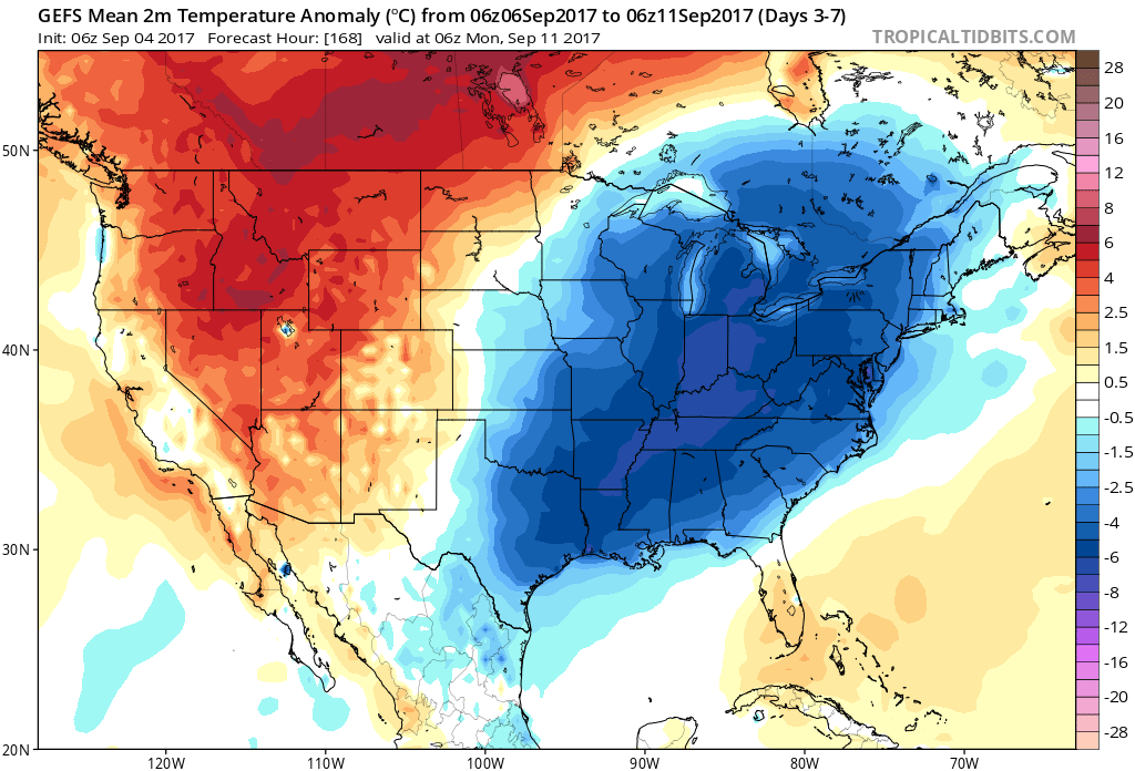
Permanent link to this article: https://indywx.com/pleasant-now-very-cool-wet-for-some-and-windy-close-to-the-week/

Tuesday Morning Rambles…

I.)  Overnight rain and storms impacted central Indiana during the overnight.  Some of the slow moving storms dumped a quick 2″ of rain in isolated areas, but most ended up…

You must be logged in to view this content. Click Here to become a member of IndyWX.com for full access.  Already a member of IndyWx.com All-Access?  Log-in here.

Permanent link to this article: https://indywx.com/tuesday-morning-rambles-4/