Sunday Improvements; Next Storm Arrives Late Next Week…
 Highlights:
- Wet Saturday
- Nice stretch of weather on deck
- Next storm arrives late next week
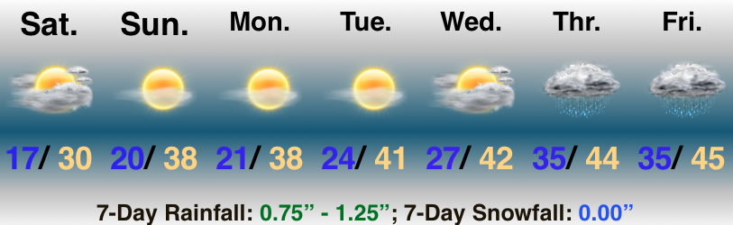
Damp Today; Improvements On The Way…There’s no change to the thought that heaviest and steadiest rain will remain south of the I-70 “mountain chain,” but lighter rain and showers will push north, encompassing more of central Indiana as the day progresses. The trade off for today’s damp weather comes in the form of increasing sunshine Sunday through the middle of next week. Temperatures will run above normal, as well!
The next storm system will begin to impact the region Wednesday afternoon as clouds increase, eventually giving way to rain Thursday morning. As low pressure tracks northeast and strengthens, it’ll help pull enough cold air south to allow precipitation to transition to wet snow Friday.

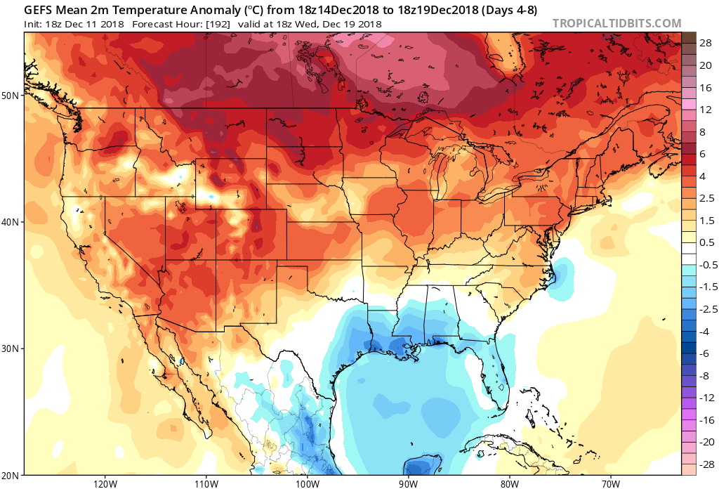 While this will support a 5-10 day period of temperatures of 5° to 10° above average (milder overnight lows, and a few days with highs at or above 50° are a good bet during the period, as well), the stage is already being set in motion for a return of colder conditions around the Christmas holiday. While admittedly, transitional periods can be “finicky,” there’s support from other pattern drivers behind a wintry return between the 12.22 and 12.24 time period. Furthermore, data suggests that there will be plenty of storminess to boot.
 We expect the mean ridge position to set up shop over the Pacific northwest. This will result in a warmer than average regime across the west. At the same time, the trough will be pushing back into the east. As the cold air settles back in, we expect a rather active time of things during the period. This certainly doesn’t mean we’re talking snow storms, but it does appear likely that at least one or two systems of interest loom. We’ll have to deal with the challenges that will come from one or both as time draws closer.
 Highlights:
 Highlights: