Category: Forecast Discussion

Next Week Turns More Active…

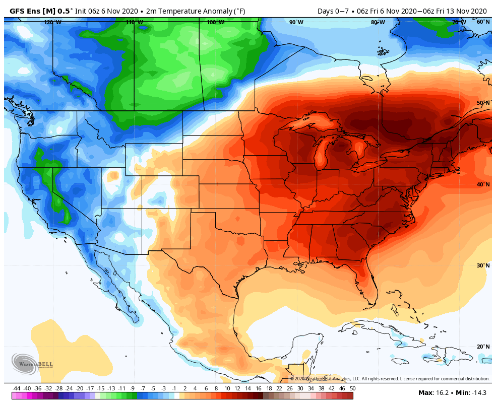
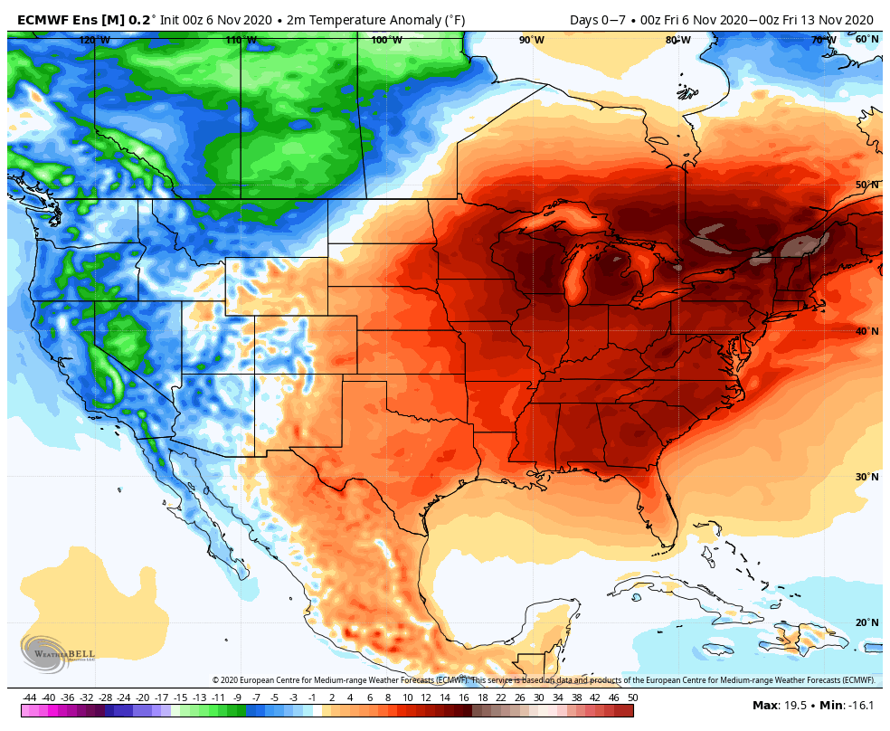
Our quiet and unseasonably pleasant weather pattern will carry us straight through the weekend and to open the early part of the work week. Until Tuesday, expect a “rinse and repeat” pattern to the likes of what we’ve been enjoying the past several days. For those wrapping up final Harvest20 work or perhaps getting a jump on the exterior Christmas decorating, you couldn’t ask for better conditions.

Things will begin to change Tuesday as the first of (2) cold fronts moves through the region. Clouds will increase Monday evening and showers (perhaps even embedded thunder) will blow into town Tuesday PM into Wednesday morning.

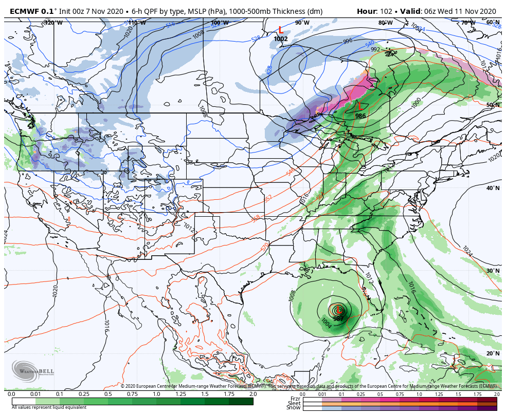
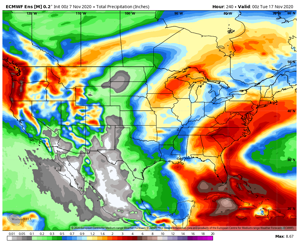
Note “Eta” is also expected to be churning in the Gulf of Mexico at this point- at least in some shape or form. While we don’t expect impacts from what’s left of Eta up this way, our friends in the Southeast and potentially up the eastern seaboard should monitor the progress of Eta during the upcoming week.

Temperatures behind the frontal passage Wednesday will “cool” back to seasonal averages for this time of year.

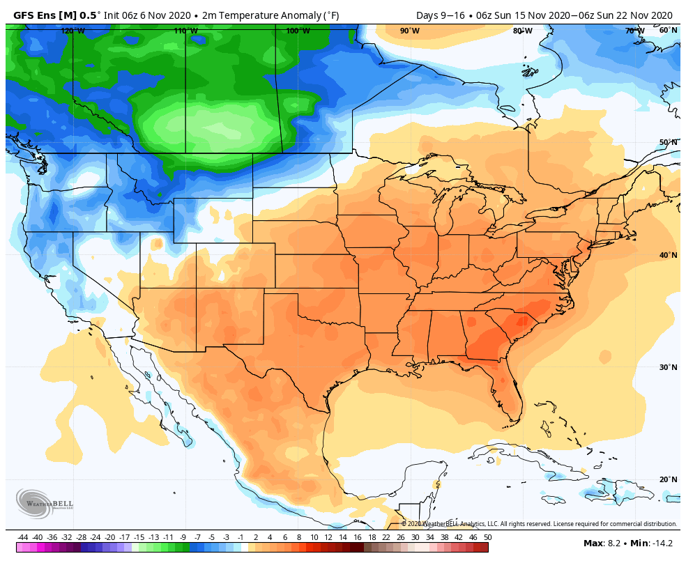
As we look ahead to next weekend, another cold front will sweep through the region. Accordingly, we can expect another round of showers and thunderstorms Saturday into Sunday. It then appears as if a “pop” of colder air (lows around freezing and highs in the upper 40s to lower 50s) will flow into the region early parts of Week 2, at least briefly.

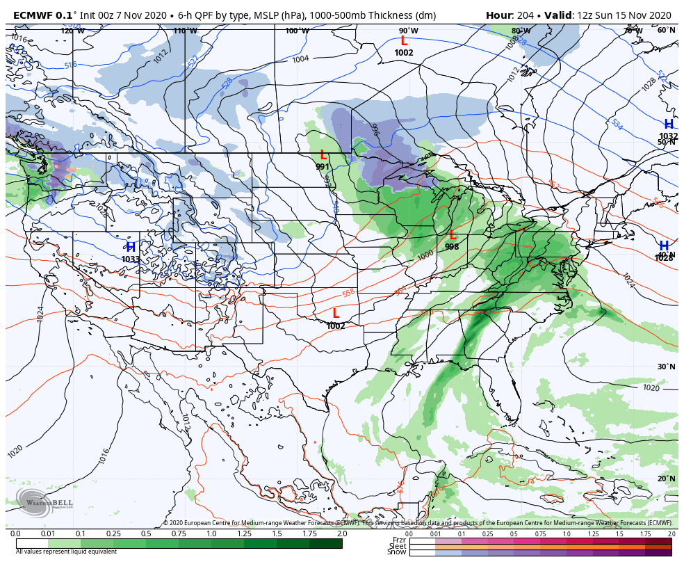
Models aren’t overly excited on rainfall numbers, locally. We’ll forecast between 0.50” and 1” falling between the two frontal passages which is in line with both the GFS and European ensemble data.

Permanent link to this article: https://indywx.com/next-week-turns-more-active/

The Beat Goes On (For Now)…

The unseasonable warmth won’t last, at least not to this magnitude, but an overall warmer than average pattern should persist over the upcoming couple of weeks.

The teleconnections (positive AO, positive EPO, negative PNA) are aligned in a manner that will drive the ‘mean’ ridge position across the eastern portion of the country.

Subsequently, the warmth, relative to normal, remains locked in over the East through mid month. Note how similar the GEFS and EPS are between Week 1 and Week 2.

Though we will cool off behind the passage of a cold front next week, we’re still running above normal into Week 2.

We’re not ready to throw in the towel on the idea we could be looking at a more wholesale pattern shift late month. The MJO supports that idea. Note Phase 2 this time of year favors the chill to settle into the East.

It’ll be an interesting test case in what otherwise looks to be a mild to much milder than normal (and quiet) pattern.

Permanent link to this article: https://indywx.com/the-beat-goes-on-for-now/

VIDEO: Next Opportunity For Rain Arrives Tuesday PM; Looking Ahead At The Longer Range…

You must be logged in to view this content. Click Here to become a member of IndyWX.com for full access.  Already a member of IndyWx.com All-Access?  Log-in here.

Permanent link to this article: https://indywx.com/video-next-opportunity-for-rain-arrives-tuesday-pm-looking-ahead-at-the-longer-range/

VIDEO: Quiet Times Continue; Turning More Active Next Week…

You must be logged in to view this content. Click Here to become a member of IndyWX.com for full access.  Already a member of IndyWx.com All-Access?  Log-in here.

Permanent link to this article: https://indywx.com/video-quiet-times-continue-turning-more-active-next-week/

VIDEO: Gusty Winds Midweek, Otherwise Quiet Times Rumble Along…

You must be logged in to view this content. Click Here to become a member of IndyWX.com for full access.  Already a member of IndyWx.com All-Access?  Log-in here.

Permanent link to this article: https://indywx.com/video-gusty-winds-midweek-otherwise-quiet-times-rumble-along/