Category: Forecast Discussion

Periods Of Storms; BIG Push Of Chilly Air On The Way…

Thr.

Fri.

Sat.

Sun.

Mon.

Tue.

Wed.

 Status-weather-showers-day-icon

 Status-weather-storm-night-icon

 Status-weather-showers-scattered-icon

 Status-weather-showers-day-icon

 Status-weather-clouds-icon

 Status-weather-showers-day-icon

 Status-weather-clouds-icon

61/ 83

46/ 70

43/ 49

40/ 57

44/ 64

49/ 64

48/ 70 

Changes…BIG weather changes begin today as a warm front lifts through the region.  This will lead to a warm and windy afternoon with showers and a possible rumble of thunder arriving as early as the morning rush.  Periods of showers and thunderstorms will continue this afternoon and evening, but we also want to note there will be plenty of dry time in between rain drops.  A bigger push of showers and thunderstorms will blow into town tonight into the wee morning hours Friday.  A couple of these storms may reach severe levels, especially for western communities.  Damaging straight line winds are the biggest concern.

Showers and thunderstorms continue Friday, but the bigger weather story will become our temperatures as a MUCH colder air mass rushes into the area Friday evening on a gusty northwest wind.  Falling temperatures can be expected through the afternoon Friday so you’ll want to be sure to pack the jacket and cold weather gear tomorrow.

Chilly Weekend…Well below normal temperatures can be expected this weekend along with unsettled conditions.  Saturday continues to look like a mostly cloudy and blustery day with periods of drizzle and/ or sprinkles.  Sunday will feature more in the way of sunshine, but caution we may also deal with widely scattered light showers.

Timing Issues…We’ll fine tune early next week once our first storm system moves through the region. As of now, we target Tuesday as the best day of showers, but timing issues abound.  More on this later.

Upcoming 7-Day Precipitation Forecast

  • 7-Day Rainfall Forecast: 1″ – 1.50″
  • 7-Day Snowfall Forecast: 0.00″

John Salewicz sent in this great sunset photo on the Carmel/ Zionsville line Wednesday evening. Thanks, John!

By5hQFxCAAEPvEf

Permanent link to this article: https://indywx.com/2014/10/02/periods-of-storms-big-push-of-chilly-air-on-the-way/

Well-Advertised Major Changes Waiting On Deck…

Thursday will begin the major shift from relatively mild and stable weather that we’ve enjoyed for the past week and a half to one that’s drastically different, and much more resemblant of November by Saturday.

First rain drops will likely splatter on wind shields as early as the morning commute across central Indiana.

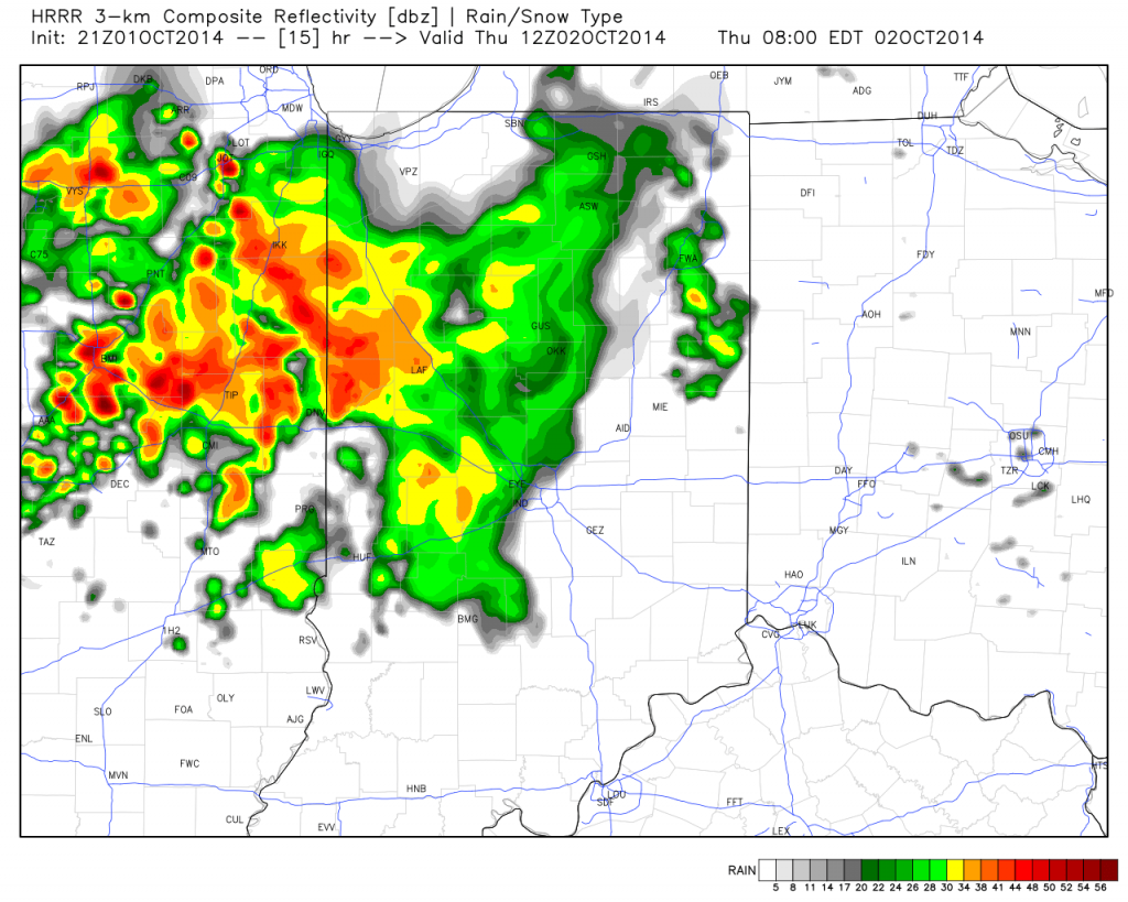
hrrr_ref_indy_16

We’ll then see a “lull” in the action through the majority of the day before more widespread showers and embedded strong to severe thunderstorms rumble in Thursday night into Friday morning.  Here’s a look at forecast radar Friday morning.

hires_ref_ky_43

The Storm Prediction Center does highlight western sections of the state for a Slight Risk of severe weather Thursday.  We’ll continue to monitor things closely.  Localized damaging straight line wind is the primary severe threat in the highlighted risk area.

day2otlk_1730

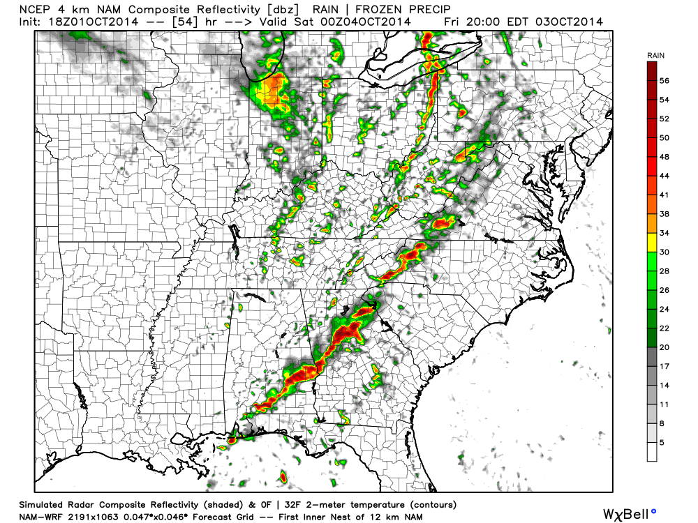
We also want to highlight Friday afternoon and evening for another round of showers and embedded thunder.

hires_ref_ky_55

Rainfall totals should reach between 1″-2″ with locally heavier amounts between the period of Thursday morning and Saturday morning.

hires_t_precip_indy_20

The rain and gusty storms will fall ahead of a strong autumn cold front that will send temperatures on a rapid downward trend come Friday night.  A deep trough will carve itself out over the eastern region Saturday and ultimately have temperatures all the way to the Gulf Coast feeling November-ish by Saturday (perfect football weather, IMO).

By the way, the record low max will be in jeopardy Saturday (49 degrees, courtesy of Sean Ash) as many central Indiana communities may struggle to make it out of the 40s for highs with considerable cloudiness, pesky drizzle, and gusty winds.  Have the jackets and sweaters ready, friends!

gfs_namer_072_500_vort_ht_s


gfs_t2m_min_east_39

Permanent link to this article: https://indywx.com/2014/10/01/well-advertised-major-changes-waiting-on-deck/

Weekly Outlook: Pleasant, But Big Changes Hit Late Week…

– What a beauty of a Sunday evening underway! Temperatures across the Ohio Valley and Mid West are running 15°-20° above where we’d expect them. The recent dry, warm stretch…

You must be logged in to view this content. Click Here to become a member of IndyWX.com for full access.  Already a member of IndyWx.com All-Access?  Log-in here.

Permanent link to this article: https://indywx.com/2014/09/28/weekly-outlook-pleasant-but-big-changes-hit-late-week/

Warm IndySportsReport.Com Colts Forecast

Colts v. Titians Forecast Prepared For:

The Indiana Sports Report

09.28.14

Happy game day Colts fans!  High pressure will remain firmly entrenched across the Ohio Valley region and this will supply tailgaters with ideal early fall weather.  Despite some mid and high level cloudiness early, sunshine and unseasonably warm temperatures can be expected with a light breeze.  Visit IndyWx.com for “Indy’s Behind The Scenes Weather!”

Tailgate Weather

Kickoff Weather

Heading Home

Mid and high level clouds, otherwise partly cloudy. Partly cloudy Mostly clear
Temp: 60-70 Temp: 78-80 Temp:  81-83
Wind:  NE 5 MPH Wind: NE 5 MPH Wind:  NE 5 MPH
Precip: 0.00” Precip: 0.00” Precip:  0.00”


Morning mid and high level cloudiness should give way to increasingly sunny conditions this afternoon.

Morning mid and high level cloudiness should give way to increasingly sunny conditions this afternoon.

Permanent link to this article: https://indywx.com/2014/09/28/warm-indysportsreport-com-colts-forecast/

Enjoy This Weekend; Changes Coming…

Sat.

Sun.

Mon.

Tue.

Wed.

Thr.

Fri.

 Status-weather-clouds-icon

 Status-weather-clouds-icon

 Status-weather-clouds-icon

 Status-weather-clouds-icon

 Status-weather-clouds-icon

 Status-weather-clouds-icon

 Status-weather-showers-day-icon

56/ 80

55/ 81

58/ 80

55/ 78

55/ 78

58/ 81

55/ 69 

Warm; Sun-Filled Weekend…High pressure will anchor itself over the eastern Great Lakes and remain close enough to our region to supply continued sunny skies and dry conditions.  We’ll also continue to enjoy a much warmer than normal feel of things (normal highs this time of year are in the lower 70s).  Enjoy, because this time next week will look and feel MUCH different…

On Cruise Control…No reason to waste many pixels on the early and mid week stretch.  Dry skies and warm air will be the rule up until Friday.

Strong Autumn Cold Front…A strong cold front will move into the area Friday and crash our perfect weather party.  Look for increasing clouds Thursday along with showers and thunderstorms Friday.  Temperatures will crash behind the boundary and set up a weekend that feels more like November than October.

Upcoming 7-Day Precipitation Forecast:

  • 7-Day Rainfall Forecast: 0.50″ – 0.75″
  • 7-Day Snowfall Forecast: 0.00″

Jason Burton sent in this beautiful sunrise shot from Union City Friday morning!  Thanks, Jason!

ByewOWKIEAAk0aJ

Fan of calm, warm weather?  Enjoy this weekend. A look at next weekend shows a drastically different look...

Fan of calm, warm weather? Enjoy this weekend. A look at next weekend shows a drastically different look…

Permanent link to this article: https://indywx.com/2014/09/27/enjoy-this-weekend-changes-coming/

Focusing On The Warmth…

The extended stretch of dry weather will continue well into next week. In addition to the dry weather, temperatures will also moderate from the unseasonably cool conditions for the majority…

You must be logged in to view this content. Click Here to become a member of IndyWX.com for full access.  Already a member of IndyWx.com All-Access?  Log-in here.

Permanent link to this article: https://indywx.com/2014/09/25/focusing-on-the-warmth/

More On The “Typhoon Rule”

Perhaps you’ve heard folks discuss the “typhoon rule” over the past few weeks. What I despise is when people take credit for certain ideas without giving credit where credit is…

You must be logged in to view this content. Click Here to become a member of IndyWX.com for full access.  Already a member of IndyWx.com All-Access?  Log-in here.

Permanent link to this article: https://indywx.com/2014/09/22/more-on-the-typhoon-rule/

Weekly Outlook: Cool Start, Mild Finish

A secondary cold front is moving into central Indiana this afternoon with clouds, gusty northerly breezes, and fresh cool air. Speaking of cool, September, so far, has been cooler and…

You must be logged in to view this content. Click Here to become a member of IndyWX.com for full access.  Already a member of IndyWx.com All-Access?  Log-in here.

Permanent link to this article: https://indywx.com/2014/09/21/weekly-outlook-cool-start-mild-finish/

Catching Up On A Tuesday Evening…

Several interesting weather items are on the docket and each will have to be dealt with as they come over the course of the upcoming 7 days.  Some of the headlines include a brief warm-up Saturday, weekend rain that could include a tropical connection Sunday, and another big shot of October-like chill next week.

While we have a few more days of below normal temperatures in front of us, we eye at least one day where temperatures will manage to climb above normal and that’s Saturday.  All indications still suggest we’ll be very close, if not a degree or two higher, than the 80 degree mark along with a nice southwest air flow in place Saturday.  All-in-all, it’ll be a great day to take care of any early-autumn yard work that’s needing to get done.

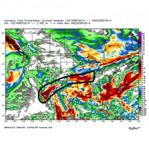
Changes brew Sunday as a cold front draws near.  This is where questions lie and they actually have to do with Tropical Storm Odile (currently all the way to our southwest over the central Baja California peninsula region).  Odilemoisture

While the GFS and European forecast models still aren’t interested in “welcoming” Odile’s moisture into the region, we note the Canadian model does suggest some tropical moisture, courtesy of Odile, gets entangled along the front Sunday.  We’ll continue to keep a close eye on things and monitor the forecast data accordingly moving forward through the back half of the work week.


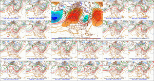
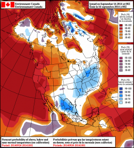
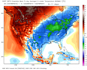
The other item of interest has to do with yet another big blast of autumn air that will have things feeling very much like October around these parts come early next week.  The above average temperatures Saturday will hang around just for the day as yet another unseasonably chilly air mass moves into the area Monday into Tuesday of next week as a significant trough develops over the east with an impressive western ridge in place.  f156


Note the GEFS and Canadian show the return of the unseasonable chill next week.  Keep those jackets handy.  Early indications would suggest this type air mass is plenty capable of highs in the upper 50s/ lower 60s and overnight lows in the upper 30s/ lower 40s during the height of the chill (most likely Tuesday).  Stay tuned…

2014091600_054@007_E1_north@america_I_NAEFS@TEMPERATURE_anomaly@probability@combined@week2_198gefs_t2anom_by5_conus_45


Permanent link to this article: https://indywx.com/2014/09/16/catching-up-on-a-tuesday-evening/

Gorgeous Fall Weather…

Sun.

Mon.

Tue.

Wed.

Thr.

Fri.

Sat.

 Status-weather-clouds-icon

 Status-weather-showers-day-icon

 Status-weather-clouds-icon

 Status-weather-clouds-icon

 Status-weather-clouds-icon

 Status-weather-clouds-icon

 Status-weather-clouds-icon

46/ 68

46/ 69

48/ 67

46/ 68

46/ 71

49/ 75

54/ 82 

Fantastic Fall Day…Chilly Canadian high pressure will remain in control of our weather today and help supply lots of sunshine.  High temperatures will rebound into the upper 60s after the chilly start, but this is still (11) degrees below the average high of 79.

Weak Frontal Boundary Moves In…A weak and moisture-starved frontal boundary will slip into the region Monday afternoon and evening (about 12 hours earlier than we thought yesterday).  We’ll notice an increase in cloudiness tomorrow along with the chance of a few light showers through the afternoon and evening.  We’re not looking at significant rainfall totals, but plan to pack the umbrella as you may need it heading out of the office tomorrow evening.

Back To Dry And Cool…With the exception of Monday, the rest of the work week will be dominated by more ideal fall weather.  Temperatures will remain below average, though slowly begin to moderate towards week’s end.  Sunshine will continue and the combination between dry sunny days and clear, chilly nights will likely begin getting the color season underway a bit earlier than normal this year.  BTW- in the coming weeks ahead, please send in your fall foliage shots to bill@indywx.com!

Quick Warm-Up Ahead Of Next Storm System…While we think we’ll stay dry Saturday, the second half of next weekend may be wet and unsettled as our next storm system moves through.  We’re siding with the European forecast model in regards to rainfall/ storm timing and another chilly Canadian high moving in for now.  Stay tuned.

7-Day Precipitation Forecast:

  • 7-Day Rainfall Forecast: 0.10-0.25″
  • 7-Day Snowfall Forecast: 0.00″
A weak frontal boundary will slip through the region Monday evening with light rain.

A weak frontal boundary will slip through the region Monday evening with light rain.


Permanent link to this article: https://indywx.com/2014/09/14/gorgeous-fall-weather/

IndyWx.com