You must be logged in to view this content. Click Here to become a member of IndyWX.com for full access. Already a member of IndyWx.com All-Access? Log-in here.
Category: Forecast Discussion
Permanent link to this article: https://indywx.com/2015/02/25/wednesday-evening-video-update-loaded-pattern/
Feb 24
Tuesday Evening Video Update; Lots Of Winter On The Table…
You must be logged in to view this content. Click Here to become a member of IndyWX.com for full access. Already a member of IndyWx.com All-Access? Log-in here.
Permanent link to this article: https://indywx.com/2015/02/24/tuesday-evening-video-update-lots-of-winter-on-the-table/
Feb 23
Busy Winter Weather…
February has been a brutally cold month and there’s no let-up in sight during the upcoming 7-10 days.
 The snowpack has expanded over the past few days.
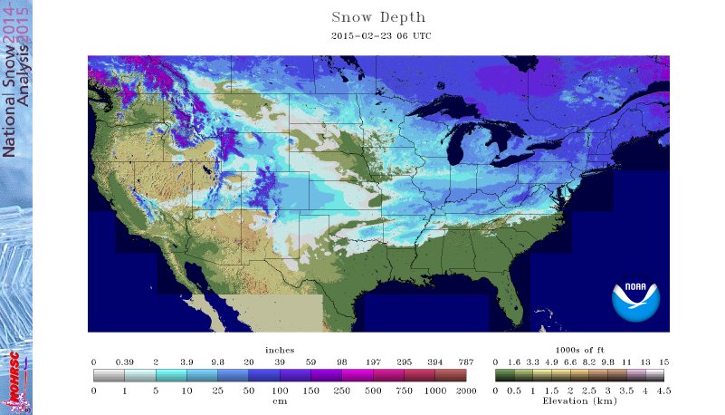 The arctic air is very hard to move and forecast models can struggle mightily in the mid range when arctic air is involved. Add in a vast snowpack over the TN Valley and Ohio Valley and I wouldn’t buy full force into the warm, mostly liquid precipitation solutions as depicted by some European and GFS runs as of late. More on that later.
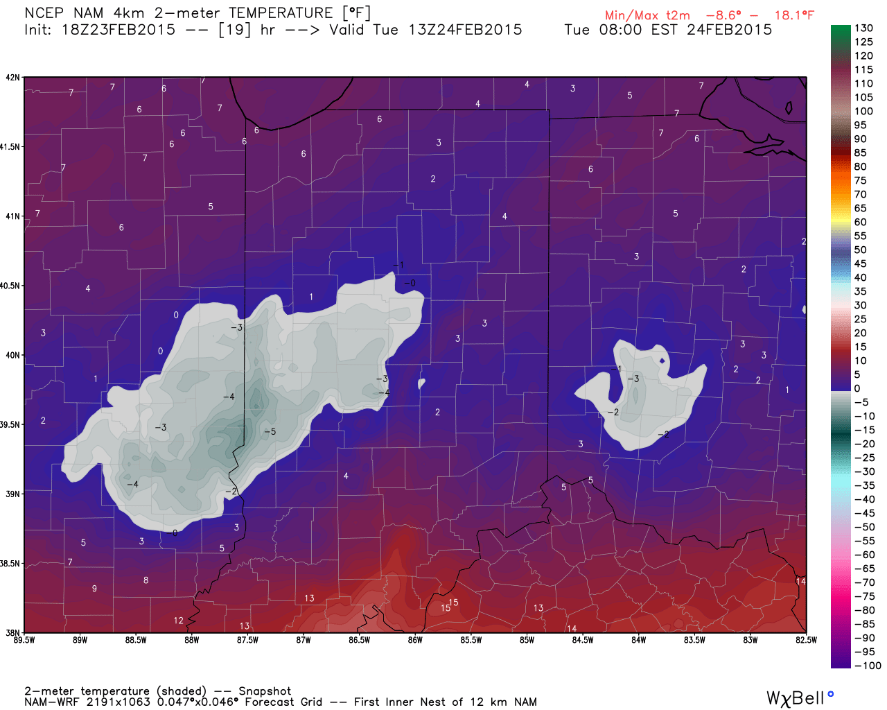
Arctic air is the story in the short-term along with a gusty wind that will precede very light snow Tuesday afternoon/ evening.
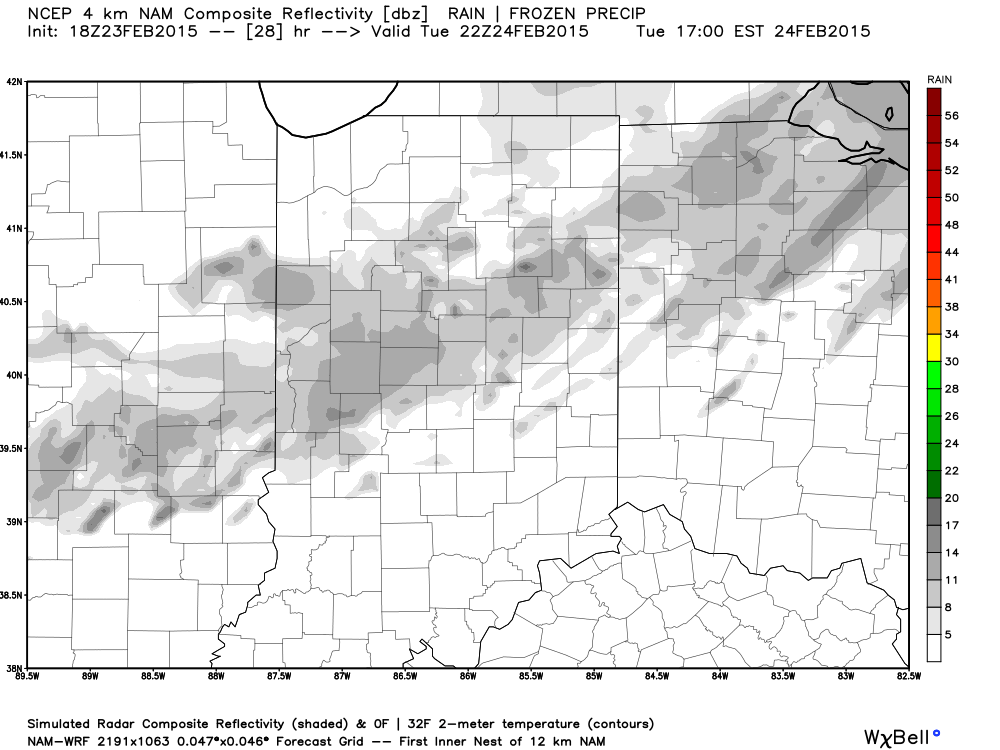 More bitterly cold, arctic air will be with us as we wrap up the work week and head into the weekend. Additional records will fall.
Snow may also be with us. We’re keeping a close eye on a clipper system that could deliver accumulating snow prospects around these parts Wednesday night/ Thursday. The latest RGEM solution (below) depicts a more easterly track. We also note the latest GFS delivers light snow in here Wednesday night and Thursday, as well. We’ll keep a close eye on things.
 Late weekend into early next week features another complicated and very complex event. We believe it’s far too early to buy into any one particular solution provided by the various forecast models, but certainly have to “raise an eyebrow” to the mostly wet, warmer solutions. There’s an awful lot of dense arctic air around and with a widespread snowpack we have to wonder if modeling may be overdoing the warming (where have we seen this before ;-)).
A wavy front may lead to more wintry “mischief” Sunday into early next week. Again- far too early for specifics, but additional wintry weather is certainly possible.
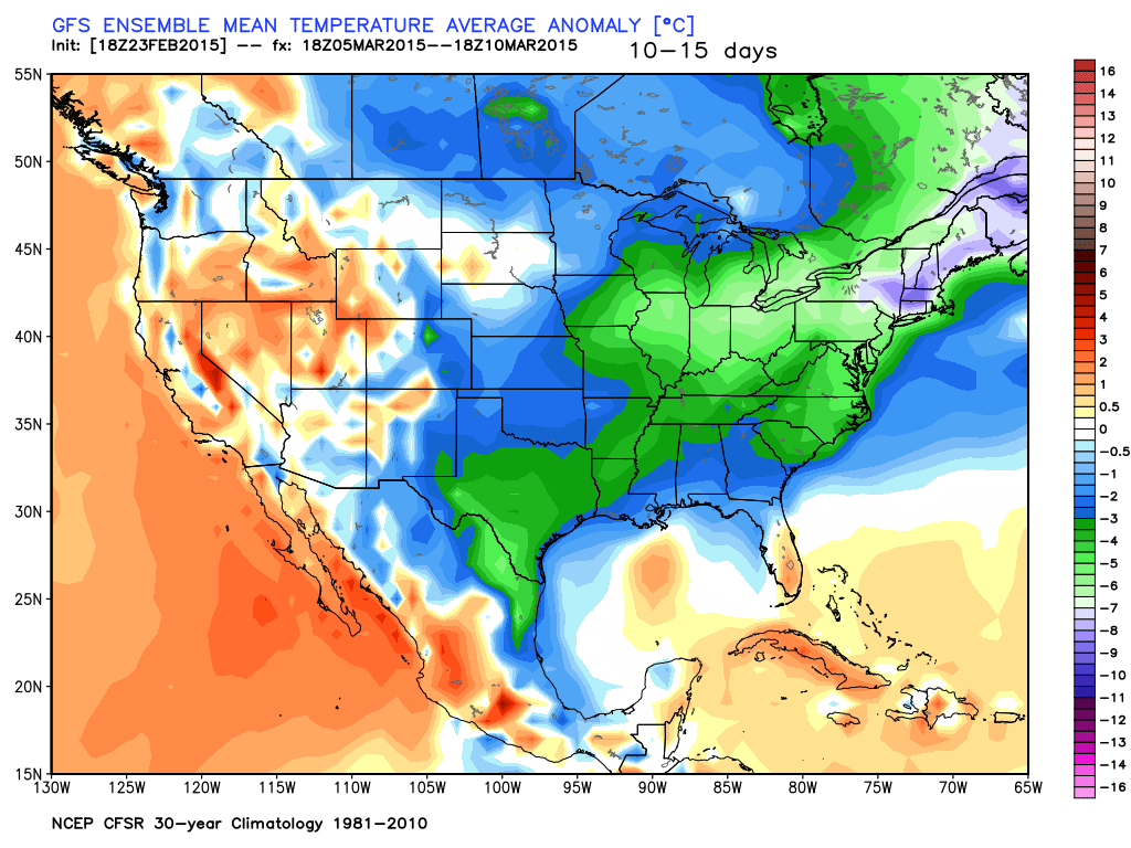
 In the longer term, there’s just no let up in sight from the colder than normal conditions. Sure we may see a couple of days of milder air (we are heading into March, after all), but, as a whole, the majority of the upcoming couple weeks look MUCH colder than normal.
Permanent link to this article: https://indywx.com/2015/02/23/busy-winter-weather/
Feb 21
Saturday Morning Update
Good snowy Saturday morning, friends! We’re getting reports of 3″-5″ of snow so far across central Indiana from “round 1” of our winter storm. While heavy snow bursts remain on radar this morning (case in point from Whitestown down to the west side of Indianapolis), the widespread snow has come to a brief end. Brief is the key word here as widespread snow will overspread most of the region late morning into early afternoon. An additional 1″-2″ of snow will be a good bet from “round 2.”
Here’s a snap shot of what the radar may look like later this morning- centered on 11a.
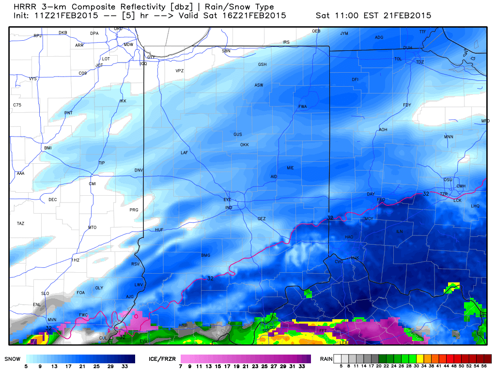 As we push deeper into the afternoon, snow should slowly press south and east of our region. It’ll be important to go ahead and begin the big dig as cold reloads tonight into Sunday and another record cold shot eyes the region early next week.
We’ll have more on your 7-day forecast later today, including another potential winter storm late in the period. For now, enjoy the snow!
Permanent link to this article: https://indywx.com/2015/02/21/saturday-morning-update/
Feb 20
Winter Storm Video Brief
You must be logged in to view this content. Click Here to become a member of IndyWX.com for full access. Already a member of IndyWx.com All-Access? Log-in here.
Permanent link to this article: https://indywx.com/2015/02/20/winter-storm-video-brief/
Feb 19
Latest Thinking On Friday Night-Saturday Winter Storm…
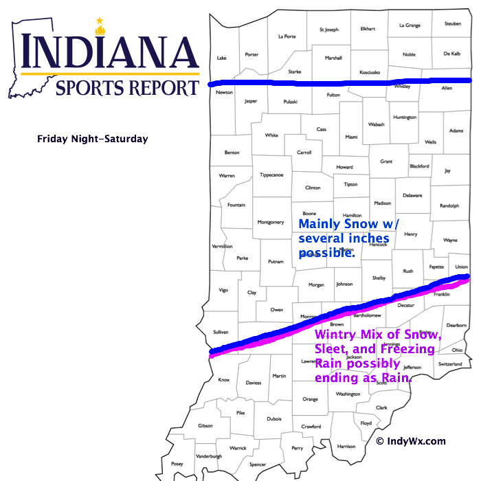
Here’s our latest thinking in regards to Friday night and Saturday.
- Light snow will likely overspread central Indiana Friday night with precipitation intensity increasing late night into early Saturday.
- Periods of light to moderate precipitation (location dependent between snow, ice, and rain) will impact the area Saturday, especially through early afternoon. Several inches of snow will be possible in the “mainly snow zone,” and a first call accumulation forecast will be posted Friday morning.
- You’ll want to shovel and plow any snow and ice Saturday night as temperatures fall Sunday.
- We’ll welcome in the arctic express yet again next week, including more sub-zero temperatures ahead. In fact, next week may feature colder conditions than our current arctic outbreak, especially if we put a snowpack down across central Indiana.
Permanent link to this article: https://indywx.com/2015/02/19/latest-thinking-on-friday-night-saturday-winter-storm/
Feb 18
Dangerous Cold; Weekend Talk…
You must be logged in to view this content. Click Here to become a member of IndyWX.com for full access. Already a member of IndyWx.com All-Access? Log-in here.
Permanent link to this article: https://indywx.com/2015/02/18/dangerous-cold-weekend-talk/
Feb 18
Dangerously Cold; Still Watching The Weekend…
Arctic air just continues to pour into the region and if you’ve been paying attention, each arctic air mass has been colder than the previous. The upcoming couple of days…
You must be logged in to view this content. Click Here to become a member of IndyWX.com for full access. Already a member of IndyWx.com All-Access? Log-in here.
Permanent link to this article: https://indywx.com/2015/02/18/dangerously-cold-still-watching-the-weekend/
Feb 17
Tuesday Evening Video: More Arctic Cold & Snow Ahead…
You must be logged in to view this content. Click Here to become a member of IndyWX.com for full access. Already a member of IndyWx.com All-Access? Log-in here.
Permanent link to this article: https://indywx.com/2015/02/17/tuesday-evening-video-more-arctic-cold-snow-ahead/
Feb 15
Sunday Night From The Road…
I apologize for the late post this evening. I’ll be on the road through Monday so posts will be off schedule really until Tuesday. There’s not a lot today that’s…
You must be logged in to view this content. Click Here to become a member of IndyWX.com for full access. Already a member of IndyWx.com All-Access? Log-in here.
Permanent link to this article: https://indywx.com/2015/02/15/sunday-night-from-the-road/

