Category: Forecast Discussion

Active Times…

An active weather pattern will put the Ohio Valley in for busy times this week. First up is a snow maker that will drop in this afternoon. Snow may even…

You must be logged in to view this content. Click Here to become a member of IndyWX.com for full access.  Already a member of IndyWx.com All-Access?  Log-in here.

Permanent link to this article: https://indywx.com/2015/03/23/active-times/

Sunday Afternoon Catch Up…

It has been a very busy weekend and I apologize for a lack of posts today until now. We have a very active weather pattern on our hands this week.…

You must be logged in to view this content. Click Here to become a member of IndyWX.com for full access.  Already a member of IndyWx.com All-Access?  Log-in here.

Permanent link to this article: https://indywx.com/2015/03/22/sunday-afternoon-catch-up/

Busy Weather Week Next Week…

After a relatively quiet week of weather around these parts, next week promises to be different.  We’ll deal with showers and thunderstorms Wednesday into Thursday. Heavy rain will be possible…

You must be logged in to view this content. Click Here to become a member of IndyWX.com for full access.  Already a member of IndyWx.com All-Access?  Log-in here.

Permanent link to this article: https://indywx.com/2015/03/20/busy-weather-week-next-week/

3/18/15 Ag Weather Report

A weak weather maker will impact Indiana and the Ohio Valley Thursday, especially during the afternoon into the overnight. Precipitation will be relatively light with most amounts around one tenth of an inch, or less.  Note the light precipitation moving through the region Thursday with time stamps below of 7p Thursday and 1a Friday.  Wet snow will mix in with the rain over northeastern IN tomorrow night.

7pm


1amfri


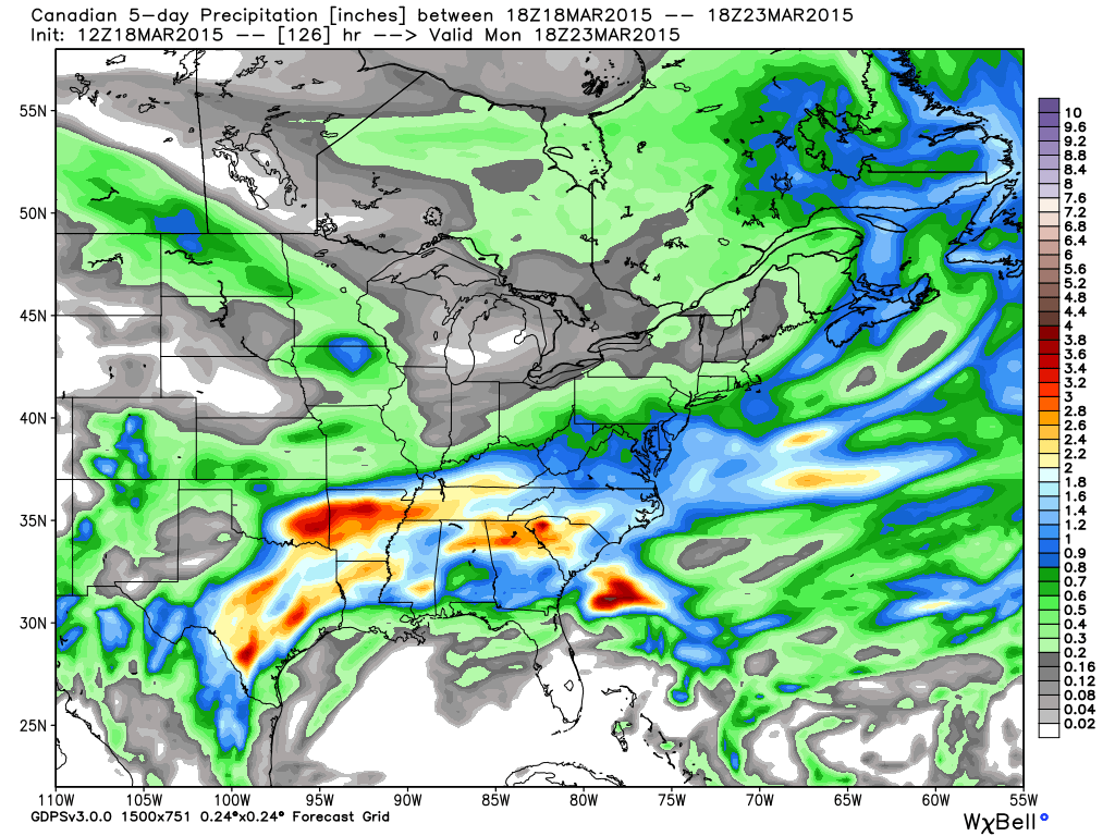
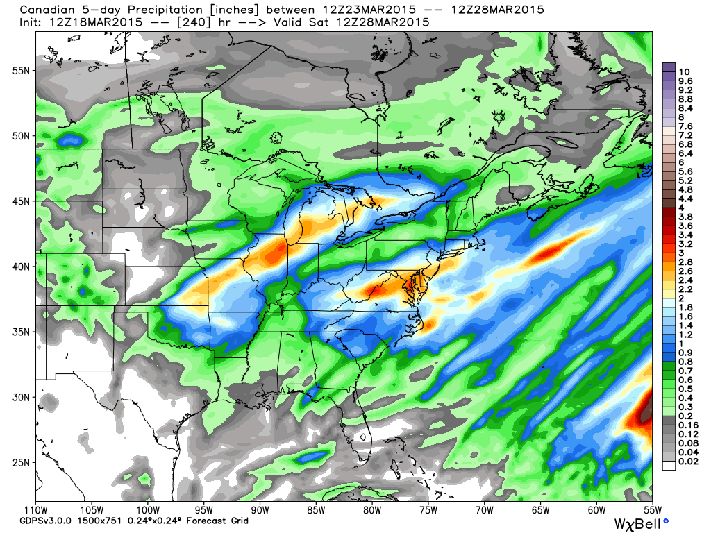
A more active week is ahead, with a couple storm systems to track.  Note forecast precipitation amounts increase from week 1 to week 2.

3181532315


3231532815


Heaviest rains target the lower Ohio Valley and Tennessee Valley week 1 before shifting north week 2.  The heavy precipitation axis points a finger from OK and AR through MO and IL, northern IN, and MI week 2.

Some of this heavier rain is just what the Doctor ordered for areas beginning to reflect abnormally dry conditions and/ or drought.

20150310_south_none

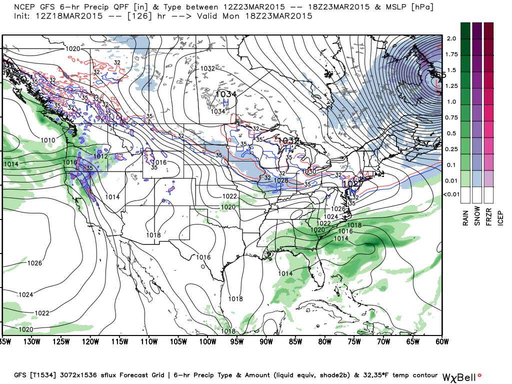
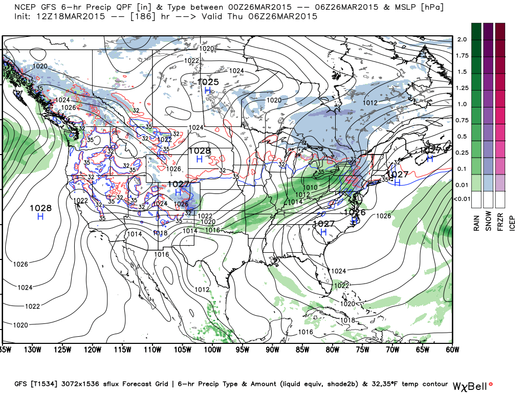
20150310_midwest_noneWe track a weak, but cold system early next week that could deliver a touch of light wet snow Monday.  The GFS led the way on this, but the European and Canadian have jumped on board with today’s runs.

Monday


Another (stronger) storm system is in the offing later next week.  This should be the one that delivers heavy rains from the mid south on northeast.

Thursday


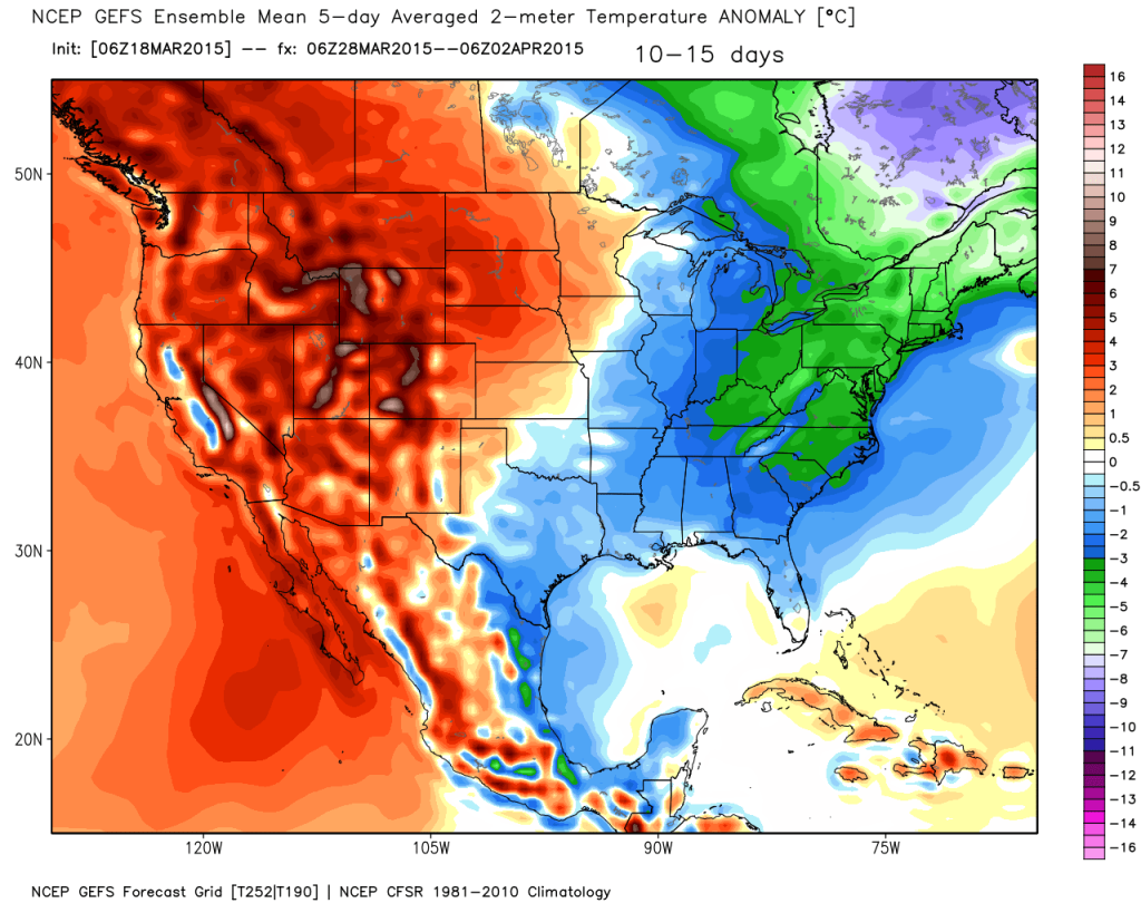
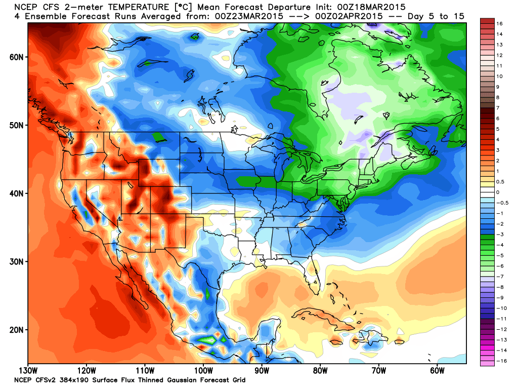
Looking ahead towards late month into early April, temperatures will reflect the normal “roller coaster” regime for this time of year; however biased colder than normal.  Note the excellent model consensus on the colder than average regime.

2015031800_054@007_E1_north@america_I_NAEFS@TEMPERATURE_anomaly@probability@combined@week2_198


gefs_t2anom_by5_conus_61


cfs_anom_t2m_conus_2015031800_x61

Permanent link to this article: https://indywx.com/2015/03/18/31815-ag-weather-report/

Rain Gear Needed; Push For 70° Next Week!

Good morning and happy Friday! A wet day is on tap as moisture streams north from the Gulf of Mexico. Periods of heavy rain will be a good bet, especially…

You must be logged in to view this content. Click Here to become a member of IndyWX.com for full access.  Already a member of IndyWx.com All-Access?  Log-in here.

Permanent link to this article: https://indywx.com/2015/03/13/rain-gear-needed-push-for-70-next-week/

Spring Fling!

A true taste of spring weather is on the way for the middle of the week as highs zoom to around 60° (give or take a few degrees) for many.…

You must be logged in to view this content. Click Here to become a member of IndyWX.com for full access.  Already a member of IndyWx.com All-Access?  Log-in here.

Permanent link to this article: https://indywx.com/2015/03/09/spring-fling/

Milder Air And Rain…

Forecast models are coming around to a more aggressive, wetter, solution for Tuesday. As such, we’ll hit the rain a little harder in our forecast. Anticipate a wet afternoon, especially…

You must be logged in to view this content. Click Here to become a member of IndyWX.com for full access.  Already a member of IndyWx.com All-Access?  Log-in here.

Permanent link to this article: https://indywx.com/2015/03/09/milder-air-and-rain/

Touching Base On A Saturday Afternoon…

You must be logged in to view this content. Click Here to become a member of IndyWX.com for full access.  Already a member of IndyWx.com All-Access?  Log-in here.

Permanent link to this article: https://indywx.com/2015/03/07/touching-base-on-a-saturday-afternoon/

Where We Are And Where We’re Going…

It’s another frigid start to the day and this seems to be the story of the winter of 2024-2015. The weather roundup of 7am temperatures and March 6th snow cover…

You must be logged in to view this content. Click Here to become a member of IndyWX.com for full access.  Already a member of IndyWx.com All-Access?  Log-in here.

Permanent link to this article: https://indywx.com/2015/03/06/where-we-are-and-where-were-going/

Warm Up Coming…

After a long and cold winter, many are excited about hearing of the prospects of a warm up and first true taste of spring.

While the European data has totally bought in to the impressive “spring fling” next week, the GFS isn’t as excited of the potentially warmer times.  Case in point, the GFS and European couldn’t be in more different camps for mid and late next week.  Where the GFS has low/ mid 40s for highs the European has low/ mid 60s for highs.  What’s 20 degrees amongst friends?!

Wild model swings and disagreements are common when pattern changes are taking place.   While we might not get as warm as the Euro. would imply, it’s a safe bet we’ll be considerably warmer than the chilly GFS readings.

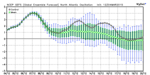
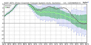
Note the AO and NAO strongly positive through the next 10-15 days.  This is the time of the year when these teleconnections can impact our region’s weather in the most significant way.  Both of these are warm signals taken at face value.
3


4


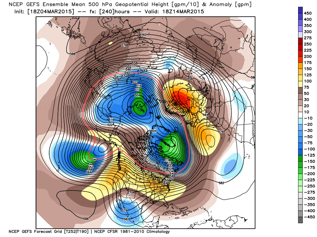
Note the pattern flip to a “flat” ridge by Day 10, indicative of the milder times ahead.
1


However, by Day 15 we notice the Alaskan ridge redeveloping.  This is NOT a signal for warm weather across our part of the region, as the steering currents would tap available cold air and direct it south into the Mid West and Ohio Valley.

1


So, what do we take from this?  We’re going to warm next week without question.  While the extent of the warming is up for debate, the overall milder times for a 5-7 period is a good call at this point.  On the flip side, we’re not ready to buy into the idea that spring is here for good just yet.  The building Alaskan ridge by the end of Week 2 would imply a cold close to March, and potentially continuing into early April.

Another item to keep a close eye on the upcoming 4-6 weeks?  Those NAO and AO signals.  Should they remain predominately positive this time of year then it’ll be exceptionally challenging to get any sort of cold pattern to lock in for more than a day or two.

Permanent link to this article: https://indywx.com/2015/03/04/warm-up-coming/

IndyWx.com