Category: Forecast Discussion
With the combination of the race and Memorial Day weekend, a busy week is ahead. Here are a few weather headlines that have our attention as we open the week:…
You must be logged in to view this content. Click Here to become a member of IndyWX.com for full access. Already a member of IndyWx.com All-Access? Log-in here.
Permanent link to this article: https://indywx.com/2015/05/17/thoughts-on-the-big-week-ahead/
1.) The first half of May has been warmer and drier than average, locally. 2.) Sunday is shaping up to be a very busy severe weather day in…
You must be logged in to view this content. Click Here to become a member of IndyWX.com for full access. Already a member of IndyWx.com All-Access? Log-in here.
Permanent link to this article: https://indywx.com/2015/05/16/saturday-morning-rambles-5/
You must be logged in to view this content. Click Here to become a member of IndyWX.com for full access. Already a member of IndyWx.com All-Access? Log-in here.
Permanent link to this article: https://indywx.com/2015/05/14/touching-base-on-thursday-evening/
 Highlights:
- Another chilly start
- Warmth and humidity on the uptick heading into the weekend
- More dry hours than wet this weekend
- Much cooler next week
We’ll enjoy one more beautiful day Thursday, though we’ll note an increase in afternoon cloudiness. While a shower will be possible Thursday evening (courtesy of a warm front passing through the region), it won’t amount to much as dry air will “eat away” at what will look like a rather impressive surge of moisture to our west Thursday morning. Once the warm front blows through tomorrow night, a much more humid and unseasonably warm air mass will engulf the region to wrap up the work week and head into the weekend.
A widely scattered storm will be possible, but there will be many more dry hours than wet. Better coverage of showers and thunderstorms arrives Sunday night/ Monday as a cold front presses through the region. Total rainfall potential between this weekend and Monday looks to fall in the half inch to one inch range for most. A much cooler and drier air mass returns next week (even cooler than this current air mass).
 A light shower will be possible Thursday evening as a warm front lifts through the region.
 Warmth and humidity will be on the uptick Friday and continue through the weekend. Prepare to sweat as dew points approach 70 degrees this weekend.
 Most widespread showers and thunderstorms will arrive Sunday evening into Monday, courtesy of a cold front passing through the region.
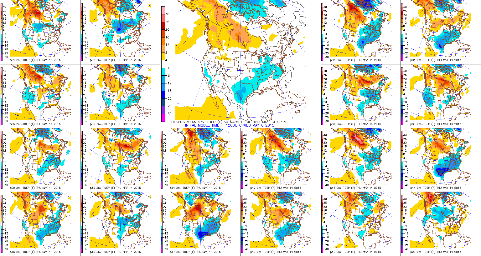
 A MUCH cooler air mass will settle into the Mid West region next week. In fact, next week’s chill looks more impressive than our current cool air mass- both from a duration perspective and absolute temperature.
Permanent link to this article: https://indywx.com/2015/05/13/one-more-pleasant-day-before-warmth-and-humidity-increases/
The story through Thursday will be one summed up in two words: dry and cool! High pressure will supply beautiful weather as we head into the latter portion of the work week. (May be a good couple days to use some of that PTO :-))!
Temperatures both tomorrow morning and Thursday morning will fall into the 40s. In fact, some neighborhoods away from the city, itself, may fall to between 38-39 just before sunrise Wednesday. Unlike today, afternoon cloudiness won’t be an issue and winds will be much lighter.
Changes will ensue as we progress into the weekend thanks to our air flow shifting around to a more southerly and southwesterly direction. This will pull increasingly humid air northward and we’ll introduce widely scattered showers and thunderstorms into the central IN weather picture Friday afternoon, continuing through the weekend.
 It should be noted, however, that modeling today isn’t nearly as wet and stormy as previous runs. Will this be proven to be an anomaly, or is the drier trend the correct solution? We’ll give it a couple more runs before taking things at face value, but feel confident in saying that while scattered showers and thunderstorms will be in the picture, many more dry hours can be expected as opposed to wet and stormy.
Permanent link to this article: https://indywx.com/2015/05/12/cool-and-dry-through-thursday-weekend-changes/
-
Filed under 7-Day Outlook, Canadian Model, Forecast, Forecast Discussion, Heavy Rain, HRRR, Rain, Spring, T-storms, Unseasonably Cool Weather, Unseasonably Warm
-
May 11, 2015
 Highlights:
- Much cooler and drier through Thursday
- Moisture increases this weekend
- Stormy early next week
A cold front swept through the state this evening and a much drier and cooler brand of air is filtering into IN as we type this. That cooler and drier regime will carry us into late week before moisture slowly begins to return. High pressure will shift east and allow a moist return flow Friday into the weekend. Add in a couple of disturbances and the associated forcing, combined with the increasing warmth and humidity, and the stage is set for periods of showers and thunderstorms over the weekend. It certainly won’t rain the entire time, but plan on localized heavy downpours.
 A MUCH cooler air mass will greet Hoosiers out the door Tuesday morning. Even cooler air will be with us Wednesday and Thursday mornings.
 High pressure will supply plentiful sunshine and cooler than normal air through mid week.
 A southwesterly return flow will lead to increasing chances for showers and thunderstorms across not only our local area, but across a widespread portion of the Plains and Ohio Valley. Furthermore, a significant severe weather outbreak appears to be a good bet across the Plains.
 After a dry mid week stretch, active times return over the weekend into early next week. Localized torrential downpours are likely. Most of the 1″ to 2″ of rain forecast shown above (courtesy of the GEM model off the Weatherbell.com suite) is expected to fall early next week.
Permanent link to this article: https://indywx.com/2015/05/11/a-much-cooler-drier-trend/
We continue to closely monitor the threat of severe weather today. Best chances of severe thunderstorms likely will come this afternoon into the early evening hours from west to east,…
You must be logged in to view this content. Click Here to become a member of IndyWX.com for full access. Already a member of IndyWx.com All-Access? Log-in here.
Permanent link to this article: https://indywx.com/2015/05/11/severe-weather-potential-today/
First and foremost, here’s wishing a very happy Mother’s Day to all of the moms out there! May has gotten off to a much warmer and drier than normal start. …
You must be logged in to view this content. Click Here to become a member of IndyWX.com for full access. Already a member of IndyWx.com All-Access? Log-in here.
Permanent link to this article: https://indywx.com/2015/05/10/sunday-morning-thoughts/
-
Filed under Forecast Discussion, Forecast Models, Heavy Rain, Rain, Severe Weather, Spring, Summer, T-storms, Unseasonably Cool Weather, Unseasonably Warm
-
May 8, 2015
May has gotten off to a warm (dare I say hot?) start. The past couple days have felt more like July than May with mid to upper 80s commonplace.…
You must be logged in to view this content. Click Here to become a member of IndyWX.com for full access. Already a member of IndyWx.com All-Access? Log-in here.
Permanent link to this article: https://indywx.com/2015/05/08/friday-morning-rambles/
-
Filed under 7-Day Outlook, Forecast, Forecast Discussion, Forecast Models, Heavy Rain, Rain, Spring, T-storms, Unseasonably Cool Weather, Unseasonably Warm
-
May 6, 2015
 Highlights:
- Feeling like summer
- Storm chances ramp up going into the weekend
- Best chances of widespread rain arrives Monday
- Much cooler next week
As we get set to put a wrap on another busy work week, near record warmth is the big weather story. Those unseasonably warm conditions we’ve dealt with over the past few days will continue into the weekend, but we’ll also add rain and storm chances. Coverage of thunderstorms will be categorized as “isolated” Friday, “scattered” Saturday and Sunday, and “widespread” Monday. As moisture continues to surge into the region, locally heavy downpours can be expected, and a downright muggy feel. A severe storm is certainly possible, but the more widespread severe outbreak will remain to our west across the central Plains region. Much cooler air will pour into the region behind a Monday night frontal passage.
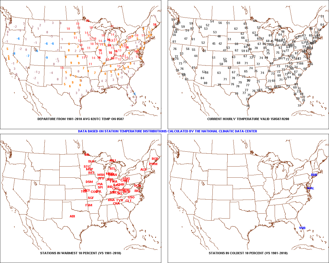
 As we type this (around 10p Wednesday evening), temperatures are still in the middle 70s and a whopping 15-20 degrees above average this hour across the area.
 Think it’s humid now? Just wait until the weekend. A strong southwest flow will pull moisture-rich air northward, courtesy of a Gulf of Mexico connection. Dew points will approach 70 degrees across many southern and central IN communities and help fuel locally heavy rainfall with any storm that develops Friday night through Monday.
 A MUCH cooler air mass will filter into the region behind the cold frontal passage Monday night/ early Tuesday. After a week of summer-like heat, upper 50s for highs will feel downright chilly.
Permanent link to this article: https://indywx.com/2015/05/06/summer-like-turns-much-cooler-next-week-storms-in-between/


