Category: Forecast Discussion

Cooler Times Ahead By Mid Month?

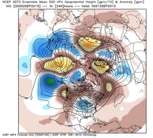
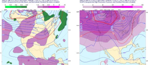
Summer sure doesn’t appear to be letting go anytime soon as our recent 7-day outlook suggests, but there are indications that our unseasonably hot and humid regime may take a back seat to the refreshing taste of fall in about 10 days.  The big “tip of the cap” towards the cooler pattern?  The PNA, or Pacific North American pattern, shifting from negative to positive.  As shown below, both the European (top) and GFS (bottom) highlight the PNA shift to positive.

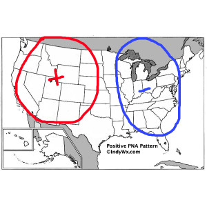
Screen Shot 2015-09-02 at 7.58.03 AMA positive PNA favors eastern troughiness and an associated cooler than normal regime over our neck of the woods.

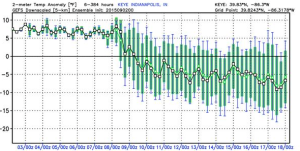
PositivePNASure enough, models are trending towards a much cooler direction for week 2.

Screen Shot 2015-09-02 at 7.54.04 AM

Screen Shot 2015-09-02 at 7.53.54 AM

Screen Shot 2015-09-02 at 7.54.14 AMIt’ll be fun to watch things unfold.  For now, if you’re a fan of summer weather, be sure to enjoy the next week, or so, as things appear to be changing for the much cooler side of things around the 10th (give or take a day or two).

Permanent link to this article: https://indywx.com/2015/09/02/cooler-times-ahead-by-mid-month/

Tuesday Weather Notebook…

  Tuesday Storms: A small, but vigorous upper level disturbance is overhead this morning and will serve as a focal point for thunderstorm development. The disturbance shows up very nicely…

You must be logged in to view this content. Click Here to become a member of IndyWX.com for full access.  Already a member of IndyWx.com All-Access?  Log-in here.

Permanent link to this article: https://indywx.com/2015/09/01/tuesday-weather-notebook-2/

Monday Weather Notebook…

Cool August:    Despite the warm close to August, the month, as a whole, has been cooler than average across the Plains, Ohio Valley, and Tennessee Valley. Heat Expands:   …

You must be logged in to view this content. Click Here to become a member of IndyWX.com for full access.  Already a member of IndyWx.com All-Access?  Log-in here.

Permanent link to this article: https://indywx.com/2015/08/31/monday-weather-notebook-2/

Welcome To The Weekend!

Quick post this morning (we’ll update our 7-day later this evening) to highlight our weekend forecast.  We’ll begin to go through a transition this weekend from the unseasonably cool, dry,…

You must be logged in to view this content. Click Here to become a member of IndyWX.com for full access.  Already a member of IndyWx.com All-Access?  Log-in here.

Permanent link to this article: https://indywx.com/2015/08/28/welcome-to-the-weekend/

Thursday Weather Notebook…

Cool and Dry:       We’re off to a cool start this morning with many reporting sites in the lower 50s. Note the cooler than normal air extends all the…

You must be logged in to view this content. Click Here to become a member of IndyWX.com for full access.  Already a member of IndyWx.com All-Access?  Log-in here.

Permanent link to this article: https://indywx.com/2015/08/27/thursday-weather-notebook-2/

Wednesday Weather Notebook….

Refreshing: We’re off to another pleasantly cool start this morning. Also note the cooler air has been able to ooze into the southeast.     Speaking of cool, it’s been a…

You must be logged in to view this content. Click Here to become a member of IndyWX.com for full access.  Already a member of IndyWx.com All-Access?  Log-in here.

Permanent link to this article: https://indywx.com/2015/08/26/wednesday-weather-notebook/

A Word On Early September…

First and foremost, I’ll apologize in advance for a lack of posts today and go ahead and apologize for the same tomorrow.  We’ve been incredibly busy over the past couple days and as a result posting has (and will be) out of schedule until mid week.

We wanted to briefly touch on early September with this post.  (This isn’t our September forecast, as that will be posted by the end of the week).

Speaking of September, we’ve always had September as a warmer than normal month.  Despite the warm September forecast, we did initially think we may have a 2-3 day period in early September that would feature yet another pop of cooler than normal air.  That’s speaking specifically at the period around 9.3-9.5 (give or take a day or two) and after a warmer than normal stretch this weekend into early next week.  (By the way, after a warm September, we think things turn cold rather fast in October and November, but that’s for another day).

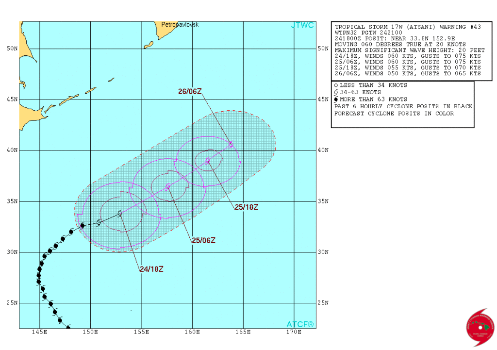
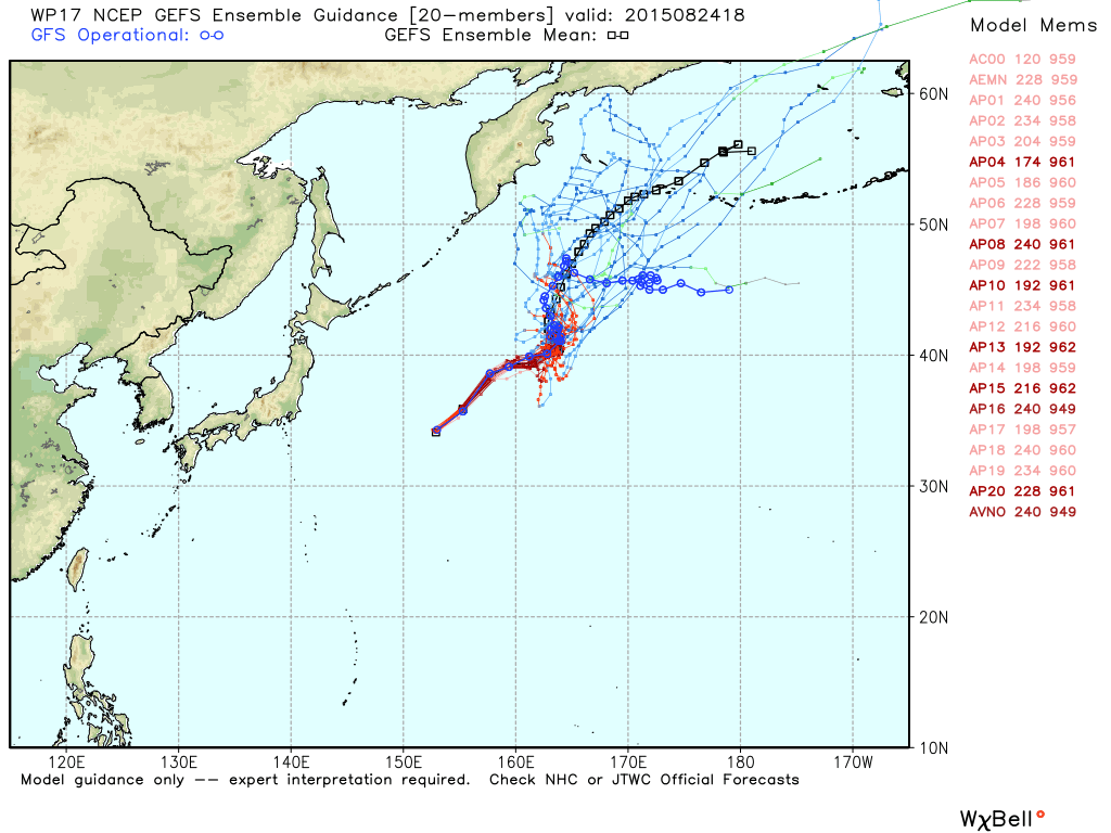
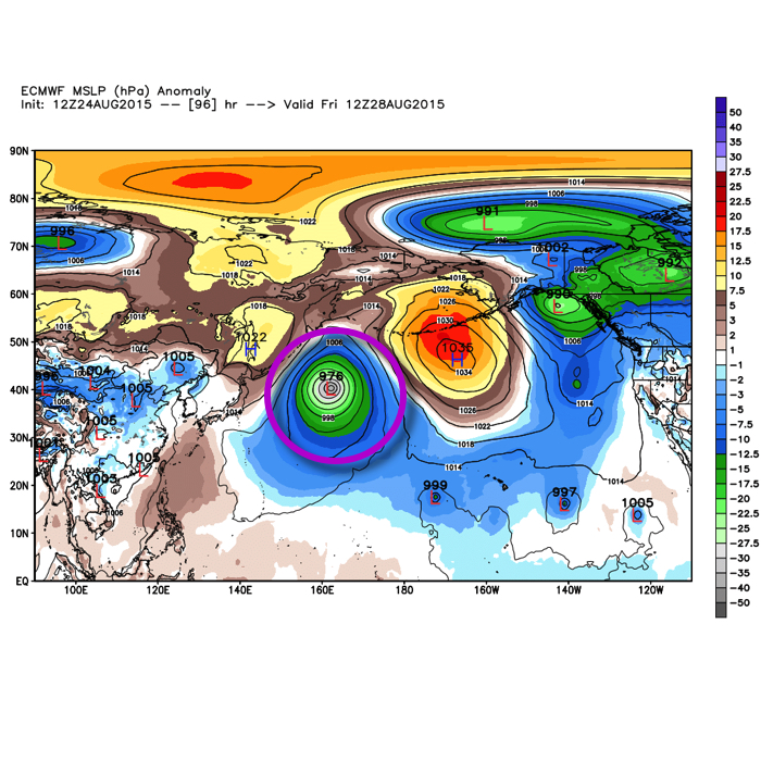
The reasoning behind our thinking of a few days of cooler air in the 9.3-9.5 time frame was from the overall pattern that is leading to Typhoon Atsani recurving in the western north Pacific.  It’s important to note that it isn’t the recurving typhoon itself, but the overall pattern that provides a good hint at what’s ahead downstream 6-10 days later- be it ridging or the tendency for “troughiness.”

wp1715However, modeling has been trending towards Atsani stalling in the north Pacific and even some data likes to drift the system northwest over time through the upcoming weekend before significant weakening.

gefs_WP17_current


Atsani

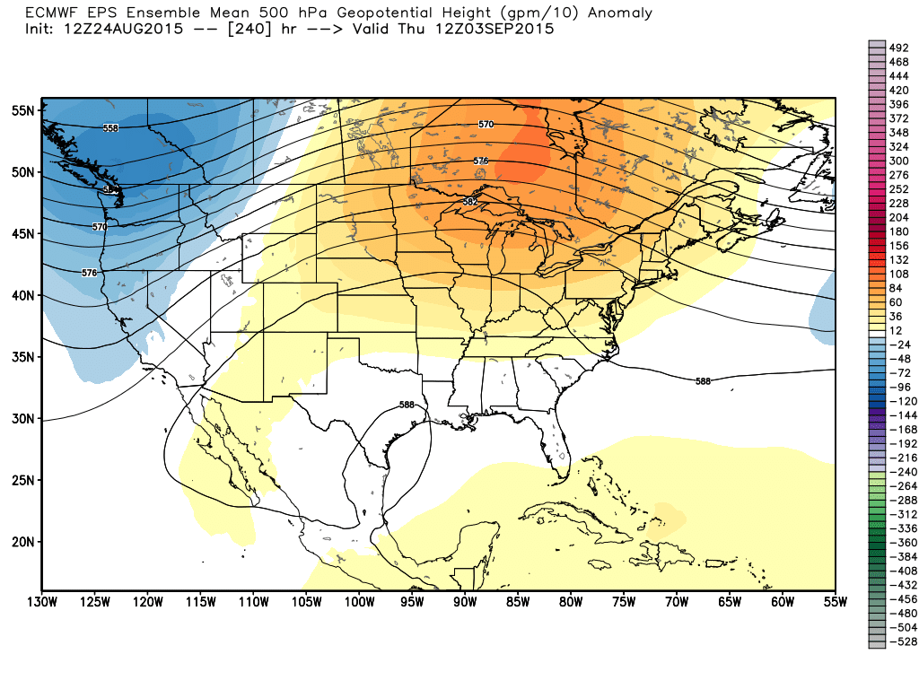
The end result here?  Much less emphasis on cool and attention that turns to a rather lengthy period of warmer than normal temperatures through the month of September, including early September.

ecm_eps_z500a_conus_11Much more later!

Permanent link to this article: https://indywx.com/2015/08/24/a-word-on-early-september/

Saturday Morning: A Look Where We’ve Been And Where We’re Going…

August has been cooler and drier than normal month-to-date.  As we’ll get into below, this cooler, dry trend should continue to wrap up the month.

* Click on any image to enlarge.
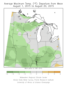
August temperature departure- month-to-date.
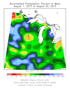
August temperature departure- month-to-date.

August precipitation departure- month-to-date

August precipitation departure- month-to-date2015 to date has been cool central and east:2015 to date has been cool central and east:

2015 to date has been cool central and east:
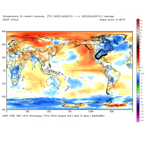
4The upcoming winter looks fun and challenging.  It’s a volatile look with the strong Nino and warm northern, eastern Pacific (positive PDO).  Certainly can’t “broad brush” the upcoming winter forecast solely based off similar strong Ninos of the past…
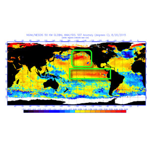
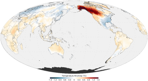
10Positive PDO temperature anomalies favor western Canada ridging and troughiness east.  It’s a pattern that favors a cooler than normal regime across the east and southeast.
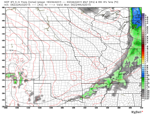
11As we go into the weekend, sunshine and comfortable conditions today will give way to increasingly cloudy skies Sunday with a threat of a shower or thunderstorm, especially during the afternoon and evening.  A few of these storms could reach strong levels.  The culprit?  Another strong late August cold front.  Most rainfall totals will be around a quarter inch Sunday, but there will be some locally heavier totals with stronger storms.
5Warmer conditions will build in briefly in between the early week cool spell and stronger push of cool inbound Sunday night that will remain with us through the majority of the upcoming work week.
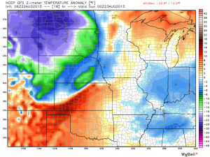
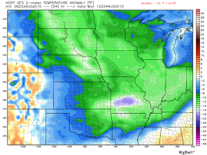
6

7Longer term, we think conditions warm going into next weekend after a very cool, fall-like week, but don’t necessarily agree with the GFS ensemble plot below into early September.
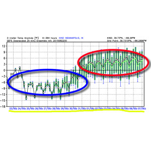
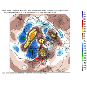
3We expect ridging to build in to close the last couple days of August.
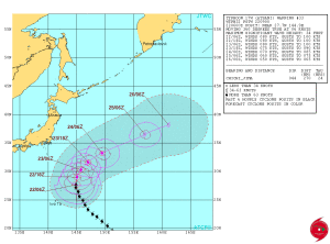
9However, recurving Typhoon Atsani argues for a return of cooler air (briefly) and an associated trough arriving between September 2nd and 4th…
8Images credited to the following:

  • weatherbell.com
  • http://www.usno.navy.mil/JTWC/
  • http://mrcc.isws.illinois.edu/cliwatch/watch.htm#seasonMaps
Permanent link to this article: https://indywx.com/2015/08/22/saturday-morning-a-look-where-weve-been-and-where-were-going/

Thursday Weather Notebook…

Wow, what a difference 24 hours can make! If you haven’t stepped outside yet this morning you’ll certainly notice the cooler, drier, and almost fall feel to the air upon…

You must be logged in to view this content. Click Here to become a member of IndyWX.com for full access.  Already a member of IndyWx.com All-Access?  Log-in here.

Permanent link to this article: https://indywx.com/2015/08/20/thursday-weather-notebook/

Wednesday Weather Notebook; Strong Storms Still Possible…

A significant late summer cold front will move into the warm and humid air mass currently in place later tonight. This time tomorrow will feel mighty different outside with a…

You must be logged in to view this content. Click Here to become a member of IndyWX.com for full access.  Already a member of IndyWx.com All-Access?  Log-in here.

Permanent link to this article: https://indywx.com/2015/08/19/wednesday-weather-notebook-strong-storms-still-possible/

IndyWx.com