You must be logged in to view this content. Click Here to become a member of IndyWX.com for full access. Already a member of IndyWx.com All-Access? Log-in here.

Sep 01
You must be logged in to view this content. Click Here to become a member of IndyWX.com for full access. Already a member of IndyWx.com All-Access? Log-in here.
Permanent link to this article: https://indywx.com/2016/09/01/video-more-on-hermine-and-the-labor-day-weekend/
Sep 01
Meteorological fall runs from Sept. 1st through Nov. 30th. With that said, it’s only fitting we feel more fall-like on this the first day of meteorological fall. We note 24 hour dew point changes below. The browns indicate much drier air pressing south over the next 24-36 hours.
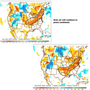 You’ll definitely notice the drier, crisp feel to the air upon stepping outside this morning. If you try hard enough, you can almost smell fall! 🙂
That drier air will support multiple nights with low temperatures into the lower and middle 50s tonight through Sunday morning. We may even have a few neighborhoods dip into the upper 40s Friday or Saturday morning.
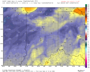 We know this is the beginning of the transitional time of the year. Eventually, these cold fronts will back more and more of a punch as we rumble deeper into fall. On the flip side, summer isn’t ready to go away without a fight. In fact, temperatures well above normal will return for Labor Day, itself, and continue into the majority of next week. A string of highs in the upper 80s to lower 90s will be common next week.
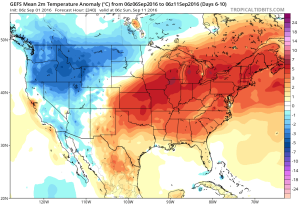 Longer term, there are indications that continue to support the idea of a potentially more significant cool down around mid September. Stay tuned…
Permanent link to this article: https://indywx.com/2016/09/01/meteorological-fall-begins-with-a-fall-like-feel/
Aug 30
Today into Wednesday will offer up more of what we’ve grown so accustomed to over the past several days- incredibly humid air, along with scattered heavy thunderstorms. Similar to days past, the humid, “heavy” nature to our air will help fuel localized torrential downpours.
Thankfully, the hour glass has been “flipped” and time is running out on the humid air mass. In fact, as early as Thursday morning, we’ll notice a huge change. A northeast flow will provide a much drier brand of air and temperatures will also cool significantly. Several mornings (Thursday through Sunday) will feature lows in the 50s with highs in the 70s. Lows into the upper 30s will drive southeast into the high ground of the beautiful east TN mountains.
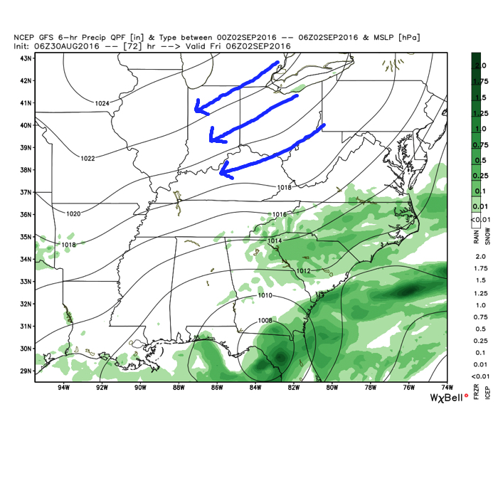
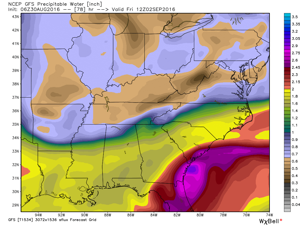
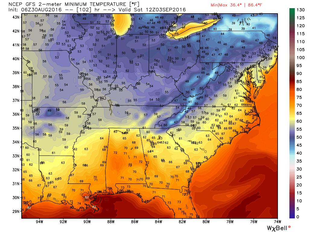 Eventually, our air flow will back around to the southwest and help push Labor Day into the “hot” territory. Highs in the upper 80s to around 90 will be common for Labor Day, itself.
The balance of the first half of September looks warm, but there are indications for changes to begin showing up towards mid to late month that would lead towards more sustained, consistent pushes of cool…
Permanent link to this article: https://indywx.com/2016/08/30/changes-ahead/
Aug 27
You must be logged in to view this content. Click Here to become a member of IndyWX.com for full access. Already a member of IndyWx.com All-Access? Log-in here.
Permanent link to this article: https://indywx.com/2016/08/27/video-talking-storm-chances-and-briefly-cooler-air/
Aug 24
Indiana is blessed with a truly incredible weather community. Please understand that I’m not just throwing around the word “community” lightly here. The relationships that have stemmed from one single…
You must be logged in to view this content. Click Here to become a member of IndyWX.com for full access. Already a member of IndyWx.com All-Access? Log-in here.
Permanent link to this article: https://indywx.com/2016/08/24/wednesday-evening-thoughts-for-the-love-of-weather-we-have-to-get-better/
Aug 24
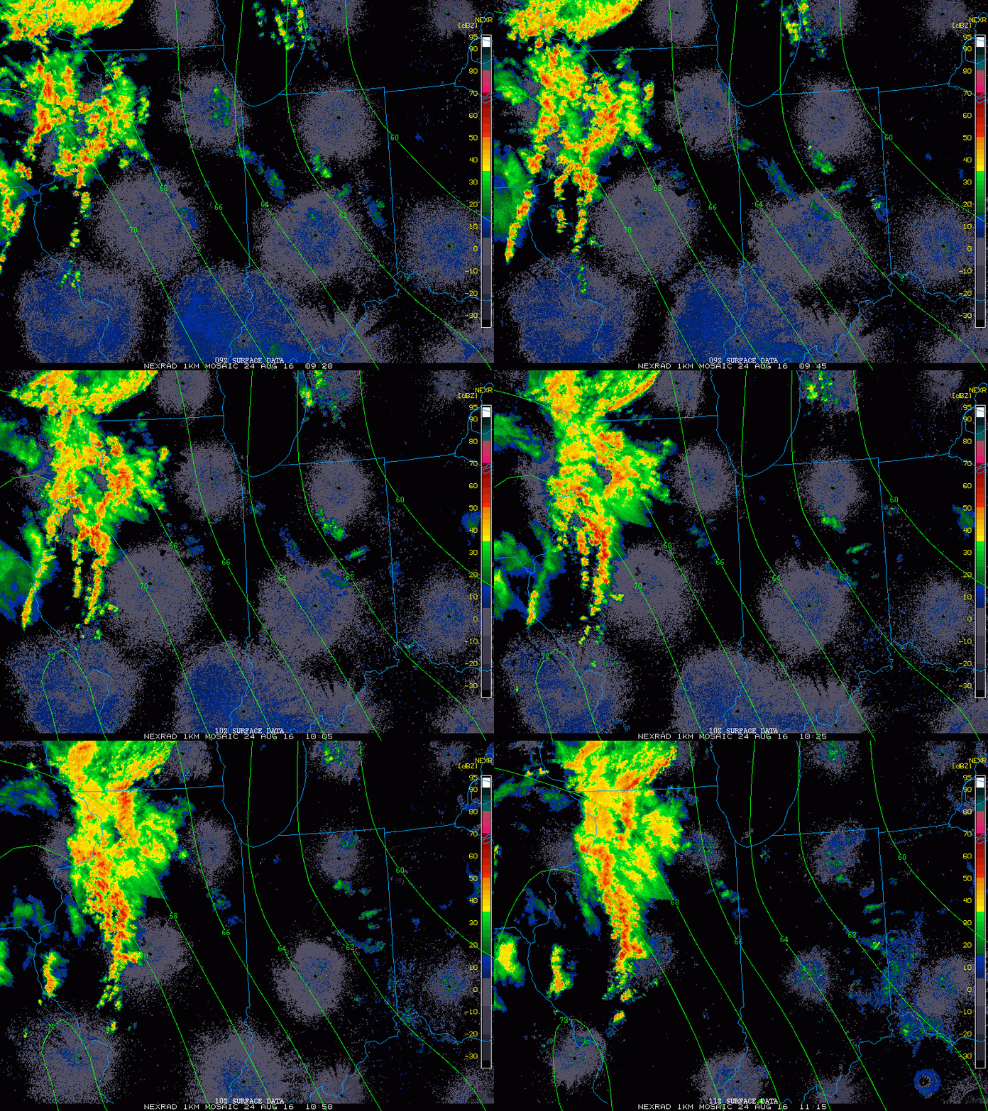
1.) Humidity is on the rise this morning and scattered showers and thunderstorms will follow late morning into the early afternoon.
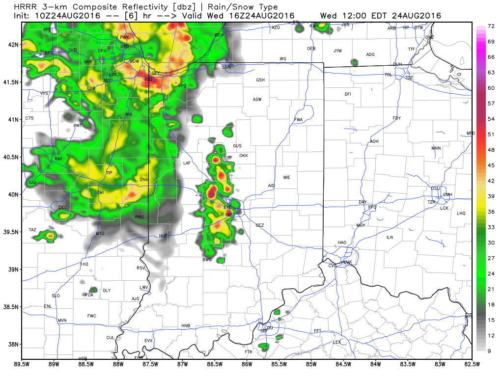
 2.) HRRR futurecast radar delivers thunderstorms into central IN around the lunchtime hour.
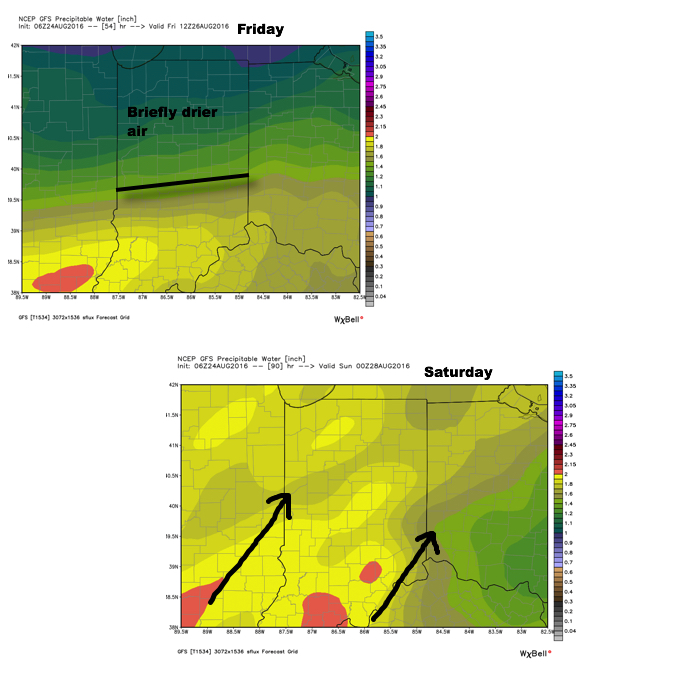
 3.) Scattered thunderstorms remain Thursday (some strong to severe), but drier air will briefly push in across the northern half of the region Friday. We think from Indianapolis and points north, it’ll be a very pleasant end to the work week. That said, “briefly” is the key word. Moisture will surge north again Saturday and Sunday and isolated to scattered storms will follow suit.
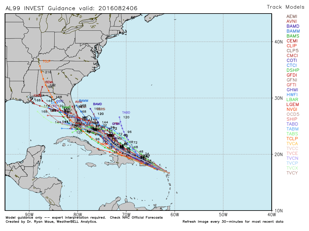
 4.) Attention next week will shift to the tropics. There are many more questions than answers at this point, but understand the potential is there for significant tropical troubles next week. Intensity and track are far from etched in stone, but if your travels take you to the Gulf Coast, we suggest you remain abreast of the latest developments- particularly the southeastern FL coast and the north-central Gulf Coast.
Here on the home front, it’s not entirely out of the equation our region deals with tropical remnants in the Week 2 time period.
Patience is required as we sort through the data in the coming days…
Permanent link to this article: https://indywx.com/2016/08/24/wednesday-morning-weather-notebook/
Aug 23
You must be logged in to view this content. Click Here to become a member of IndyWX.com for full access. Already a member of IndyWx.com All-Access? Log-in here.
Permanent link to this article: https://indywx.com/2016/08/23/video-so-long-pleasant-air-storm-chances-return/
Aug 20
You must be logged in to view this content. Click Here to become a member of IndyWX.com for full access. Already a member of IndyWx.com All-Access? Log-in here.
Permanent link to this article: https://indywx.com/2016/08/20/video-unsettled-now-but-a-beautiful-2nd-half-of-the-weekend-ahead/
Aug 15
The National Weather Service has expanded the Flash Flood Watch to encompass more of the viewing area. This is in effect until 8p Tuesday.
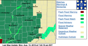 No doubt about it, today will be very wet across the entire region, including periods of heavy rain- especially across the western half of the state.
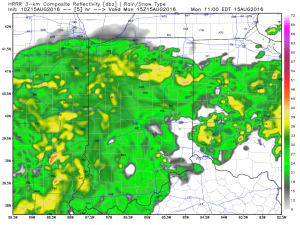
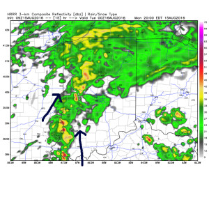
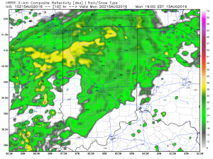 Tropical moisture will continue to stream into the state tonight into Tuesday. In fact, most intense rains will likely set up tonight and may feature “banding” signatures that would train over the same areas. Within these intense rain bands, prolific rainfall rates can be expected, enhancing the flash flood risk. Latest short-term model data shows this threat, and would place a premium focus on areas generally west of US-31. We’ll have to keep a close eye on things.
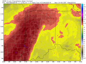
 Plenty of “juice” is available to tap into across western sections tonight. Precipitable water values (PWATs) of 2″-2.5″ will be more than enough to fuel torrential rainfall.
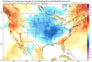
 Eventually (mid and late week), we’ll dry things out and a significant cool down is still in store developing this weekend into early next week. Lows will fall deep into the 50s with highs only in the 70s. Talk about an early taste of fall…
Permanent link to this article: https://indywx.com/2016/08/15/wet-day-enhanced-flood-risk-tonight-for-some/
Aug 13
Central Indiana is enjoying some needed “down time” in the rainfall department this evening, but this won’t last as rain coverage and intensity returns overnight and Sunday morning. Like today, locally heavy downpours will be likely.
Sunday morning will feature widespread rain across central Indiana, including localized heavy rain. Another “lull” in the activity will likely arrive Sunday afternoon into the evening hours, but we caution rain and embedded thunder will really begin to ramp up and increase in coverage and intensity yet again late Sunday night into the day Monday.
The second surge of moisture is more in direct association with the tropical moisture and energy moving north. This area of rain will likely include embedded rates of 3″-4″/ hour for some very localized areas. It’s impossible to pin point where these areas are, but don’t be surprised to hear (or see) some very heavy rain Monday.
Permanent link to this article: https://indywx.com/2016/08/13/lull-in-the-rain-wont-last/