If you’re a fan of cold weather, including being on the field to “cash-in” on multiple winter storm threats, this is a pattern for you. In all honesty, it’s tough to ask for a better pattern to yield such things. With that said, each respected storm threat will have its’ own set of challenges that will have to be dealt with. While we’re confident on IND being above normal in the snow department for the month of December by the 20th, it’s impossible to put numbers (from an accumulation perspective) on specific storm systems from this distance. With that said, please know that the pattern is one that will have multiple impactful winter events lining up behind one another and it’ll be important to keep updated with forecasts as we progress through the next few weeks. Needless to say, there will be plenty of opportunities to get those favorite photos with Christmas lights/ decor in the snow this season!
We’re tracking (3) winter systems over the upcoming week:
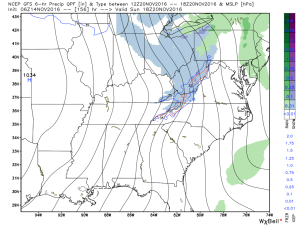
1.) Today: Dry air initially made it difficult for precipitation to make it to the surface this morning. Heavier precipitation rates will arrive after lunch and fall for a few hours (between 1p-6p for most of central IN). This will fall as mostly a cold rain from Indy and points south. Further north, including north-central IN, this will fall as a rain-snow mix (snow should become the predominant form of precipitation shortly after starting. Across northern portions of the state, this will be mostly snow and we note modeling trending colder with recent runs. With heavier snowfall rates this afternoon/ evening, travel may become dicey across northern IN and wet snow accumulations of 2″-4″. A coating to less than 1″ of snow is possible as far south as the northern suburbs of Indy. The following time stamps can give you an idea what the radar may look like this afternoon into the evening hours.
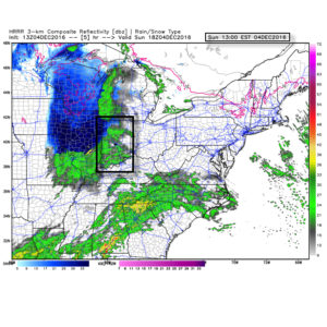
1p forecast radar
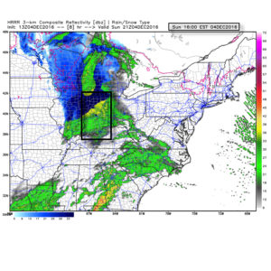
4p forecast radar
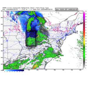
6p forecast radar
Temperatures tonight will fall below freezing for most (upper 20s to around 30) and with the lingering moisture on area roadways and sidewalks, a couple slick spots could develop here and there so be mindful. We don’t anticipate major issues, however.
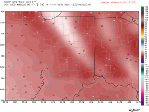
2.) Wednesday night-Thursday: An arctic front will blow into town mid week and we remain bullish on the idea a wave of low pressure delivers a shot of accumulating snow as the arctic plunge moves in. As we’ve relayed over the past few days, model data is far from being in agreement on this idea, but when one looks at the overall pattern, it’s easy to see how there should be more reflection of low pressure moving along the pressing arctic boundary. These can be tricky and many times modeling is “forced” to play catch-up at last minute. For now, we continue with the idea of accumulating snow across central IN in the Wednesday night-Thursday time frame ahead of the coldest air so far this season. Temperatures will fall to between 10-15 degrees for lows by late week, including single digit ‘chills.
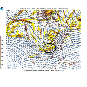
Arctic waves can be tricky in the medium range and must be watched closely.
3.) Saturday-Sunday: Our next wintry threat appears to roll into town next weekend. Similar to mid week, this, too, could be an accumulating event. It’s far too soon to get specific on timing, snowfall amounts, etc., but just know we’re keeping a close eye on next weekend for potentially more of a widespread wintry event and will sure-up details as we progress deeper into the week.
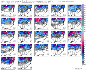
GFS ensemble members show the snowy pattern ahead over the upcoming week.

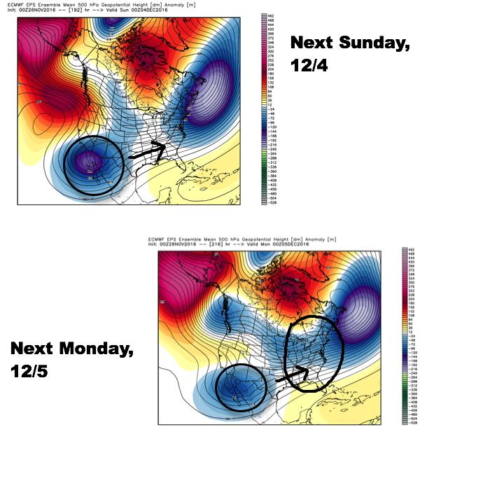 Since then, the European has begun to lock-in to a trend of bringing that SW energy out quicker and, in return, igniting a surface low to develop in the western Gulf of Mexico (GOM) Saturday before tracking northeast into the TN Valley (Sunday) and Great Lakes region (Monday).
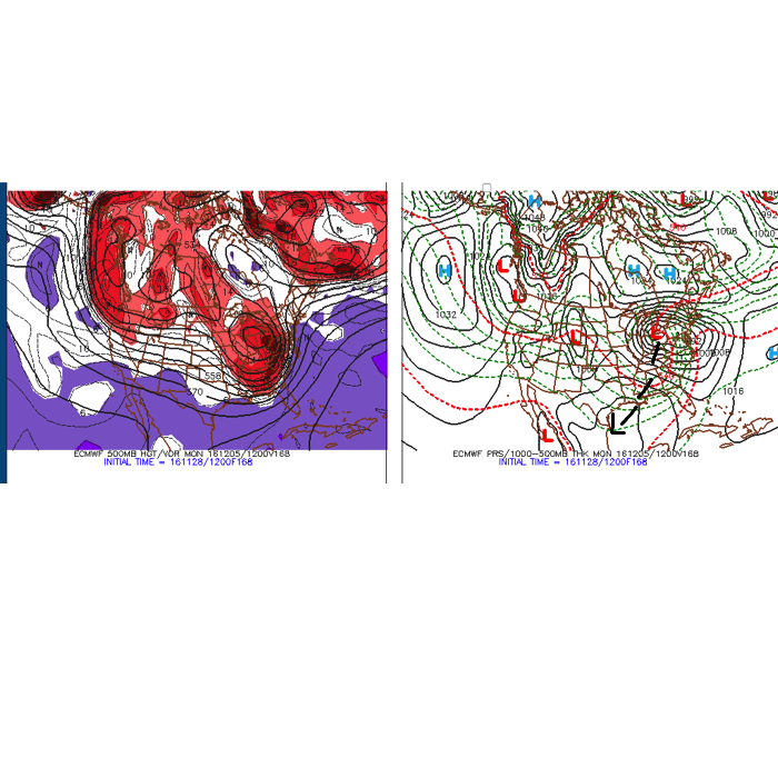 Taken verbatim, this would spread a cold rain into central IN Sunday before colder air begins to change the rain over to a wet, heavy snow Sunday night into Monday morning across central IN. Heavy, wind-blown, snow amounts would result with such a solution for portions of central IN. Such a scenario would be a high-impact event. While the majority of model data (factoring in the GFS and Canadian, for example) is far from agreeing on such a solution, it’s important to note that a trend of such a scenario is beginning to develop within the powerful European forecast model. Furthermore, roughly half of the European’s (51) ensemble members agree on an impactful winter event in the Sunday-Monday time period for central Indiana.
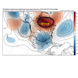
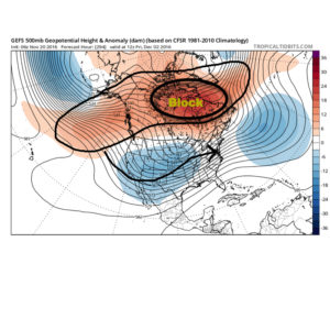
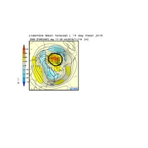
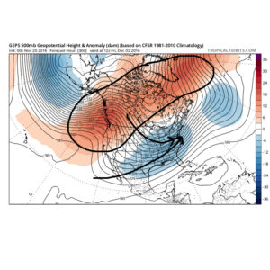 The Weeklies also show this pattern in the longer-term. While we can’t show the European data here (due to licensing), we can show the JMAs. Again, note the high-latitude blocking.
 Active times are ahead as a busy storm track develops. Perhaps the scene for many will look a little something like this as we push into the Christmas season…
 In the meantime, gas up the snow blower and sharpen the snow shovel. If our idea is correct, a snowier than average December will come out of this blocky pattern.
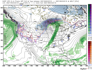
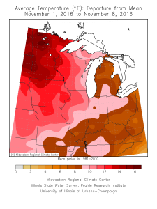 Speaking of warmth, 2016 has been a very warm year.
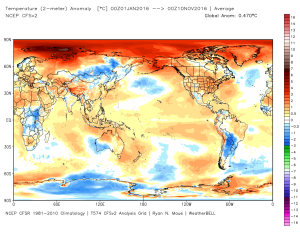 (The cold of 2014 seems so long ago…)
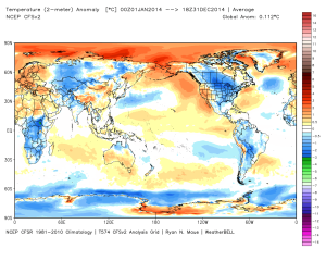 Back to present. We’ve targeted the middle part of November to finally beginning “bucking” the recent warm trend. This won’t happen overnight and will be a battle of back and forth, initially. Thus, the “step-down” label. To be clear, November, as a whole, will finish much warmer than average. It’s virtually impossible to counter the incredibly warm start. That said, we do anticipate “jabs” of colder air working in here over the next couple weeks. For instance, this weekend will feature lows in the 20s for most and highs not making it out of the 40s Saturday afternoon. (The average low and high at IND Saturday are 37 and 54).
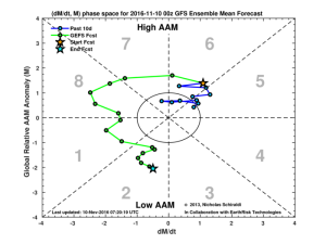
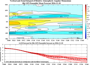 When we look at the AAM forecast (above), we note the westerlies may begin to slow (indicative of the negative values) in the 8-10 day period. This is crucial and, simply put, has to happen for the pattern to begin shifting into more of a position to allow sustained cold to enter the equation. We want to reiterate that this, in and of itself, doesn’t create the cold, but instead allows the pattern to begin shifting away from the Nino-like (warm) regime into more of a La Nina pattern, as a whole. – Hey, you have to start somewhere.
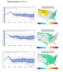 Additionally, the EPO is forecast negative off the GEFS and EPS. (Images courtesy of Weatherbell.com).
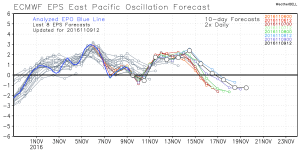
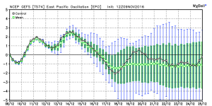 Again, this is a cold signal. (Image courtesy of Madusweather.com).
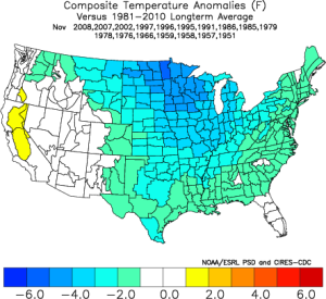 The ensemble data is also beginning to key-in on higher heights (blocking) developing over the top. Notice the significant changes in the overall look to the pattern between now and days 11-16. (Images courtesy of Weatherbell.com).
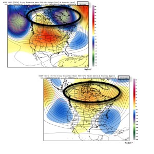 In summary, and in the face of *most* seasonal data that is screaming warm, warm, warm, we still don’t have any significant changes to our overall thinking of “step-down” mid-November giving way to more sustained wintry-like conditions in the overall sense from the Thanksgiving-Christmas period. Time will tell and only the Good Lord knows what the future holds, but we’ve done far too much work and research to throw the “game plan” in the trash before the game even begins…