You must be logged in to view this content. Click Here to become a member of IndyWX.com for full access. Already a member of IndyWx.com All-Access? Log-in here.
Category: Forecast Discussion
Permanent link to this article: https://indywx.com/2017/07/07/video-stormy-afternoon-ahead-for-some-active-pattern-remains/
Jul 05
“Rinse & Repeat” Pattern…
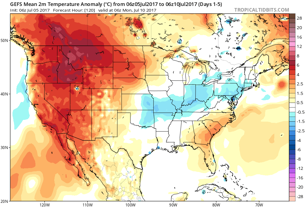
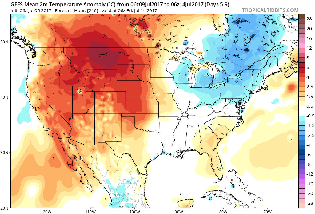
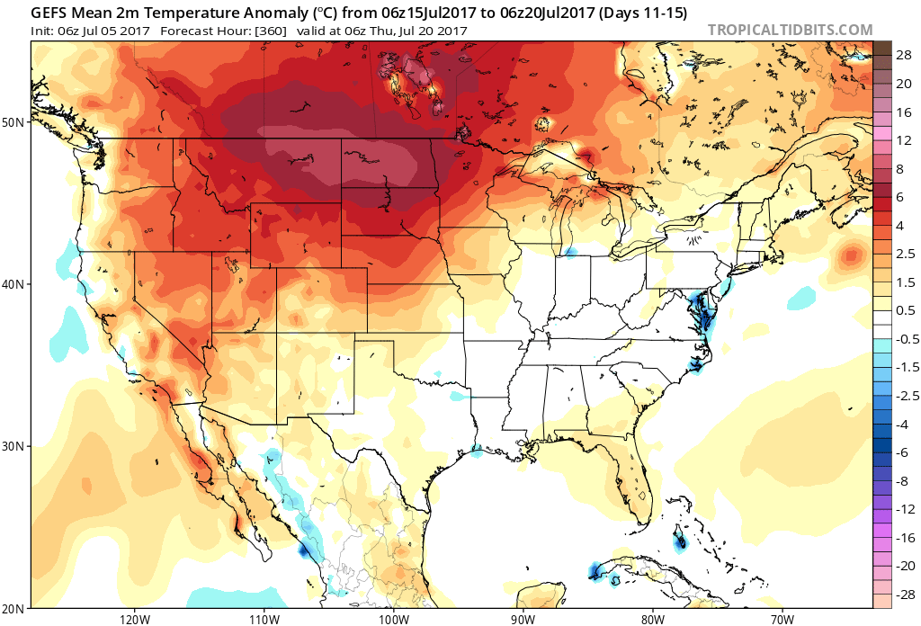
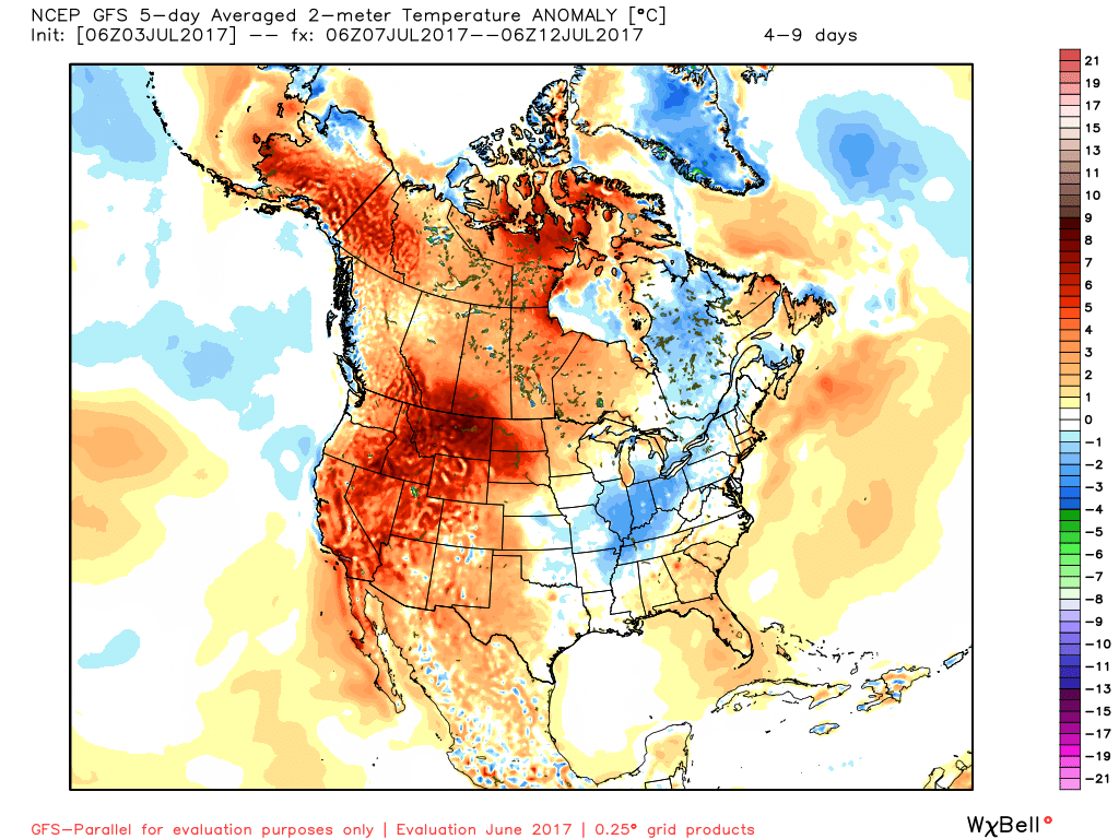
As we look deeper into mid and late July, the one item that continues to stand out in our weather pattern is a lack of any serious heat, relative to average. It’s obvious that the “hot dome” really wants to set up shop over the Rocky Mountain region and while brief “spurts” of warmer air will try to eject out towards our region, the balance of the medium and longer range looks to be dominated by a northwest flow aloft and seasonal to slightly below average conditions.
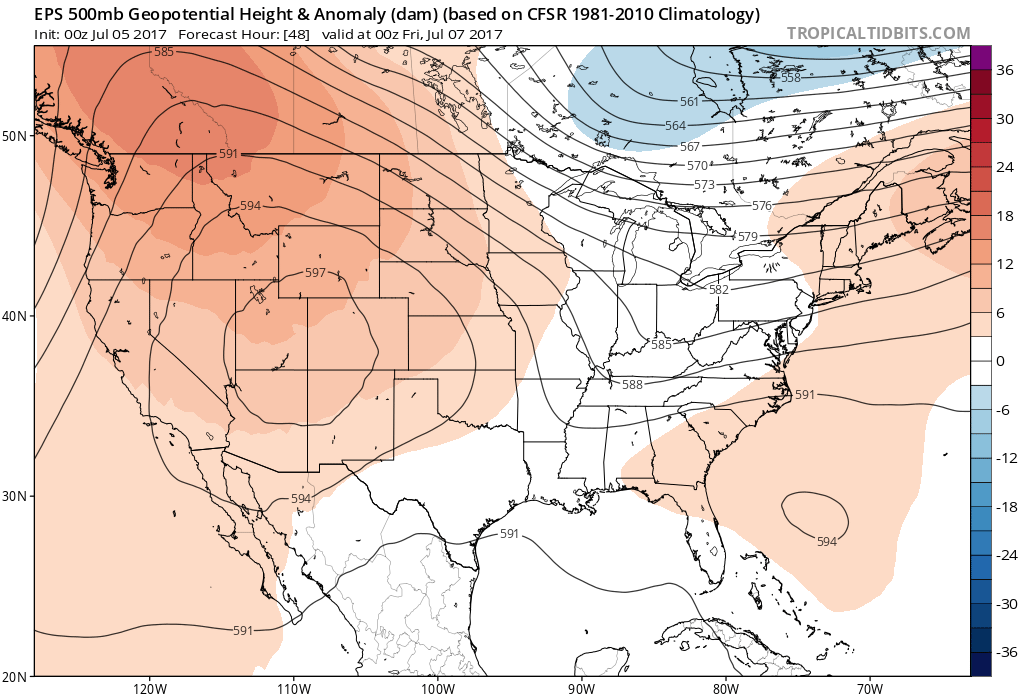
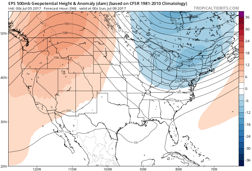
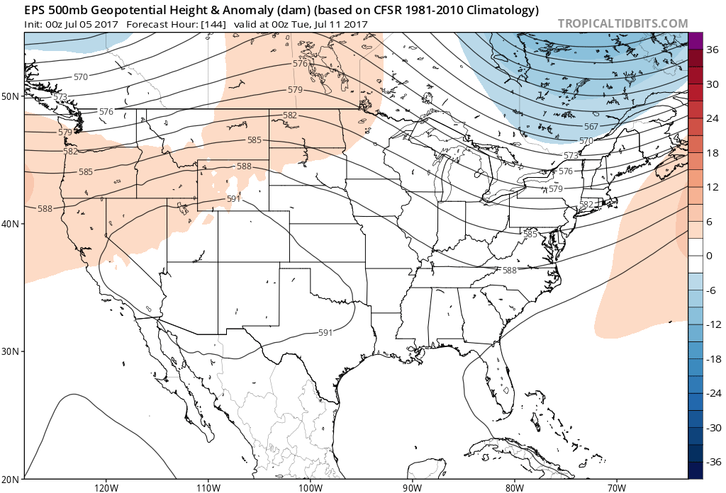
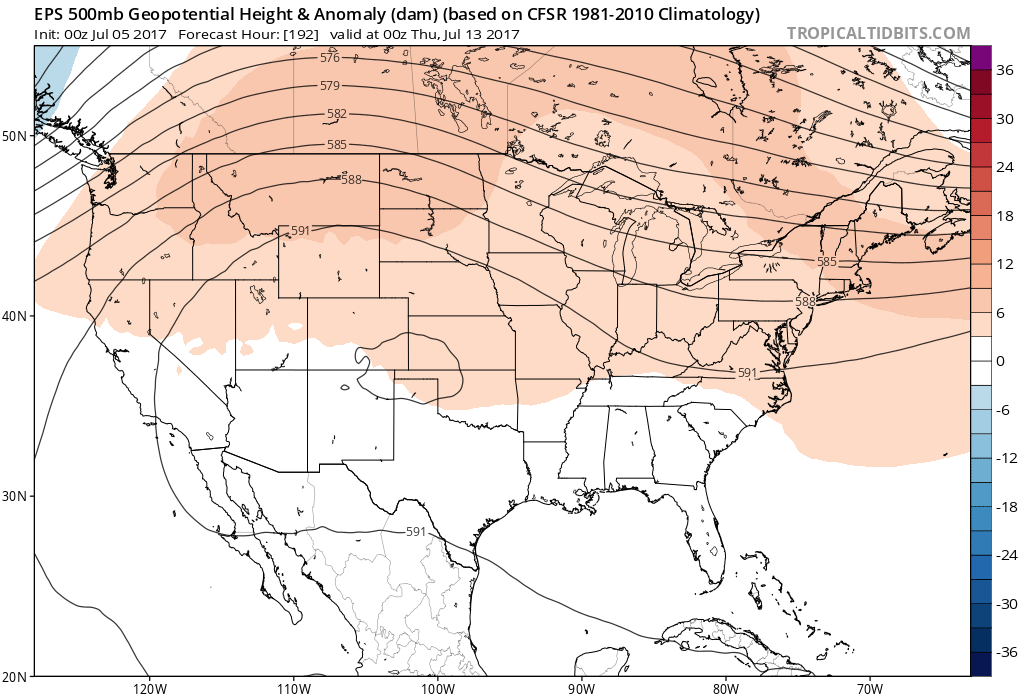
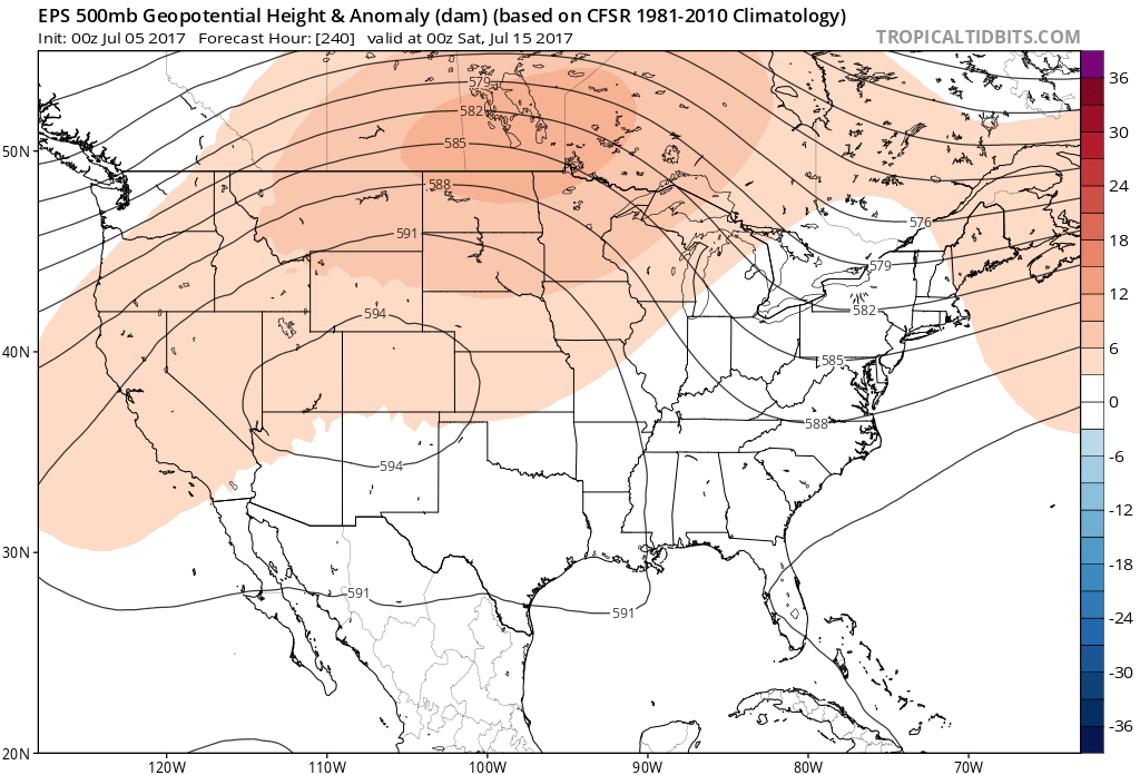 At least through mid-July, this will keep the west and Rocky Mountain region well above average and promote seasonal to cooler than average conditions, overall, for our region.
Permanent link to this article: https://indywx.com/2017/07/05/rinse-repeat-pattern/
Jul 03
Monday Morning Rambles…
An early look at the radar this morning shows a couple of lone storms near Decatur and Blufton. These are moving off to the east.
 While we’ll maintain mention of a widely scattered thunderstorm today and Independence Day, the majority of both days will remain rain-free.
A wave of low pressure will track through the Ohio Valley Wednesday night into Thursday and this will result in an uptick in storm coverage. Locally heavy rainfall will be possible. While some localized totals could be higher, we think widespread rains of 1″-1.5″ is a good bet Wednesday night into Thursday.

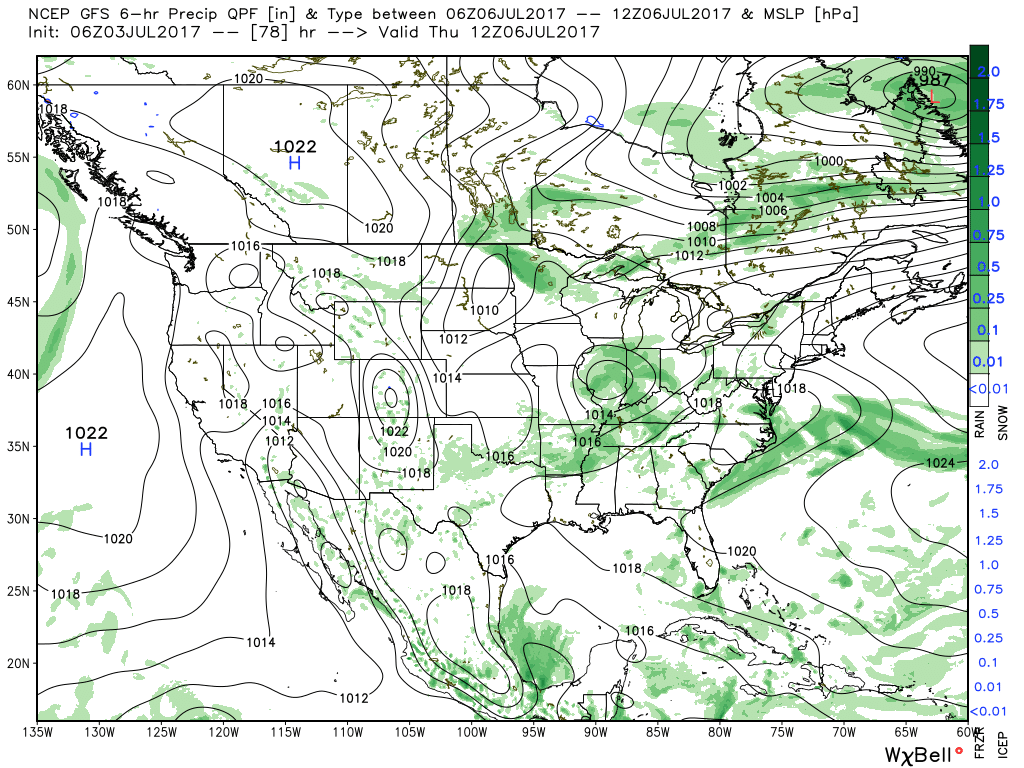 High pressure will build in over the weekend and aid in a drier and cooler theme.
 Lows will return to the 50s across central Indiana Sunday morning and refreshing (upper 50s at night and upper 70s to lower 80s during the day) air will remain with us into early next week.
Permanent link to this article: https://indywx.com/2017/07/03/monday-morning-rambles-4/
Jun 30
VIDEO: Closing Out June And Heading Into July…
You must be logged in to view this content. Click Here to become a member of IndyWX.com for full access. Already a member of IndyWx.com All-Access? Log-in here.
Permanent link to this article: https://indywx.com/2017/06/30/video-closing-out-june-and-heading-into-july/
Jun 29
Thursday Morning Rambles…
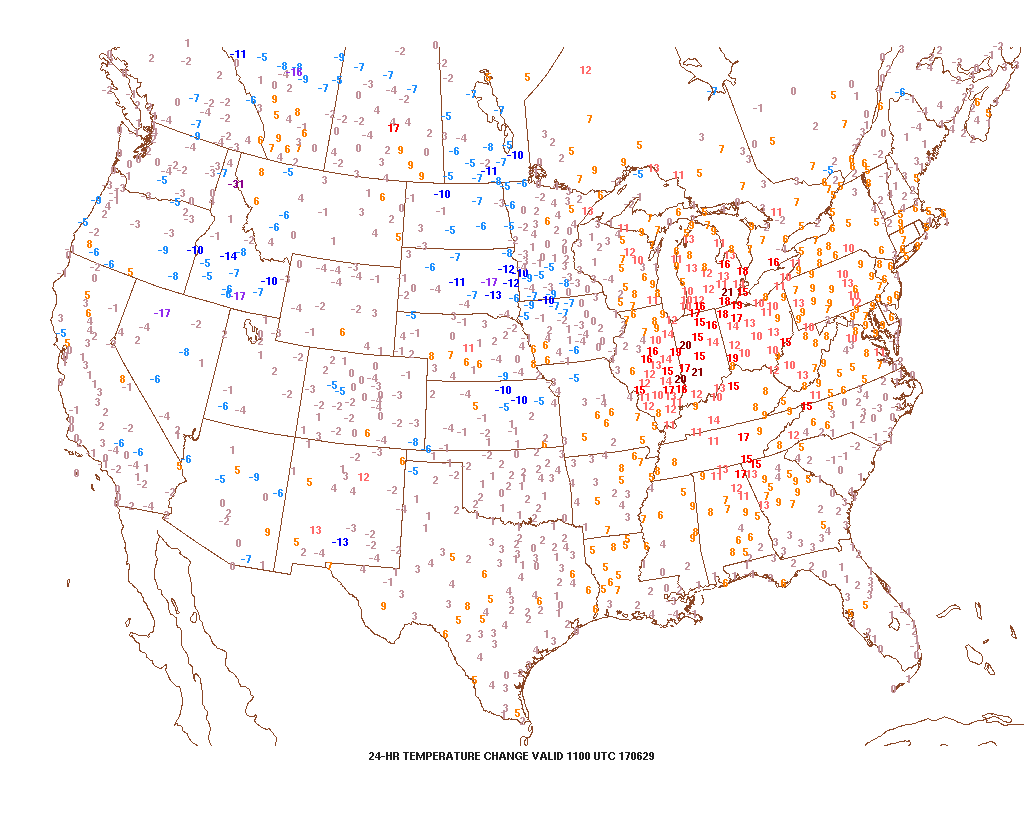
1.) Temperatures are running much warmer across the Mid West and Ohio Valley this morning. In most cases, communities are 15° to 20° ahead of this time 24 hours ago. Ah, the fall-like feel was nice while we had it!
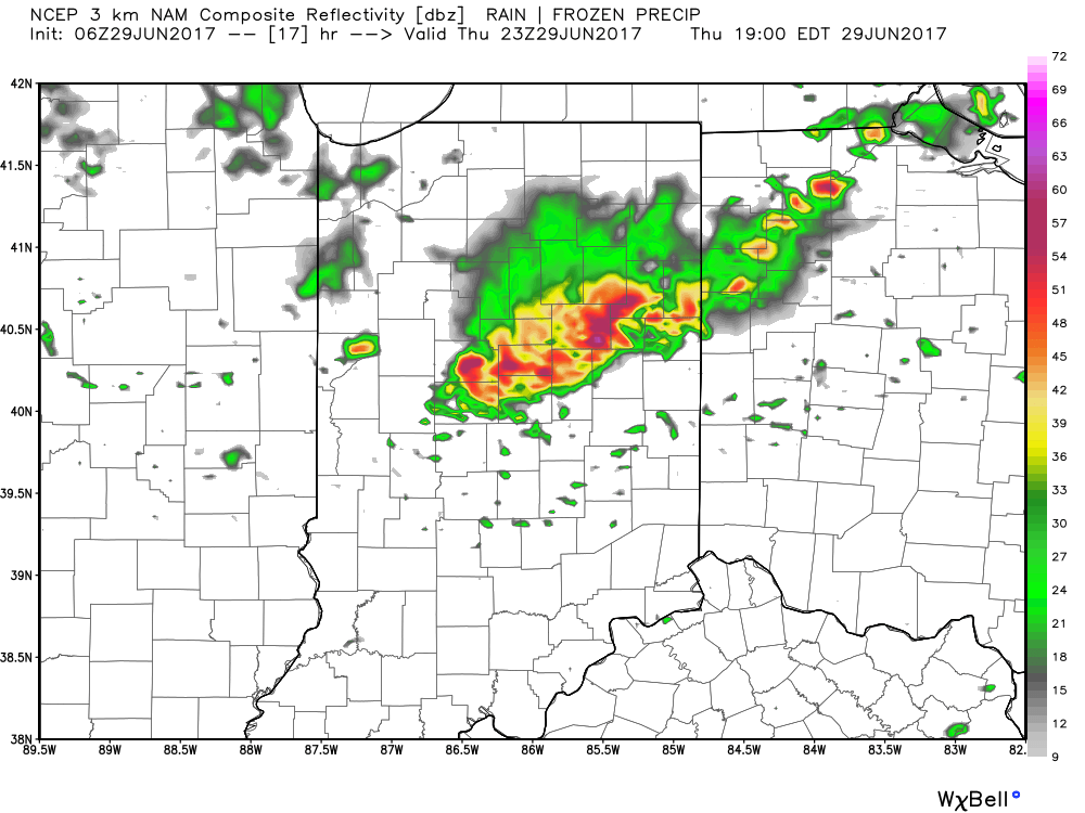
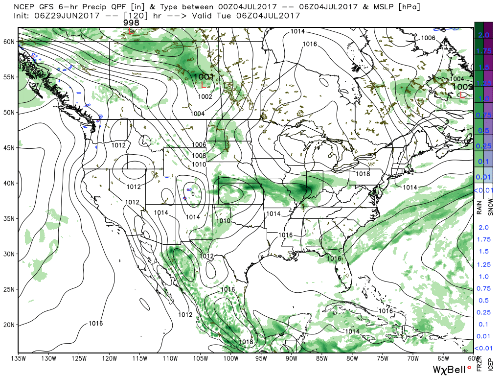
 2.) With the increasing warmth and humidity will also come an increase in shower and thunderstorm chances today through Saturday. Most widespread coverage of thunderstorms should occur during the evening hours today and Friday night into Saturday morning. Drier air will try and work in Saturday afternoon into Sunday. Here’s a look at the forecast radar valid at 7p this evening.
 3.) While we should dry things out Saturday afternoon into Sunday, active times will return early next week. We’ll have to fine tune timing, but the period Monday into Independence Day may feature a rather strong storm complex moving in a southeast fashion across the region. Again, details still have to be determined. While strong storms are possible at some point during the period, more dry time than wet can be expected.
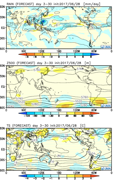
 4.) The latest JMA Weeklies are in and while we’ll have a more extensive post this evening on the weekly breakdown, the screaming message to us is an active period continues along with cooler anomalies setting up shop across the central, including our region.
Permanent link to this article: https://indywx.com/2017/06/29/thursday-morning-rambles-3/
Jun 25
Another Week Is Upon Us; Looking Ahead…
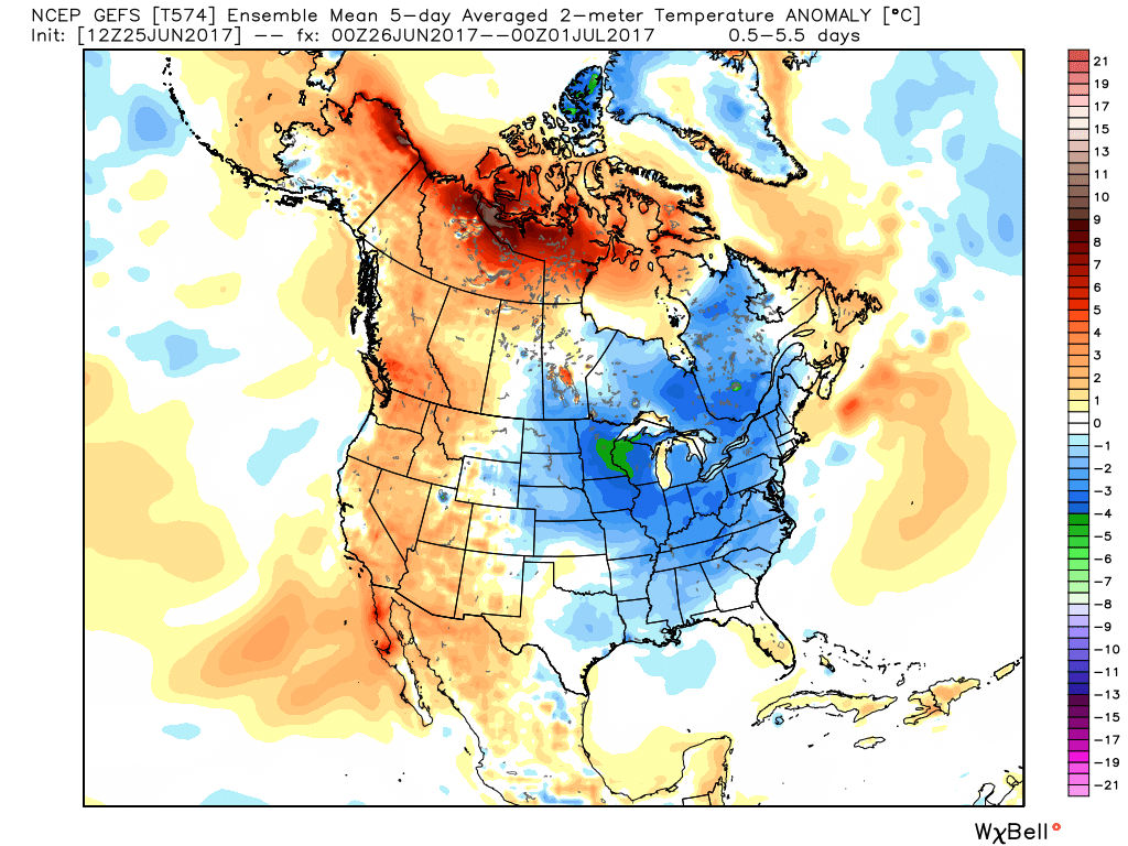
I. The new work week will open up with a continuation of unseasonably cool temperatures. Speaking of temperatures, how nice has it been to have air equivalent of late-September as we get set to wrap up the month of June?!
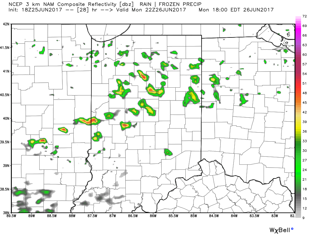
 II: A weak upper level disturbance will drift overhead Monday afternoon and help spark scattered showers and thunderstorms into the evening hours. Not everyone will get wet Monday evening, but a couple gusty storms are possible. Here’s a look at the radar valid at 6p Monday.
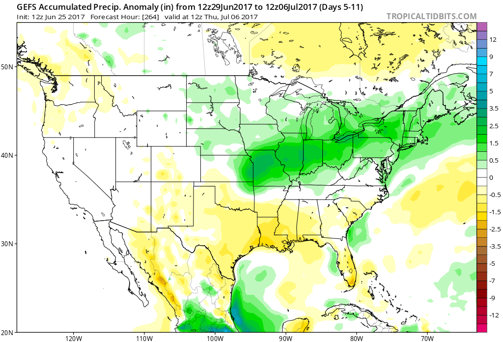
 III. After a dry Tuesday and Wednesday, better shower and thunderstorm chances will return to our forecast for late week into next weekend. Additionally, temperatures and humidity levels will return to closer to seasonal norms.
 IV. An active pattern will remain with us as we progress through the first half of June. A busy NW flow aloft will likely send multiple storm clusters southeast into the region and we’ll have to be mindful for the potential of some of these storm complexes containing strong-to-severe storms and excessive rainfall.
Permanent link to this article: https://indywx.com/2017/06/25/another-week-is-upon-us-looking-ahead/
Jun 22
VIDEO: Heavy Rain Develops Overnight Into Friday…
The combination of an approaching cold front to our north and remnant tropical moisture from Cindy will serve to enhance rainfall amounts across central Indiana late tonight into early Friday evening.…
You must be logged in to view this content. Click Here to become a member of IndyWX.com for full access. Already a member of IndyWx.com All-Access? Log-in here.
Permanent link to this article: https://indywx.com/2017/06/22/video-heavy-rain-develops-overnight-into-friday/
Jun 20
VIDEO: Storms Rumble In For Some Tonight; Tropical Talk; & A Cool Close To June…
You must be logged in to view this content. Click Here to become a member of IndyWX.com for full access. Already a member of IndyWx.com All-Access? Log-in here.
Permanent link to this article: https://indywx.com/2017/06/20/video-storms-rumble-in-for-some-tonight-tropical-talk-a-cool-close-to-june/
Jun 18
Upcoming Week Headliners…
I. Drier and Cooler Air Returns: A cold front will pass this evening and allow a much less humid and cooler air mass to return to the state. Dew points will fall into the 50s by Monday morning and highs should only reach the upper 70s to around 80 Monday afternoon. Refreshing air will remain in place through the day Tuesday.
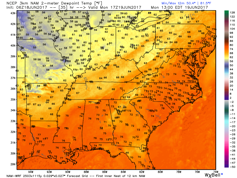
A much less humid air mass will arrive to open the work week.
II. Watching the Gulf: All eyes will be on the Gulf of Mexico this week as it tries to breed early season tropical “mischief.” There are many more questions than answers right now concerning the all-important details (ultimate track and strength), but confidence is high on a depression or storm forming in the Gulf by middle to latter portions of the week. Early thinking would place more emphasis on this being a big inland rain event across portions of the southeast, as opposed to this thing ramping up fast enough to be a big wind/ surge problem, but stay tuned.
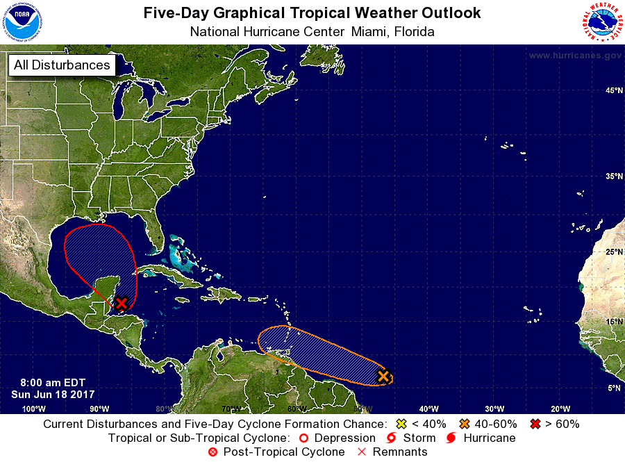
Confidence is high on early season tropical development this week in the Gulf of Mexico.
III. Unsettled Weather Returns: A storm system will approach the region by the latter portions of the work week, including the weekend. As a result, a warmer and increasingly moist air mass will return and help spawn showers and thunderstorms. Unfortunately, timing isn’t our friend as numerous showers and thunderstorms are forecast Friday-Sunday. Locally heavy rain is also a good bet.

Heavy rain and storm chances increase late week.
IV. June Ends On A Cool Note: Once we get rid of the significant storm next weekend, an unseasonably cool air mass will build in over the Great Lakes and Ohio Valley in the 8-10 day time period. How do highs in the upper 60s to lower 70s sound and lows in the middle 50s?
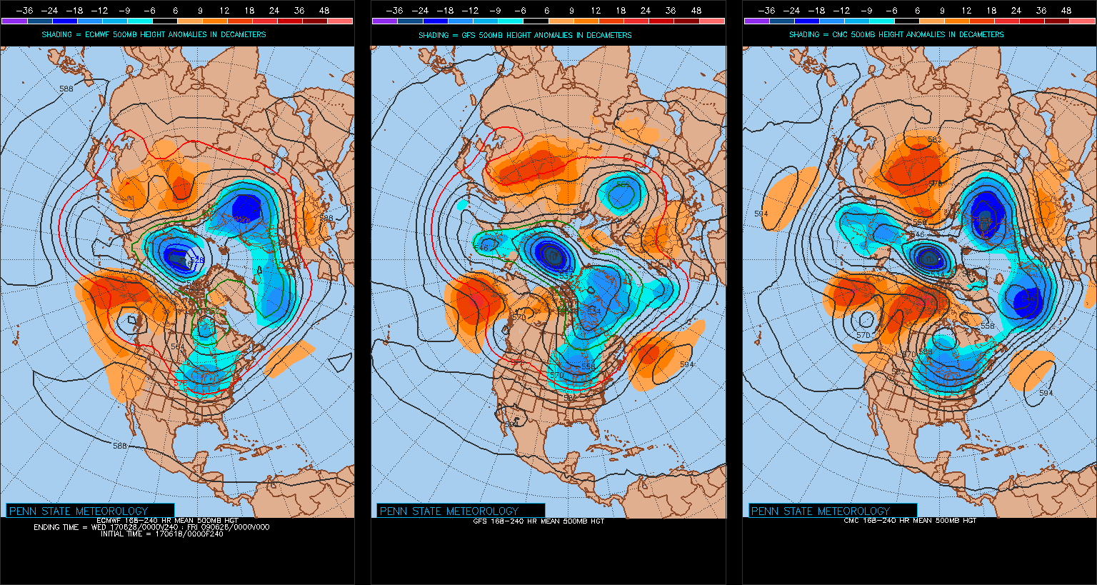
Models agree on an unseasonably cool close to June.
Permanent link to this article: https://indywx.com/2017/06/18/upcoming-week-headliners/
Jun 15
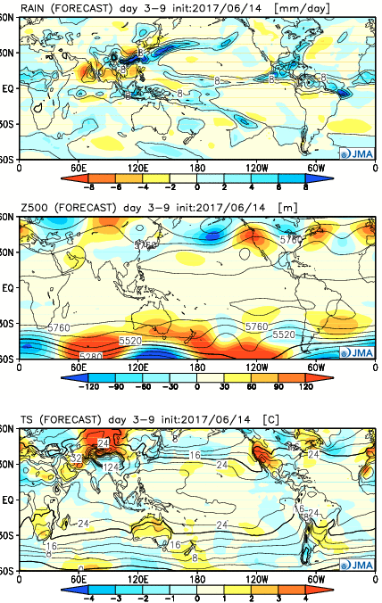
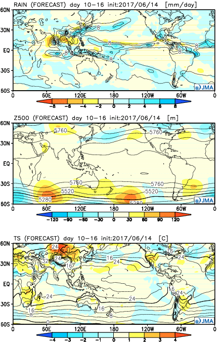
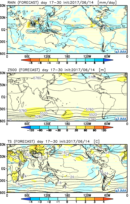
JMA Weeklies: Heat Relief Coming And An Active Pattern As We Get Into July…
The new JMA Weeklies are in and highlighted by the following:
- Heat relief on the way through Week 1
- Core of heat, relative to normal, backs west through the period
- Active NW flow regime to open July
Week 1:
The JMA Weeklies really try to emphasize the “transient” nature of the pattern and associated dry, hot weather some folks were becoming concerned about only a couple of days ago. Week 1 is highlighted by a much wetter regime through the Ohio Valley and most of the East. As the ridge pulls back west, a cooler regime returns to our region, while the Southwest bakes with anomalously hot weather.
 Week 2:
The pattern favors wetter than normal conditions across the upper Mid West, including Great Lakes. The mean upper ridge is forecast to remain out west. Fittingly, the warmest temperatures, relative to average, will be confined to the west.
 Weeks 3-4:
As we push into July, the upper pattern sets-up in a manner that will require us to keep a very close eye on storm potential. With a northwest flow aloft, we’ll have to be mindful of the potential of storm clusters impacting the region- tracking northwest to southeast. Through the balance of the period, the hottest weather should remain to our west, relative to normal.
Permanent link to this article: https://indywx.com/2017/06/15/jma-weeklies-heat-relief-coming-and-an-active-pattern-as-we-get-into-july/

