Model data continues to suggest a Greenland block will develop as we progress into late-November. This kind of pattern creates a “log jam” of sorts in the weather pattern and is the type pattern notorious for unseasonably cold regimes across our region. The overall agreement between various models raises our confidence in this pattern unfolding as Thanksgiving nears.

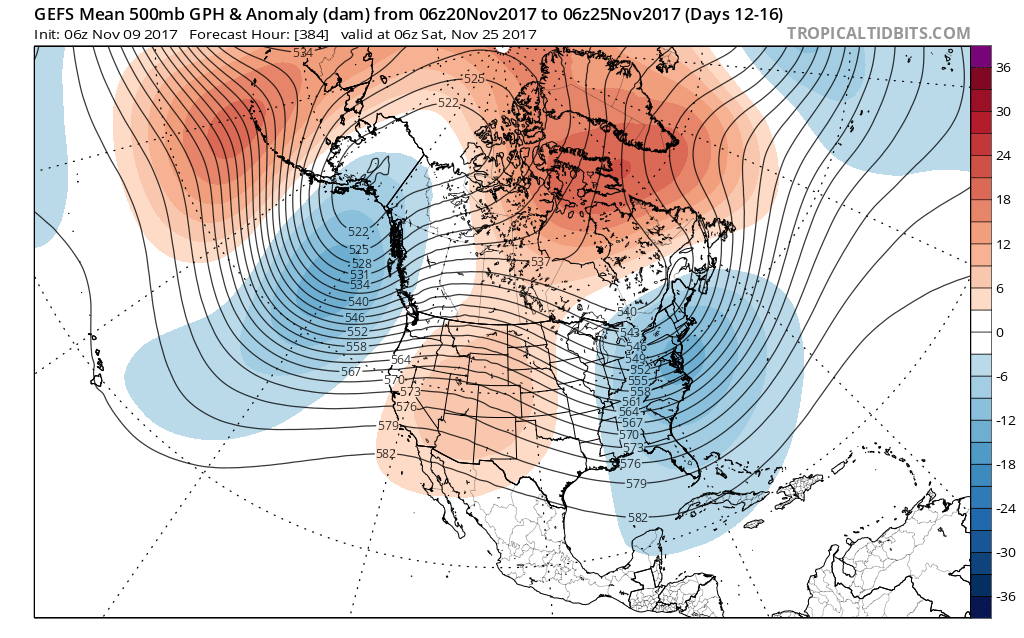 Such a pattern illustrated above, per the European ensemble (image 1) and the GFS ensemble (image 2), would help drill a tongue of unseasonably cold air through the northern Plains, into the Mid West, and across the East.
A look at the 00z teleconnections this morning shows 3/4 “big boy” drivers going to that cold look for late-November, as well:
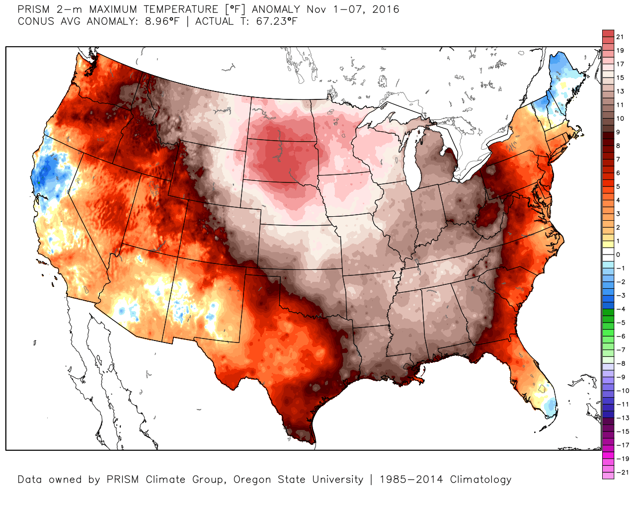
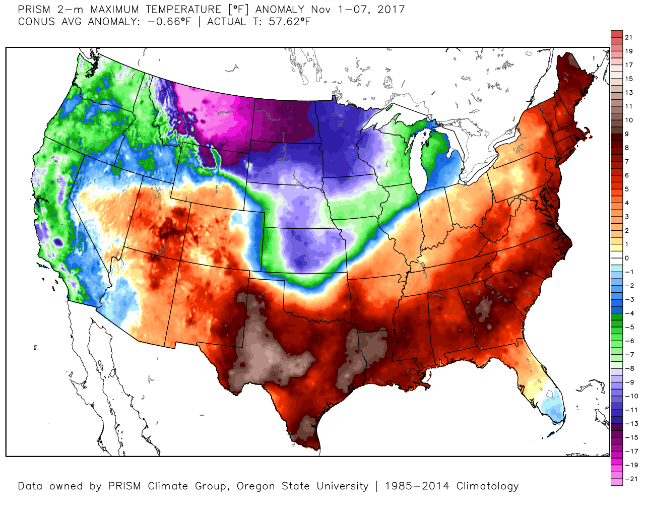
 We’ve been discussing early snow cover across Canada and the northern tier for weeks and how models would have to “correct” colder as they realize the air masses traveling over the snowpack won’t be able to modify as they normally would without that snowpack. The differences between this November and last are startling and show how the early snowpack is beginning to “feedback” on itself leading to early-season cold air.
2016 snowpack and temperatures anomalies through the first week of November:

 2017 snowpack and temperatures anomalies through the first week of November:

 Given the overall look to the pattern downstream, I anticipate the cold will continue to “press” and eventually overwhelm the pattern east as we progress through the second half of the month.
To close, we expect a developing Greenland Block to help drive an unseasonably cold late-November, including the Thanksgiving holiday. This is the type pattern that can also help generate early season wintry “fun and games,” however it’s far too early to be specific with any sorts of potential wintry events that may eventually come in this pattern. Stay tuned.



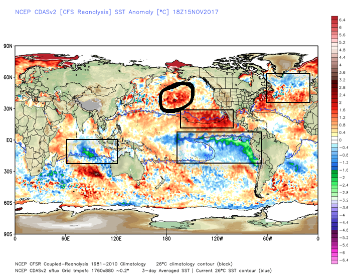
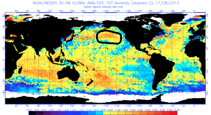
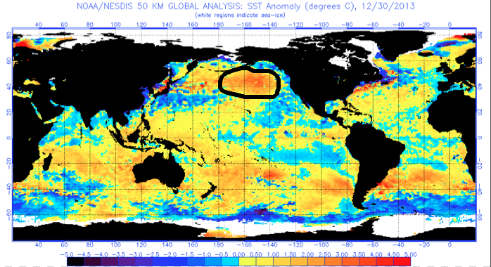
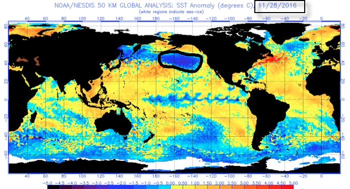 What makes seasonal forecasting so challenging (and fun :-)) are the multiple features that can impact a forecast. We’ve talked about the importance of ENSO (various types of Nino and Nina events) in past updates, as well as low solar and QBO. All of these moving parts and pieces are coming together in a manner that seems to be favoring more of a cold, wintry regime, locally, this year. Is that us saying another blockbuster 2013-2014 winter awaits? Absolutely not (there are other differences noted above with the SST configuration). However, it is suggesting that this winter will be absolutely nothing like the past couple…
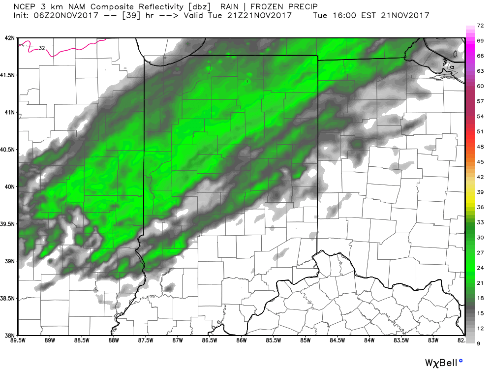
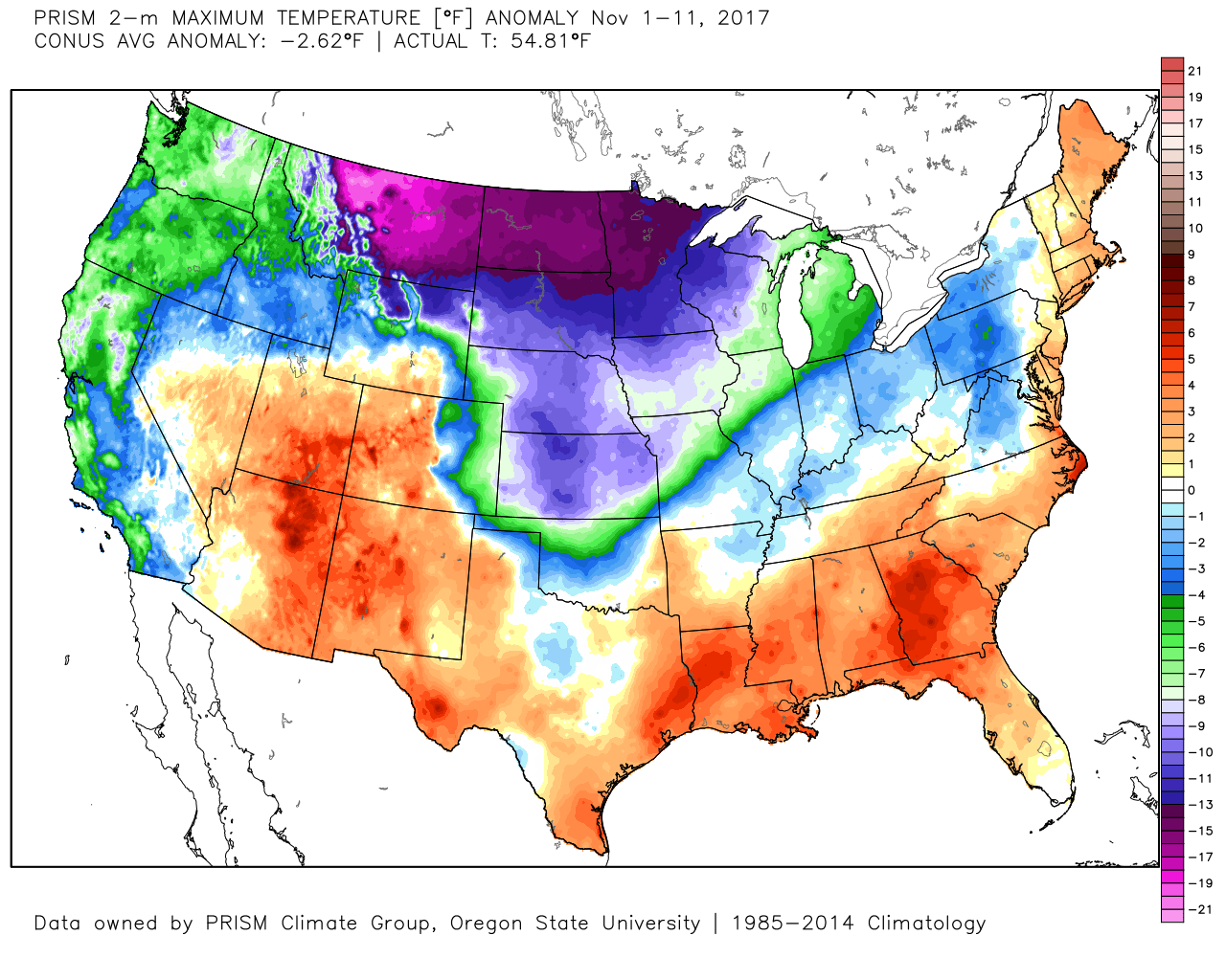 Despite an active weather week ahead, the open to the new work week will be rather uneventful. Weak high pressure will keep us dry today and Tuesday. Fog and low clouds should give way to an increasingly bright sky by this afternoon (still more clouds than sun today) and partly cloudy skies Tuesday.
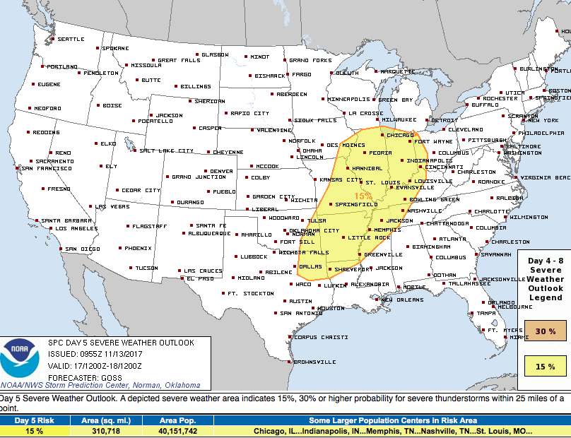
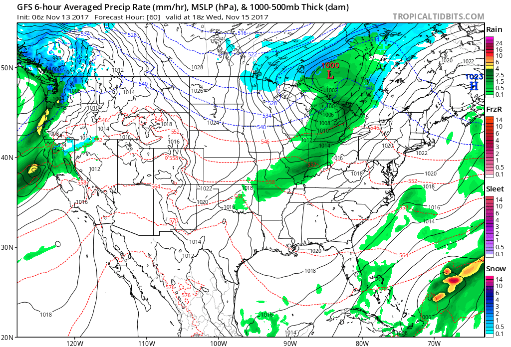 A stronger storm will impact the region as we close out the work week. Strengthening low pressure will track into the Great Lakes and drag a trailing cold front through our region Friday evening. A briefly milder southwesterly air flow will push temperatures close to 60° Friday afternoon/ evening before the sharply colder push of air blows into town for the weekend. The transition may include strong to severe thunderstorms Friday PM, and the Storm Prediction Center (SPC) has outlined a large portion of the region under a severe risk Friday. It’ll be important to stay tuned to future updates. Even outside of potentially damaging thunderstorm gusts, non-t-storm winds will gust over 40 MPH Friday.
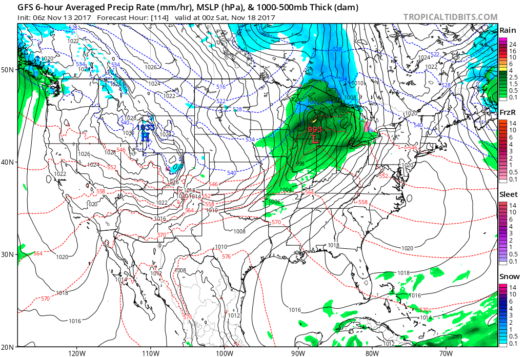
 Once the cold front sweeps through the region, a sharply colder air mass will plunge into the Ohio Valley for the weekend. Overnight data has trended even colder and would suggest falling Saturday temperatures (most of the day will be spent in the 30s) and highs only in the lower to middle 30s Sunday.
 Speaking of cold, Thanksgiving week is looking unseasonably cold, and there’s also the potential of early-season snow (far too early for specifics).
 Such a pattern illustrated above, per the European ensemble (image 1) and the GFS ensemble (image 2), would help drill a tongue of unseasonably cold air through the northern Plains, into the Mid West, and across the East.
 We’ve been discussing early snow cover across Canada and the northern tier for weeks and how models would have to “correct” colder as they realize the air masses traveling over the snowpack won’t be able to modify as they normally would without that snowpack. The differences between this November and last are startling and show how the early snowpack is beginning to “feedback” on itself leading to early-season cold air.
 2017 snowpack and temperatures anomalies through the first week of November:
 Given the overall look to the pattern downstream, I anticipate the cold will continue to “press” and eventually overwhelm the pattern east as we progress through the second half of the month.