You must be logged in to view this content. Click Here to become a member of IndyWX.com for full access. Already a member of IndyWx.com All-Access? Log-in here.
Category: Forecast Discussion
Permanent link to this article: https://indywx.com/2017/12/21/video-sure-hope-you-like-winter/
Dec 20
Touching Base On Wednesday Evening: Busy Winter Pattern Awaits…
Before we get into some of the latest thinking concerning the weather around Christmas, we want to reiterate the pending pattern change is one that we haven’t had the pleasure of “enjoying” over the past few winters. Our idea is that a prolonged significantly colder than normal pattern is with us to close 2017 and continues into (at least) the first few weeks of January. At times, and especially if we can get a healthy snowpack down, temperatures may become severely cold. Speaking of snowpack, winter storms and rumors of storms will come fast and furious in this pattern and it’ll be important you keep abreast of the latest forecast as you go about your holiday travels this year. It’ll be very, very interesting to see how the general public perceives the coming few weeks as winter conditions will be much more impactful when compared to the past few years. Needless to say, we’ve alerted our snow clients that it’s most certainly time to stock up on the coffee and other energy drinks…some long days (and nights) are likely in this pattern down the road.
Now to the shorter-term:
I.) Our first winter weather maker will arrive on the scene Saturday. Guidance today has trended colder, overall, and suggests we need to be on guard for the potential of a narrow, yet possibly heavy, band of wet snow developing on the northern side of the precipitation shield Saturday morning. As of now, central Indiana into western and central Ohio should keep close tabs on forecast developments. We’ll have to “hone in” on overall snow placement over the next 24-48 hours, but that’s the best we can do from this distance.
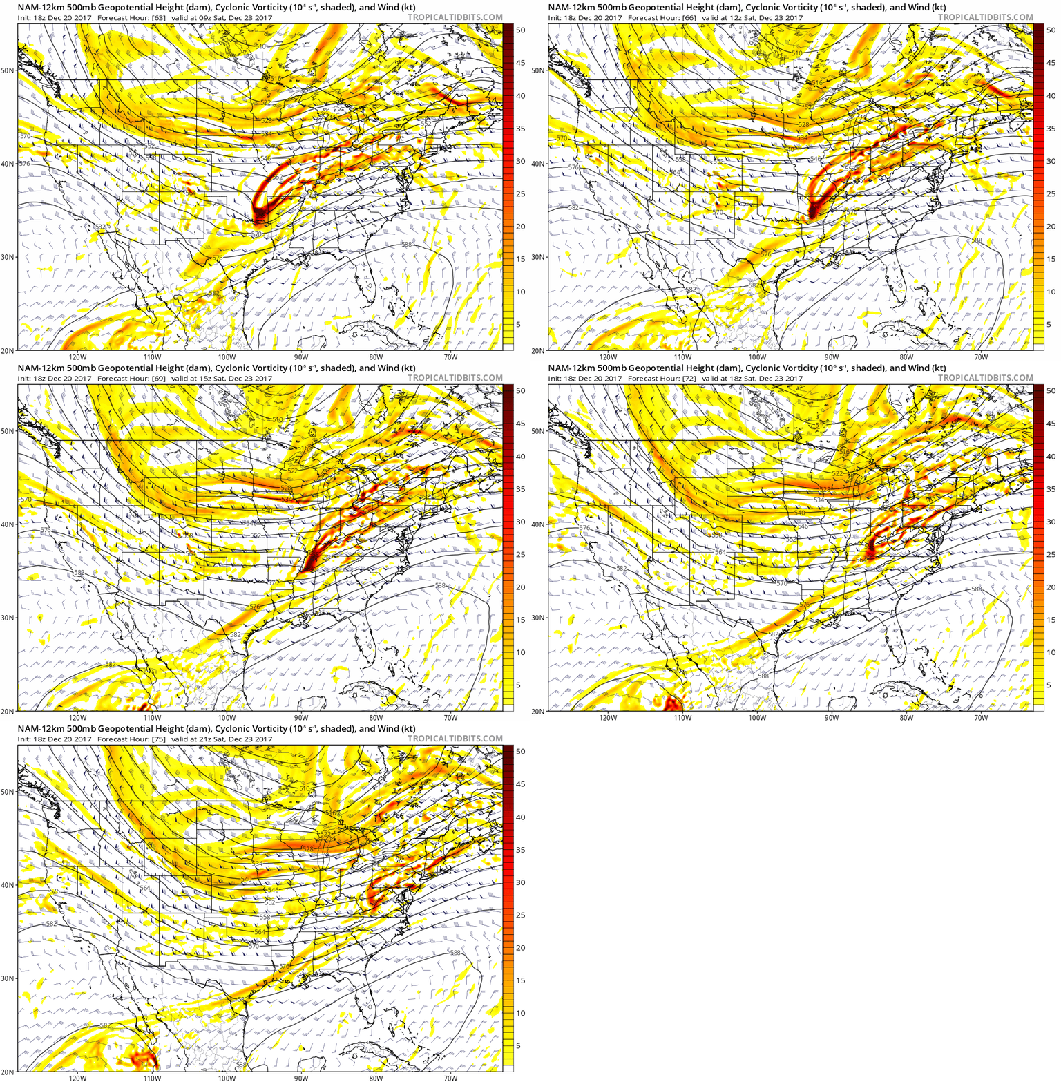 II.) Additional upper level energy will rotate across the Ohio Valley Christmas Eve and this, combined with arctic air pushing into the region, should maximize moisture production and lead to a period of snow and snow showers Christmas Eve afternoon into early Christmas Day. This energy should feature some Christmas “magic” and be enough to provide a more widespread light accumulation across the region (when compared to Saturday).
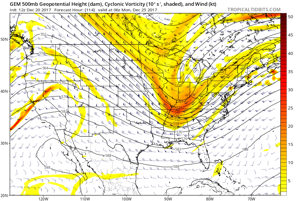 III.) As we look forward to middle and latter parts of next week, the pattern screams potential is on the table for a more widespread, significant winter storm (Plains to the Northeast). While obviously early on in the game, the overall pattern does back up the idea presented by modeling.
The wintry hits don’t stop there, but we’ll save those details for later posts. Make it a great Wednesday evening!
Permanent link to this article: https://indywx.com/2017/12/20/touching-base-on-wednesday-evening-busy-winter-pattern-awaits/
Dec 19
VIDEO: Cooler For Midweek; Discussing Christmas Snow…
You must be logged in to view this content. Click Here to become a member of IndyWX.com for full access. Already a member of IndyWx.com All-Access? Log-in here.
Permanent link to this article: https://indywx.com/2017/12/19/video-cooler-for-midweek-discussing-christmas-snow/
Dec 18
Arctic Hammer Drops Down Around Christmas…
While the evolution of how things transpire from a snow perspective are “murky,” at best, confidence continues to run very high on the prospects of a nasty period of bitter air arriving around Christmas.
Before we dig into the cold details, the pattern is one that still screams “trouble” from a wintry perspective in the December 23rd-Christmas Eve period. We posted over the weekend of the PNA-EPO going to battle Christmas weekend, and before the cold overwhelms, a consensus of the data continues to paint an interesting scenario as resistance will be present initially from the southeastern ridge. Modeling will continue to struggle with this evolution over the next few days, but we’re hopeful we’ll begin to gain more clarity by late in the work week. Needless to say, a stripe of impactful wintry precipitation should fall in a southwest-northeast fashion given the pattern, but whether that’s to our northwest, over our region, or off to our southeast is simply impossible to call from this distance. A glance at the individual ensemble members (GEFS shown below) shows this nicely, as well. The European ensemble members also paint a similar picture.
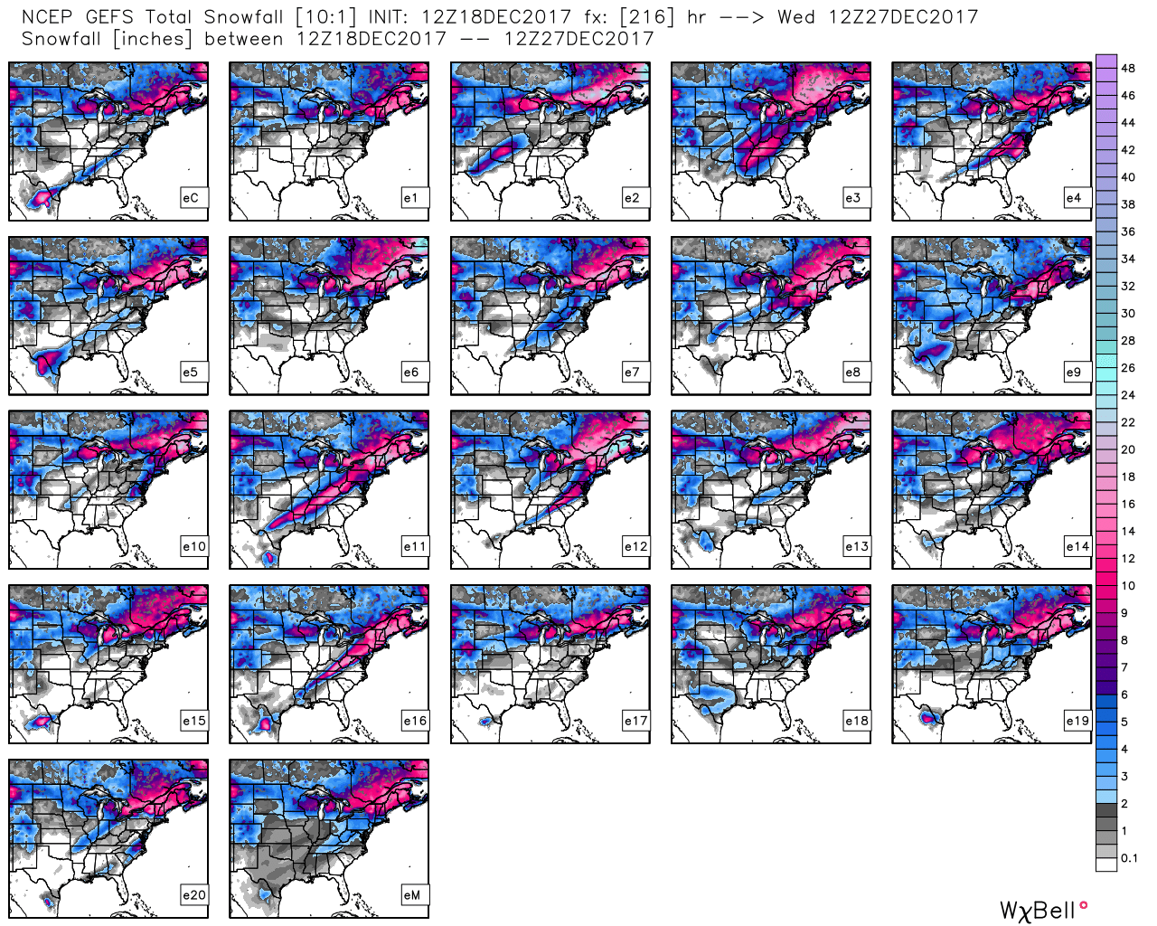 Hang in there as we continue to sort through the data over the next few days. Once confidence increases (for or against an event), you’ll be the first to know! 🙂
Now to the ugly stuff: Bitterly cold air of true arctic origin will be dislodged southeast late week and encompass more of the country by Christmas weekend. Eventually, this arctic air will make it across the Appalachians and reach the East Coast just after Christmas.
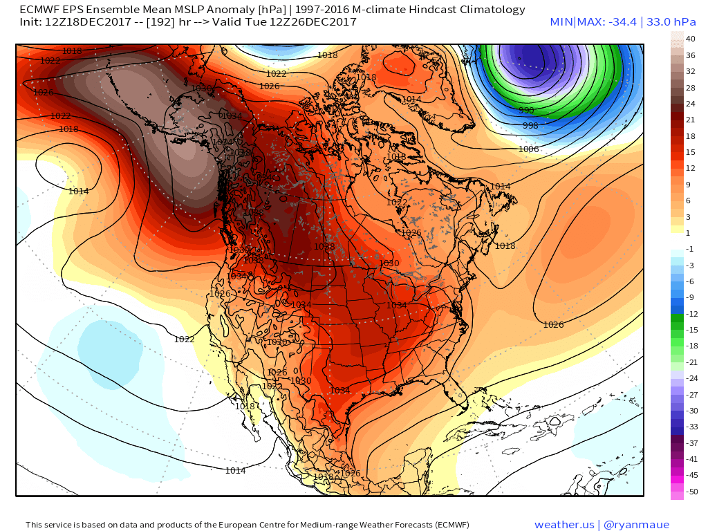 Recent operational data (GFS and Canadian included) has suggested a sprawling high in the range of 1050mb+ descending into the eastern slopes of the northern Rockies. Such a regime would be plenty capable of spreading sub-zero temperatures east into the Ohio Valley (with or without snow on the ground). Add in a biting north wind and wind chill values would drop to levels of dangerous and deadly levels if any length of time was spent outdoors. Some of the latest data paints a picture similar to shades of the famous ’13-14 winter (20° to 30° below zero chill factor). If you have travel plans over the Christmas holiday, please plan in advance to have a winter survival kit packed and loaded. It absolutely never hurts to be prepared.
Permanent link to this article: https://indywx.com/2017/12/18/arctic-hammer-drops-down-around-christmas/
Dec 18
VIDEO: Gloomy Monday; Colder Pattern Awaits…
You must be logged in to view this content. Click Here to become a member of IndyWX.com for full access. Already a member of IndyWx.com All-Access? Log-in here.
Permanent link to this article: https://indywx.com/2017/12/18/video-gloomy-monday-colder-pattern-awaits/
Dec 16
EPO-PNA Battle
One of the many ingredients we like to throw into the mixing bowl when developing our medium range forecast is the teleconnection breakdown. Many times, the various teleconnections play into themselves and agree, but, at times, conflicting signals lead to a fight. At any given time, one or the other “big boy” teleconnections can take control of the pattern and simply overwhelm. As things stand now, it appears as if the two teleconnections trying to control are the EPO (Eastern Pacific Oscillation) and PNA (Pacific North America pattern), highlighted below.
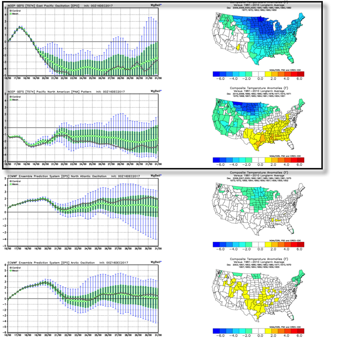 As we’d expect, as these two fight it out, a battle will ensue across the central and eventually eastern portion of the country. The negative EPO is a widespread cold pattern, while a negative PNA favors south-central and southeastern ridging (a warmer pattern).
When we look at the latest ensemble data, we see this battle playing out within the modeling.
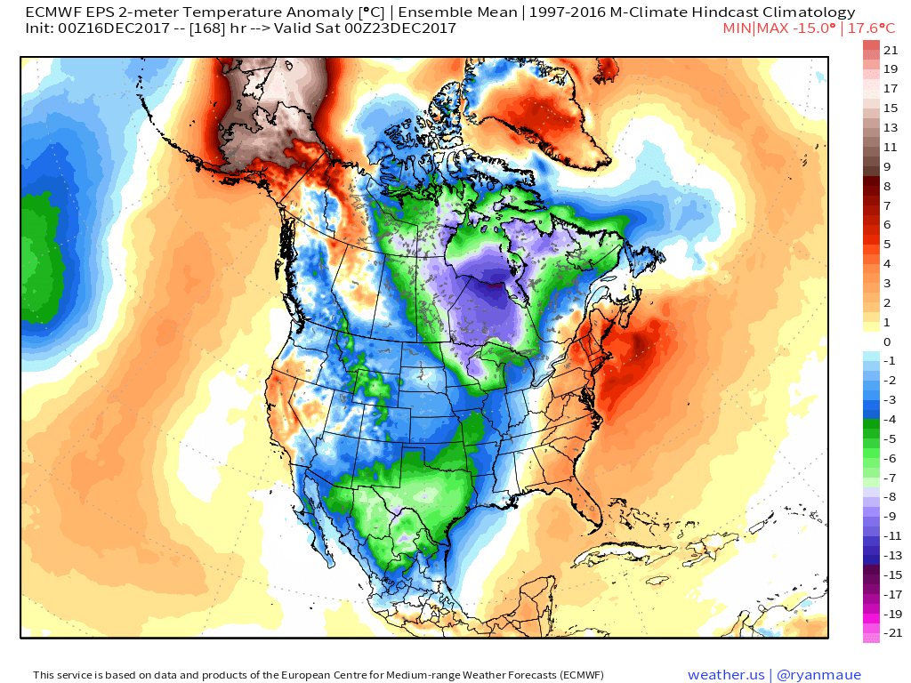
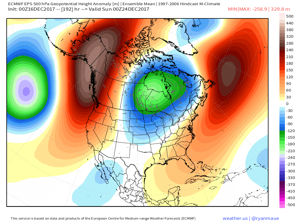 Eventually, we expect the deeply negative EPO to take control and overwhelm the pattern with cold. However, as this transition of power takes place, the negative PNA won’t go down without a fight and will likely play a role in the weather leading up to Christmas.
The negative PNA suggests we need to remain on guard for the potential of an interior snow/ ice event around Christmas. As we’ve been mentioning, from this distance there’s no way to say whether this is an impactful wintry event for our region, or just to our north or south. We should be able to become more detailed within the next few days…
Permanent link to this article: https://indywx.com/2017/12/16/epo-pna-battle/
Dec 14
VIDEO: Latest Thoughts Around The Pattern As Christmas Nears…
You must be logged in to view this content. Click Here to become a member of IndyWX.com for full access. Already a member of IndyWx.com All-Access? Log-in here.
Permanent link to this article: https://indywx.com/2017/12/14/video-latest-thoughts-around-the-pattern-as-christmas-nears/
Dec 13
Wednesday Evening Rambles…Cold Reinforcements Tonight; Weekend Moderation…
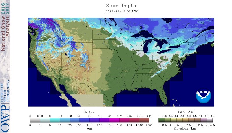
I. A look at the current snowpack shows the northwest flow nicely, and another storm is just missing central Indiana to the north and northeast this evening (not included in this morning’s snowpack update). The southern Appalachians have also been capitalizing in this northwest flow pattern, not to mention the southern stream event that dumped hefty snows on the Deep South.
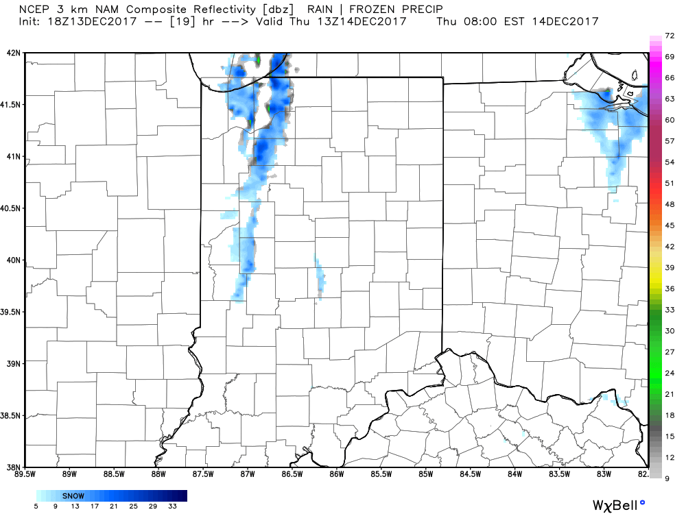
 II. While the sticking snows will miss us this go around, scattered snow showers will impact central IN overnight into early Thursday morning. There’s also still the potential of a skinny lake effect snow band to impact a narrow portion of western and north-central IN early Thursday.
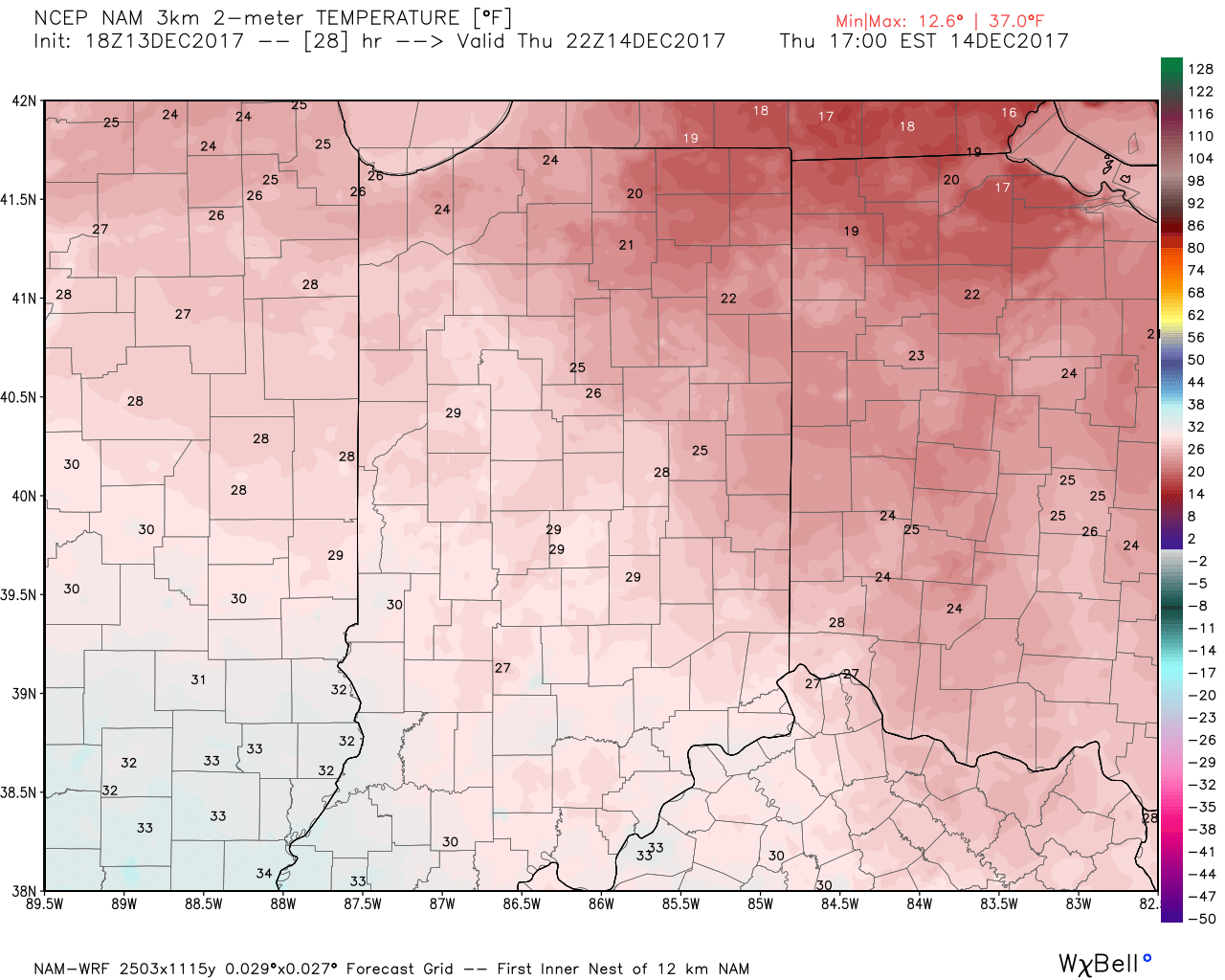
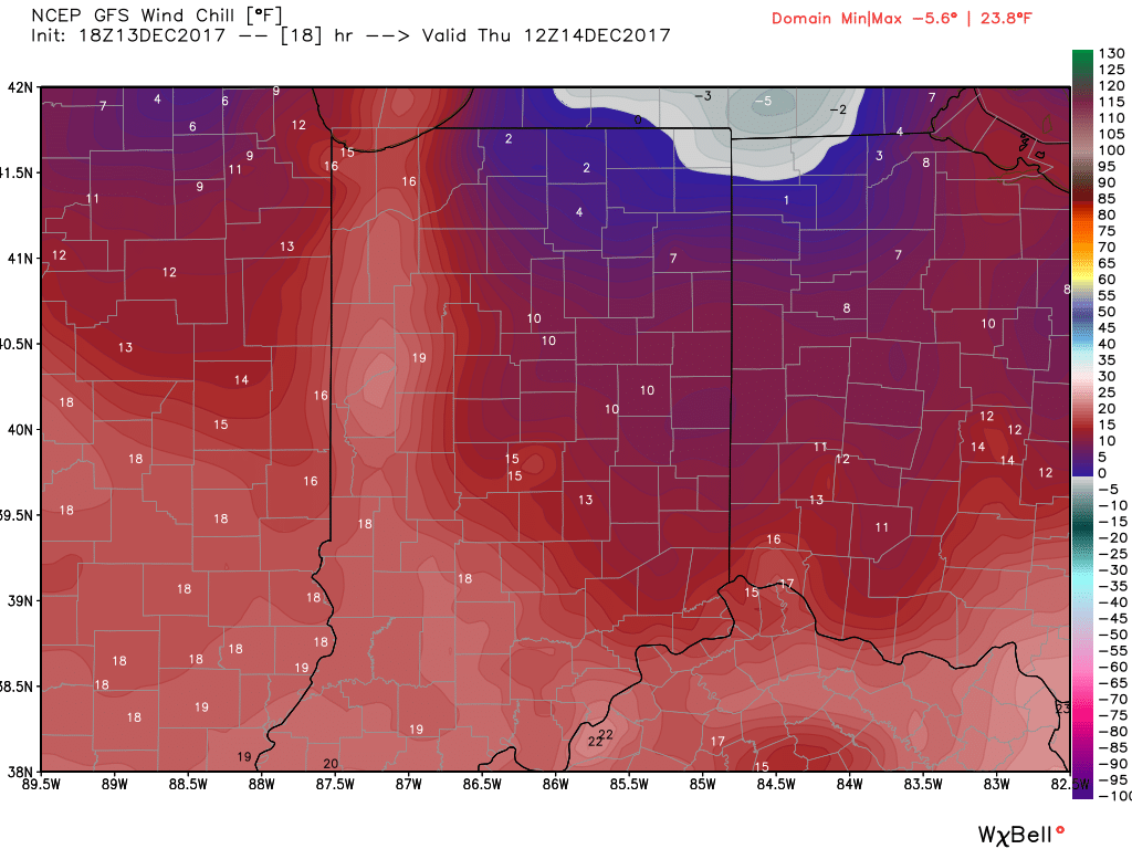
 III. Reinforcing cold air will plunge south Thursday. Highs will remain below freezing along with wind chill values in the 10s most of the day.
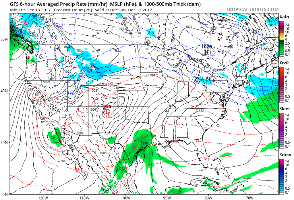
 IV: A milder southwesterly air flow will result in slightly “warmer” temperatures this weekend (mid 40s for highs Saturday) before showers arrive to close the weekend. Despite the slight relaxation of the cold, this will come with a gusty breeze over the weekend.
Permanent link to this article: https://indywx.com/2017/12/13/wednesday-evening-rambles-cold-reinforcements-tonight-weekend-moderation/
Dec 12
Tuesday Evening Rambles: Wintry Weather And More Christmas Week Chatter…
I.) The pattern we’re currently dealing with is one that presents multiple challenges in the near term. East-central and northeastern portions of the state have gotten in on the snow act today, but, so far, most of central Indiana has missed out on the snowy goods. With such a fast-paced northwest flow, we have to remain on guard for potential “surprises” in this pattern. Perhaps the HRRR is beginning to pick up on this. Latest runs want to deliver a “pop” of snow Wednesday morning, associated with “warm” air advection (WAA). We’ll monitor tonight.
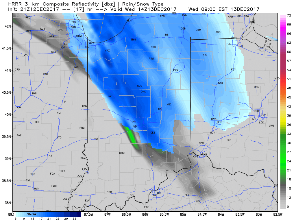
9a forecast radar Wednesday
II. The northwest flow will continue to provide disturbances plenty capable of producing periods of snow again Wednesday evening through the end of the week. Are these monster storms? Hardly, but they can “suddenly” become sufficient enough to create travel problems given the pattern. For those who live across the northern half of the state, plan to keep close tabs to local forecasts if you have travel plans through the end of the week.
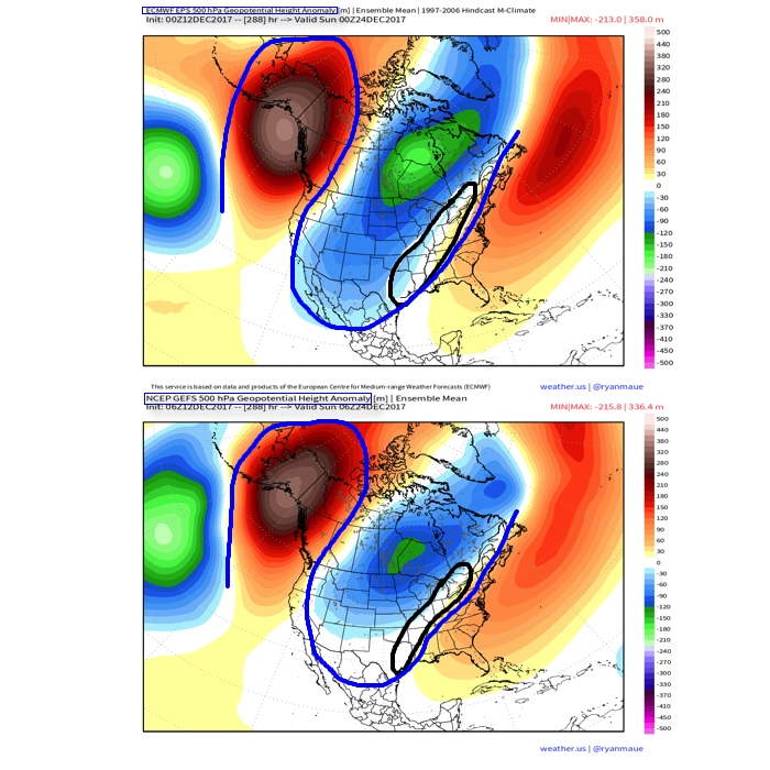
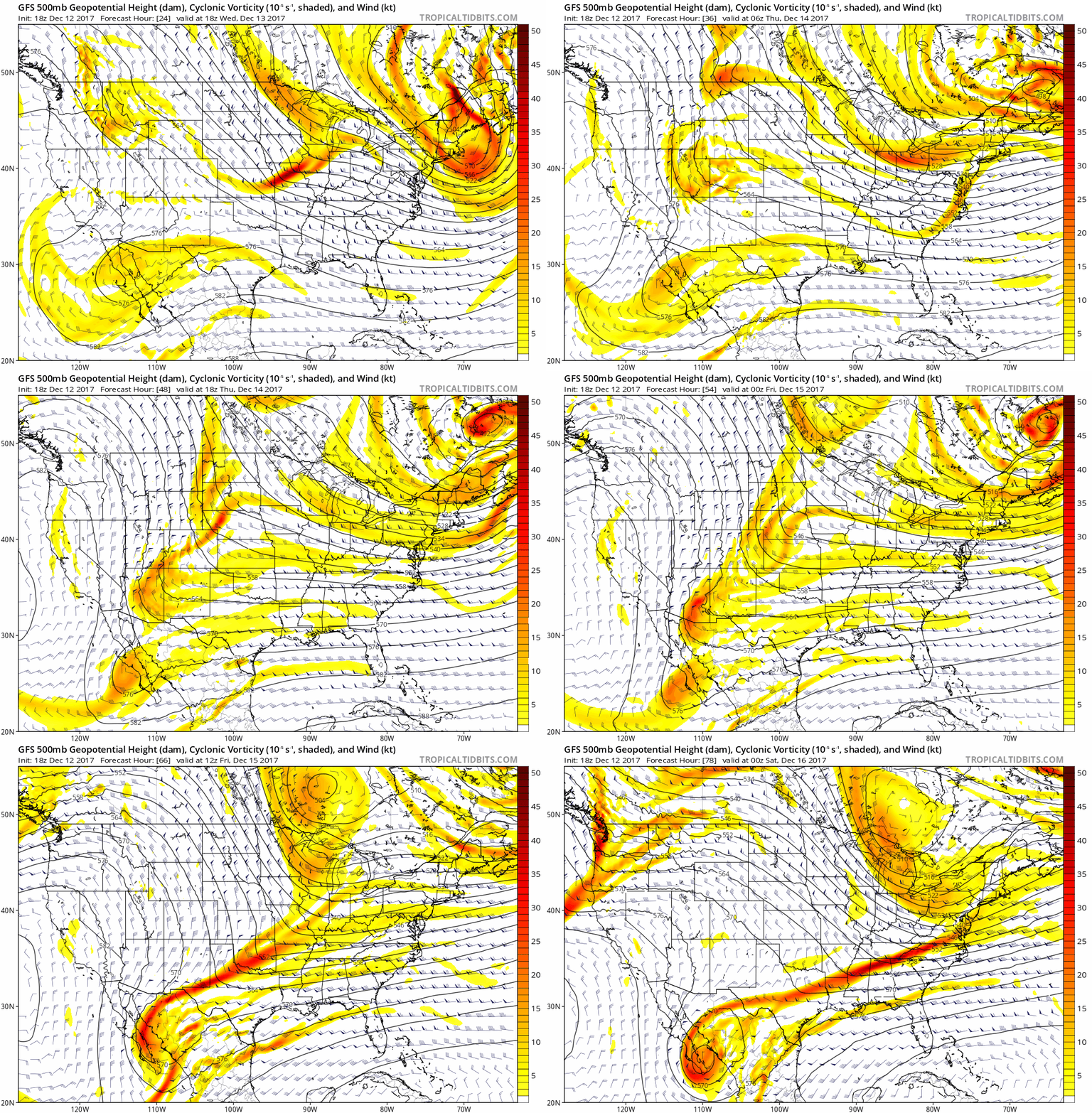 III. A period of brief moderation will come in this pattern early Christmas week, but all eyes continue to focus on the period between December 22nd through December 26th for the potential of impactful weather across our region. For model “worshipers” out there, we suggest paying more attention to overall trends, and a blend of ensemble data, as opposed to specifics associated with operational runs. It’s a “jailbreak” pattern of sorts as true arctic air will be pouring down the Plains while the southeastern ridge tries to fight for a time. The resistance from the southeastern ridge and associated tight thermal gradient should promote a very stormy regime for the interior (Ohio Valley into the interior northeast) as we head into the true holiday/ Christmas stretch. As of now, we favor the idea of multiple waves along the pressing arctic boundary, as opposed to one big storm. Looking back through the records shows some of the heaviest snows at IND have come from similar set-ups. Understanding each set-up is unique, the overall pattern does have to raise an eye brow for potential of wintry weather in, or around, our region as Christmas approaches…
Permanent link to this article: https://indywx.com/2017/12/12/tuesday-evening-rambles-wintry-weather-and-more-christmas-week-chatter/
Dec 11
VIDEO: Attention Required Tonight; Additional Upper Energy Poses A Challenge This Week…
You must be logged in to view this content. Click Here to become a member of IndyWX.com for full access. Already a member of IndyWx.com All-Access? Log-in here.
Permanent link to this article: https://indywx.com/2017/12/11/video-attention-required-tonight-additional-upper-energy-poses-a-challenge-this-week/
