Updated 07.07.23 @ 7:31a
You must be logged in to view this content. Click Here to become a member of IndyWX.com for full access. Already a member of IndyWx.com All-Access? Log-in here.

Jul 07
Updated 07.07.23 @ 7:31a
You must be logged in to view this content. Click Here to become a member of IndyWX.com for full access. Already a member of IndyWx.com All-Access? Log-in here.
Permanent link to this article: https://indywx.com/video-watching-saturday-storm-threat-next-week-opens-nice-before-turning-unsettled-mid-and-late-week/
Jul 06
Updated 07.06.23 @ 7:50a
You must be logged in to view this content. Click Here to become a member of IndyWX.com for full access. Already a member of IndyWx.com All-Access? Log-in here.
Permanent link to this article: https://indywx.com/video-pleasant-close-to-the-work-week-recent-wet-pattern-shift-looks-to-hold-through-july/
Jul 05
Updated 07.05.23 @ 8:15p
You must be logged in to view this content. Click Here to become a member of IndyWX.com for full access. Already a member of IndyWx.com All-Access? Log-in here.
Permanent link to this article: https://indywx.com/video-storms-tonight-give-way-to-briefly-drier-air-to-close-the-short-work-week-back-to-unsettled-this-weekend/
Jul 04
Updated 07.04.23 @ 10:53p
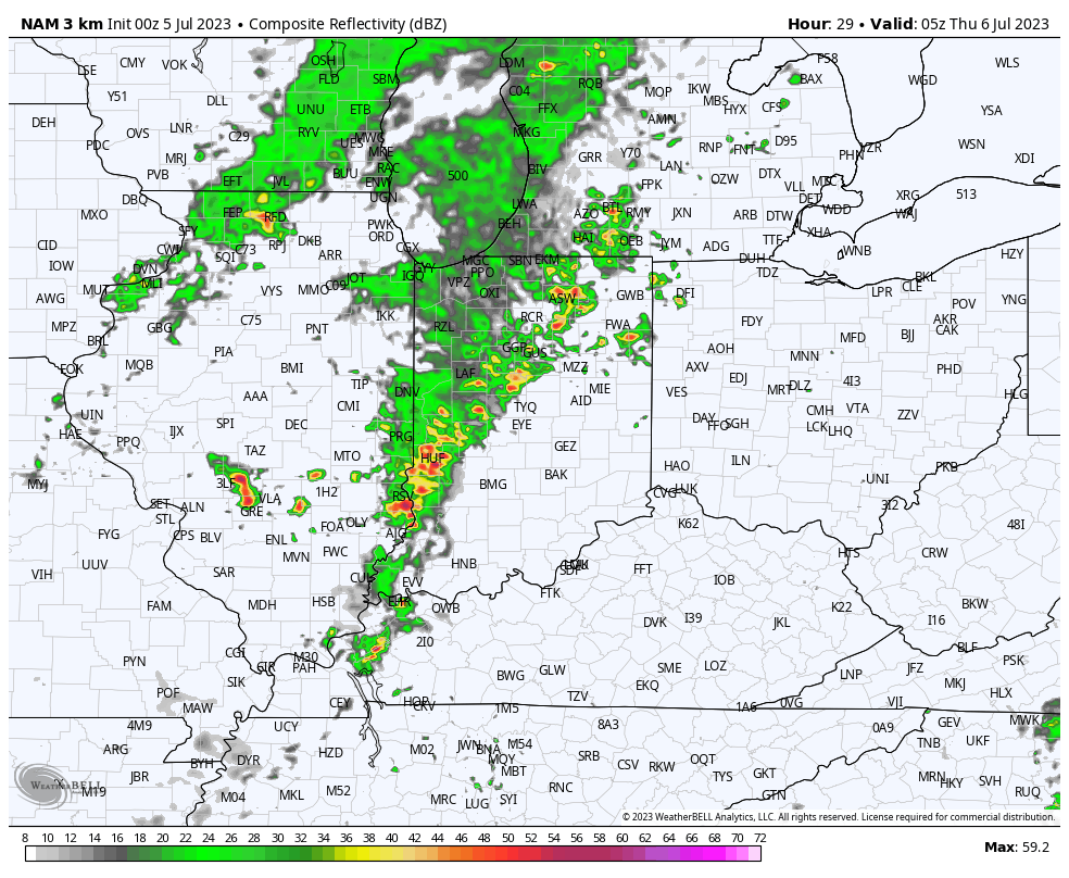
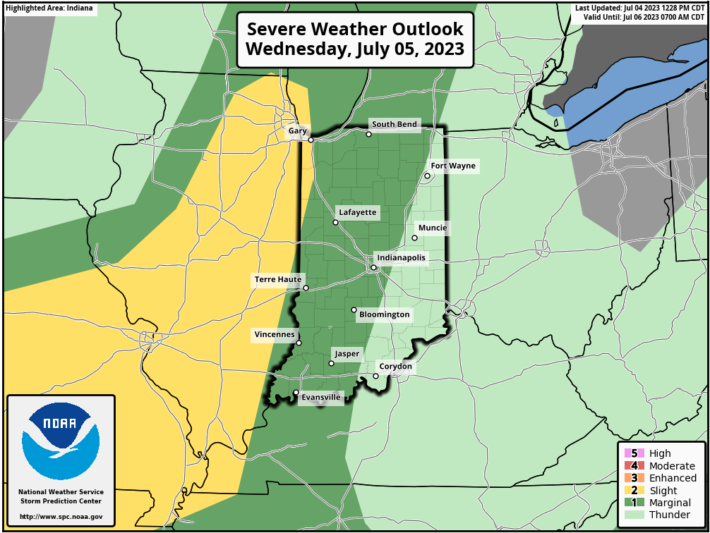
Most of our hump day should feature quiet conditions. A couple renegade storms will likely fire up during the mid to late afternoon hours. These will be ahead of a more organized line of storms impacting Illinois. That particular line will rumble east into the state towards 10p to 11p and likely reach the city, itself, around midnight.

The Storm Prediction Center (SPC) includes central Indiana in a ‘marginal’ risk of severe weather Wednesday. Damaging straight line winds are of biggest concern with this line.

While we’ll need to monitor radar trends and overall timing, as of this evening, it doesn’t appear that this will be a widespread severe weather maker (available energy and a late evening arrival argue against this being a significant event).
On the road early tomorrow morning but will be sure to have a fresh video update posted Wednesday evening with updates on the above and a look ahead to the next couple weeks.
Permanent link to this article: https://indywx.com/wednesday-evening-rumbles/
Jul 04
Updated 07.04.23 @ 6:14a
There’s something about the 4th of July that signals a shift within. It’s been this way for me since back in the high school days. Back then, the following week meant 2-a-days were beginning as a new football season was only a few weeks away. Fast forward to today, and I understand some of the big box retailers are preparing to display their fall and Halloween decor over the next couple weeks. SEC Media Days, the unofficial “official” start of the college football season gets rolling in Nashville on July 17th. Heck, before you know it, we’ll be producing our annual winter outlook.
Okay, back to present.
As the Nino continues to mature, we believe the rest of meteorological summer (through end of month August) continues to keep any significant or long lasting heat away from our neck of the woods. In addition, the dry stretch that typically develops at some point each and every summer is also behind us. Simply put, the next 6-7 weeks appear to run near normal from a temperature standpoint and slightly above to above normal from a precipitation perspective. Overall, I prefer to lean on the latest JMA monthly product.
July
Temperatures

Precipitation

August
Temperatures

Precipitation

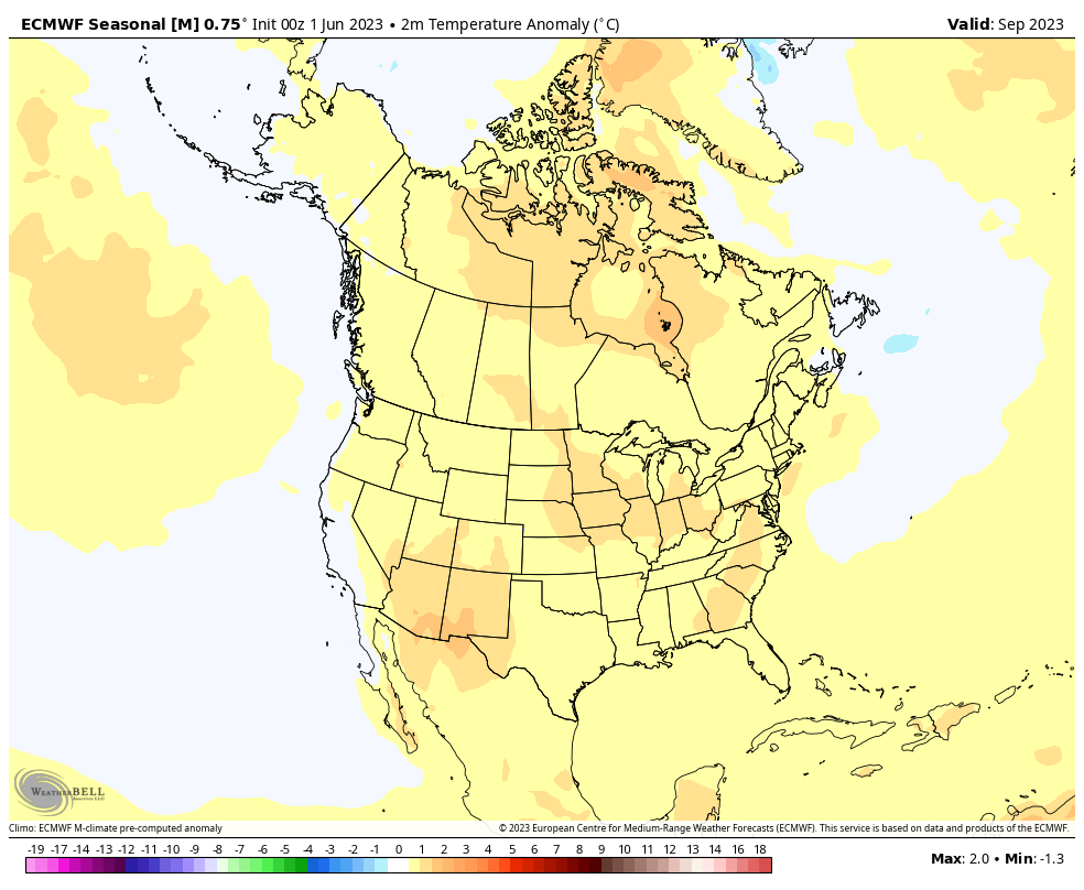
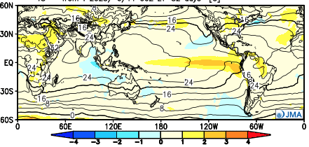
As we look ahead to autumn, the early call is for a warmer than normal open to fall as a whole. Certainly fits the bill with recent autumn trends…
We note both the JMA and latest European Seasonal product going towards this mild look. More on the entire fall seasonal outlook over the next few weeks.


From our family to yours, we’re wishing you a blessed Independence Day! A fresh batch of storms arrive later Wednesday and our short-term update later tonight will handle the latest look there.
Permanent link to this article: https://indywx.com/brief-break-in-the-pattern-gives-us-time-to-look-ahead-to-the-remainder-of-met-summer-open-to-autumn/