Periods Of Storms; Localized Flooding…
|
Fri. |
Sat. |
Sun. |
Mon. |
Tue. |
Wed. |
Thr. |
|
|
|
|
|
|
|
|
|
74/ 88 |
72/ 89 |
72/ 90 |
72/ 90 |
71/ 91 |
70/ 88 |
69/ 83 |
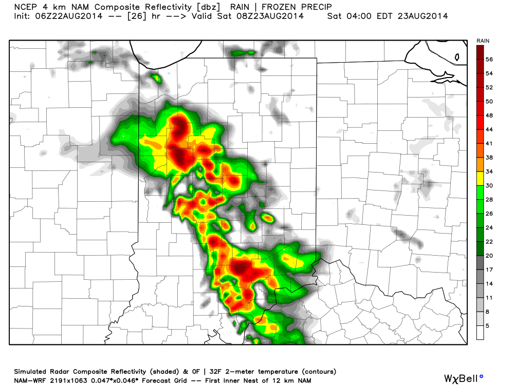
More Storms To Go…Our “ring of fire” pattern continues into the weekend and as disturbances ride the periphery of the heat dome to our south, periods of thunderstorms will be the result here. Locally heavy rain will be possible with each storm complex and localized flooding will result. Some extreme rainfall amounts of 5-8″ has been reported over the past couple days across north-central Indiana where training of storms has occurred.
After our current storm complex moves southeast, we think we deal with an additional couple of storm complexes late tonight into early Saturday and again Saturday evening. Overall coverage of storms will be on the decline as we go deeper into the weekend, but rain can’t be totally eliminated from your forecast.
Hot And Humid…While we may fall a degree or two shy of the polarizing 90 degree mark, it’ll still feel mighty hot and humid today and Saturday. As rain and storm chances begin to decrease, that’ll allow us to take temperatures up a couple notches late weekend into early next week. We forecast lower 90s Sunday through at least next Tuesday.
Late Month Relief…We still forecast a cooler pattern developing to wrap up August and move into September. Much more on this in the coming days. Right now, the big story remains the storm chances in the short term.
7-Day Precipitation Forecast:
- 7-Day Rainfall Forecast: 2.00″ (locally heavier totals)
- 7-Day Snowfall Forecast: 0.00″