
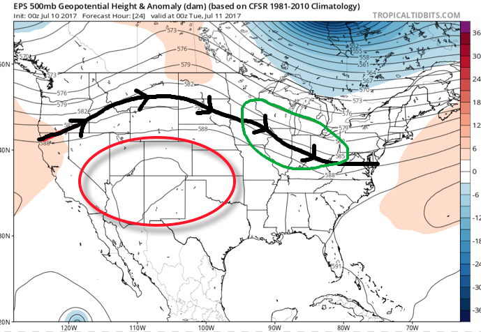
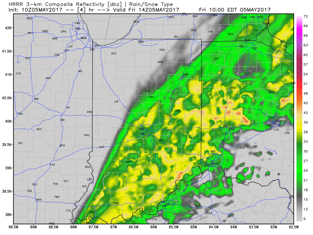
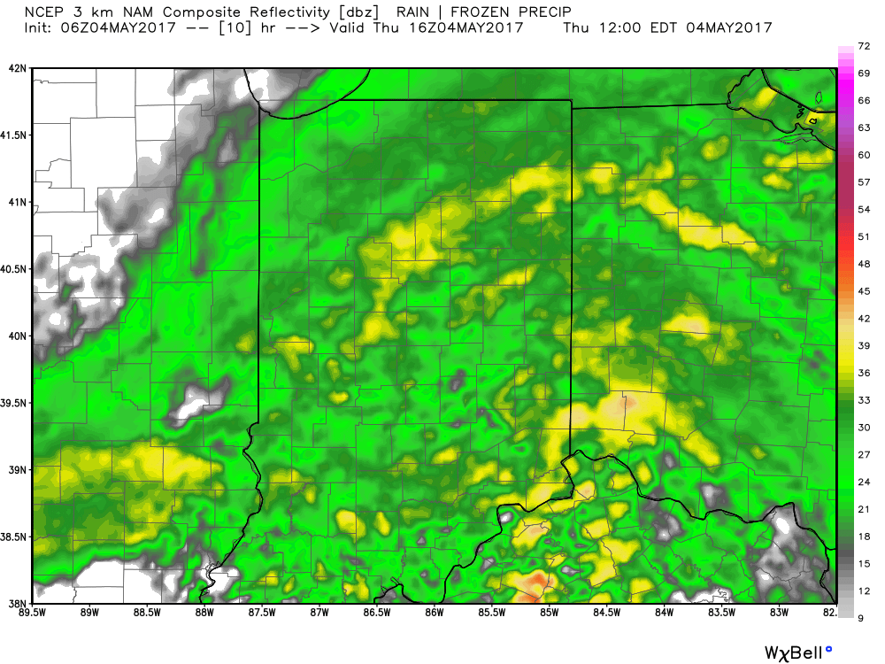
The overall set-up this week will include a northwest flow aloft with multiple disturbances riding southeast out of the upper Mid West into the Ohio Valley. Each disturbance will aid in helping ignite more widespread rain and thunderstorms. The first couple waves of rain and thunderstorms look to impact central Indiana late morning into the early afternoon before the potential of additional thunderstorms late evening into the overnight. Some of the storms may become severe, including damaging winds.
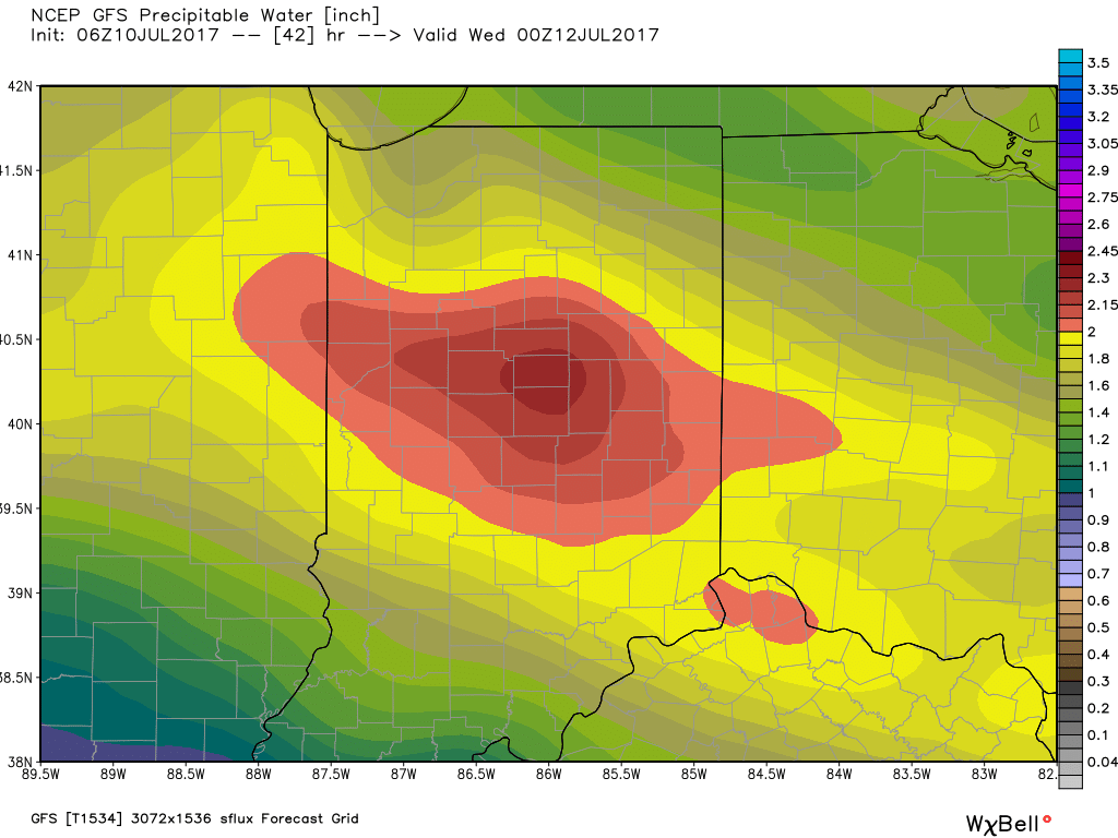
 A quick step outside this morning will tell the story on just how different it feels. Gone is the refreshing air mass we enjoyed over the weekend and in return we’ve transitioned to an oppressive, tropical feel. Dew points will remain in the 70s through the majority of the work week and precipitable water values will reach 2″+ at times. With such a moisture laden air mass in place, flash flooding will likely result for some communities as the storms continue to track over the same areas this week.
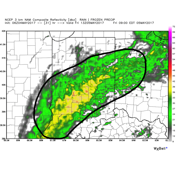
 Additional waves of thunderstorms will impact the region through mid-and-late week before we advect some drier air into the state Friday evening into the weekend. Despite the lower dew points and cooler air, we still can’t rule out a shower or thunderstorm this weekend as a secondary front settles south.
When we total things up in the rainfall department through Saturday, widespread 2″-3″ can be expected, however, as mentioned, where storms “train,” much higher totals of 3″-6″+ will be a good bet.
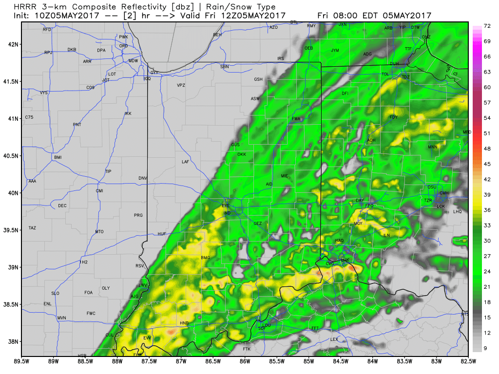
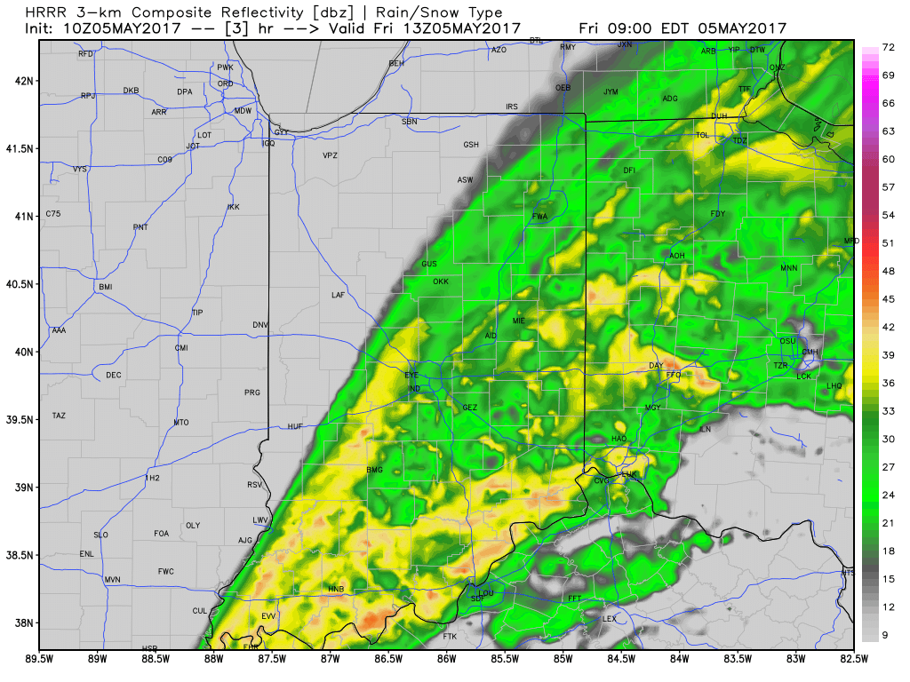
 Additional rainfall of 1″-1.5″ is likely from Indianapolis and points south and east with this band of rain before drier weather finally works in here this afternoon and evening. Otherwise, expect continued windy, cold, and raw conditions today as temperatures remain in the 40s this afternoon, including wind chills in the 30s.
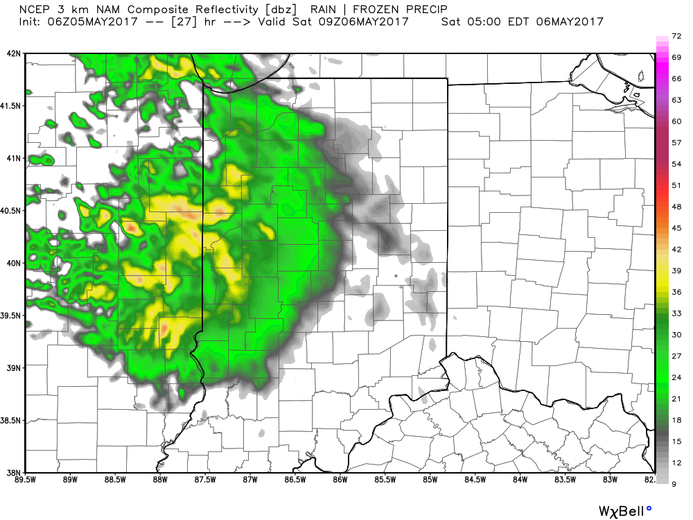
 We’ll finally get rid of the rain and introduce a drier regime Saturday afternoon into Sunday, including a sunny close to the weekend. With the drier air, overnight lows will fall to frosty levels Sunday and Monday mornings (lower to middle 30s).
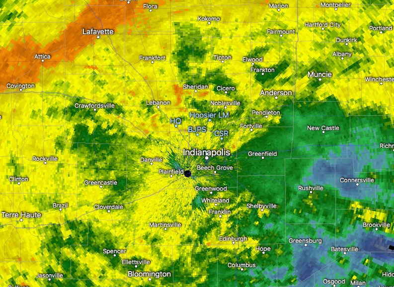
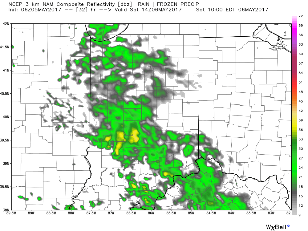
 We should finally get into drier air Friday night before one last round of showers pushes southeast across the state Saturday morning. As of this update, we bracket the 4a-10a timeframe for renewed wet weather. By Saturday afternoon, drier air should win out and result in a much more favorable forecast Saturday night into Sunday.
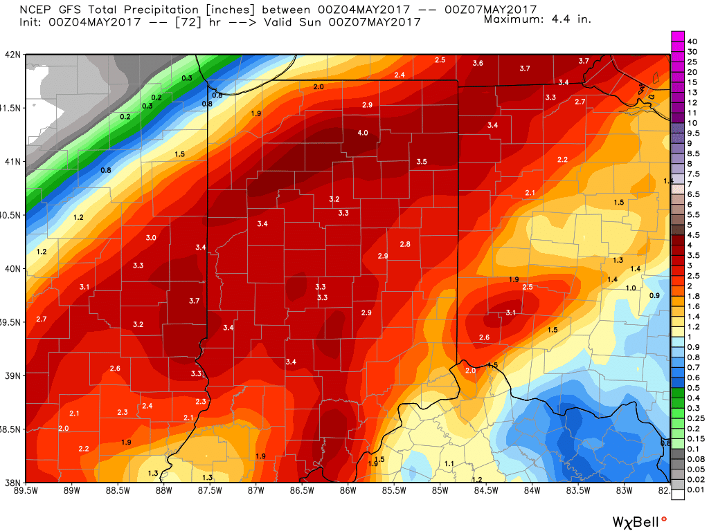 In closing, as drier air begins to arrive on the scene Saturday evening, much cooler conditions will result in areas of frost into early next week. Lows in the lower to middle 30s will be common Sunday and Monday mornings across central Indiana.