Category: Flooding

Monitoring Prospects For Heavy Weekend Rain…

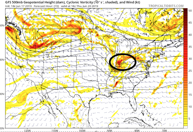
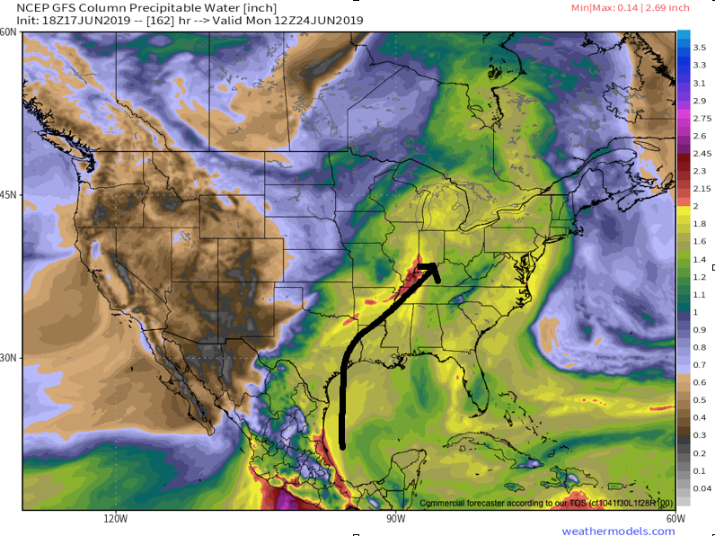
A combination of ingredients are coming together to offer up the potential of heavy rain for portions of the region this weekend.

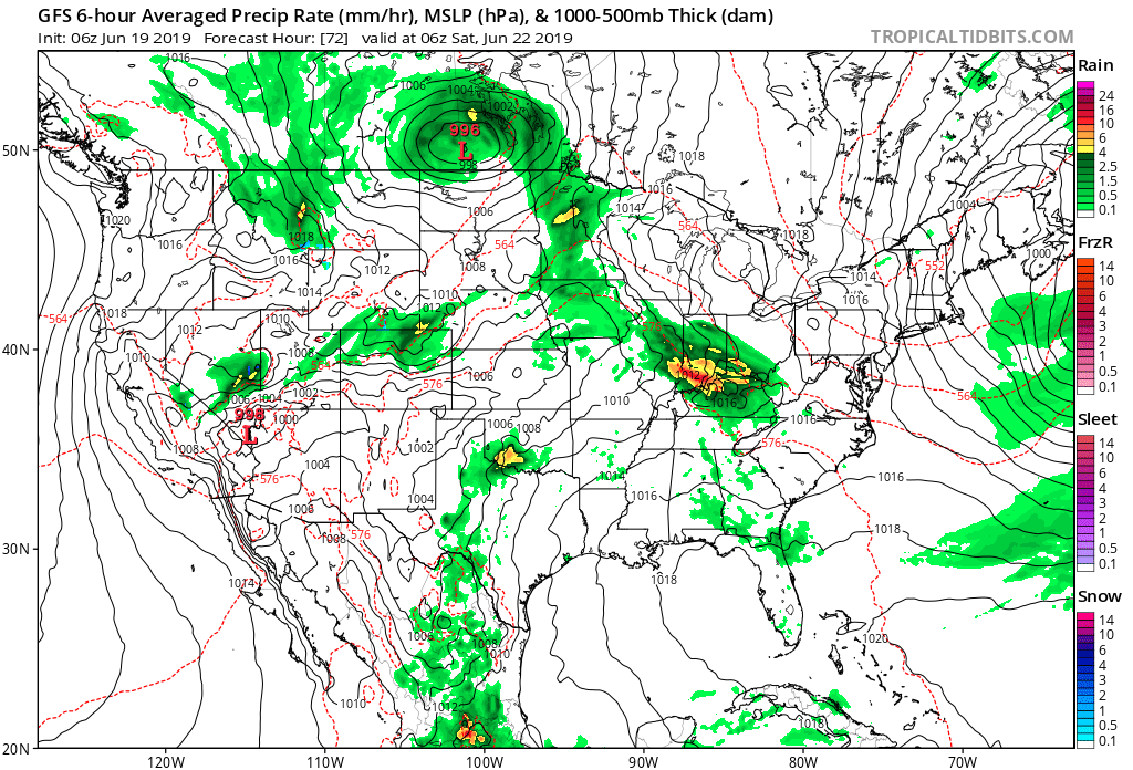
An approaching cold front will drop slowly southeast out of the Plains while a tropical low moves inland from the central Gulf Coast.

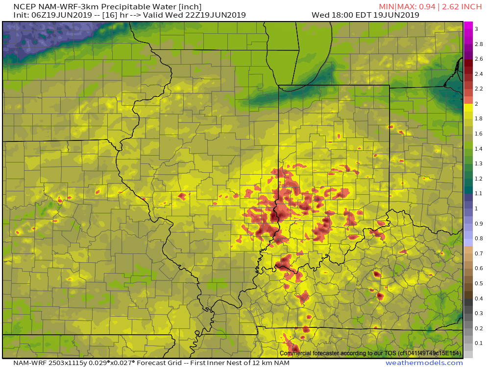
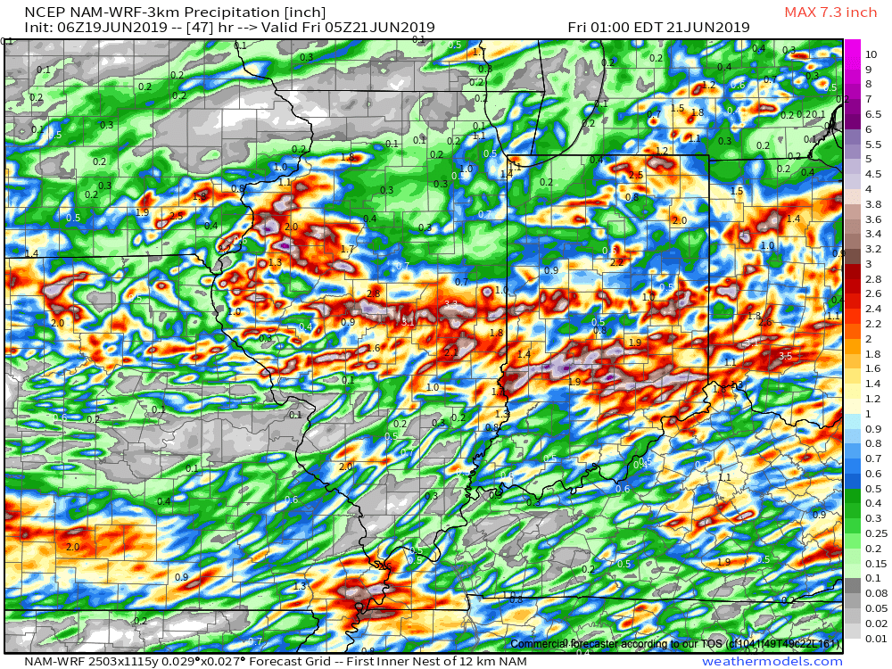
Wknd8:13The precise placement of the front will serve as the focal point for heavy weekend rains.  As we’d expect from this distance, modeling disagrees on the all-important specifics.  Using a model blend, central Indiana is on the table for heavy late week-weekend rain as of now.  Precipitable water values (PWATs) will be above 2″ and suggest the threat of torrential downpours, including localized flash flooding across the Ohio Valley.  Eventually, the cold front will sweep the tropical-rich moisture away from the region and cooler, much less humid air will press in by this time next week.

We still have time to watch the evolution of things play out as we progress through mid week. Stay tuned as we “sure-up” the details and hone in on the area where heavy rain is likely.

Permanent link to this article: https://indywx.com/2016/08/08/monitoring-prospects-for-heavy-weekend-rain/

Dry And Turning Hot; Watching Late Week…

Screen Shot 2016-08-07 at 10.47.30 AMHighlights:

  • Sun-filled days
  • Heat cranks up
  • Late week questions

Turning Up The Heat…After a refreshing weekend, the heat returns later this week.  Look for highs in the lower 90s with an oppressive feel to the air, as humidity builds.  “Air you can wear” will be an appropriate forecast title come mid week.  The forecast is easy through the midweek stretch with sunshine as the rule.

Things become more unclear as we approach the back half of the week and the weekend.  We note the GFS is rather progressive in swinging a cold front through here with scattered showers and thunderstorms, followed by a significantly cooler/ drier air mass a week from today.  On the  other hand, the European solution is drastically different as it slows the front to a “crawl” coming through the Ohio Valley and also entrains GOM (Gulf of Mexico) moisture from the serious rain/ flood maker later this week across the Gulf states.  It’s a significantly wetter look, locally, and a situation we’ll continue to keep a close eye on in the coming day, or two.

Upcoming 7-Day Precipitation Forecast:

  • Snowfall: 0.00″
  • Rainfall: 0.50″-1.00″

Permanent link to this article: https://indywx.com/2016/08/07/dry-and-turning-hot-watching-late-week/

More Active Pattern Early Week…

The Corn Belt and parts of the Ohio Valley will be in a favorable position for periods of storminess as we progress through the early portions of the new week.

It’s an admittedly tricky pattern when it comes down to the all-important details (timing, track, etc.), but just know from this distance, it’s a pattern conducive for thunderstorm development and localized flash flooding.

The region will be located on the NE flank of a hot dome centered to our SW.

The region will be located on the NE flank of a hot dome centered to our SW.

Disturbances love to ride northwest to southeast around the periphery of the ridge.  Accordingly, the subtle northwest flow aloft will likely send a couple disturbances into the region over the early week stretch.

NWFlowThe atmosphere will be loaded with moisture and precipitable water values (2″+) will promote localized flash flooding within the storm complexes.

MoistureWe think the initial wave of storms will ride southeast late tonight and early Monday and could encompass SW portions of the forecast area.  The pattern is favorable for additional storm complexes to travel southeast Tuesday and Wednesday, however.

With the moisture content in the atmosphere, localized flash flooding will result where training takes place.  We caution that this won’t be a uniform event (some neighborhoods will see a half inch of rain this week while others may see as much as 3″-4″).  We’ll have to treat each complex as they come and fine tune the specifics within the forecast.

Permanent link to this article: https://indywx.com/2016/07/31/more-active-pattern-early-week/

Storms Increase In Coverage This Afternoon…

Screen Shot 2016-07-28 at 7.27.22 AMHighlights:

  • Storm coverage increases
  • Cooler than days past
  • Unsettled pattern next week

Stormy At Times…Widespread thunderstorms have resulted in as much as 4″-5″ of rain across southeastern IN during the early morning hours.  Flash flooding has resulted (including in and around the Cincy area, as well).  Closer to the home front, upper air energy will combine with a weak surface wave of low pressure to result in an enhanced storm chance this afternoon and evening across central IN.  Some locally heavy rain will accompany the stronger storms that develop, along with vivid lightning.

Scattered storm chances will remain Friday into Saturday, but there will also be plenty of dry hours, as well.  Drier air should keep most of the state rain-free Sunday before an unsettled regime returns for early and middle parts of next week.

Upcoming 7-Day Precipitation Forecast:

  • Snowfall: 0.00″
  • Rainfall: 0.75″-1.25″ (locally heavier totals)

Permanent link to this article: https://indywx.com/2016/07/28/storms-increase-in-coverage-this-afternoon/

Unseasonably Cool; Heavy Rains…

Screen Shot 2016-07-03 at 10.14.18 AMHighlights:

  • Heavy rain
  • Unseasonably cool
  • Turning warmer
  • Active, stormy time later in the week

Jacket And Rain Gear Needed…The first of two rounds of widespread, soaking rains is pushing across central IN this morning.  Periods of moderate to heavy rains will develop later tonight as round two arrives on the scene.  Localized flooding is likely tonight and Monday morning.  The overall set-up is one that features a stationary front draped across the region with ripples of energy (low pressure) moving along the boundary.  In addition to the wet weather, this will also set up quite the temperature gradient across the state today.  Here across central IN, jackets will be needed all day with highs struggling to climb much out of the middle 60s.  Downstate, temperatures will zoom into the 80s with a severe component added into the mix tonight for southern IN (with the focus primarily being straight line winds).

Showers and thunderstorms will continue Independence Day, but we’re still hopeful in thinking we begin to dry things out for the afternoon and evening.  That’s great news for the fireworks and festivities planned tomorrow evening.

We begin to heat things back up and add storms into the mix for mid and late week as the region gets into an active NW flow regime.  The potential is there for a couple of rather noisy storm complexes later this week.  We’ll keep a close eye on things.

Upcoming 7-Day Precipitation Forecast:

  • Snowfall: 0.00″
  • Rainfall: 3.5″-4.5″ (locally heavier amounts)

Permanent link to this article: https://indywx.com/2016/07/03/unseasonably-cool-heavy-rains/

Unseasonably Cool; The Calm Before The Storm…

The morning is off to a dry and unseasonably cool start, including filtered sunshine.  Temperatures are running 15-20 degrees below normal across the state, with many central IN neighborhoods currently in the lower to middle 50s.

t0Mid and high level clouds will spread over the region today, but we’ll stay dry.  We’ll notice a lowering and thickening cloud deck by evening and this is a hint at things to come Sunday.

Screen Shot 2016-07-02 at 7.44.09 AMRain will overspread the region Sunday morning, increasing in coverage and intensity as we progress into Sunday evening.

hires_ref_indy_31Rain will turn locally heavy at times and we expect a widespread swath of 2″-3″ totals through the heart of the state, with localized heavier amounts.  Precipitable water values exceed 2″ across central and southern IN Sunday evening and will likely promote a flash flood threat.
1Most of the rain falls Sunday morning-Monday morning before drier air begins to try and work in here as Monday afternoon arrives.  As of now, we think Monday evening firework shows should be a go!

Sunday will also be a chilly day for the time of the year as temperatures north of I-70 likely remain in the 60s most of the day.

We’ll have a video update posted later this evening with fresh thoughts from the 12z model suite.

Permanent link to this article: https://indywx.com/2016/07/02/unseasonably-cool-the-calm-before-the-storm/

Video Update On Tonight’s Severe Weather Event…

You must be logged in to view this content. Click Here to become a member of IndyWX.com for full access.  Already a member of IndyWx.com All-Access?  Log-in here.

Permanent link to this article: https://indywx.com/2016/06/22/video-update-on-tonights-severe-weather-event/

Latest Thinking On What Will Be A Busy Wednesday…

The SPC (Storm Prediction Center) maintains a significant severe weather risk across Indiana Wednesday.  A Slight risk encompasses the southern portions of the state, while an Enhanced risk takes up residence across central Indiana.  Finally, a Moderate risk is located across the northern third of the state.  Given the latest data, we wouldn’t be surprised if a portion of the Enhanced/ Moderate risk areas are upgraded to a rare High risk during the early Wednesday morning SPC update.  Regardless, we want to be very clear that Wednesday is a potentially dangerous weather day across Indiana.

2We won’t bore you with the meteorological ingredients/ lingo that are coming together to lead to an active Wednesday with this post, but please know that nearly all severe weather parameters point to the threat, and even likelihood, of an active day.

That said, there are unknowns.  How does morning convection impact our ability to heat/ destabilize things during the afternoon?  Are models underestimating the cold pool that will likely develop with the storms during the afternoon/ evening?  If so, a further southeast track and more robust situation could unfold (when compared to what forecast radar products suggest as of this post Tuesday evening).

While all modes of severe weather are certainly possible, for our immediate region, we’re particularly concerned for the threat of widespread damaging winds and flash flooding.  It wouldn’t surprise us if localized 3″+ amounts fall across portions of central and northern IN Wednesday.  Precipitable water values (PWATs) surging to 2″+ give increased confidence on localized flash flooding, especially considering the recent wet times.

6

FlashFloodThreatThe first of multiple storm clusters will likely be moving into central IN Wednesday morning.  Here’s an idea of what the radar may look like around 7a.

1We think we undergo a “lull” in the action Wednesday afternoon before a potentially more serious complex of storms blows into town during the evening hours.  We caution that we’re not as confident on specific timing with the evening round of storms.

3

4Current data would imply a tornado threat for areas from northern IL into northwestern IN with the afternoon/ evening convection before “morphing” into a more widespread damaging wind threat as the line propels southeast into the nighttime hours.  Timing will have to be fine tuned as Wednesday morning arrives.

To close, if you take anything from this post, please understand the importance of knowing your family’s severe weather safety plan.  Have a means of getting the latest watch and warning information from the National Weather Service and take any and all bulletins seriously.

Much more later!

Permanent link to this article: https://indywx.com/2016/06/21/latest-thinking-on-what-will-be-a-busy-wednesday/

Needed Breather Today Before Wednesday Severe…

Screen Shot 2016-06-21 at 7.10.47 AMHighlights:

  • Needed quiet time today
  • Stormy mid week; high-impact severe event possible
  • Drier to close the week

All Eyes On Wednesday…Today is an easy one.  Drier air will move into central parts of the state as we progress into the afternoon and evening hours, and we’ll also enjoy lots of sunshine.  It’ll feel fantastic out come evening!

All eyes will remain locked in on Wednesday as we monitor the prospects of potentially two rounds of thunderstorms.  Timing and track will have to be fine tuned, but we think the day offers up the possibility of morning thunderstorms, followed by a second round of storms during the afternoon and evening hours.  All modes of severe weather are in play, locally, Wednesday- particularly damaging wind.  Additionally, localized flash flooding will be likely where storms train.  It’ll be an important day to have a means to get the latest watches and warnings.  It wouldn’t be a bad idea to review your severe weather safety plan with your family at some point today.

After morning storms Thursday we should dry things out during the second half of the day and on into the first half of the weekend. Storm chances return Sunday-Monday.

Upcoming 7-Day Precipitation Forecast:

  • Snowfall: 0.00″
  • Rainfall: 1.5″-2.5″ (locally heavier totals)

Permanent link to this article: https://indywx.com/2016/06/21/needed-breather-today-before-wednesday-severe/

Video Update: Monday Morning Thoughts On A Busy Week Ahead…

You must be logged in to view this content. Click Here to become a member of IndyWX.com for full access.  Already a member of IndyWx.com All-Access?  Log-in here.

Permanent link to this article: https://indywx.com/2016/06/20/video-update-monday-morning-thoughts-on-a-busy-week-ahead/

IndyWx.com