Quiet For Now, But Attention Warranted In The 7-9 Day Window…
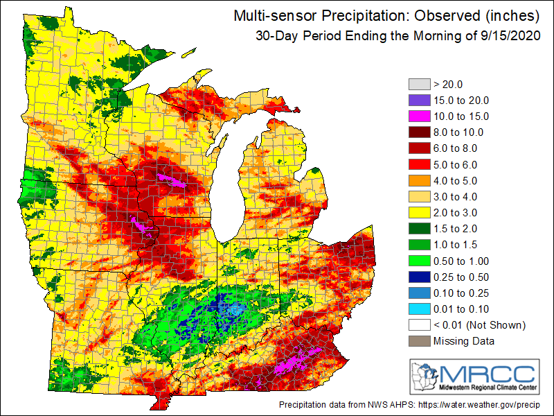
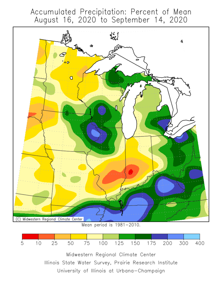
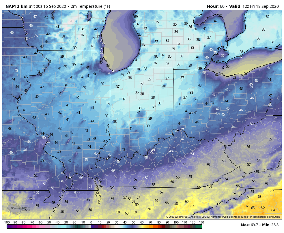
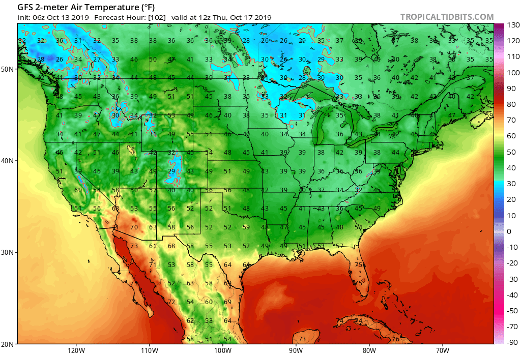
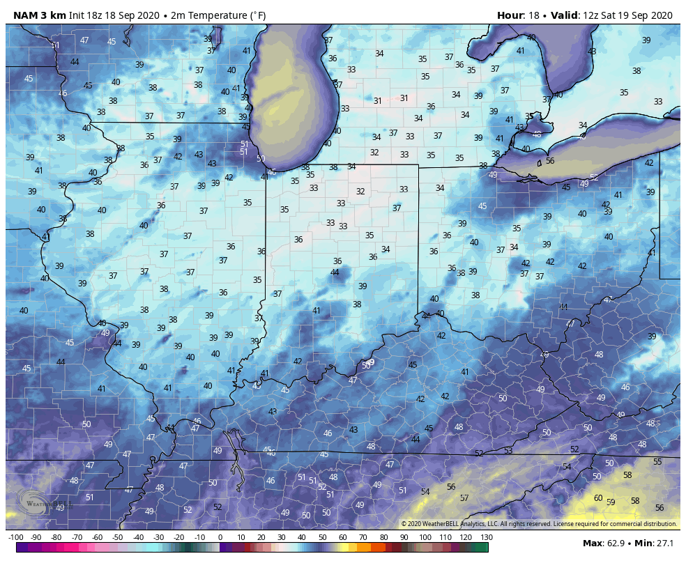
The big story in the immediate term is centered squarely on the temperature forecast. Frost Advisories are up for our friends across northern parts of the state, northwestern OH, and into southwestern MI. Even a few folks outside of the city, itself, can expect patchy frost (a few weeks early mind you, and another byproduct of the recent dryness) across central Indiana.
There’s no reason to waste a lot of pixels on the short-term forecast as quiet conditions prevail. High pressure will remain in control for the upcoming work week with slowly moderating temperatures. We’ll go from below, to seasonal, to slightly above normal by week’s end.
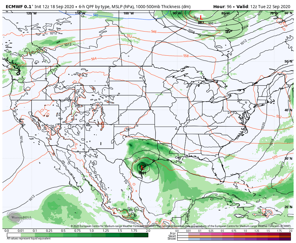
The next “problem” arises by next weekend as forecast models sort out what to do with remnant tropical moisture from now TS Beta and an approaching cold front. In this morning’s client video (never posted due to the connectivity issues), we walked through the various solutions. We’ll be “back to normal” from a video perspective late tomorrow and appreciate your patience more than you know.
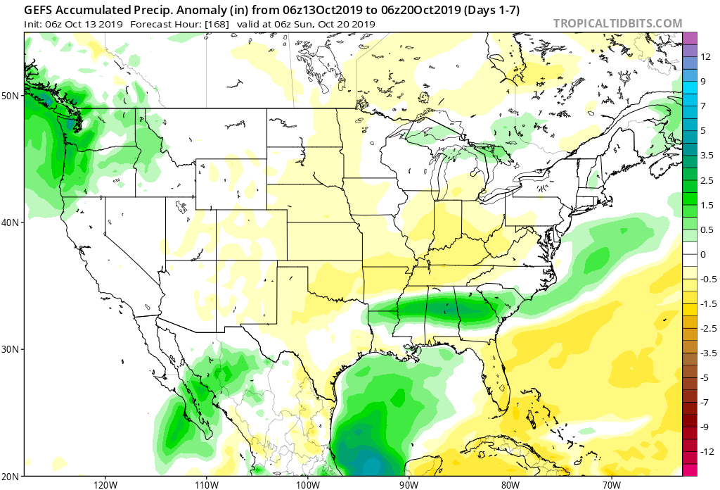
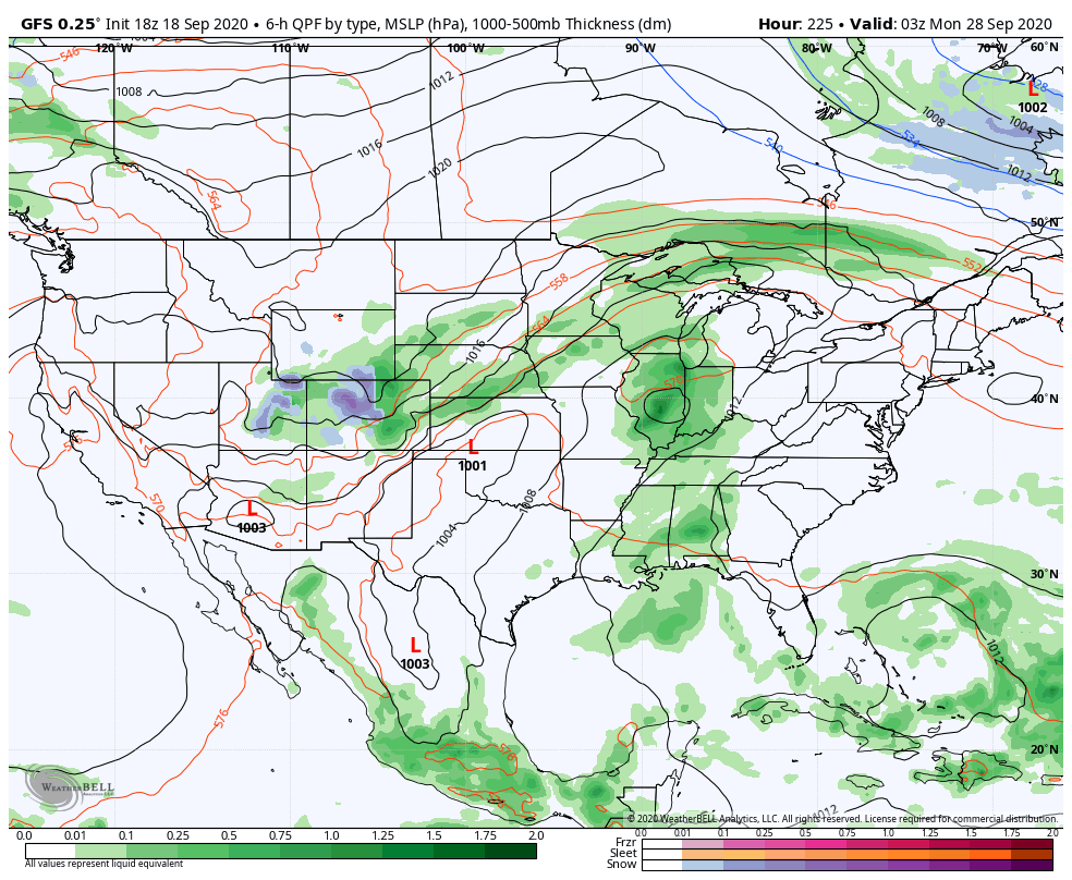
There’s two windows that are open late next week/ next weekend, including the Deep South and the Ohio Valley dealing with remnant tropical moisture. Given the overall pattern, we favor the southern solution from this distance, but should Beta “dilly dally” in the western Gulf, there will be an opportunity for that next approaching trough to pull that remnant tropical moisture northward into an area desperately needing rainfall. Stay tuned. Interestingly, the European and GFS both agree on the northern trend at 12z.

Notes and Asides: We’ll be back at home base tomorrow night after being down on the Gulf for the past week and will resume normal video production at that point. Despite the quiet times right now, it’ll be interesting to see how things begin to ramp up late next week. Much more later. Have a relaxing Friday evening.