
We’re opening the new week with the same old unseasonably warm and muggy weather pattern that was with us the majority of last week, but significant changes loom during the week ahead. Ultimately, summer will be laid to rest (finally) and a legitimate, “stick and hold” fall pattern will take hold. The transition will feature a “game changer” of a midweek cold front that will take us from an August to a November feel in as little as 24 hours. Here are some highlights between now and then:
I. A strong ridge will continue to promote an unseasonably warm and muggy feel by early-October standards. Scattered “splash and dash” storms are possible through the early portion of the week, but organized significant rain isn’t anticipated.
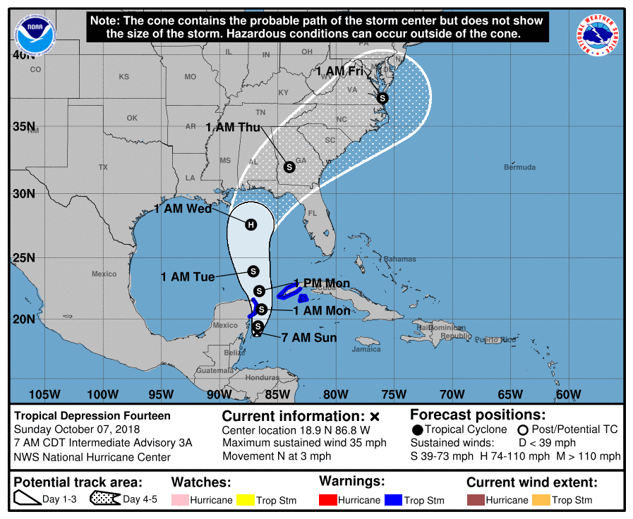
 II. TD 14 will strengthen into Tropical Storm Michael later today and eventually a hurricane before making landfall along the Florida panhandle during the middle of the week. The remnant moisture of Michael will then race northeast and impact the flood-ravaged Carolinas during the latter stages of the work week.
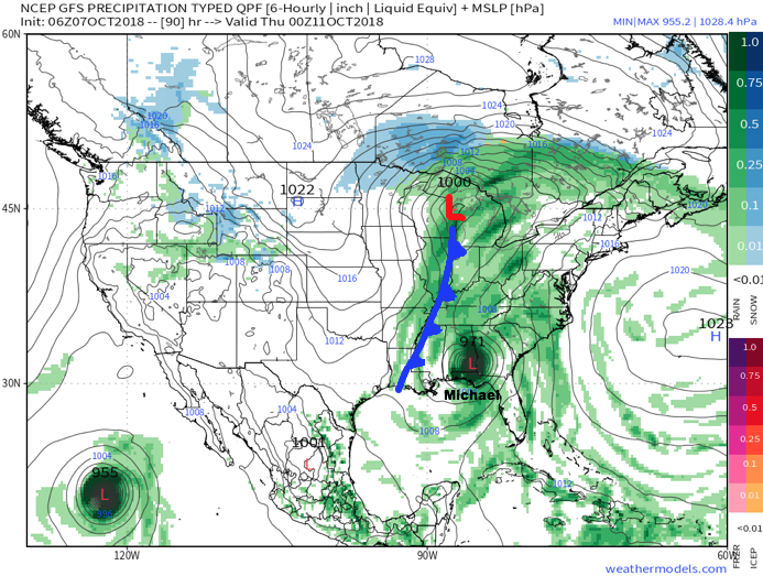
 III. As Michael’s remnant moisture tracks northeast into the Carolinas, a strong cold front will sweep through the Mid West and Ohio Valley. Better chances of organized showers and thunderstorms will arrive ahead of the front Wednesday. Once the front passes, a dramatic wind shift to the northwest will push a MUCH cooler and drier air mass into the region.
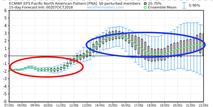
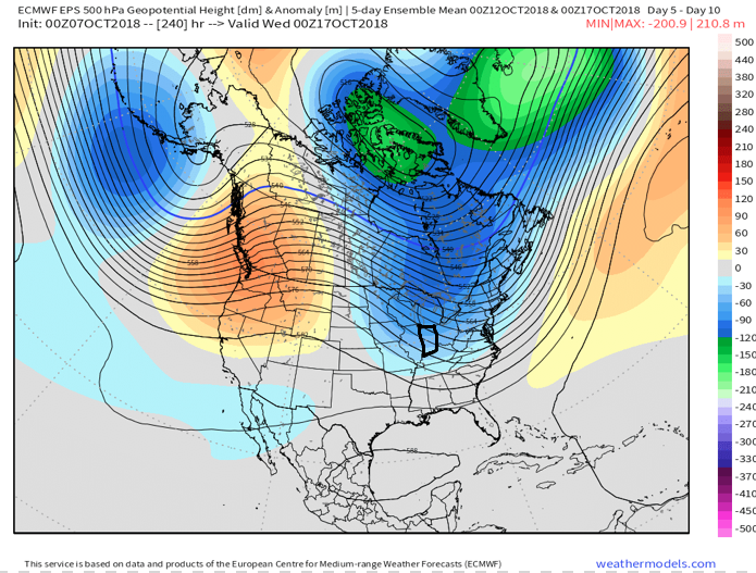
 IV. We note the PNA (Pacific North America pattern) is flipping to a positive state and that will drive a more sustained period of colder air during the medium and longer range period- or mid and late October.
 The air will grow cold enough to support the potential of frost during the 5-10 day period on at least a couple of nights. Additionally, reinforcing chilly air may ignite the lake effect to our north and northeast during Week 2… “Times, they are a changing!”
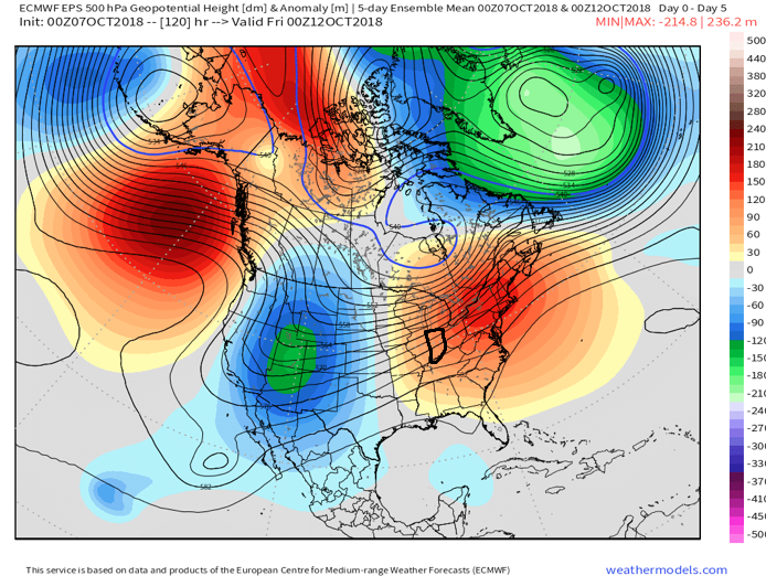
 The culprit? A persistent strong eastern ridge (the same ridge that trapped Florence across the Carolinas after she made landfall).
 A positive PNA typically leads to an eastern trough- especially during the fall months into the spring. Something like this kind of upper level pattern usually results.
 Sure enough, the models are going to this look.
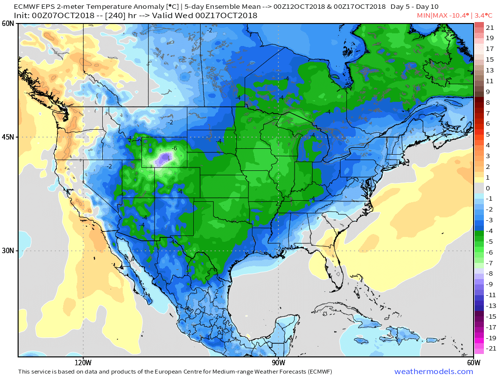
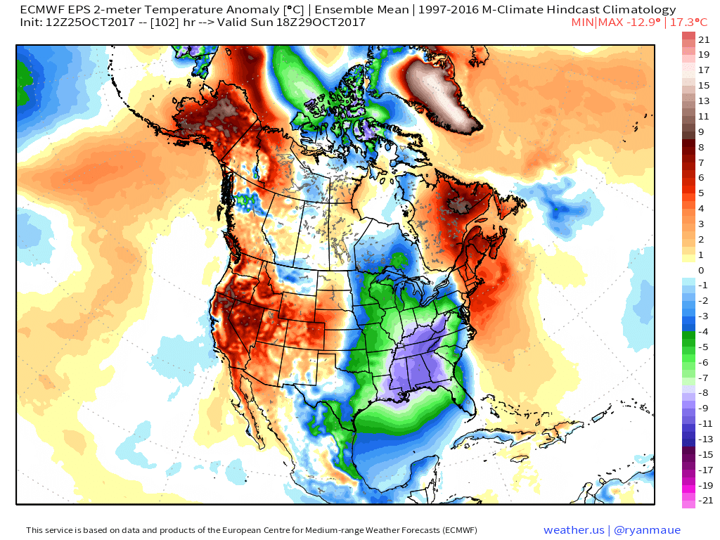
 At the surface, the eastern warmth is reversed in a significant fashion with well below average temperatures. In fact, temperatures will grow cold enough to support high ground snow in the Rockies and northern Great Lakes and the threat of an early frost into the upper Mid West and perhaps portions of the Ohio Valley during the period.
 Ah, true pumpkin spice season is right around the corner. 😉
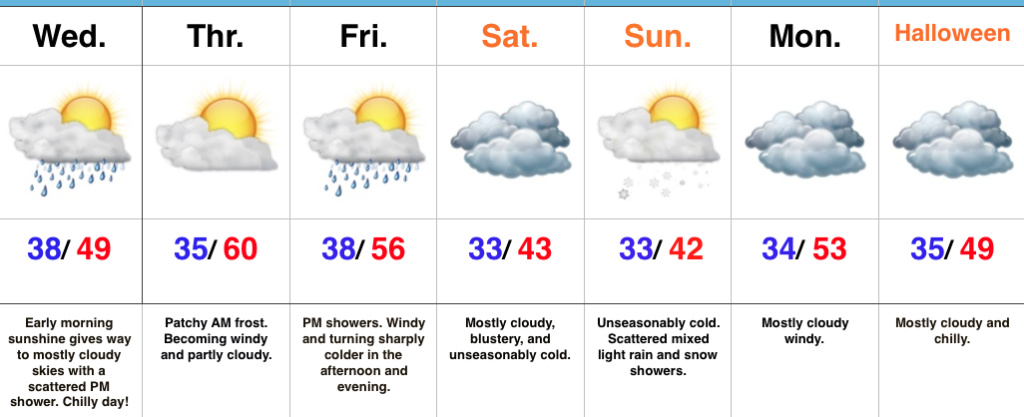
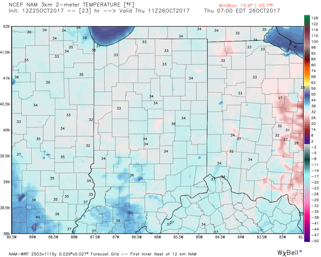 II. Gusty Thursday: After a cold, calm start to our Thursday, southerly winds will become gusty late in the afternoon. This is a result of an approaching cold front that will impact the region Friday.
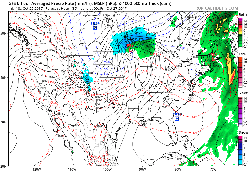 III. Unseasonably Cold Weekend: A cold front will pass Friday afternoon and a band of showers will accompany the frontal passage. Winds will shift to the northwest late in the day and drive in a sharply colder close to the work week. Air will grow cold enough to potentially support snow to mix in with the rain as precipitation comes to an end. Additionally, upper level energy and the colder air mass this weekend (the air will have a bite to it) could support mixed rain and snow showers Sunday. – Novelty stuff only, but those first flakes are always special to see. Nonetheless, temperatures will run well below normal. In fact, highs will be closer to our average low temperature this weekend.
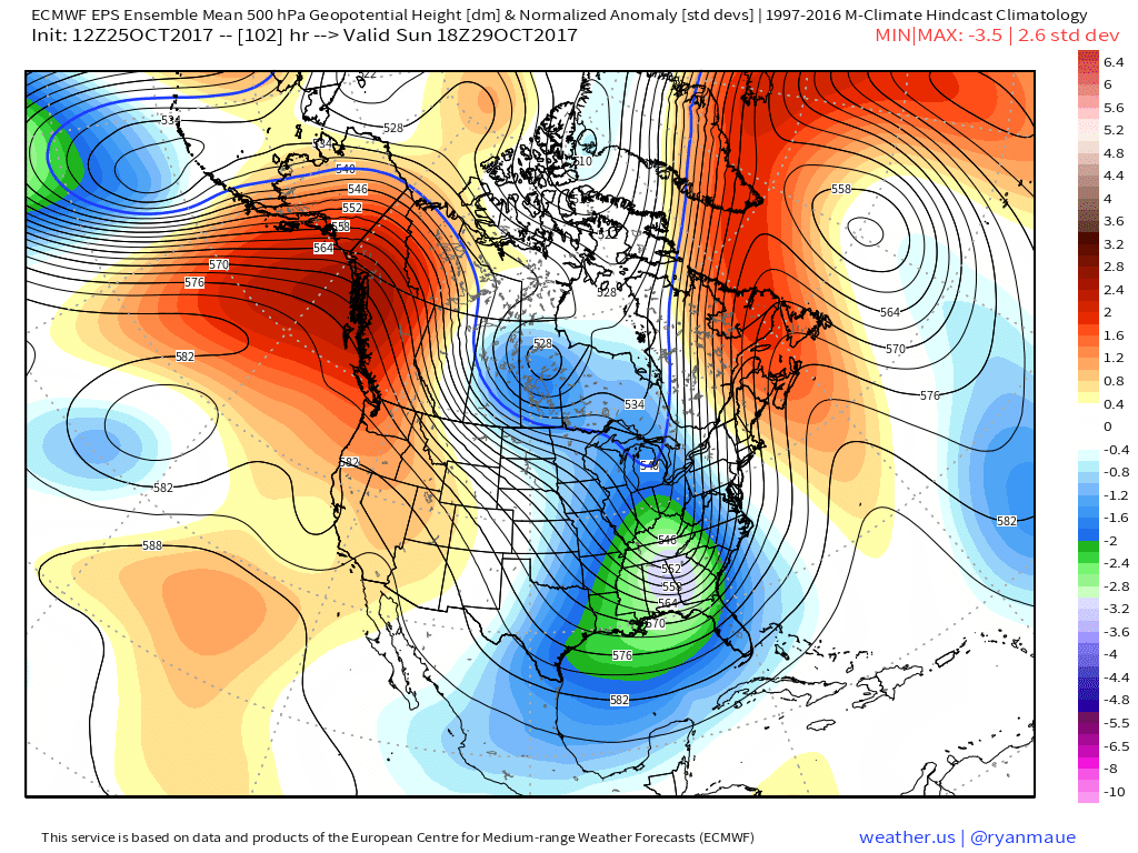
 IV: Reinforcing Halloween Chill: We still stand firm on the idea of warm costumes being required this Halloween as chilly reinforcements blow into town Monday night. This will result in Halloween featuring a high in the mid to upper 40s with lows Tuesday night/ Wednesday morning dipping to around freezing (upper 20s in outlying areas away from the metro). Most of Trick-or-treat hours should feature temperatures in the upper 30s and lower 40s.
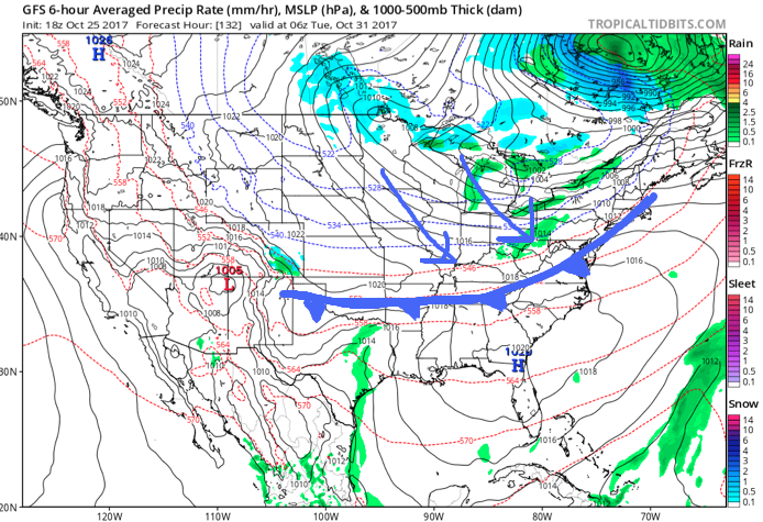
 Highlights: