Long Range Update: Latest EPO/ MJO Implications…

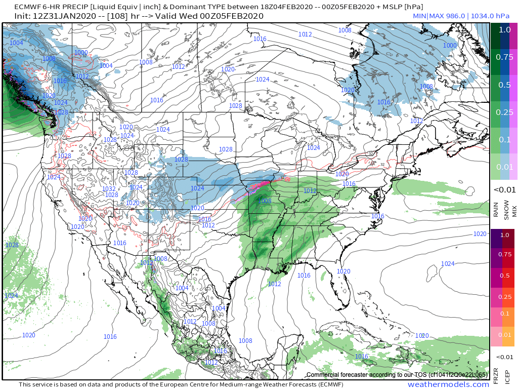
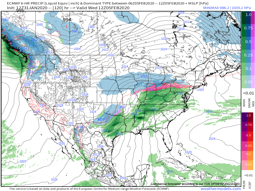
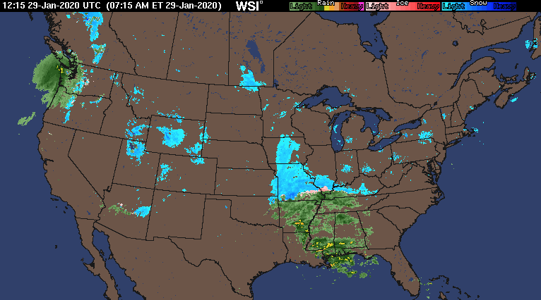
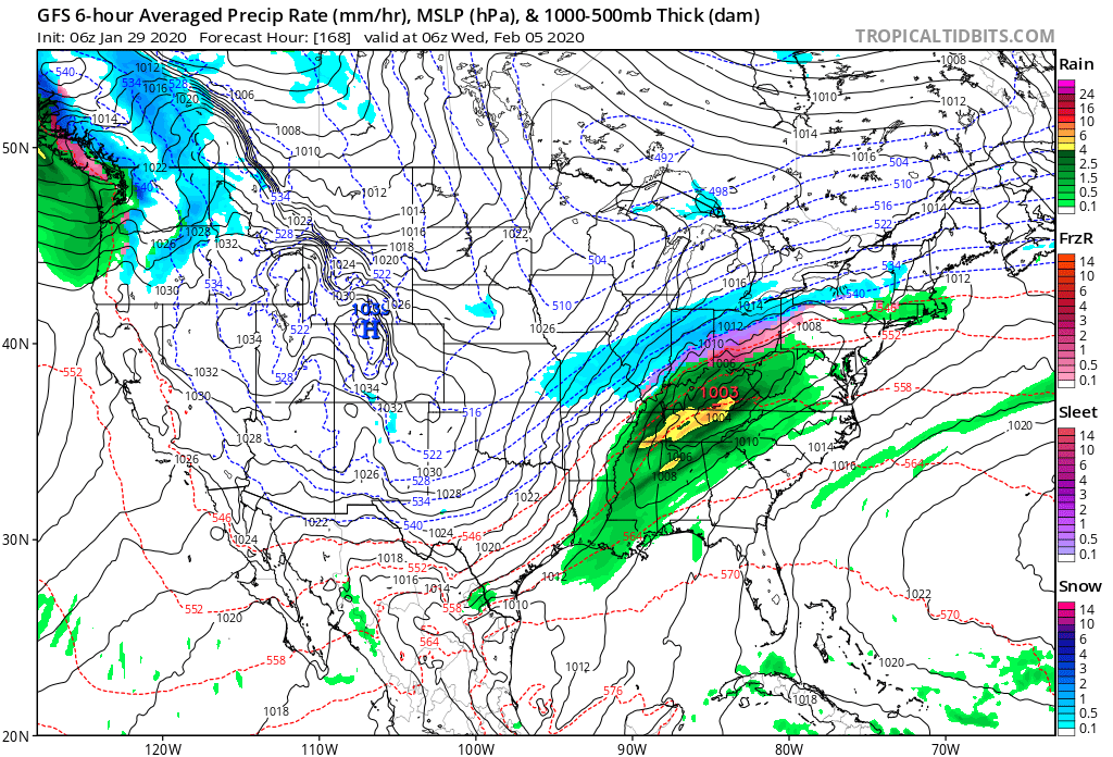
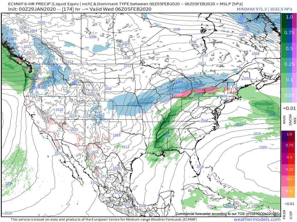
Before we dig into the late-February pattern, there’s no let-up in sight with respect to our current active weather pattern. Just next week alone, we’re tracking (3) systems:

I. Sunday

II. Wednesday

III. Thursday-Friday

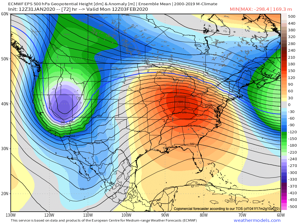
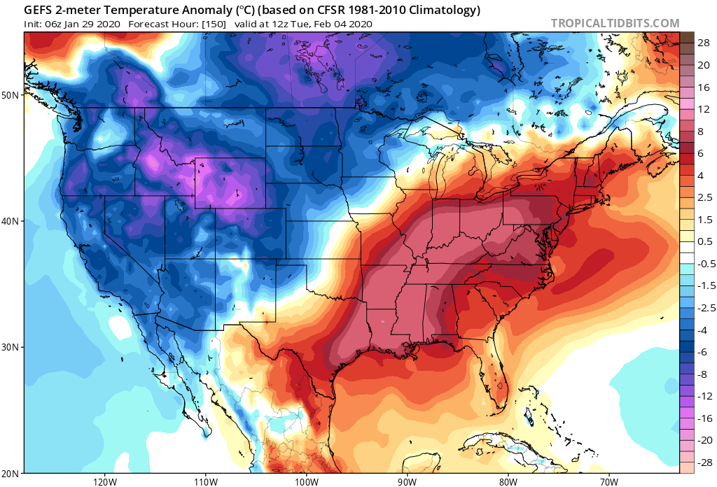
This is all part of the big battle taking place between a persistent southeast ridge and western trough. The tight thermal gradient between these features will help “fuel” continued active times, and above average precipitation next week. As mentioned this morning, at times we’ll have to deal with bouts of moderate-heavy rain, and at others, sleet, snow, and freezing rain.

An active weather pattern will continue as the ‘mean’ storm track cuts right through the Ohio Valley next week.

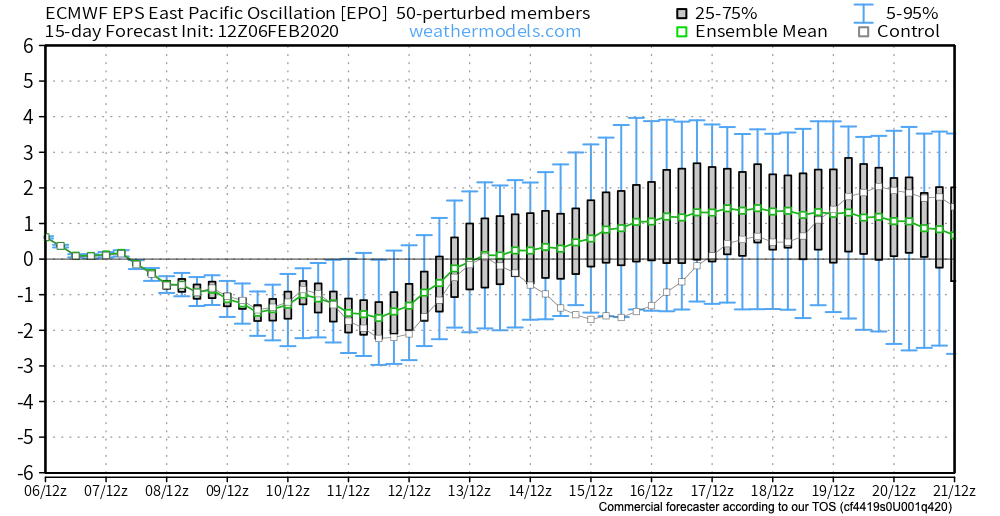
Looking ahead, we continue to build our longer range forecast by using “base ingredients” that feature a 50-50 split of the MJO (Madden Julian Oscillation) and EPO (East Pacific Oscillation).

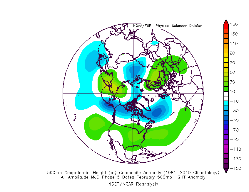
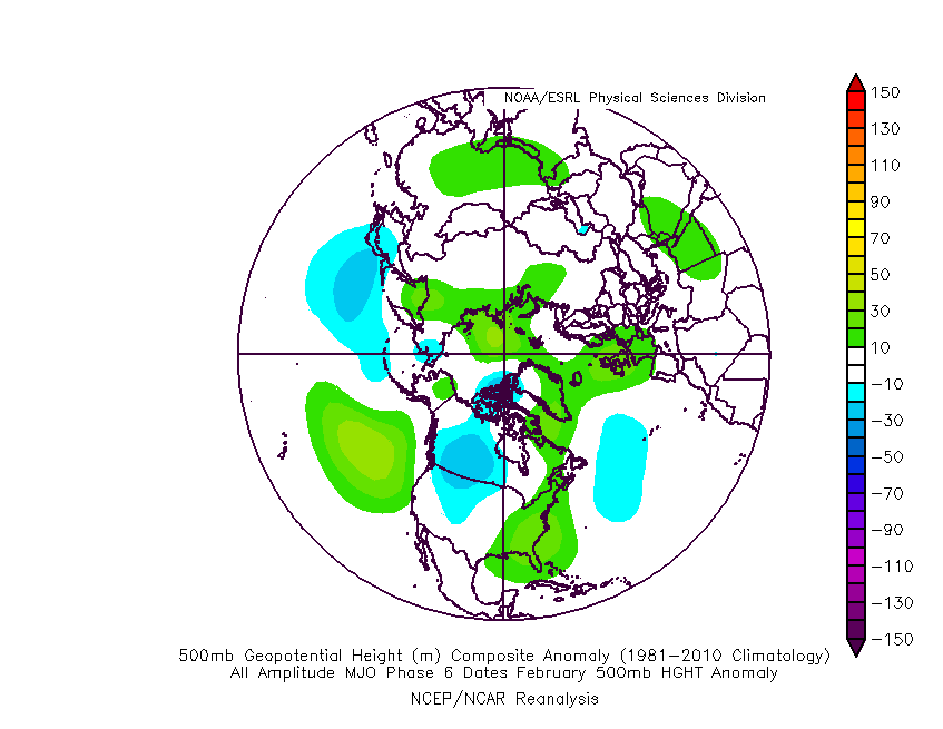
The MJO maintains a warm look, rolling things into Phase 5-6 over the next few weeks.

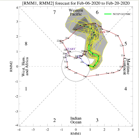
As you know by now, these are warm phases- especially across the eastern portion of the country.

The “saving grace” for fans of at least being on the playing field for a chance of wintry weather in such warm MJO phases is the negative EPO. There’s great model agreement that this negative EPO will continue into the middle part of the month and this will keep us on our toes for wintry implications as storms track through the region. Conversely, there’s reason to buy into a “blow torch” regime to close the month, as the EPO flips positive and combines with the Phase 5-6 of the MJO.

To no surprise, given the above, we see the new European Weeklies showing a warming trend (after the fight over the upcoming week) for late-February.

The JMA Weeklies from this morning (for the Weeks 3-4 time frame) would agree.

Time To Beat The Drum A Little Louder On Next Week?

After a surge of warmth engulfs the region during the early part of the week, a cold front will sag south into the central Ohio Valley Tuesday night into Wednesday.

An upper level ridge will provide a brief taste of spring to open the week.

This front will result in an expanding shield of rain Monday night into Tuesday across all of central Indiana.

Rain will increase across the area Monday evening.

As we progress through Tuesday evening, the frontal boundary will likely sag south, allowing colder air to filter in (at least at the lowest levels of the atmosphere) across north-central parts of the Ohio Valley. As another slug of moisture moves northeast along the frontal boundary, precipitation is expected to once again become widespread Tuesday night into Wednesday. With the colder air oozing in, a mixture of sleet and freezing rain is a possibility across northern IL, IN, and OH. The precise placement of the front will determine whether or not more of central Indiana can get in on the “excitement” of this icy mixture during the aforementioned time period.

It’ll be wise to pay attention to forecast details during the weekend for the Tuesday and Wednesday time period- especially if you have travel plans north.

As this takes place, the upper ridge will get “beaten back” into the 2nd half of the work week. It’s important to note, however, that there will likely still be enough resistance from the upper level ridge that the cold front will get hung up along or just east of the spine of the Appalachians in the Thursday-Friday time frame.

As this transpires, yet another wave of energy will move up along the pressing boundary. Accordingly, precipitation should once again blossom in response of this wave of low pressure moving northeast. While the European (shown below) wants to keep things east of the immediate region, it’s wise not to write this system off from this distance. Not only does other data show the threat locally, but it’s all too often where storm systems “correct” further west as time draws closer to said event…

While this week has been relatively boring in the weather department, things will change in significant fashion next week. Whether or not those changes can deliver “wintry goods” is TBD…

Stay tuned.

Things Turn More Active Early Next Week…

The short-term weather pattern will remain largely uneventful here across central Indiana. This morning, widespread precipitation is falling to our southwest, including accumulating snow across MO. This system will weaken significantly as it pushes east.

Some upper level energy is still capable of developing some light snow across central Indiana tonight into Thursday morning, but this won’t be a big deal and some neighborhoods won’t see any snow at all.

A ribbon of upper level energy will move across the state tonight.

An additional upper level disturbance will track southeast, skirting far northeastern parts of the area, and help generate a mixed rain or snow shower Saturday (again, not expected to be a big deal, locally).

Behind this system, a significant warm up will engulf the Ohio Valley, including a couple of days with highs between 50° and 55° early next week.

These spring-like temperatures will be in advance of a pressing cold front that will arrive on the scene during the middle part of the work week. As we’d imagine from this distance, modeling is handling the timing and specifics of the frontal system differently (image 1- GFS is more progressive and colder while image 2-the European is much slower/ warmer). We’ll take the next couple of days to sort through the details and have a higher level of confidence going into the weekend.

We’ll also have our February Outlook posted here tomorrow as part of Thursday’s long range video update.