Long Range Update: Closing Out August…

With a little over 2 weeks to go in meteorological summer, model data disagrees in the way the month- and season ends. That is, after the upcoming week where the consensus is cooler and drier than normal (we agree, as well). Let’s take a look at the data:

European Weeklies

Week 1

CFSv2

Week 1

GEFS

Week 1

EPS

Week 1

JMA

Week 1

The American data and JMA Weeklies are coolest (compared to the European), but compared to Weeks 2 and 3, there’s better consensus. The initial week is also looking drier than normal- especially after a “smattering” of storms tomorrow and Saturday.

Week 1 Precipitation anomalies- JMA Weeklies
Week 1 Precipitation anomalies- European ensemble

Let’s now take a look at Week 2:

European Weeklies

Week 2

CFSv2

Week 2

GEFS

Week 2

EPS

Week 2

JMA

Week 2

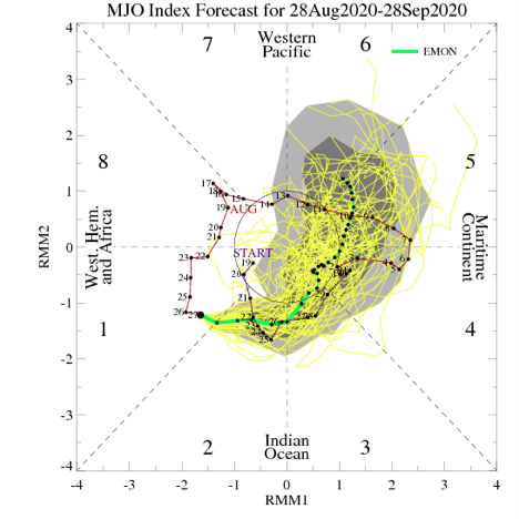
This is where our idea begins to pivot more towards the JMA Weeklies and European data (warmer look). The reason primarily has to do with the MJO moving back into Phase 8 during this time period.

This is a warm phase in August.

Furthermore, the PNA ‘mean’ is forecast to trend off the positive “mountain” (that will help drive the cooler pattern for the upcoming week) and more towards neutral.

Phase 1 is also a warmer look for our part of the country and that’s the way we’re leaning for the last week of the month (despite the very cool CFSv2).

While not overly warm, we think the JMA has the best handle on the temperature pattern in the Week 3 timeframe, locally (seasonable to slightly above normal).

The pattern should also begin to trend wetter during this time period:

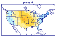
This matches up with Phase 1 of the Madden Julian oscillation:

So, to summarize, after a cool and dry period next week, we anticipate the pattern to trend warmer (more seasonable) and wetter to close the month and head into early September. One other item of note is that the tropics should really begin to heat back up during this period, as well. Of course, as is the case from time to time, that can be a wild card from a precipitation perspective. The Gulf of Mexico (GOM) looks particularly busy late August through late September, but there’s simply no way to get more specific from this distance, including potential inland impacts. It’s worth keeping a close eye though.

Before we leave, the latest JAMSTEC seasonal data updated this morning and features a “torch” of a fall, along with a warm, wet winter, locally. That southeast ridge will have to be dealt with this winter. While still early, the early lean is for a warm start to winter (including holiday season). While there are some ingredients that may keep things more interesting than what they could be otherwise, from at least this point, this doesn’t appear as if it’ll be an “exciting” winter for lovers of snow and cold. Much more later- and again, we still have a long way to go…

Thoughts Begin To Shift To Fall (And Winter)…

While we still have a few weeks left of meteorological summer, we’re hard at work finalizing our fall outlook and prep continues for winter. By the way, our fall outlook will be online Friday morning, the 28th.

From this distance, there’s obviously a risk involved with seasonal data that we’re reviewing and tweaks (particularly to the initial winter idea) will undoubtedly have to be made. In short, we anticipate a weak La Niña to dominate the fall and winter, with a robust MJO.

Of course, it’s important to remember, no La Niña is like the other and a simple “broad brush” approach never works.

Without question, the tropics will claim headlines through the fall. Unfortunately, like others, we anticipate a significant uptick in activity late August into October. A few major hurricanes are likely, as well. The Gulf of Mexico and Carolina coast appears particularly vulnerable…

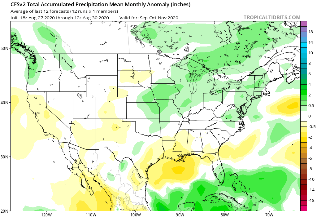
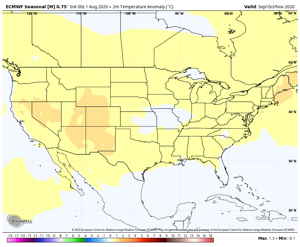
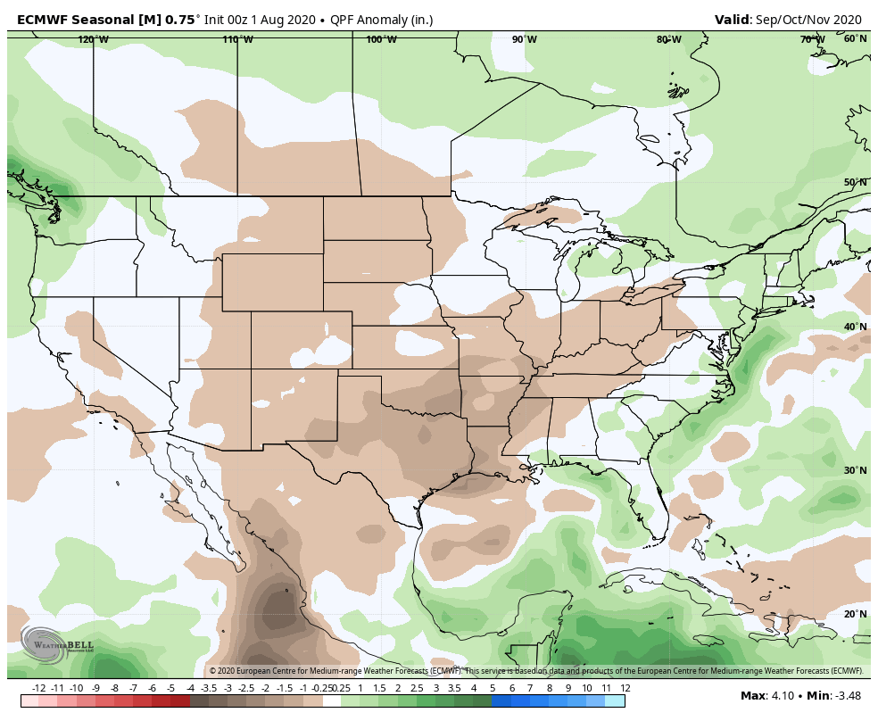
Most computer model data is leaning towards a warm autumn. We’d agree, overall, but leaning wetter than the majority of data right now, due in large part to tropical impacts.


European seasonal data for September through November.
CFSv2 seasonal data September through November.
CFSv2 seasonal data for September through November.
JAMSTEC seasonal data for September through November.

The coolest of the seasonal data is the CFSv2. It’s easy to interpret a cooler Central and East if the ridge and associated heat is so strong across the West. We will keep close tabs on trends over the next few weeks. Nina falls are notorious for at least a few weeks early on of unseasonably cool weather as well. Stay tuned.

As for winter, from this distance we’re bullish on a wetter, warmer than normal season, locally. Below normal snowfall is expected as of now. A dominant southeast ridge is expected to carry the day, at times flexing north into the TN and Ohio Valley.

European seasonal data November through January.
JAMSTEC seasonal data December through February
CFSV2 seasonal data December through February

Interesting, like fall, the CFSv2 is the “coolest” of the big 3 seasonal models. Again, we’ll continue to keep close eyes on trends. Given performance of recent winters past, you may say I’ll just go with the opposite of what these seasonal models say. You’d have good reason for doing so. Unfortunately, that southeast ridge almost seems like a lock though. It’s also becoming more difficult to ignore the trends over the past decade or two.

Much more later on both fall and winter! Enjoy your Sunday!

Weekend Rain Chatter…

Before we dig in further around our complex weekend setup, we’ll have our official August Outlook posted later this evening. All in all, we don’t have any changes to our early ideas, but will have the complete discussion posted a bit later today.

We have one more very pleasant and refreshing (by late-July standards) day dialed up before the pattern turns more hectic to close the work week and head into the weekend.

As we move into Thursday, a cold front will drift south into central Indiana. This will serve as the focal point for increased coverage of showers and thunderstorms, even as early as tomorrow morning, but more so during the afternoon and evening. We expect 50-60% coverage of rain on Thursday.

Note how the boundary sinks south Thursday night and Friday morning. This should result in drier conditions Friday as the north and northeasterly wind takes hold. As it is, we’ll forecast a partly to mostly cloudy sky Friday with most, if not all, of central Indiana remaining dry.

As all of this is taking shape, surface low pressure is expected to begin strengthening in northeast OK Friday morning. This area of low pressure will then ride the boundary east, northeast into the weekend. That’s where things begin to get a bit more tricky. Some of the data brings the front back north over the weekend (subsequently allowing this area of low pressure to track further north over IN). Other data keeps the low just to our south and east. Despite the disagreement amongst model data, we’ll remain consistent with our forecast of more widespread, more concentrated rain returning to central Indiana Saturday afternoon into Sunday. We still think this time period will produce between 1″ and 1.5″ of rain for most of the region.

Showers and embedded thunder, along with unusually cool temperatures would continue into early parts of next week with this pattern.

Despite some of the differences within the operational guidance, the GFS and European ensemble mean, both suggest wet times are ahead for our area during the aforementioned period.

Make it a great Wednesday! More later!