Updated 11.21.23 @ 7:30p
You must be logged in to view this content. Click Here to become a member of IndyWX.com for full access. Already a member of IndyWx.com All-Access? Log-in here.

Nov 21
Updated 11.21.23 @ 7:30p
You must be logged in to view this content. Click Here to become a member of IndyWX.com for full access. Already a member of IndyWx.com All-Access? Log-in here.
Permanent link to this article: https://indywx.com/evening-video-update-the-trend-is-your-friend-winter-fans/
Nov 20
Updated 11.20.23 @ 5:30p
I. The weather pattern will turn progressively colder as we move through the Thanksgiving holiday. This isn’t anything earth-shattering by any stretch, but temperatures running 4° to 8° below normal is pretty stout. There’s also still the potential of an early season arctic “jab” prior to us getting out of the first 3-5 days of December, but that likely comes after this weekend- if at all.
As a whole, it’s a dry pattern that will accompany the chill, but we will want to continue keeping an eye on energy that will eject off the Rockies over the weekend. At times models can underplay these features only to have to correct stronger as we grow closer to the potential event. Will that be the case this time? Impossible to say from this distance- just something we’ll continue to monitor with such a busy travel period. As it is today, modeling wants to “string” the energy out which would essentially be a light or non-event.
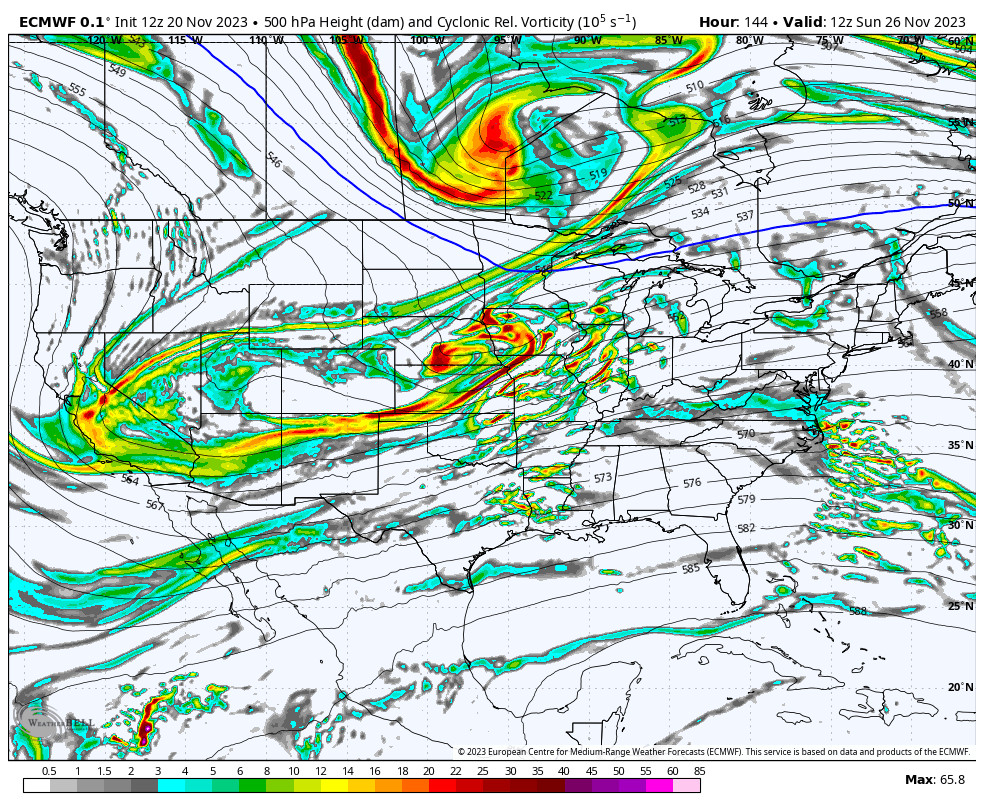
II. While the pattern drivers all are aligned for a cold open (first few days) of December, there’s reason to believe a period of milder than normal air will take foot just after- say sometime between 12/5 and 12/8, or so. That said, we’re in a bit of a fork in the road so to speak.
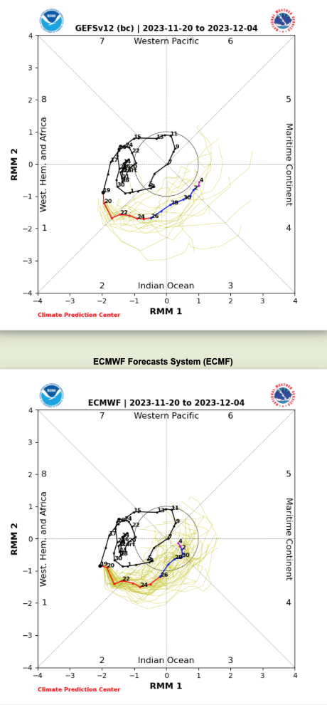
The East Pacific Oscillation (EPO) is going to pop positive at least for a period of time prior to mid-December. This strongly argues for a relaxation of the cold regime that we’ll endure to open the month. Guidance differs on the handling of the MJO, however. Should the American guidance be correct in taking things into Phase 4, when combined with what we see transpiring with the EPO, then we’re off to the races for at least a 7-10 day period of much warmer than normal temperatures. That said, European guidance collapses the MJO into the “null” phase and even hints at things emerging again in the colder phases come mid December. While we still have time to sort through this “mess,” the idea here is that the cold open to the month will moderate to slightly to moderately above normal for a 7-10 day period leading us into mid-month. Thereafter, I’m becoming increasingly bullish for a renewed cold pattern developing towards the Christmas and New Years holidays…
Permanent link to this article: https://indywx.com/dinnertime-rambles-talking-thanksgiving-weekend-and-early-december/
Nov 17
Updated 11.17.23 @ 11a
The stars are all aligning to drive a significant shift in the overall regime towards one that should yield cooler (and, at times, colder) than normal temperatures as we navigate the back half of the month.
First, we have the MJO. Note how we’re set to slide into Phases 1 and 2 between now and end of the month.
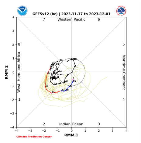
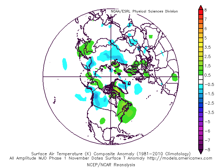
These are progressively cold phases this time of year. Phase 1 has residual warmth across the Northeast (more seasonable here on the home front) before Phase 2 becomes overwhelmingly cold.

We then have the combo of the negative EPO and positive PNA. Both cold signals for our neck of the woods.
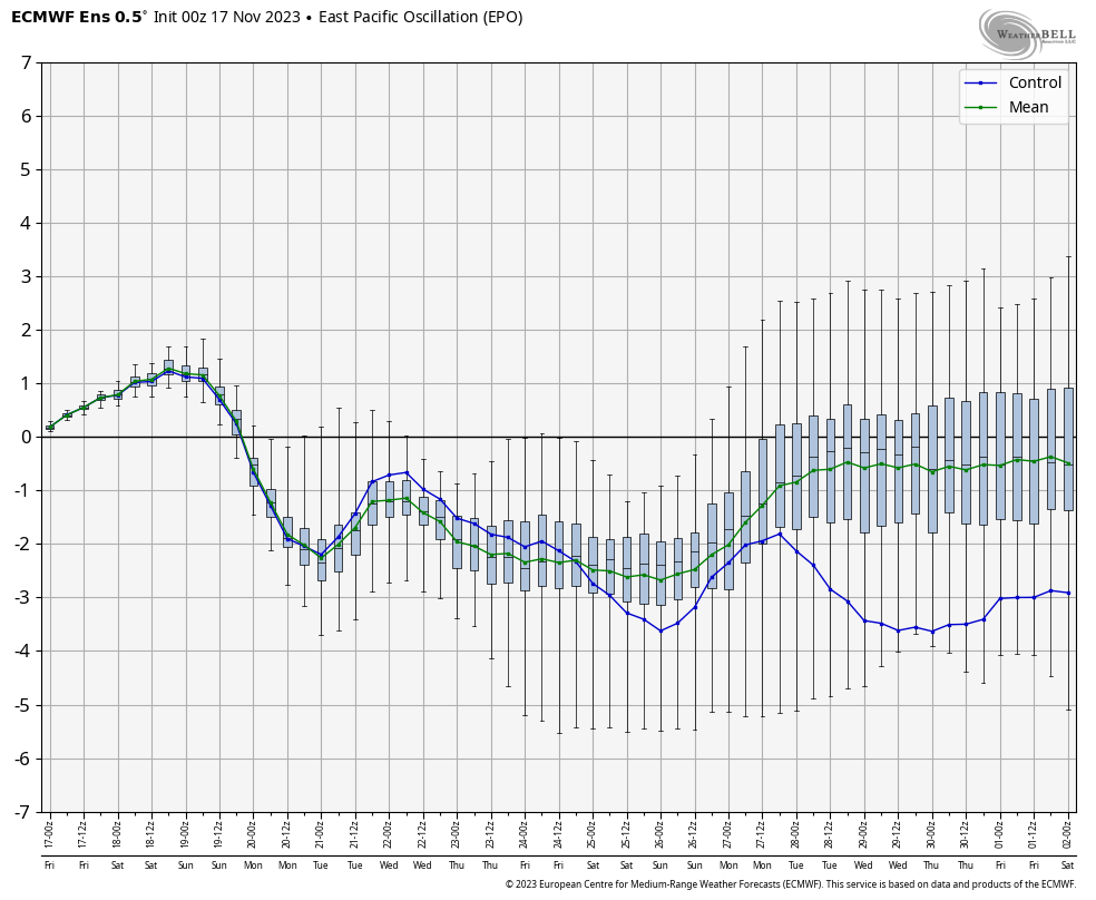
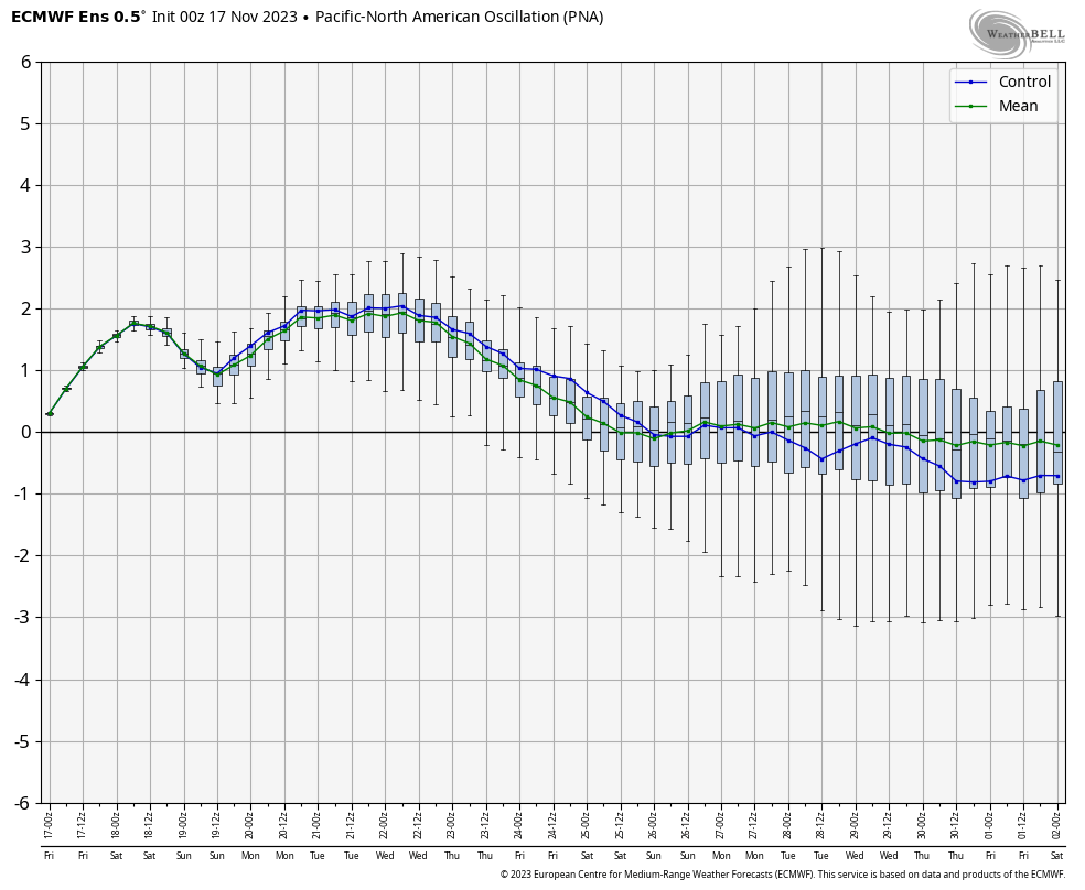
It’s no wonder model guidance is jumping on the persistent eastern trough to close out the month.
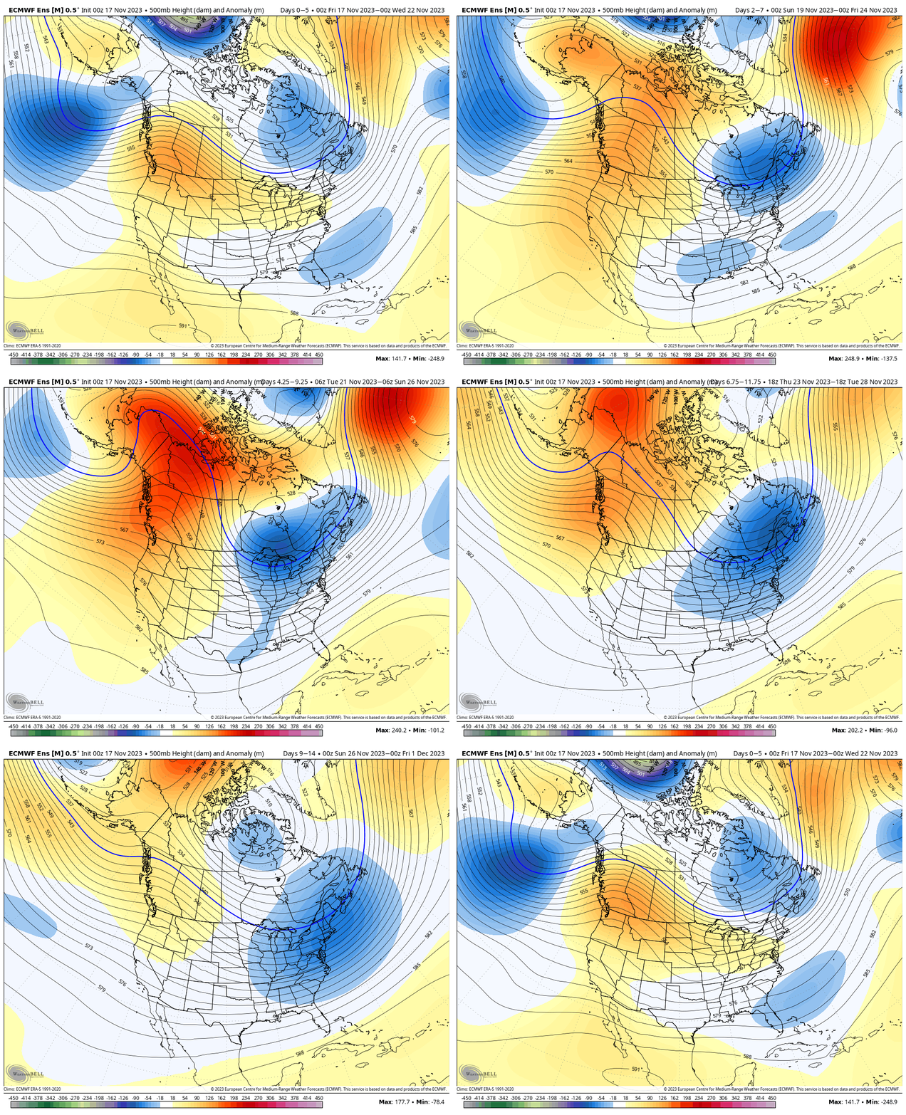
At some point in the 8-12 day period, I’d anticipate a true dislodge of true early season arctic air to get involved in the pattern. Think lows into the upper 10s, lower 20s and highs in the 30s. Still far too early to get specific with snow chances, but they will come before month’s end.
Stay tuned…
Permanent link to this article: https://indywx.com/more-on-the-cold-close-to-november/
Nov 10
Updated 11.10.23 @ 6:54a
Simply put, for this time of year, the upcoming 5-7 days is as quiet as it can be around these parts. Look for much more sunshine than we typically see this time of year along with moderating temperatures after a seasonably chilly weekend. Highs will return into the lower 60s for a good chunk of the work week ahead. All in all it’ll be a perfect week to get a jump on that exterior Christmas decorating or any end of year yard work. Enjoy!
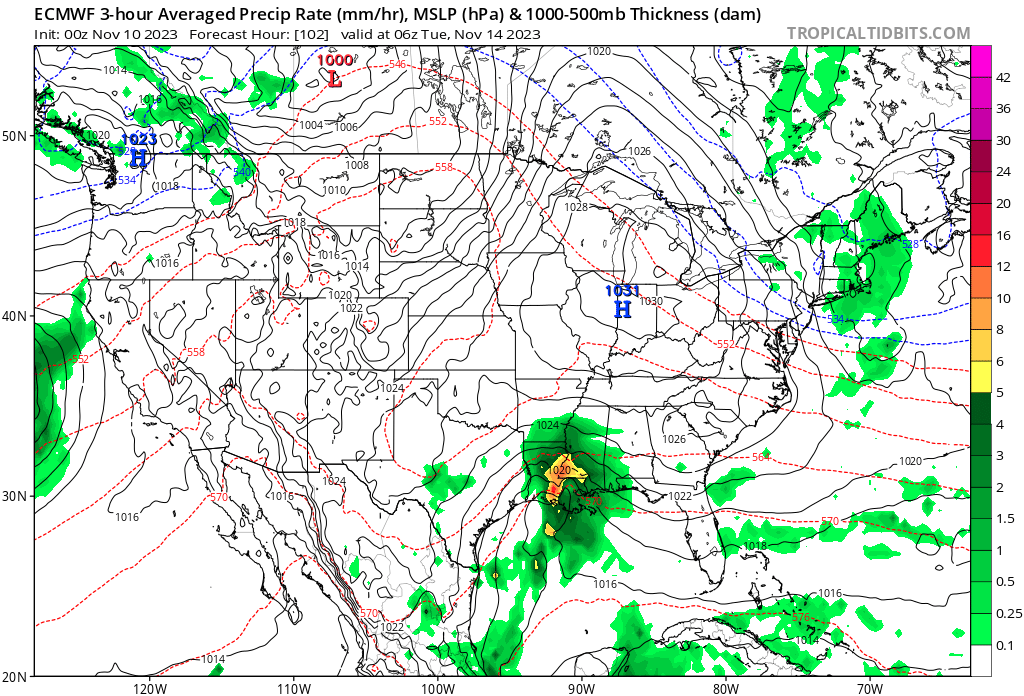
As we look ahead to Thanksgiving week, there are growing indications of a much more active pattern that will emerge. While still too early for specifics, there are likely to be some weather-related impacts to holiday travel (both going and coming home) from a couple of stronger storm systems.
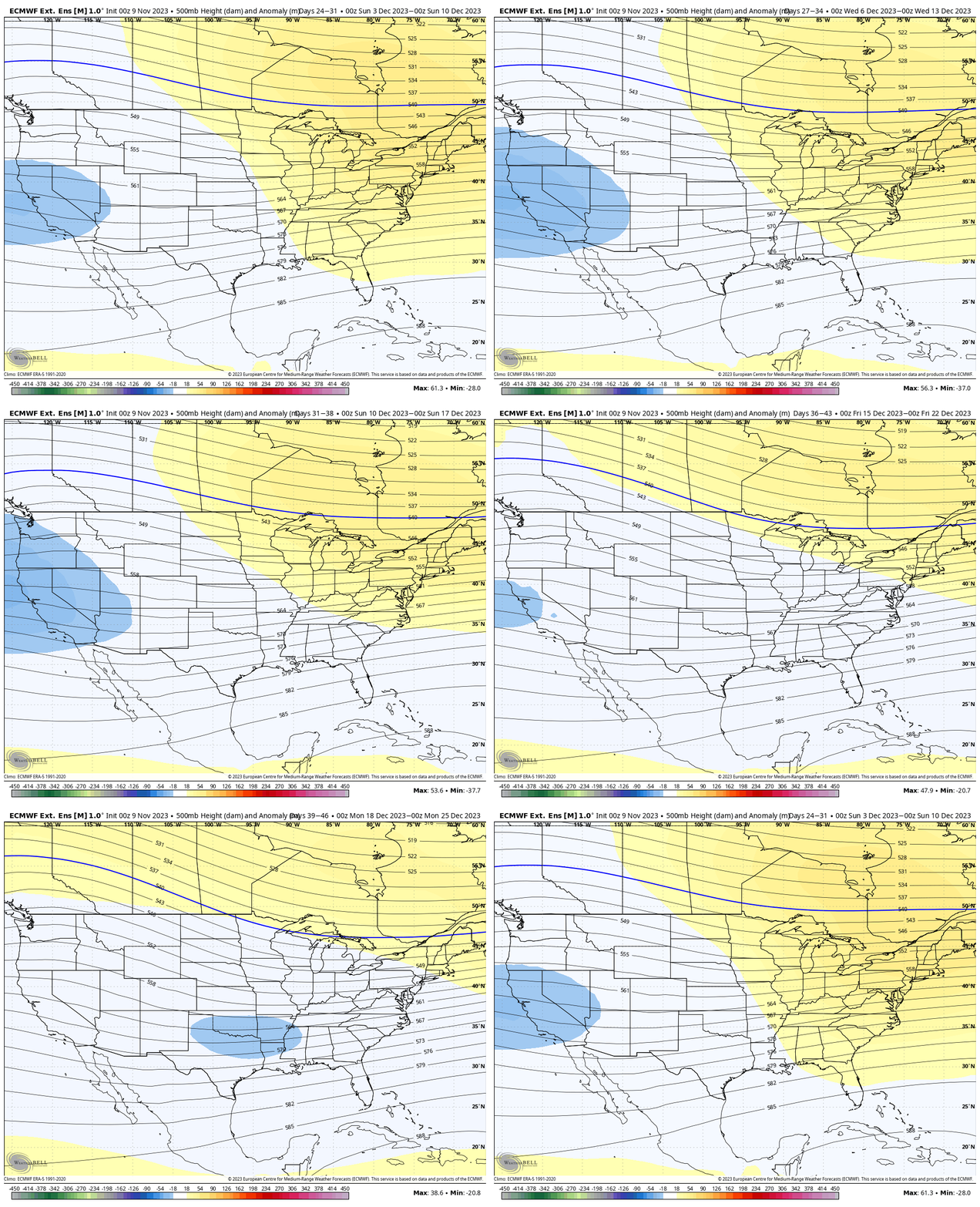
One more quick note before closing, the NEW European Weeklies are in and present an “intriguing” signal as we get closer to Christmas. Note the model see the early December ridge get washed away and a trough beginning to emerge south-central. I’d watch for the model to grow stronger and more expansive (colder impacts) in time. . .
Permanent link to this article: https://indywx.com/an-incredibly-quiet-week-ahead-of-a-potentially-busy-thanksgiving-week/
Nov 09
Updated 11.09.23 @ 10:49a
With Thanksgiving only 2 weeks from today (incredibly hard to believe), we’re able to start to get a better idea on the overall weather pattern as the “official” kickoff to the holiday season nears. The first point we want to drive home is that we should begin to see a much more active regime evolve during this 2 week period. From a temperature perspective, the pattern overall continues to look milder than average, but there will be a couple opportunities for transient pops of colder air, potentially around the all-important Thanksgiving holiday, itself.
Note how modeling sees the more active pattern evolving over the next 3-4 weeks (green represents above normal precipitation). – A significant change not only for our neck of the woods but certainly for our friends and neighbors down south (badly needed for a region suffering an expanding drought. Speaking of which, all of the dry/ droughty southern tier should reverse in significant fashion as the active Nino storm track gets going over the coming months. As the pattern continues to evolve into the ‘24 spring and summer, the south-central severe drought will be erased.

Despite attempts of troughs to roll into the Ohio Valley, they will struggle with staying power over the next 3-4 weeks. The latest JMA Weekly product and Euro/ GFS ensemble blend looks very solid given where the pattern drivers currently reside.
Week 1

Week 2

Weeks 3-4

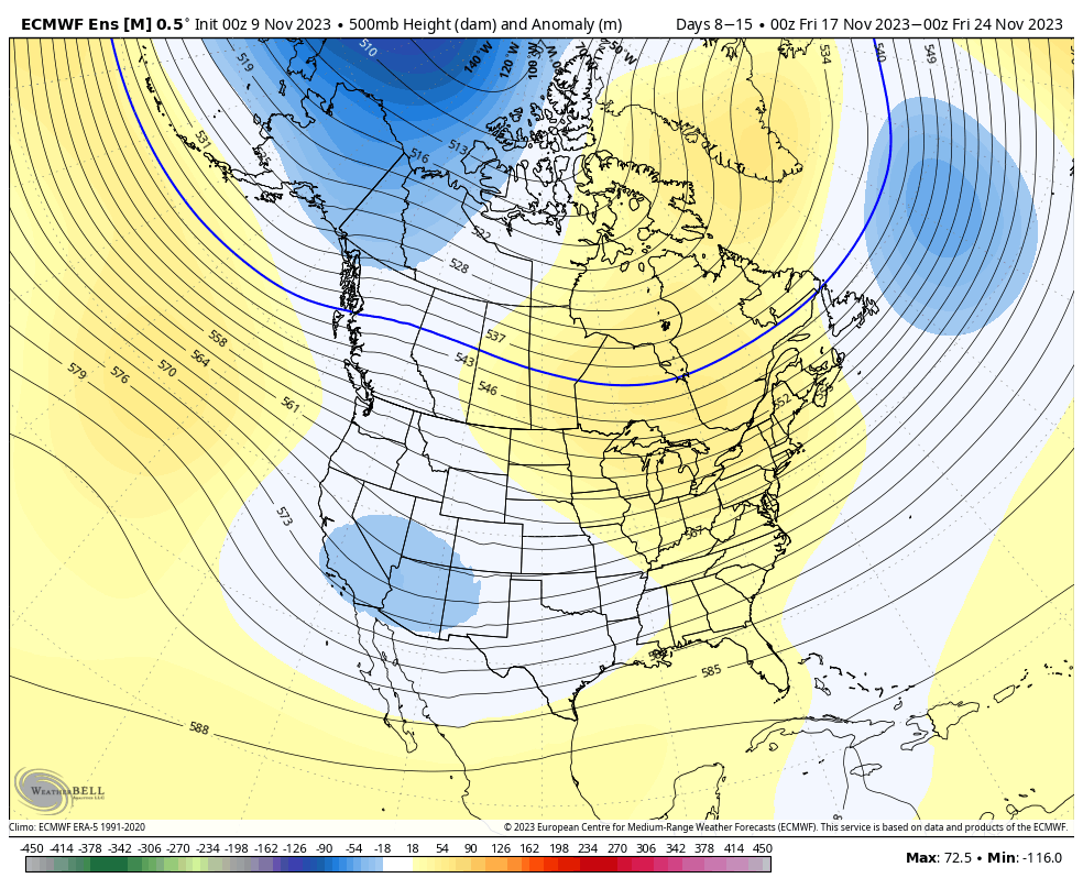
The pattern drivers of a primarily positive EPO, negative PNA, and MJO in 8/1 (all unchanged from our post earlier this week) all suggest a predominant eastern ridge, western trough placement over the upcoming 2-3 weeks.
We’ll continue to keep close tabs on the regime, especially centered on 11/22 – 11/26.
Make it a great Thursday!
Side note: Confidence is increasing that this Nino will evolve into a central-based event which will up the chances of colder/ snowier prospects come late December and on into January. More on that later next week in a more extensive update specific to this transition.
Permanent link to this article: https://indywx.com/lr-update-thanksgiving-and-early-december/