
While arriving later than originally expected (recall we originally thought the cold, wintry pattern would start on the 18th), it sure appears as if this was a case of “delayed, but not denied.”
The latest GFS and European ensembles are keying in on a significant pattern change as we put a wrap on February and open March. (Looks like we were about a week early in jumping on the cold bandwagon).

First and foremost, there’s excellent overall agreement amongst data (increases confidence significantly during the medium to long range period).
Days 1-5: Southeast ridge continues to dominate during the short-term period and there’s no high-latitude blocking to speak of. This suggests storms will continue to “cut” northwest of the region and place central Indiana in the “warm” sector, with transient, backlash cold/ snow potential.
Days 6-10: Significant changes begin to take place as heights (ridging) builds across AK. This is important as it can help “dislodge” late season cold air (and send it southeast). The SE ridge is also in the process of getting squashed during this period. We’ll likely transition away from the moisture-laden storm systems and replace with faster, overall weaker, systems that will be more capable of producing wintry precipitation.
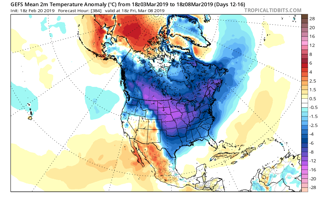
Days 12-16: A total transformation of the pattern has taken shape since the Day 1-5 period. The new ‘mean’ trough position takes up shop across the East with the AK ridge continuing to dislocate late season arctic air southeast. The GEFS also shows a reflection of a southwest ridge which can be helpful in the overall storm track that could potentially deliver more “meaningful” wintry systems across the OH and TN Valleys as we get into the first couple weeks of meteorological spring.
Side notes: We’ve reviewed the crashing SOI index and this increases our confidence in a much colder pattern developing (typically takes place around 10-12 days after the crash begins). We’ve noted the deeply negative values against the base state which would suggest the cold pattern should continue for some time. We still believe the pattern remains colder than average, overall, through the 1st half of March.
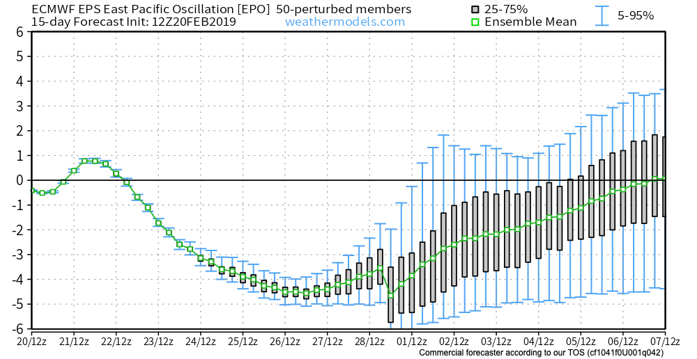
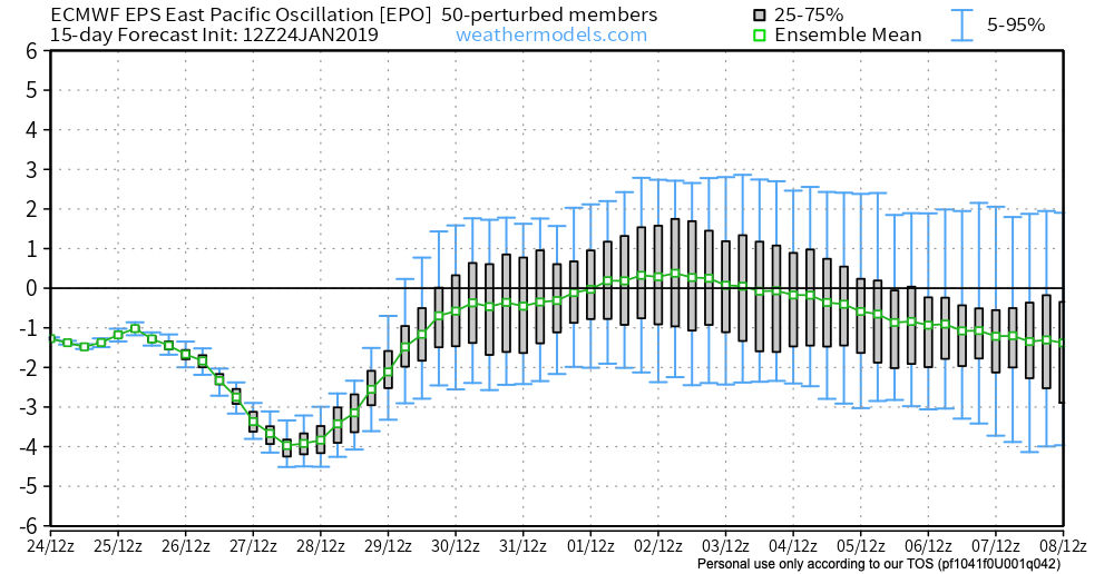
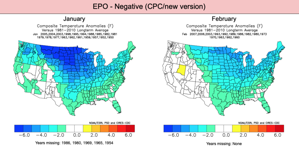
The latest deeply negative EPO adds fuel to the fire in the idea of a cold open to March.
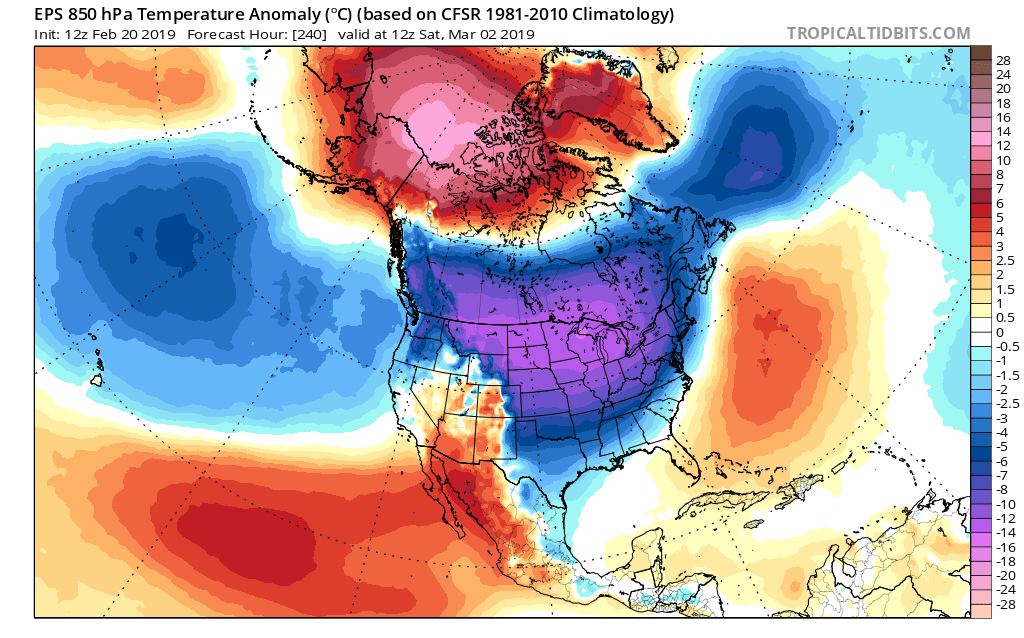
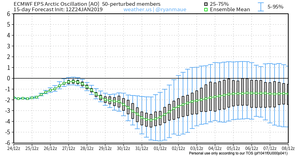
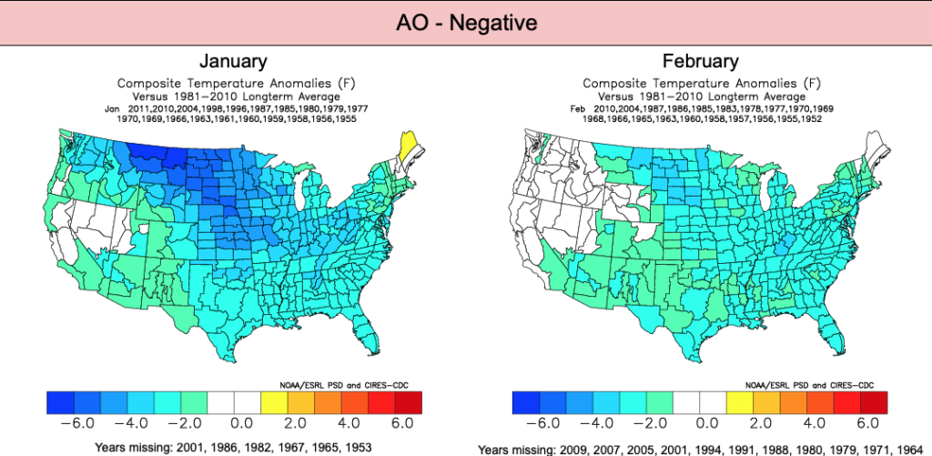
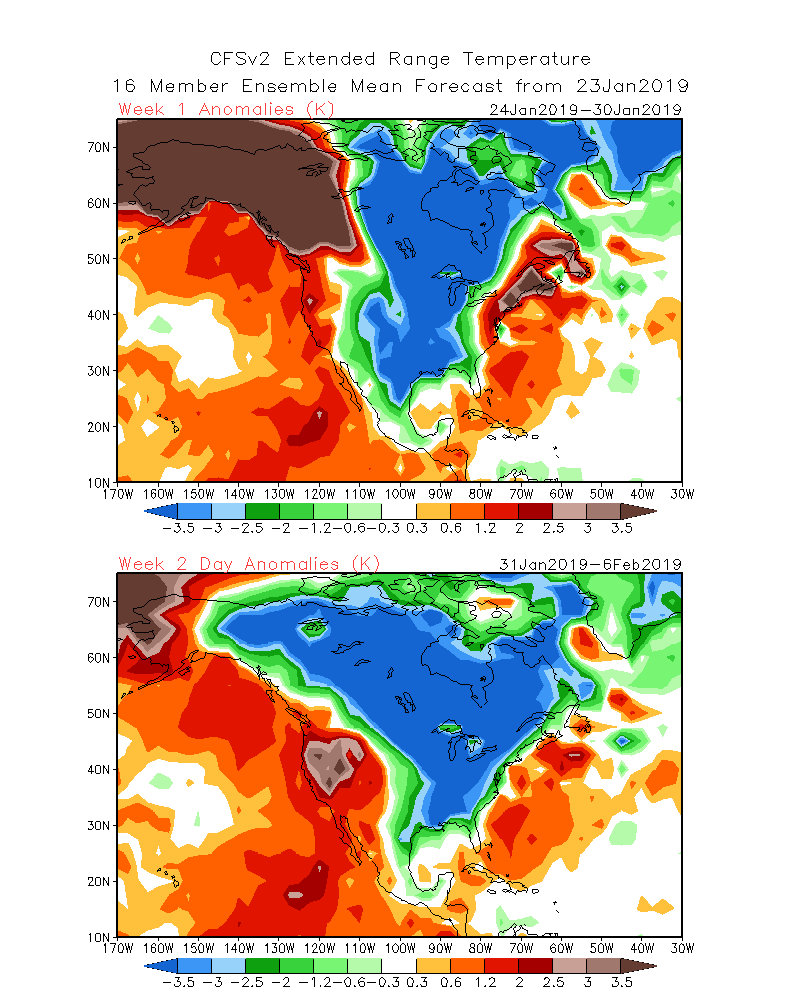
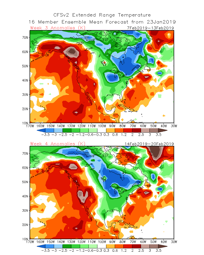
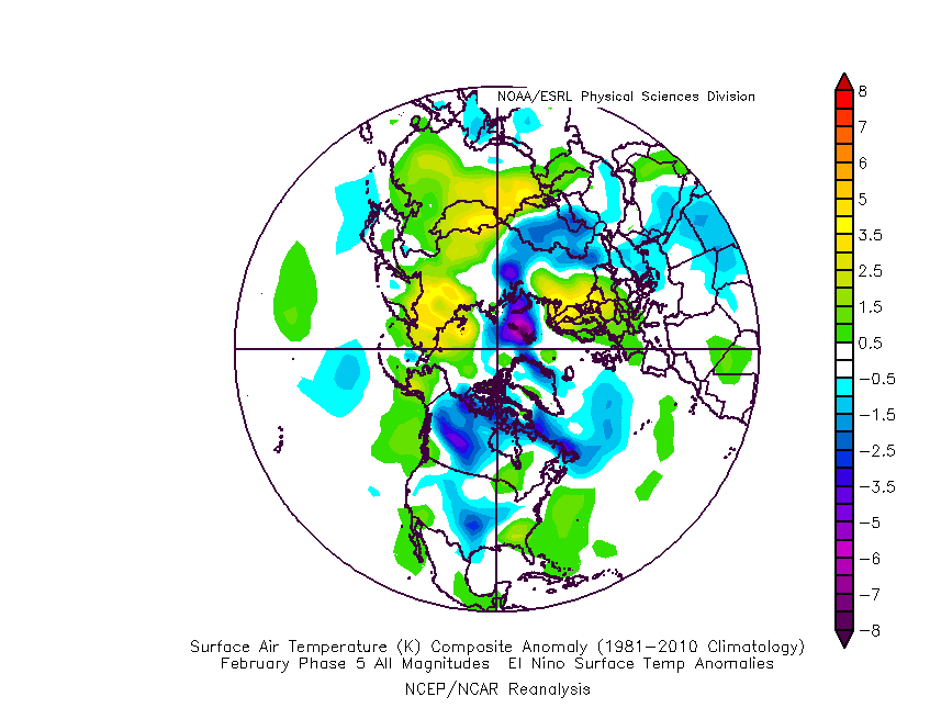
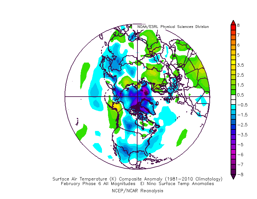
Given this, there should be no surprise to see the cold anomalies showing up on the latest medium-long range ensemble guidance:
It sure appears March will come in like a lion; will it go out like a lamb?

 The early spring “fling” has lulled many into believing winter’s finished. While the worst of the winter is certainly behind us, we continue to think a dose of “reality” awaits as we progress through the better part of the first half of March. To be more specific, we feel the period March 6th through the 20th will offer up below average temperatures and an active pattern- capable of producing wintry threats.
 Sure enough, modeling is going to the pattern that will produce below normal temperatures (doesn’t appear to be anything particularly frigid, but colder than average, nonetheless) through mid-month.
 With blocking in place, an undercutting jet will serve to deliver an active storm track.
 Keeping in mind March winter events need multiple items to come together to create impactful situations, it’s also important not to simply “buy in” to the idea that just because it’s been warm lately that winter is finished. March can be a wild month, as long-time Hoosiers are aware. The pattern we’re heading into over the next 10-14 days is one that’s been void most of the winter (high latitude blocking in place) and can serve as the player needed to flip a “nuisance” variety late-winter event to one that’s much more significant. We’ll need to remain on guard for the potential of one or two “more significant” wintry events as we move through the first couple weeks of the month.
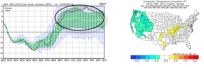 The end result is one that should promote colder than average times over the next couple weeks, overall, along with an active storm track. With blocking in place, the potential of one or two more significant late-winter events are on the table, and we’ll have to fine tune specifics as the individual storms come. While confidence is high that someone within the Ohio Valley region is likely to still deal with a big-hitter event, there’s no way to get specific until the individual players are on the field. Thereafter, the pattern should begin to transition to one more conducive for “stick and hold” spring conditions during the latter portion of the month.
 The GEFS might be a bit quick on dropping the arctic hammer, but the consistency of the model is impressive. Meanwhile, the European (even it’s ensemble data) has been much less consistent and has really been struggling the past couple of winters, overall, as a whole.
 Let’s also keep in mind that the initial cold onslaught is coming in the face of the MJO still rumbling through the warm phases. We note the European is consistently having to correct towards a more “amped up” MJO- swinging into the cold phases as we approach mid-month. And it’s mid-February that continues to have us concerned for the potential of truly nasty, severe cold.
 As for snow, it’ll come in this pattern. Again, don’t get caught up in the operational output, but understand that the pattern over the upcoming 7-10 days favors numerous fast-moving snow systems. While most of these will be light, we’ll have to keep a close eye on things as the potential exists for one of these waves to spin up a moderate event.
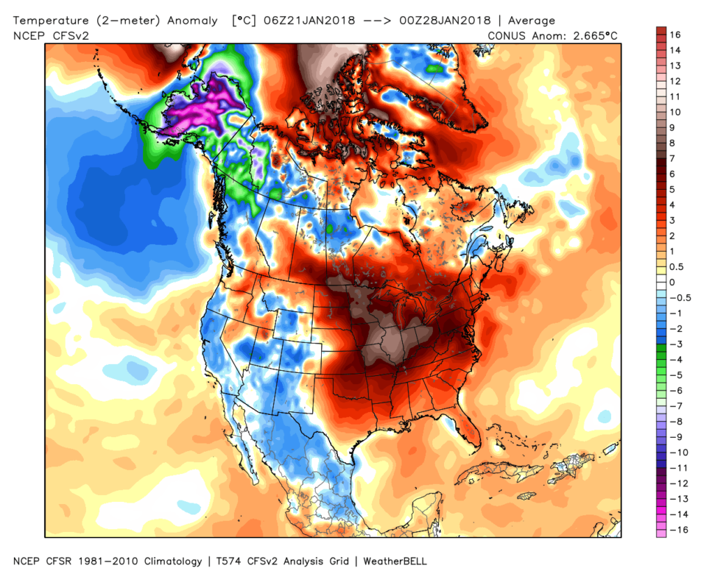 Despite the milder air over the past week, January, as a whole, is still running 4° below average at Indianapolis- a byproduct of just how frigid the first half of the month was.
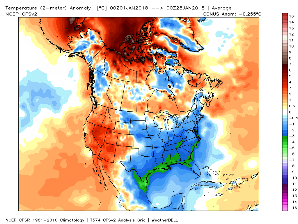 While the January thaw has been nice, times are changing and winter sure seems to be reloading for a very active second half.
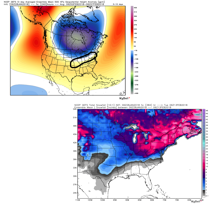 Once we get a snowpack laid down, arctic highs oozing southeast will likely lead to bitterly cold air. Recall our expectation for this pattern to yield at least (1) night of double-digit below zero lows, but it’s more towards mid-month that we think the severe cold takes hold.
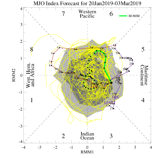
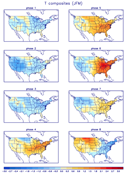
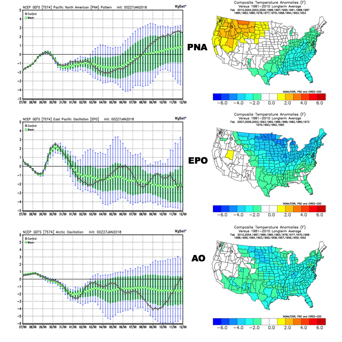 The Madden-Julian Oscillation (MJO) is forecast to rotate into the colder phase 8 as we rumble from early to mid February. Given the amplitude of the MJO, it should continue to rumble right through the cold phases of 1,2, and 3.
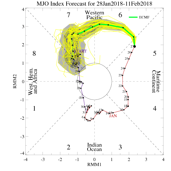
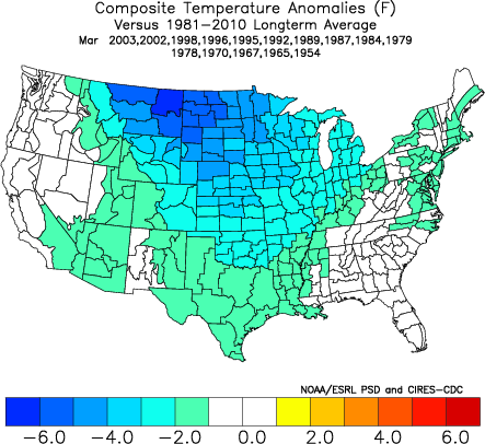
 All of these moving pieces that lead up to extended periods of cold, wintry conditions are part of a bigger outcome low solar, easterly QBO winters deal up. What we should experience with this setup is a 6-7 week period of wintry conditions, including times of severe cold. It appears to be a snowier version of what we went through late-December through mid-January. Hang in there, spring will come…eventually.