Category: EPO

A Different Kind Of “Dog Days” This Year…

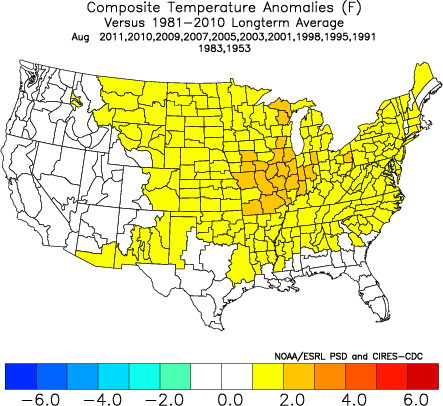
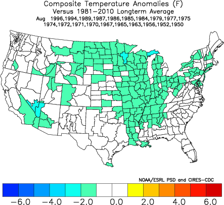
Late July and August have been known to produce some serious heat around these parts from time to time. However, it continues to look like this will not be the case this year.

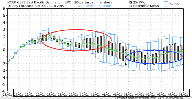
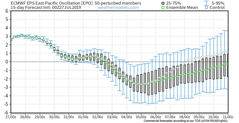
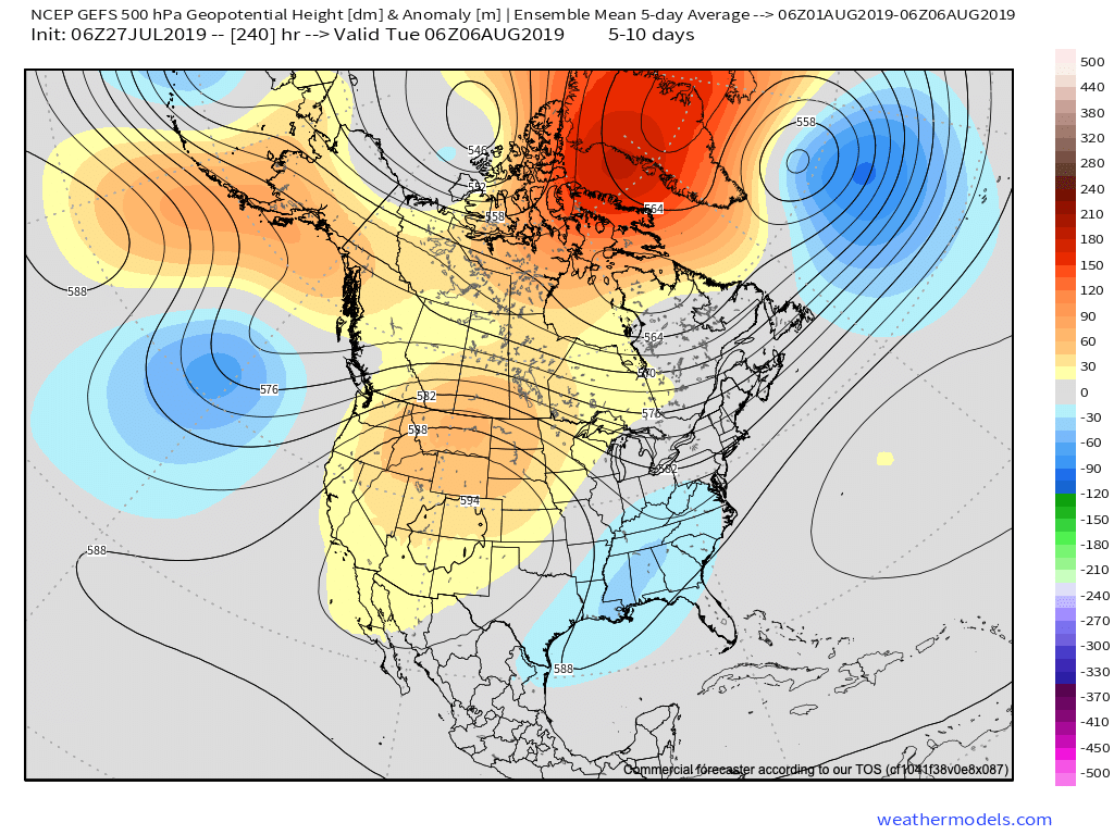
We’ve already discussed the impacts of the negative EPO. (By the way, modeling continues to take the EPO even more strongly negative with every passing update). This supports the cooler idea we have for early August.

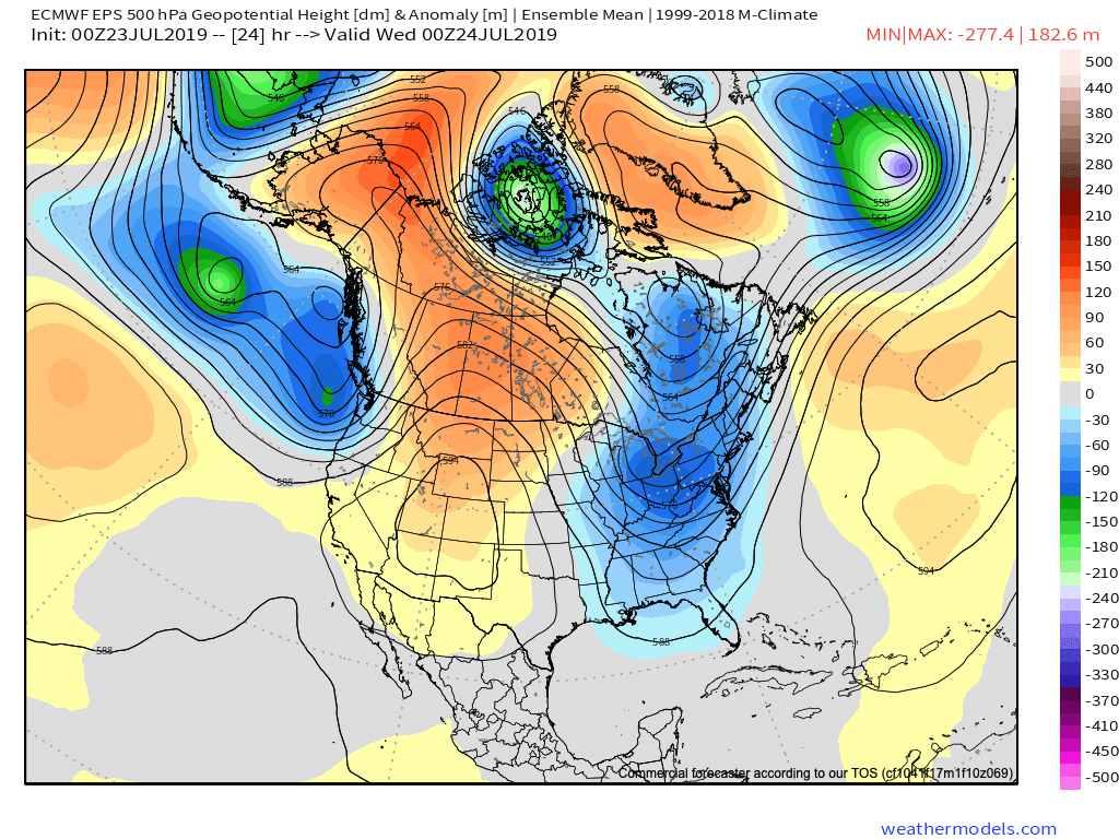
Now we see the PNA forecast to trend more positive through the better part of early August. This, too, supports the cooler pattern that will be with us through the period.

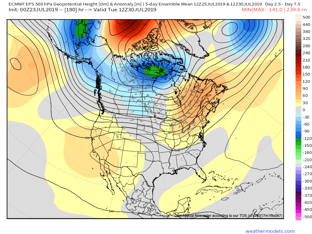
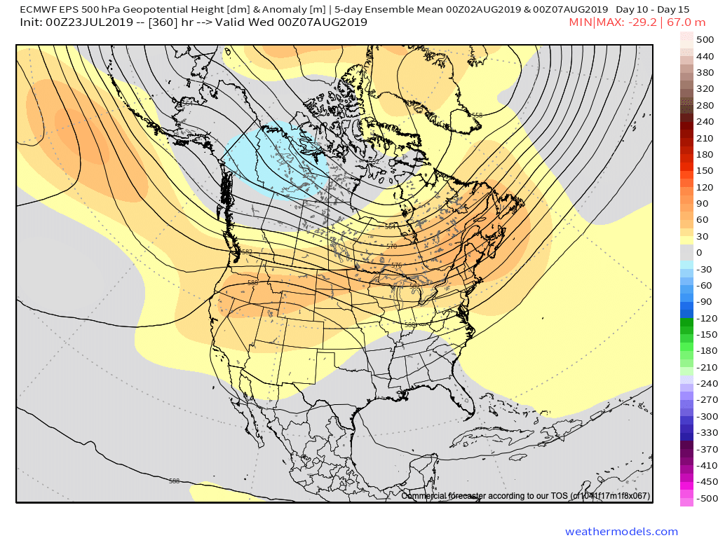
It should come as no surprise to see the models trend stronger with the eastern trough in the Weeks 2-3 time period. This period will likely feature a couple of strong frontal passages that serve as a reminder that the fall season is just around the corner.

Note the latest GEFS deepen the trough from the Day 5-10 period to Days 10-15.

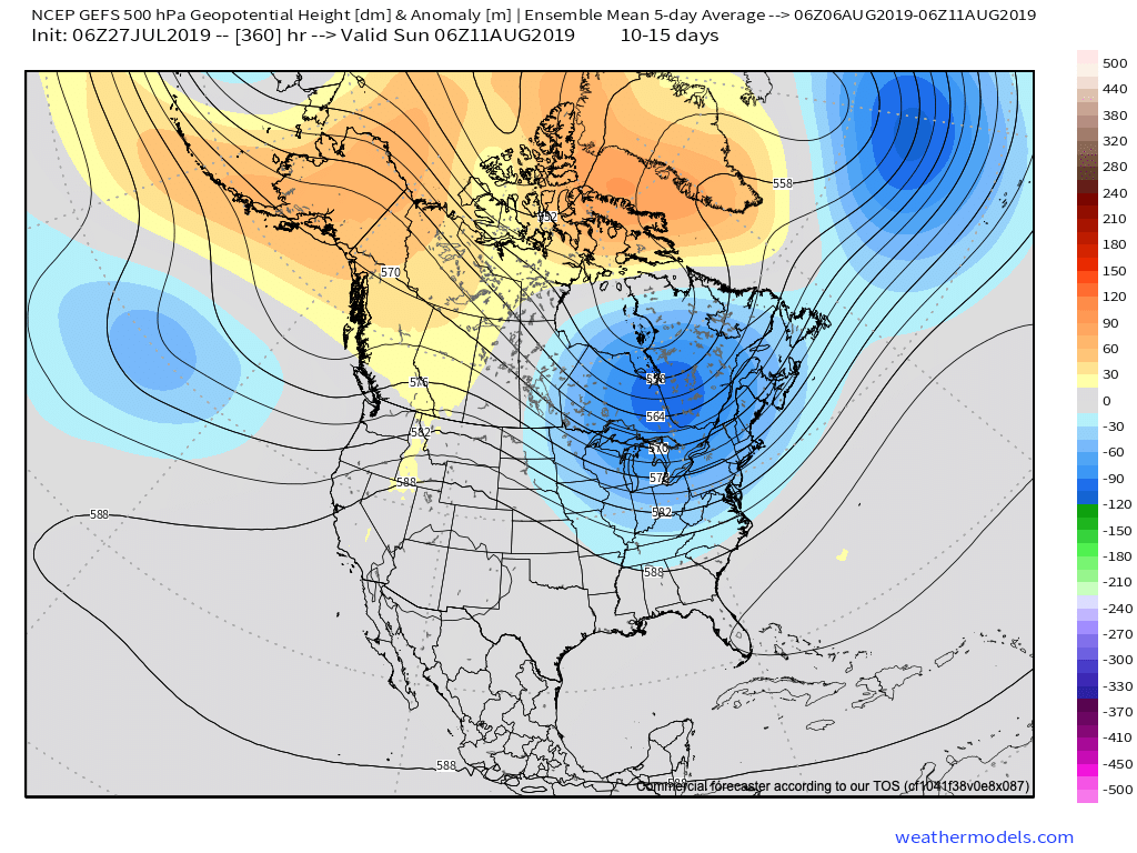
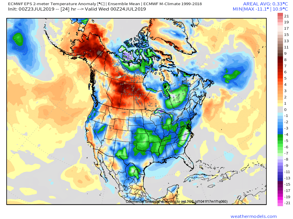
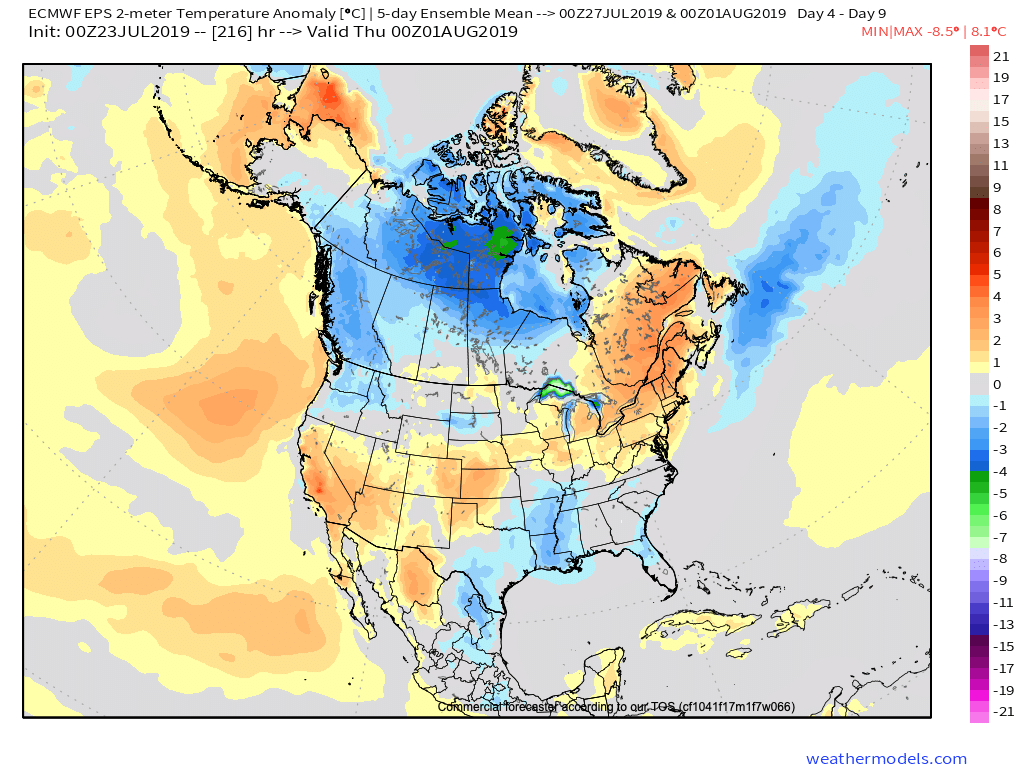
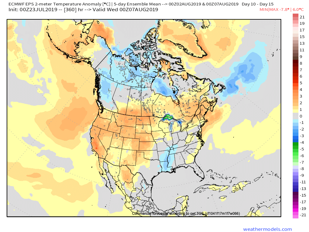
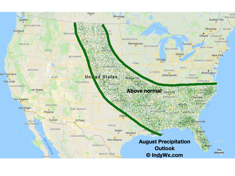
Not only will this serve to provide a rather lengthy period of cooler than normal temperatures through the 1st half of August, but should also help inject wetter conditions to boot (in large part due to the frequent nature of frontal passages).

At a time of year that can feature brutal periods of heat and/ or dry conditions, it sure continues to be the exact opposite this year!

Enjoy your Saturday, friends!

Permanent link to this article: https://indywx.com/a-different-kind-of-dog-days-this-year/

VIDEO: Dry Weekend; Looking Ahead To The Cool Pattern That Will Return Early-August…

You must be logged in to view this content. Click Here to become a member of IndyWX.com for full access.  Already a member of IndyWx.com All-Access?  Log-in here.

Permanent link to this article: https://indywx.com/video-dry-weekend-looking-ahead-to-the-cool-pattern-that-will-return-early-august/

All-Access Evening Video Update: More Early August Chatter…

You must be logged in to view this content. Click Here to become a member of IndyWX.com for full access.  Already a member of IndyWx.com All-Access?  Log-in here.

Permanent link to this article: https://indywx.com/all-access-evening-video-update-more-early-august-chatter/

EPO In Control?

As we look ahead to the August pattern, it’s becoming increasingly apparent that the EPO, or East Pacific Oscillation, is trying to take control.

During positive phases of the EPO, warmer anomalies are usually noted across the eastern United States, whereas negative phases tend to promote cooler anomalies through the central into the eastern portion of the country. While the correlation is greatest in the fall and winter, the EPO phase can also have a say in the summer pattern.

As we look ahead at the forecast EPO and upper level pattern, note the similarities:

First, here’s what a negative and positive EPO would typically yield from the perspective of temperature anomalies:

Negative EPO (in August)
Positive EPO (in August)

Here’s the forecast EPO into the first week of August.

Note how closely the modeled upper air pattern (and associated surface temperatures) follow suit:

Present (negative EPO)

July 27th – Aug 1st (positive EPO)

Aug 3rd – Aug 8th (negative EPO)

(While we can’t show it here, it’s interesting to see the latest European Weeklies keep the EPO predominantly negative to significantly so through the bulk of August and into September).

So what’s the moral of the story? We believe after a period of transitional heat this weekend into early next week that temperatures will return to seasonal levels in early August, along with an increase in rain/ storm threats as the northwest upper air flow sets up shop. Our official August forecast will be issued early next week.

Permanent link to this article: https://indywx.com/epo-in-control/

Early August Ideas…

The year continues to fly by! We’re now finalizing our forecast for the last month of meteorological summer and will include a look-ahead to our early fall ideas with the official August Outlook that hits the site later next week. With that said, here are some of our early August ideas:

I. Sea surface temperatures remain well above average through the western Atlantic basin as well as the northeastern Pacific. This should promote warmer than normal conditions, overall, along the coastal areas. Additionally, we’ll need to continue to keep a close eye on the potential of additional “home grown” (Gulf of Mexico and off the southeast US coast) tropical development as we move closer to the peak of the hurricane season.

II. The MJO isn’t nearly as hyper as months past. While we’ll continue to keep a close eye on things, we currently don’t anticipate being able to lean on this tool as a good indicator for what may transpire through the month of August (at least early on).

III. We need to keep a very close eye on the EPO over the upcoming week to see if modeling continues to project a significantly negative phase into August. This can “up the ante” for a cooler than normal central US during August if so.

IV. Lack of widespread drought/ dryness. The wet spring and early summer really can help make an impact longer term and that has been seen as early as this week (added humidity with the heat wave), but also helps overall when it comes to late summer and the respect to the staying power, or longevity, of heat waves.

Here’s our early thinking with respect to August temperatures and precipitation. Again, our final, more detailed, outlook will be issued next week!

Permanent link to this article: https://indywx.com/early-august-ideas/