
You must be logged in to view this content. Click Here to become a member of IndyWX.com for full access. Already a member of IndyWx.com All-Access? Log-in here.
Category: EPO
Permanent link to this article: https://indywx.com/video-additional-storm-chances-before-a-gorgeous-late-week-weekend/
Aug 17
VIDEO: Weekend Update And More EPO Talk…
You must be logged in to view this content. Click Here to become a member of IndyWX.com for full access. Already a member of IndyWx.com All-Access? Log-in here.
Permanent link to this article: https://indywx.com/video-weekend-update-and-more-epo-talk/
Aug 14
Changes Afoot…
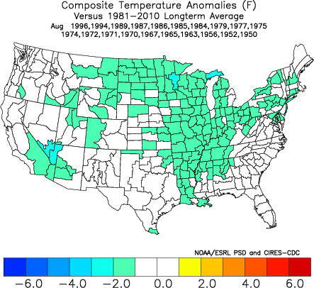
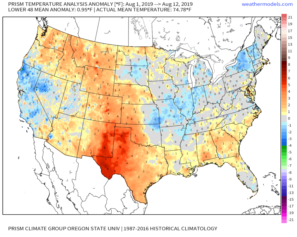
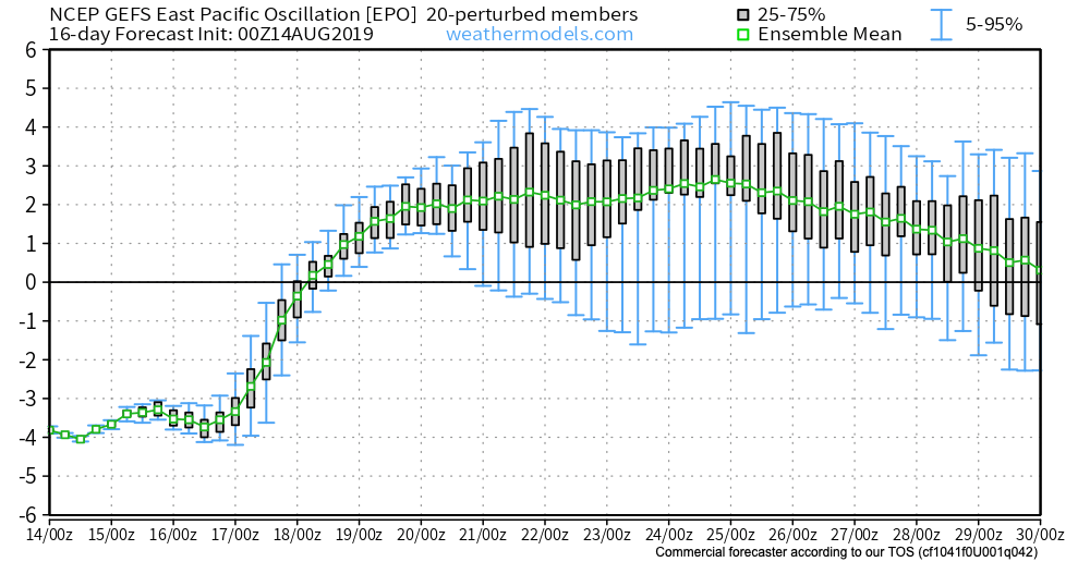
Month-to-date, a negative EPO (East Pacific Oscillation) has dominated. The result has been for a cooler regime across the central into the interior Northeast.
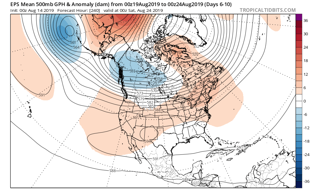
That said, big changes are taking place with the EPO and it’s set to swing strongly positive as we head into the 3rd and 4th week of the month.
This correlates to a MUCH warmer/ hotter pattern across not only our portion of the country, but a large chunk of the Lower 48.

To no surprise, we see a building heat wave showing up on the medium to long range models with more consistency beginning this weekend, continuing into next week. This is the type regime that can lead to lows in the lower 70s and highs in the lower 90s for several consecutive days.
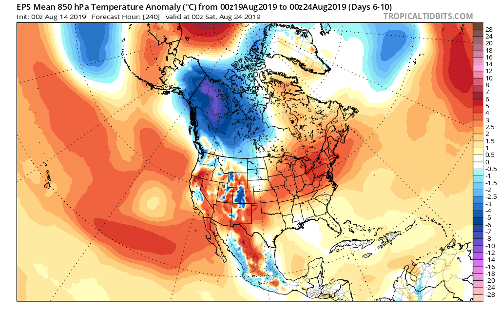
How long does the warmer pattern last? It’s all up to the EPO. As long as that baby stays positive, bet on the warmth.
Permanent link to this article: https://indywx.com/changes-afoot/
Aug 07
VIDEO: Short-Term Severe Threat; Looking Ahead To Late August…
You must be logged in to view this content. Click Here to become a member of IndyWX.com for full access. Already a member of IndyWx.com All-Access? Log-in here.
Permanent link to this article: https://indywx.com/video-short-term-severe-threat-looking-ahead-to-late-august/
Aug 02
VIDEO: “Hint” Of Fall Served Up Later Next Week…
You must be logged in to view this content. Click Here to become a member of IndyWX.com for full access. Already a member of IndyWx.com All-Access? Log-in here.
Permanent link to this article: https://indywx.com/video-hint-of-fall-served-up-later-next-week/