Updated 10.28.23 @ 9:50a
You must be logged in to view this content. Click Here to become a member of IndyWX.com for full access. Already a member of IndyWx.com All-Access? Log-in here.

Oct 28
Updated 10.28.23 @ 9:50a
You must be logged in to view this content. Click Here to become a member of IndyWX.com for full access. Already a member of IndyWx.com All-Access? Log-in here.
Permanent link to this article: https://indywx.com/video-2-rounds-of-heavier-rain-on-deck-1st-flakes-of-the-season-await/
Oct 23
Updated 10.23.23 @ 8a
You must be logged in to view this content. Click Here to become a member of IndyWX.com for full access. Already a member of IndyWx.com All-Access? Log-in here.
Permanent link to this article: https://indywx.com/video-warm-up-this-week-eyeing-wetter-times-this-weekend-and-a-big-blast-of-chilly-air-to-close-october-open-november/
Oct 16
Updated 10.16.23 @ 7:38a
You must be logged in to view this content. Click Here to become a member of IndyWX.com for full access. Already a member of IndyWx.com All-Access? Log-in here.
Permanent link to this article: https://indywx.com/video-early-and-midweek-improvements-ahead-of-a-new-storm-system/
Oct 12
Updated 10.12.23 @ 10:50a
As we roll into the second half of October, a look at the primary pattern drivers suggests there should be a lack of any sort of sustained above normal temperatures.
The PNA (image 1) should remain mostly in a positive state over the next couple weeks while the EPO (image 2) is expected to be in a neutral to negative state.


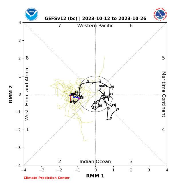
Furthermore, the MJO is forecast to sneak into Phase 1 late month. This is the correlation in October:
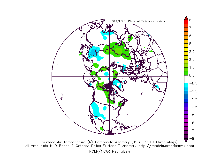
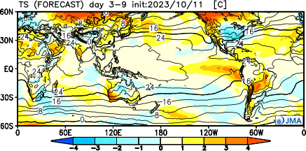
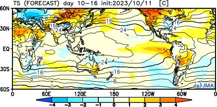
It’s hard to find much at fault with the NEW JMA Weeklies posted earlier today.
Temperatures
Week 1
Week 2
Weeks 3-4
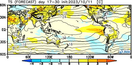
Precipitation should run average to slightly below normal over the span of the upcoming (2) weeks:

Permanent link to this article: https://indywx.com/lr-update-checking-in-on-the-pattern-drivers-to-close-october/
Oct 09
Updated 10.09.23 @ 7:35a
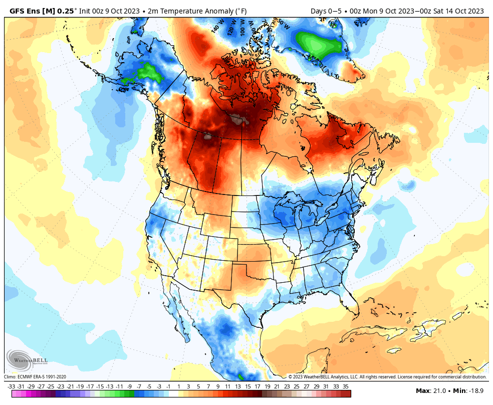
We’re opening the work week with a few scattered clouds and temperatures around the 40° mark. We’re in a pattern that will feature predominantly cooler to colder than normal temperatures over the next 10-14 days with a couple exceptions. We’ll call it a sea of cool with an island of warmth (Thursday and Friday). The relatively warmer temperatures come after the passage of a warm front and ahead of a cold front. The “in between” will feature another period of unsettled and stormy weather to close the work week.
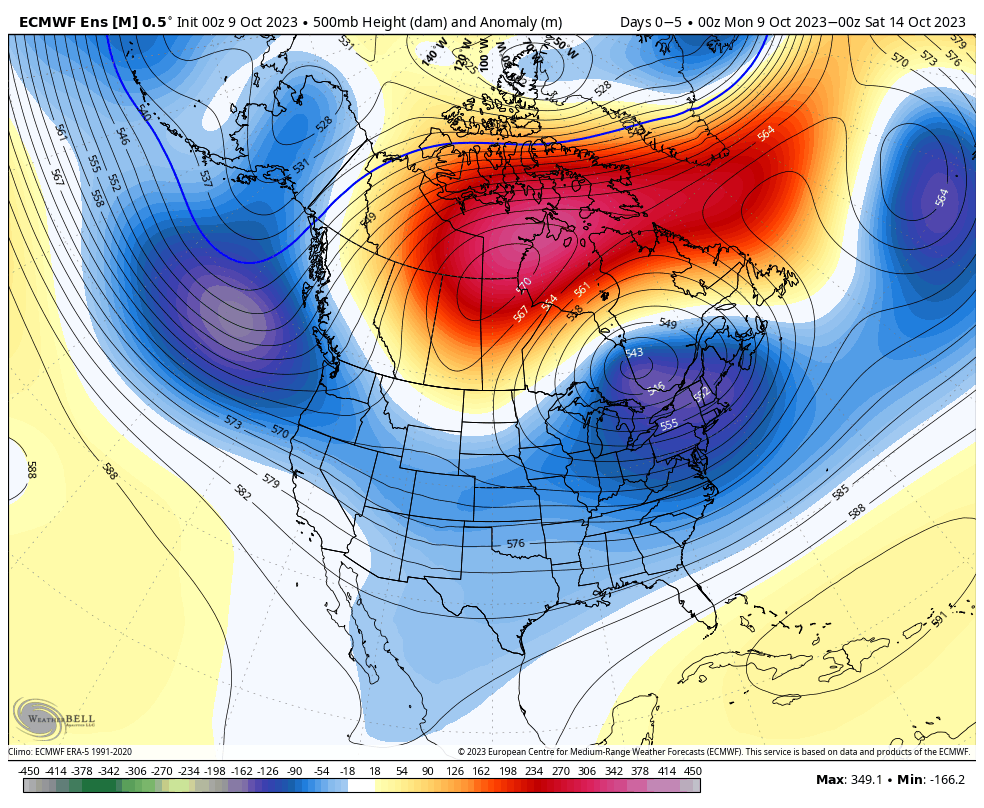
The overall upper air pattern shows that Hudson Bay blocking high and tendency for an eastern trough through the upcoming 2 week period. Another big cold shot will roll in here over the weekend and into the early Week 2 time period.
After a dry start to the week, rain chances will return late Wednesday and early Thursday (warm front) and again directly ahead of the cold front that will sweep through here Friday evening. Rainfall numbers with the passage of this system should check in between 0.25” and 0.75” for most of the region.

As we look ahead, a continued chilly pattern seems to be in store with additional storm dates that include:
10/19-10/20
10/23-10/24
Down the road, the strongly positive PNA and neutral to negative EPO should keep the chill flowing for the most part over the coming couple weeks. Eventually, these progressively colder shots will likely generate the 1st eastern flakes of the season, including for our friends in the beautiful high ground of those east TN and western NC mountains.
Permanent link to this article: https://indywx.com/active-mid-and-late-october-another-unseasonably-cold-shot-on-deck/