You must be logged in to view this content. Click Here to become a member of IndyWX.com for full access. Already a member of IndyWx.com All-Access? Log-in here.
Category: Ensemble Discussion
Permanent link to this article: https://indywx.com/2020/08/28/video-quick-start-to-a-fall-like-feel-this-year/
Aug 27
Long Range Update: Meteorological Fall Opens On A Very Active Note…
Before we dive into our latest long range discussion, Laura continues to track north this morning through western Louisiana, and remains a category 2 as of the latest update (5a eastern time). Our thoughts and prayers are with all of those affected by Laura as they wake up this morning and begin to see the horror left behind from this beast of a storm.
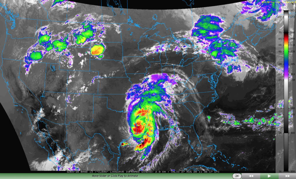
Laura will take a hard “right” turn Friday and deliver gusty winds and heavy rain to the TN Valley and into the mid-Atlantic through the weekend.

We won’t deal with any impacts from Laura’s remnants up this far north, but we will increase coverage of shower and thunderstorm activity now through Saturday evening. This is thanks to a warm, sultry airmass in place along with an approaching cold front. As that boundary drives through the region Saturday evening, a much drier airmass will arrive for the 2nd half of the weekend.

Rainfall amounts between this afternoon through Saturday afternoon should top out between 0.50″ and 1″ for most, but there will be localized 1″ to 2″ totals in the heavier storms.
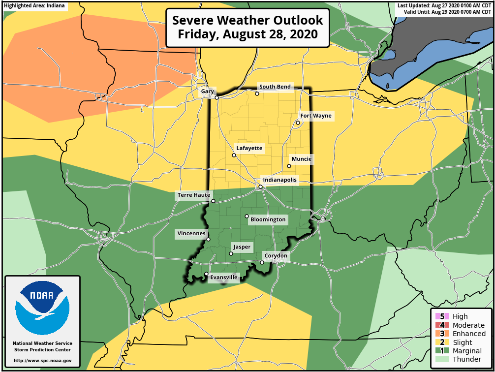
Friday will also pose a severe weather threat across the state, including the potential of damaging straight line winds as a couple “bowing” segments that move from the upper Midwest into the central Ohio Valley.
As we look ahead, we’re tracking 3 significant cold fronts between now and September 10th:
I. Aug. 29th
II. Sept. 3rd
III. Sept. 10th
Each of these cold fronts will be capable of producing strong storms and locally heavy rain, and behind each boundary, the air will grow cooler and cooler. While “transitional” warmth (relative to normal) is likely ahead of the boundaries, the first 1/3 of September should run cooler than normal across our region. Things also looks MUCH wetter than normal through the upcoming couple of weeks- a byproduct of the busy nature of the pattern.
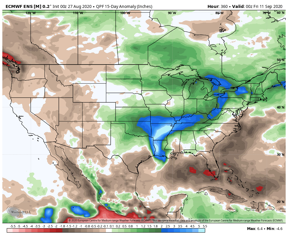
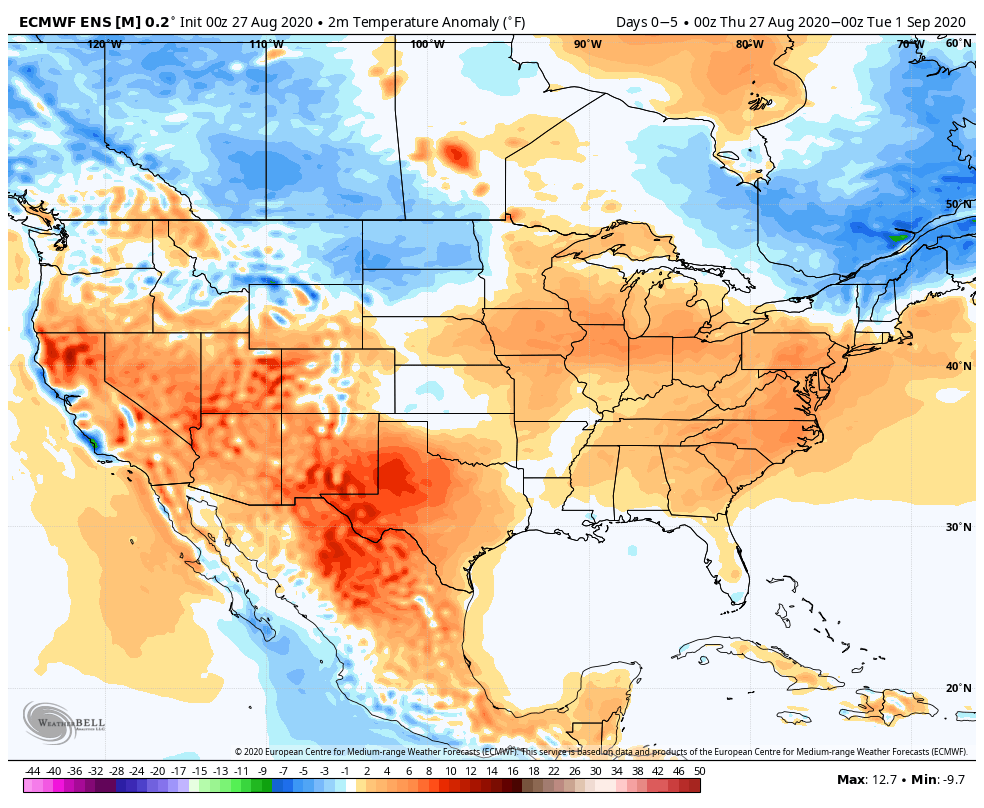
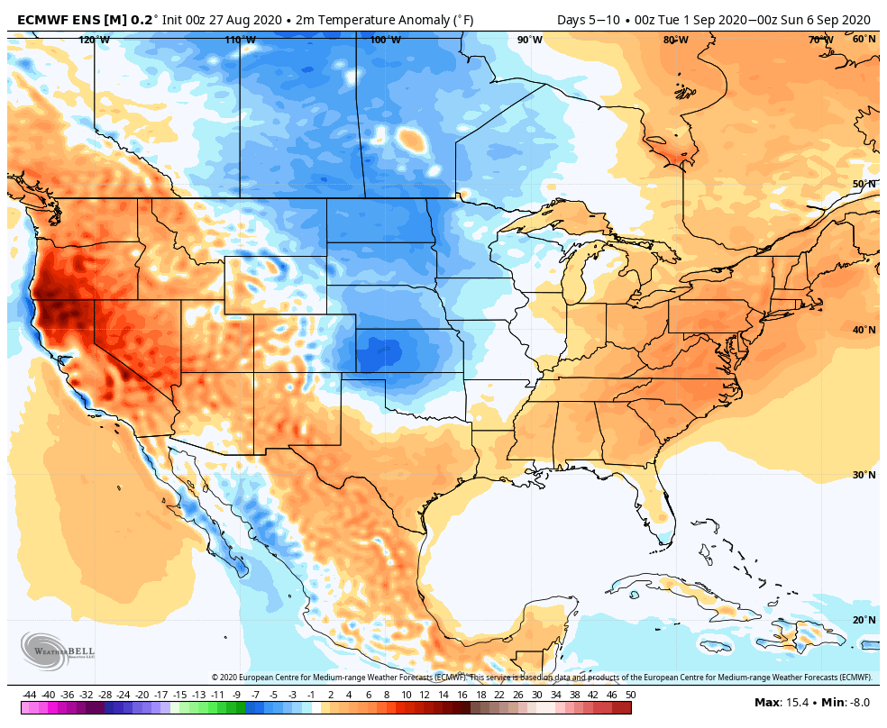
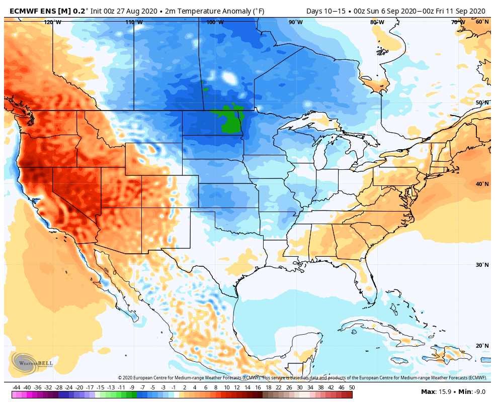
Note how the latest JMA Weeklies are also similar handling the pattern (we’ll take the week-by-week snap shots into our video a bit later) over the upcoming 3-4 weeks:
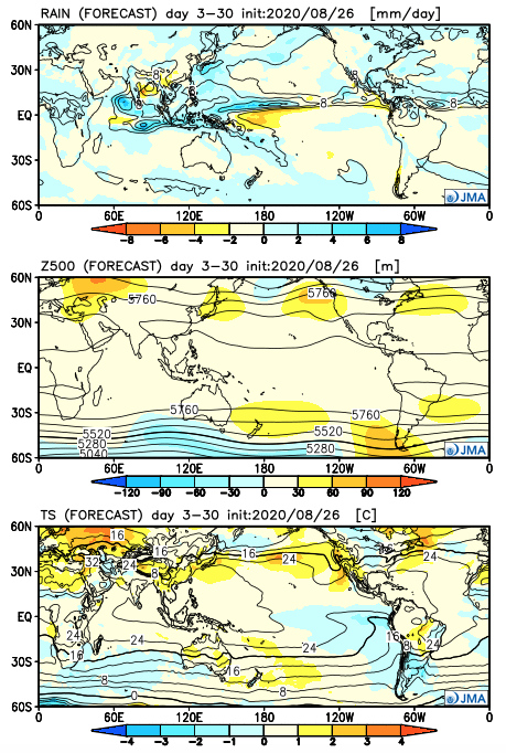
One more item of note, the tropics aren’t done, unfortunately. There should be another hurricane threat in the medium to longer range period (early September) and early thoughts here include that threat centering more on the East Coast vs. the Gulf.
Permanent link to this article: https://indywx.com/2020/08/27/long-range-update-meteorological-fall-opens-on-a-very-active-note/
Aug 25
VIDEO: Details Around What Should Become Major Hurricane Laura; Reviewing Our Pattern Into Mid-September…
You must be logged in to view this content. Click Here to become a member of IndyWX.com for full access. Already a member of IndyWx.com All-Access? Log-in here.
Permanent link to this article: https://indywx.com/2020/08/25/video-details-around-what-should-become-major-hurricane-laura-reviewing-our-pattern-into-mid-september/
Aug 23
VIDEO: All Eyes On Marco And Laura…
You must be logged in to view this content. Click Here to become a member of IndyWX.com for full access. Already a member of IndyWx.com All-Access? Log-in here.
Permanent link to this article: https://indywx.com/2020/08/23/video-all-eyes-on-marco-and-laura/
Aug 22
VIDEO: Mostly Dry Weekend; Tropics Remain A Big Focus…
You must be logged in to view this content. Click Here to become a member of IndyWX.com for full access. Already a member of IndyWx.com All-Access? Log-in here.
Permanent link to this article: https://indywx.com/2020/08/22/video-mostly-dry-weekend-tropics-remain-a-big-focus/
Aug 21
VIDEO: Detailed Tropical Discussion Into Next Week…
You must be logged in to view this content. Click Here to become a member of IndyWX.com for full access. Already a member of IndyWx.com All-Access? Log-in here.
Permanent link to this article: https://indywx.com/2020/08/21/video-detailed-tropical-discussion-into-next-week/
Aug 20
VIDEO: Humidity Increases This Weekend; Closely Watching The Gulf Into Next Week…
You must be logged in to view this content. Click Here to become a member of IndyWX.com for full access. Already a member of IndyWx.com All-Access? Log-in here.
Permanent link to this article: https://indywx.com/2020/08/20/video-humidity-increases-this-weekend-closely-watching-the-gulf-into-next-week/
Aug 14
VIDEO: Weekend Discussion And Looking Through Next Week…
You must be logged in to view this content. Click Here to become a member of IndyWX.com for full access. Already a member of IndyWx.com All-Access? Log-in here.
Permanent link to this article: https://indywx.com/2020/08/14/video-weekend-discussion-and-looking-through-next-week/
Aug 13
Long Range Update: Closing Out August…
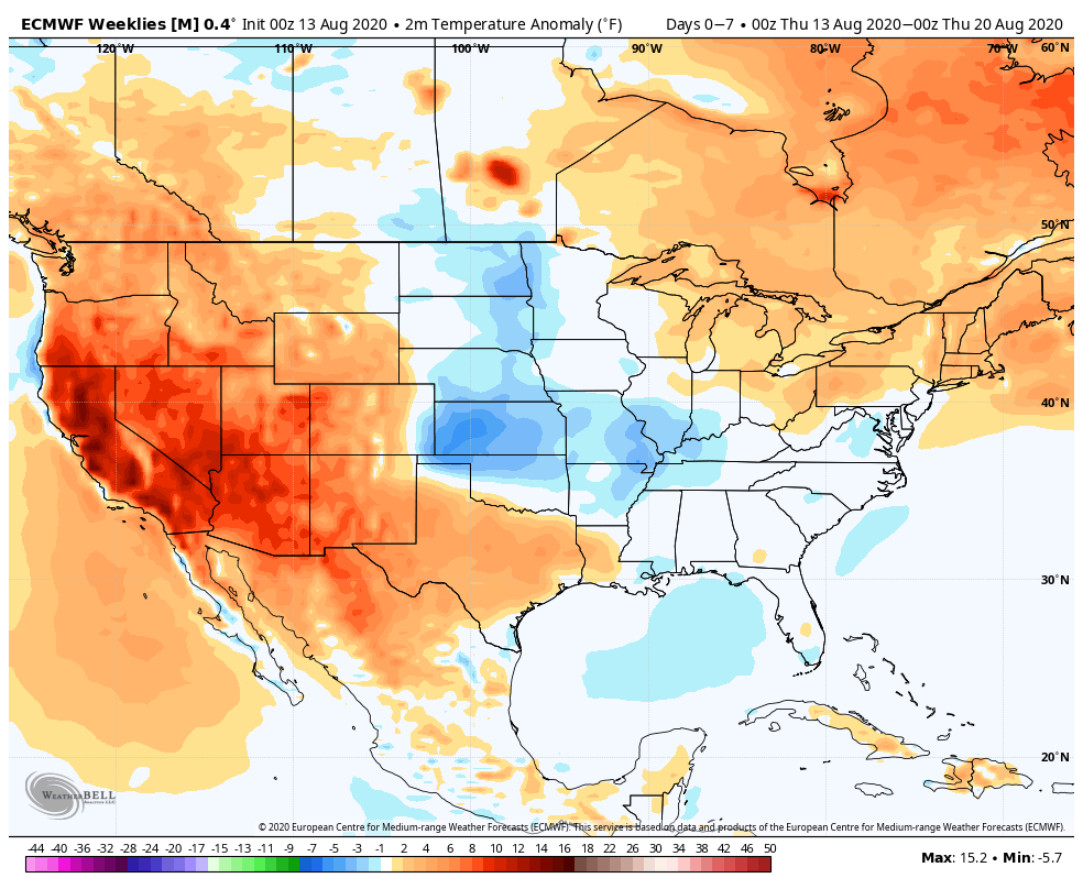
With a little over 2 weeks to go in meteorological summer, model data disagrees in the way the month- and season ends. That is, after the upcoming week where the consensus is cooler and drier than normal (we agree, as well). Let’s take a look at the data:
European Weeklies
CFSv2

GEFS
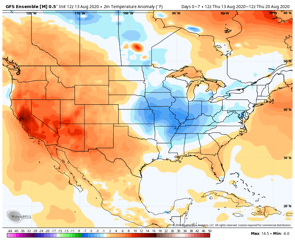
EPS

JMA
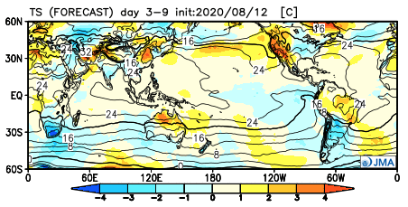
The American data and JMA Weeklies are coolest (compared to the European), but compared to Weeks 2 and 3, there’s better consensus. The initial week is also looking drier than normal- especially after a “smattering” of storms tomorrow and Saturday.
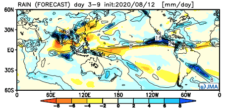

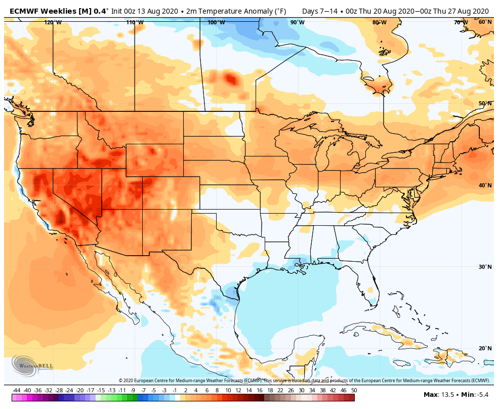
Let’s now take a look at Week 2:
European Weeklies
CFSv2
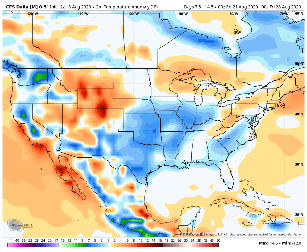
GEFS

EPS
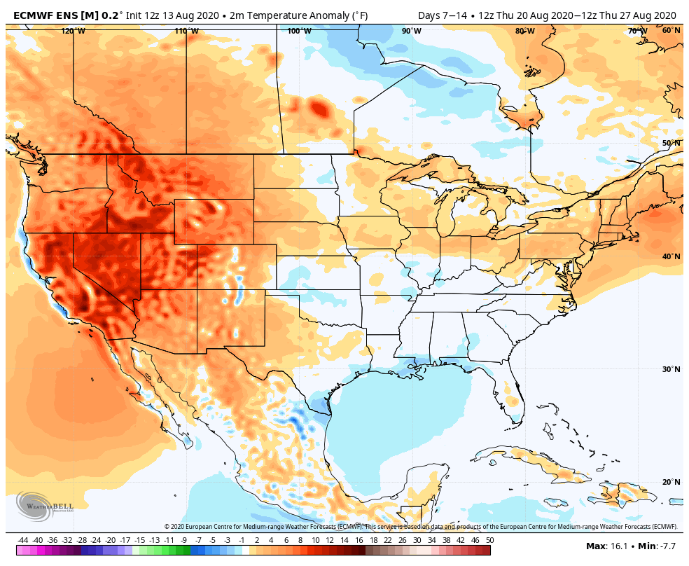
JMA
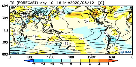
This is where our idea begins to pivot more towards the JMA Weeklies and European data (warmer look). The reason primarily has to do with the MJO moving back into Phase 8 during this time period.
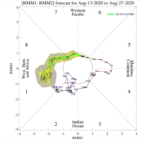
This is a warm phase in August.

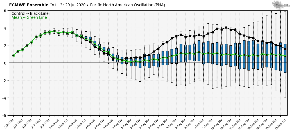
Furthermore, the PNA ‘mean’ is forecast to trend off the positive “mountain” (that will help drive the cooler pattern for the upcoming week) and more towards neutral.
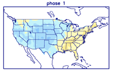
Phase 1 is also a warmer look for our part of the country and that’s the way we’re leaning for the last week of the month (despite the very cool CFSv2).
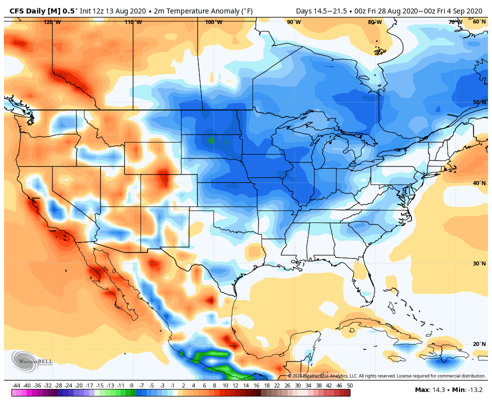
While not overly warm, we think the JMA has the best handle on the temperature pattern in the Week 3 timeframe, locally (seasonable to slightly above normal).
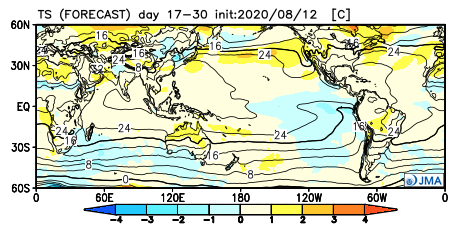
The pattern should also begin to trend wetter during this time period:
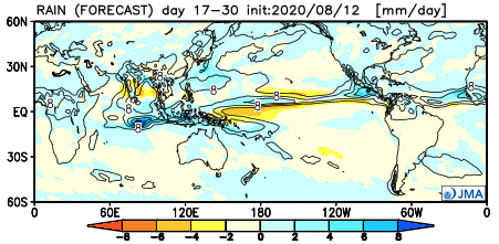
This matches up with Phase 1 of the Madden Julian oscillation:
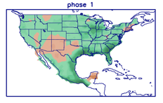
So, to summarize, after a cool and dry period next week, we anticipate the pattern to trend warmer (more seasonable) and wetter to close the month and head into early September. One other item of note is that the tropics should really begin to heat back up during this period, as well. Of course, as is the case from time to time, that can be a wild card from a precipitation perspective. The Gulf of Mexico (GOM) looks particularly busy late August through late September, but there’s simply no way to get more specific from this distance, including potential inland impacts. It’s worth keeping a close eye though.
Before we leave, the latest JAMSTEC seasonal data updated this morning and features a “torch” of a fall, along with a warm, wet winter, locally. That southeast ridge will have to be dealt with this winter. While still early, the early lean is for a warm start to winter (including holiday season). While there are some ingredients that may keep things more interesting than what they could be otherwise, from at least this point, this doesn’t appear as if it’ll be an “exciting” winter for lovers of snow and cold. Much more later- and again, we still have a long way to go…
Permanent link to this article: https://indywx.com/2020/08/13/long-range-update-closing-out-august/
Aug 12
VIDEO: Unsettled Weather Returns To Close The Week; Unseasonably Cool Air Arrives Next Week…
You must be logged in to view this content. Click Here to become a member of IndyWX.com for full access. Already a member of IndyWx.com All-Access? Log-in here.
Permanent link to this article: https://indywx.com/2020/08/12/video-unsettled-weather-returns-to-close-the-week-unseasonably-cool-air-arrives-next-week/
