VIDEO: An Active Autumn Pattern Is Here…
You must be logged in to view this content. Click Here to become a member of IndyWX.com for full access. Already a member of IndyWx.com All-Access? Log-in here.
You must be logged in to view this content. Click Here to become a member of IndyWX.com for full access. Already a member of IndyWx.com All-Access? Log-in here.
Mid and high level clouds are streaming overhead this evening and will help set up a brilliant sunset across central IN.
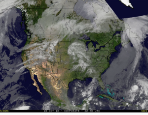 Tuesday will remain rain-free across the region, along with pleasant temperatures and humidity levels (mid 70s after a low in the lower 50s).
Moisture will continue to be transported northward Wednesday, courtesy of a gusty SW breeze at times. As the approaching cold front interacts with the moisture return, scattered showers will “blossom” across the area Wednesday night into the wee morning hours Thursday.
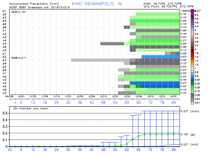
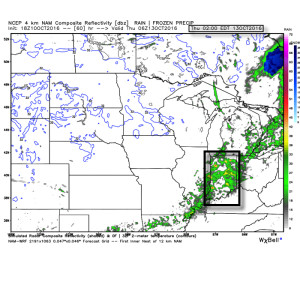 Rainfall amounts don’t look particularly impressive; generally 0.10″-0.25″ during the Wednesday night-Thursday morning time frame.
 The cool air flowing in behind the front is impressive though. In fact, highs both Thursday and Friday will likely only reach the lower 60s (if that).
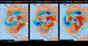
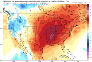
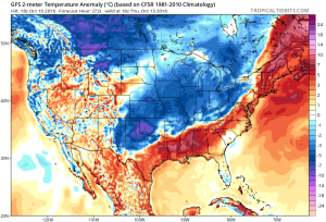 Despite the chilly air that will be with us to wrap up the work week, ensemble data is in excellent agreement on a significant warmer than average regime developing under a big eastern ridge in the 6-10 day. This will likely promote highs into the lower 80s next week for a few days. Impressive, no doubt, considering we’ll be rumbling through the second half of October by that point.
You must be logged in to view this content. Click Here to become a member of IndyWX.com for full access. Already a member of IndyWx.com All-Access? Log-in here.
…We note some significant differences in our morning ensemble data that’s creating some doubt in terms of the longevity of the coming cold. We still feel the heart of the cold is in the Mid West and Ohio Valley with this early February surge. The EC is likely a battle zone, at least initially.

 The European is much more progressive in breaking down the cold across the central and east, while the GFS ensembles look much more realistic to us. Why? The GoA trough placement. The EPS is likely “dragging its heels” across the southwest with the southern energy and in return deepens the trough too much across the four corners region.
We see the GEFS going to a significant cold period in the 10-14 day period, centered over the mid section into the Ohio Valley. This is also during the time frame we think the first of two winter events impacts the Ohio Valley.
 We’ll issue an afternoon ensemble discussion after having an opportunity to digest 12z data. Look for it in your inbox by 6p.