Cold Weekend Gives Way To Another Busy Week Of Weather…
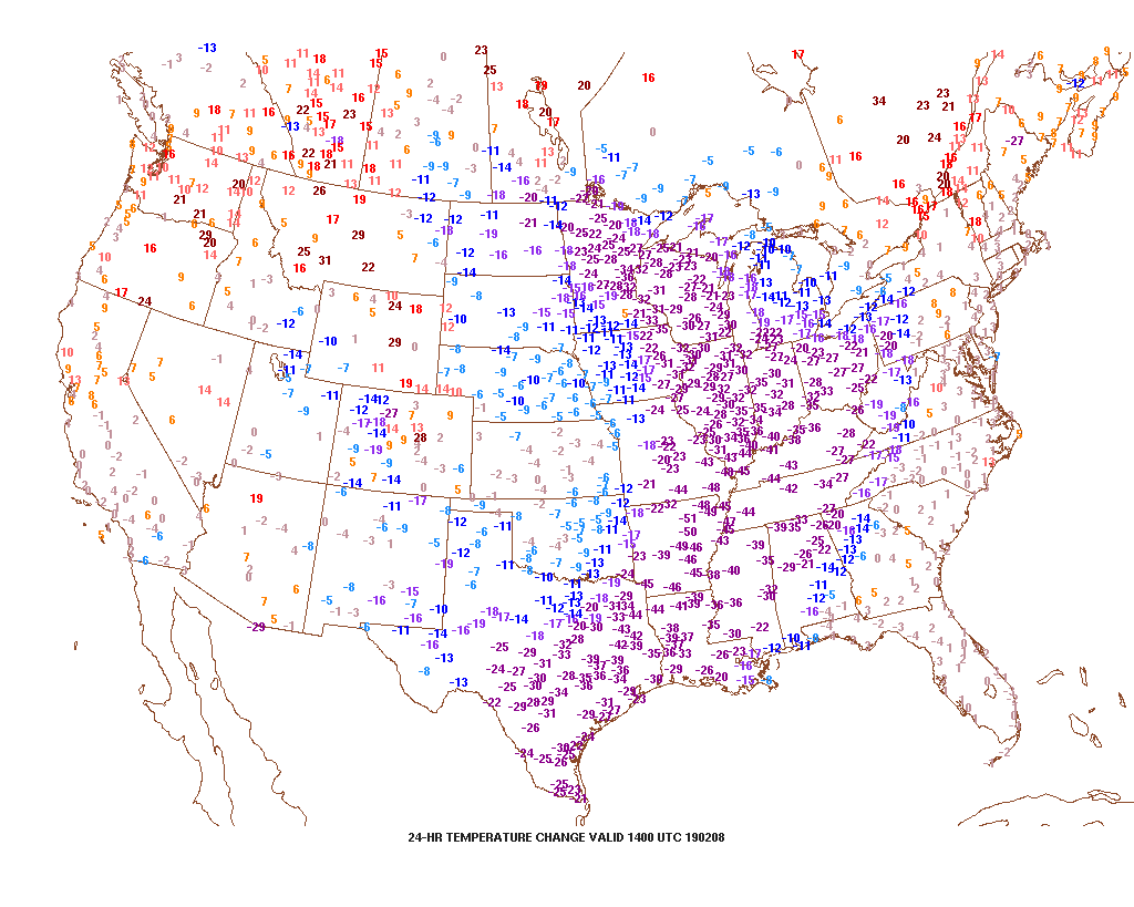
It’s feeling just a little bit different across the region this morning- to the tune of more than 30 degrees colder than this time 24 hours ago. Cold extends south all the way to Brownsville Texas. Speaking of Texas, wintry precipitation is flying across the Hill Country this morning…
Back here on the home front, cold is the story this weekend. Highs may creep into the lower 20s this afternoon, but wind chill values will remain in the single digits below zero to 5 above through the day. Light snow showers will end and we’ll introduce more in the way of sunshine through the afternoon.

Dry conditions will remain through Sunday morning, but a storm system will organize to our southwest, eventually delivering moisture into central Indiana Sunday afternoon into the evening. We remain unimpressed with this feature, but light snow is a good bet during this timeframe. Early thinking would deliver between a coating to an inch and there’s also the potential of a light “glaze” atop the snow Sunday night as milder air aloft begins to win out.


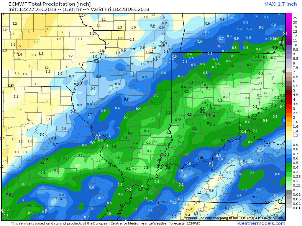
“Dueling” low pressure systems will lead to continued unsettled conditions through Tuesday. The initial low will track into the Great Lakes while a secondary area of low pressure forms along the Mid-Atlantic coast. The end result will be a briefly milder time of things and periods of rain Monday afternoon and Tuesday (0.50″ to 1″ amounts) before cold air whips back in here Wednesday.
Lingering left over moisture will fall as scattered snow showers in the sharply colder air Wednesday.

Our next storm system will deserve a watchful eye in the Thursday-Friday time frame, but it’s far too early for specifics in this hectic pattern.
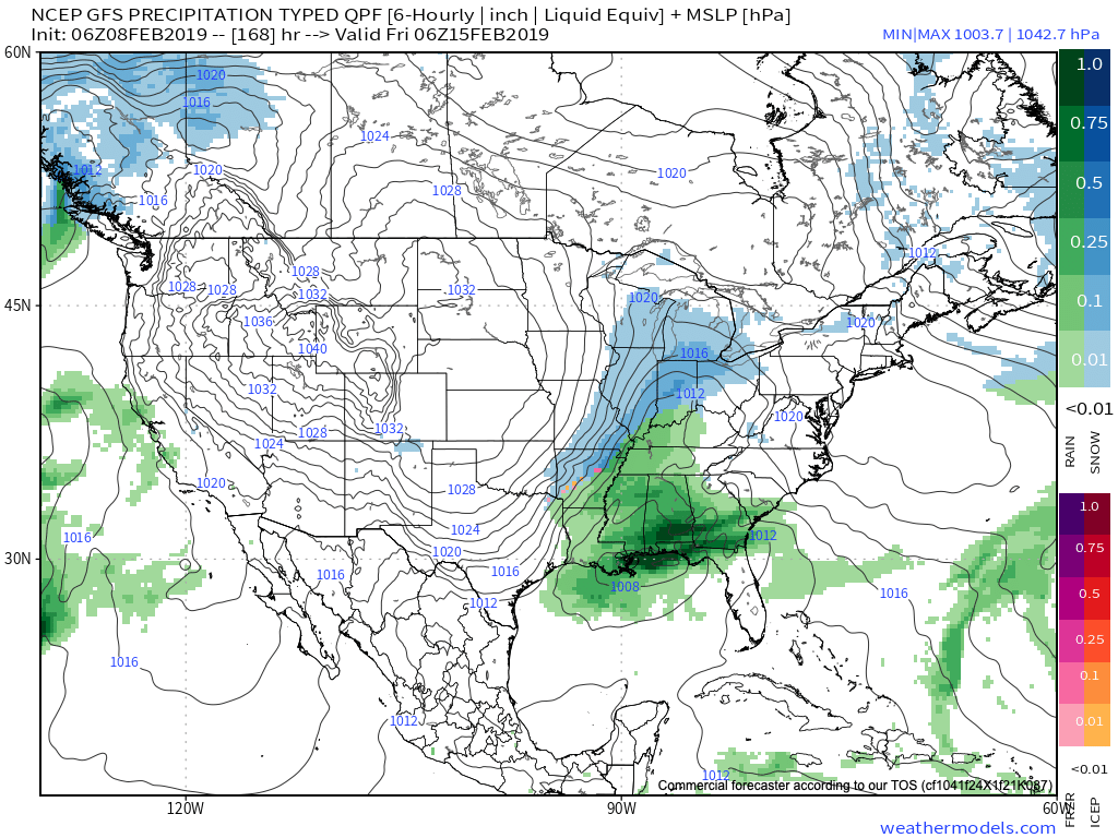
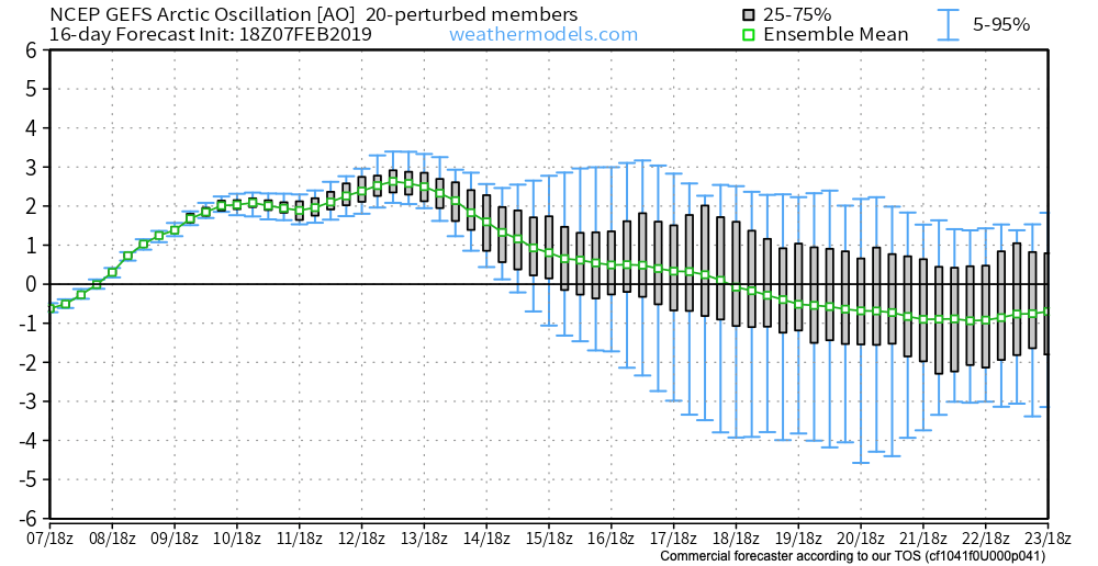
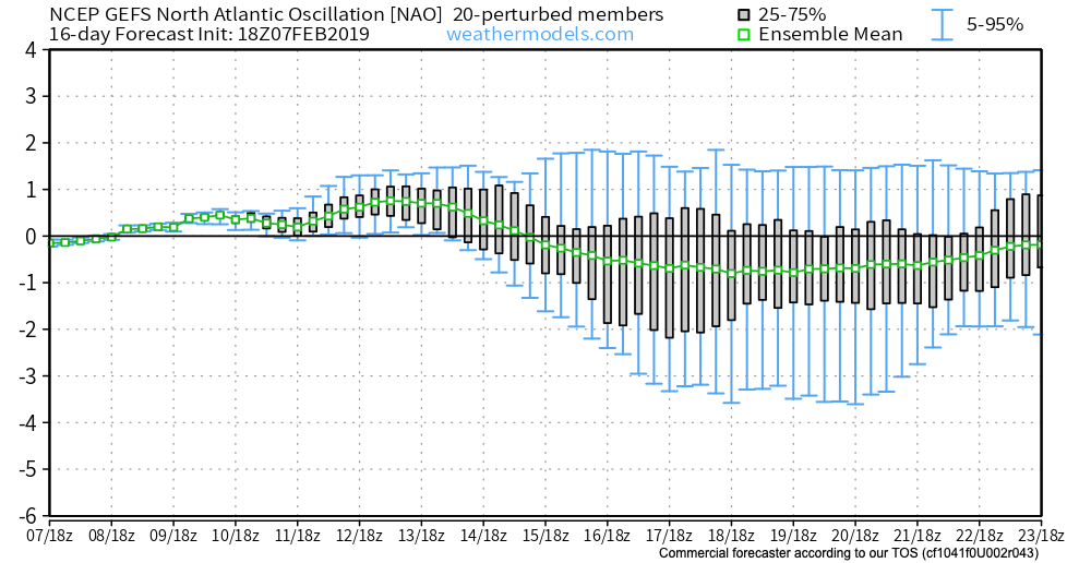
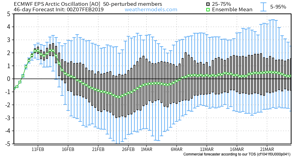
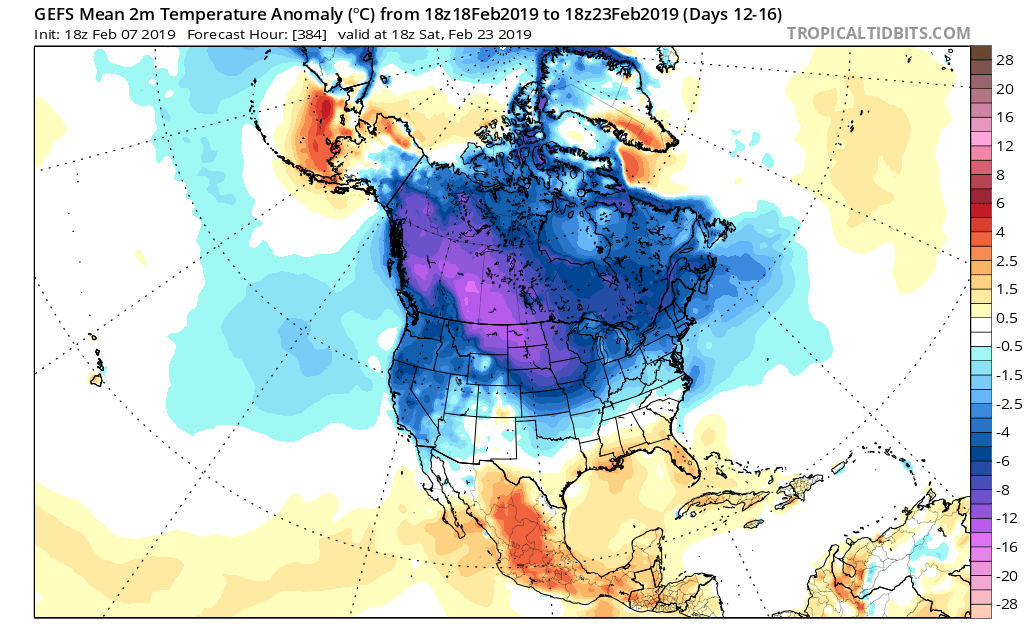
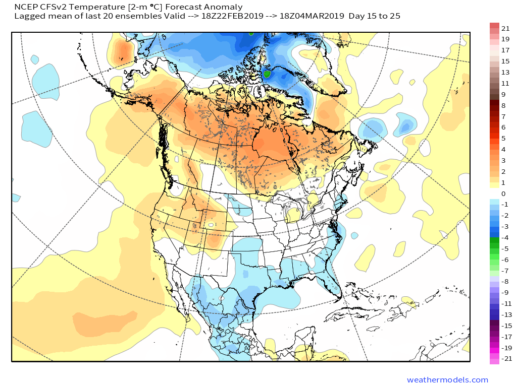
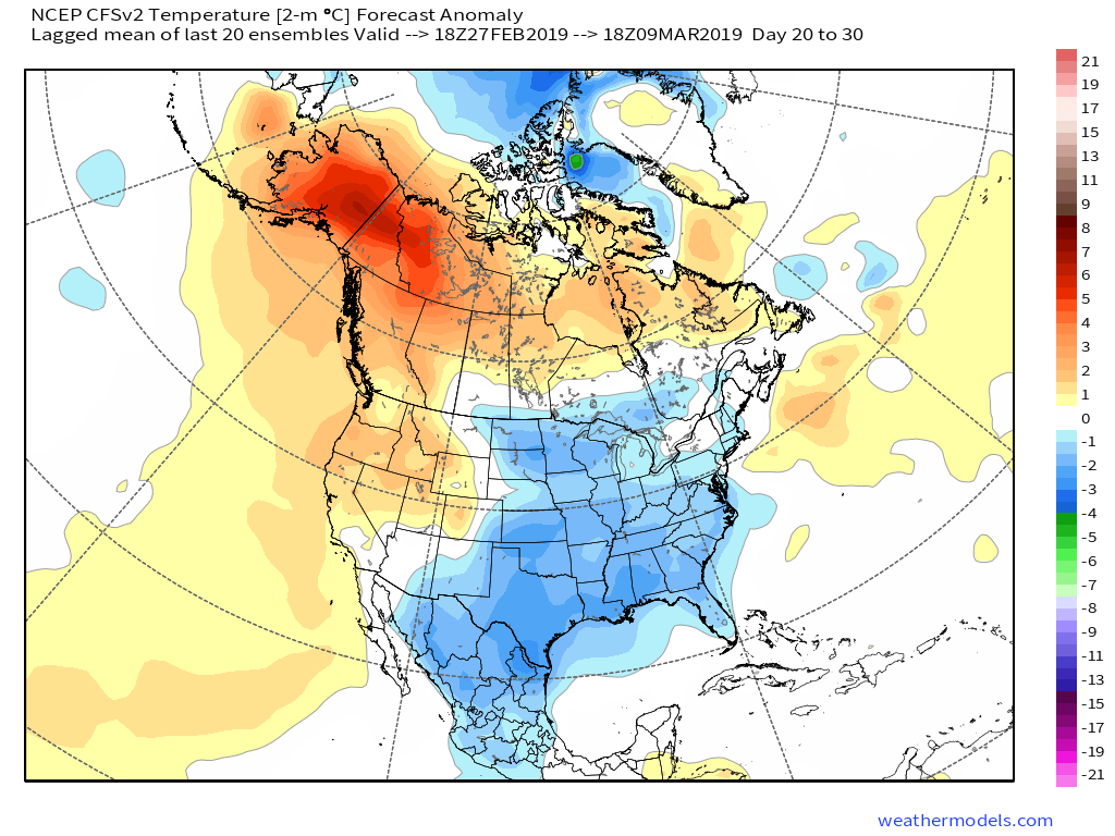
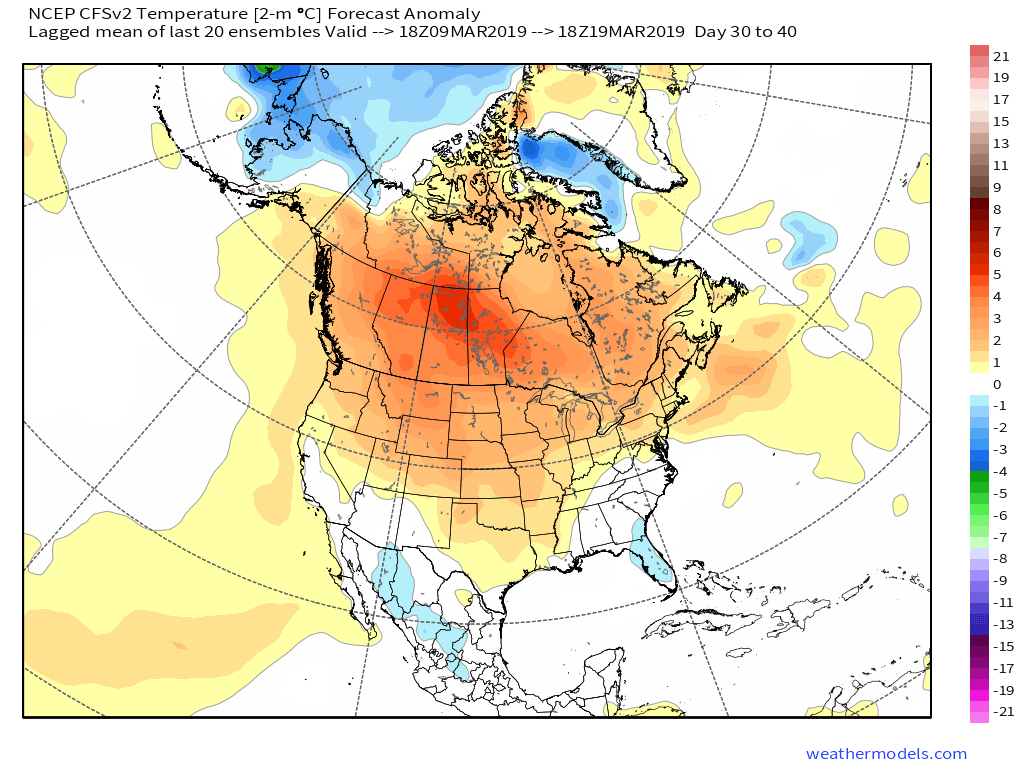
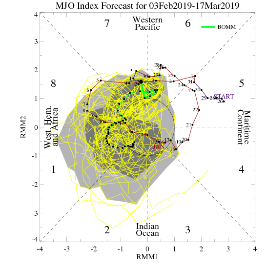
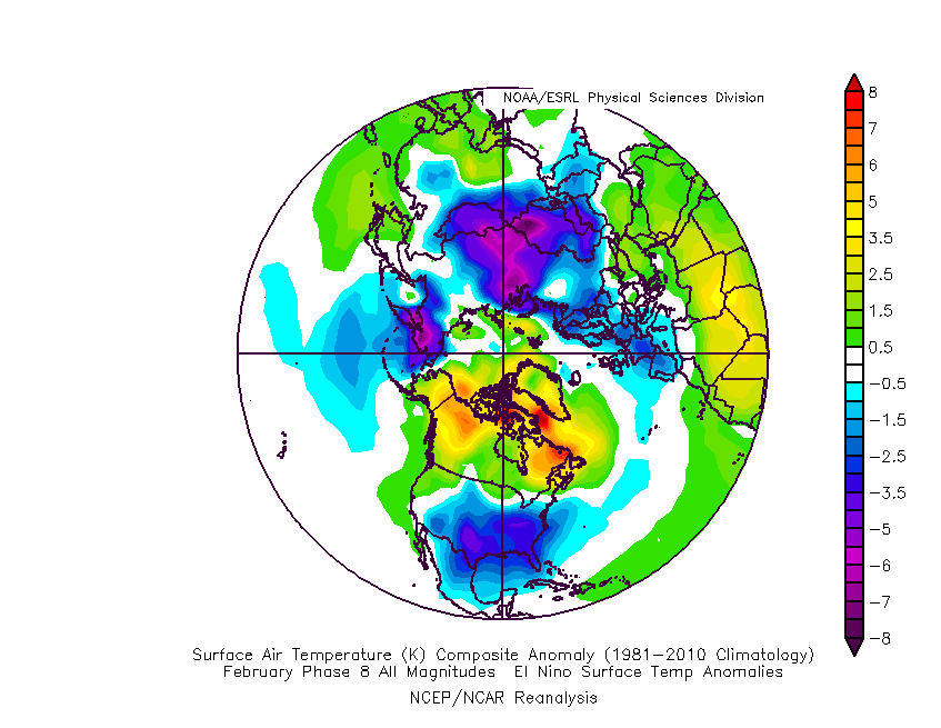
The active pattern is set to remain, along with progressively colder air as we rumble into the 2nd half of February. Above normal precipitation is anticipated, including above normal snowfall in the 2/18 through 3/10 period.




 II. A much stronger storm system will wrap up to our northwest Wednesday night and Thursday. We’ll notice an increasingly strong southerly breeze during this time period and rain will be on the increase as we progress through the day Thursday. The trade-off? Highs between 55° and 60° to close the week- though those temperatures may actually come Thursday evening before cooler air begins to slip in here during the day Friday.
 III. All attention is squarely focused on a significant pattern change that takes shape as we head into the new year. As mentioned in previous posts and discussions, the transition is likely to be a stormy one, but it’s far too early to talk precipitation types. A combination of ingredients appears to be aligning to create a colder than normal (and potentially significantly so) pattern at the traditionally coldest time of year (mid-Jan).