While arriving later than originally expected (recall we originally thought the cold, wintry pattern would start on the 18th), it sure appears as if this was a case of “delayed, but not denied.”
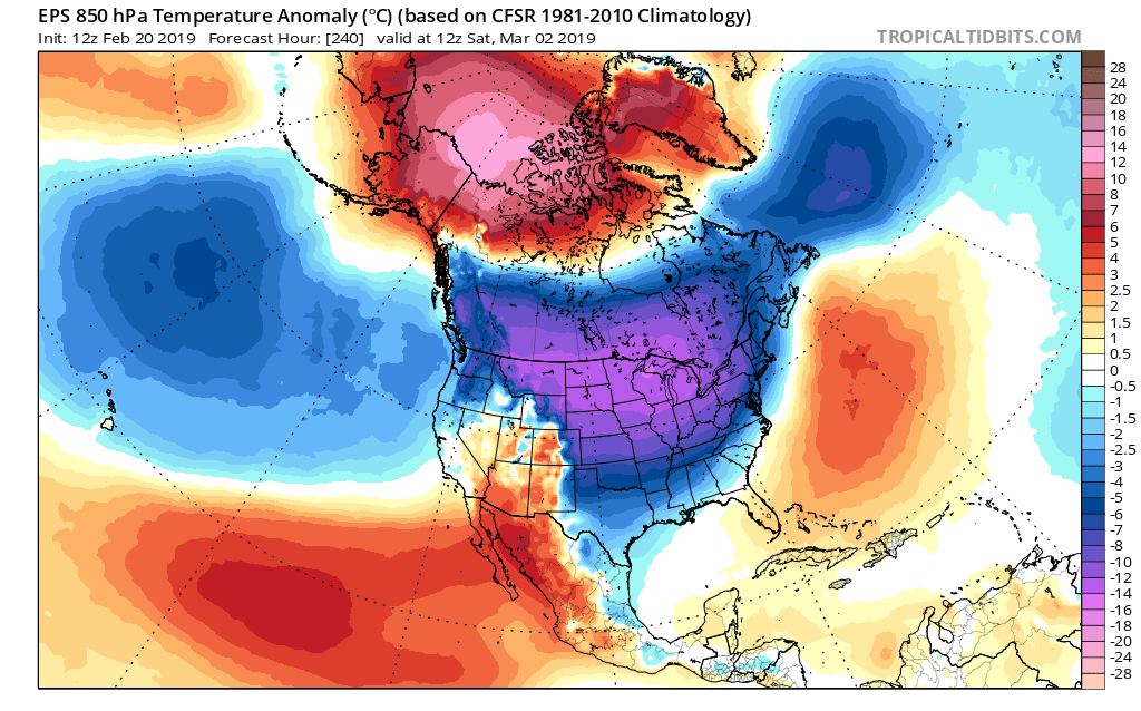
The latest GFS and European ensembles are keying in on a significant pattern change as we put a wrap on February and open March. (Looks like we were about a week early in jumping on the cold bandwagon).
First and foremost, there’s excellent overall agreement amongst data (increases confidence significantly during the medium to long range period).
Days 1-5: Southeast ridge continues to dominate during the short-term period and there’s no high-latitude blocking to speak of. This suggests storms will continue to “cut” northwest of the region and place central Indiana in the “warm” sector, with transient, backlash cold/ snow potential.
Days 6-10: Significant changes begin to take place as heights (ridging) builds across AK. This is important as it can help “dislodge” late season cold air (and send it southeast). The SE ridge is also in the process of getting squashed during this period. We’ll likely transition away from the moisture-laden storm systems and replace with faster, overall weaker, systems that will be more capable of producing wintry precipitation.
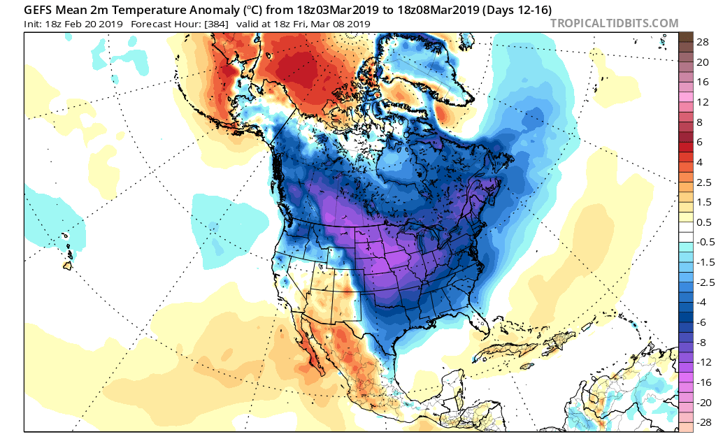
Days 12-16: A total transformation of the pattern has taken shape since the Day 1-5 period. The new ‘mean’ trough position takes up shop across the East with the AK ridge continuing to dislocate late season arctic air southeast. The GEFS also shows a reflection of a southwest ridge which can be helpful in the overall storm track that could potentially deliver more “meaningful” wintry systems across the OH and TN Valleys as we get into the first couple weeks of meteorological spring.
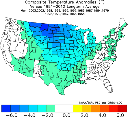
Side notes: We’ve reviewed the crashing SOI index and this increases our confidence in a much colder pattern developing (typically takes place around 10-12 days after the crash begins). We’ve noted the deeply negative values against the base state which would suggest the cold pattern should continue for some time. We still believe the pattern remains colder than average, overall, through the 1st half of March.
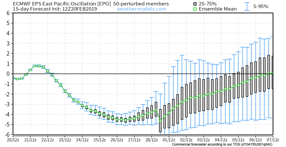
The latest deeply negative EPO adds fuel to the fire in the idea of a cold open to March.
Given this, there should be no surprise to see the cold anomalies showing up on the latest medium-long range ensemble guidance:
It sure appears March will come in like a lion; will it go out like a lamb?