Bet On The Cold…
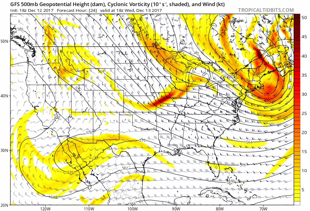
During wholesale pattern transitions, operational data will struggle at times, including some wild run-to-run swings. Earlier this week, the European wanted to put early next week in the lower 50s. At the same time, the GFS suggested lower single digits. Precisely, it was a difference of 46° between the two models for a high?! 🙂
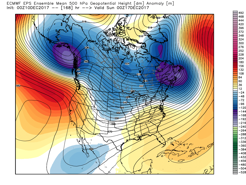
We note the teleconnections (in particular, the EPO) are aligning in a manner conducive for widespread cold.
 The GEFS might be a bit quick on dropping the arctic hammer, but the consistency of the model is impressive. Meanwhile, the European (even it’s ensemble data) has been much less consistent and has really been struggling the past couple of winters, overall, as a whole.
While we can argue as to just how cold it’ll get through the early part of February, the overwhelming message is that a prolonged colder than normal pattern will develop during this time period.
 Let’s also keep in mind that the initial cold onslaught is coming in the face of the MJO still rumbling through the warm phases. We note the European is consistently having to correct towards a more “amped up” MJO- swinging into the cold phases as we approach mid-month. And it’s mid-February that continues to have us concerned for the potential of truly nasty, severe cold.
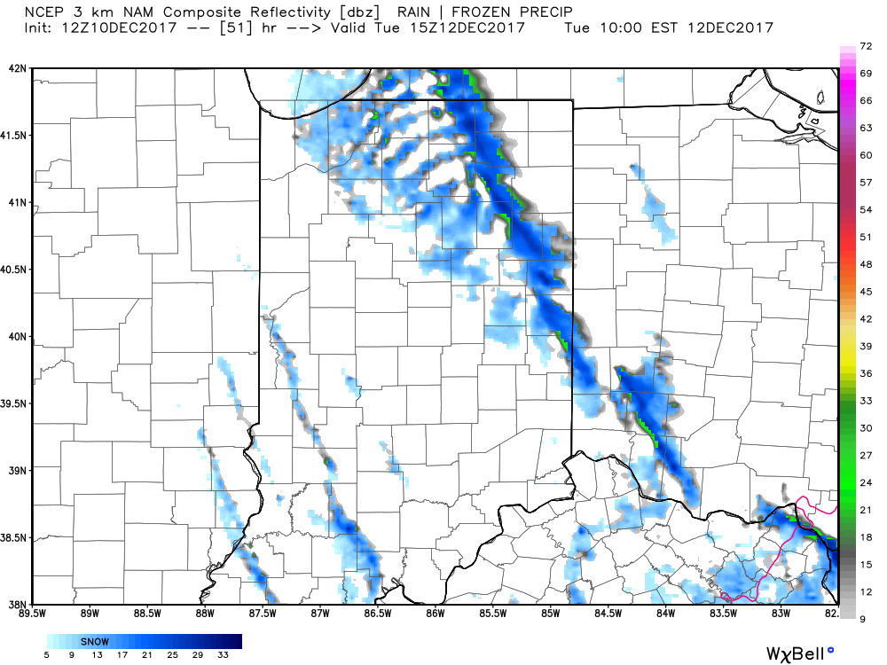
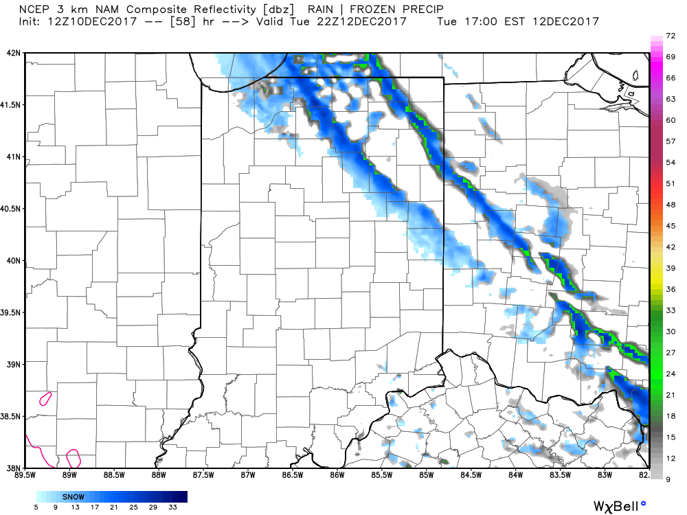
 As for snow, it’ll come in this pattern. Again, don’t get caught up in the operational output, but understand that the pattern over the upcoming 7-10 days favors numerous fast-moving snow systems. While most of these will be light, we’ll have to keep a close eye on things as the potential exists for one of these waves to spin up a moderate event.
As we look ahead to Week 2, the potential is there for a more widespread significant phased interior threat prior to the dumping of the bitterly cold air for mid-month.
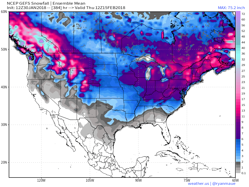
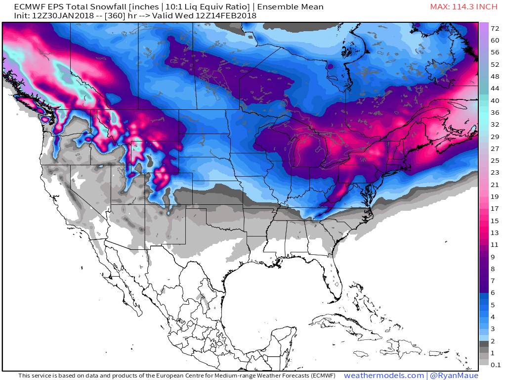
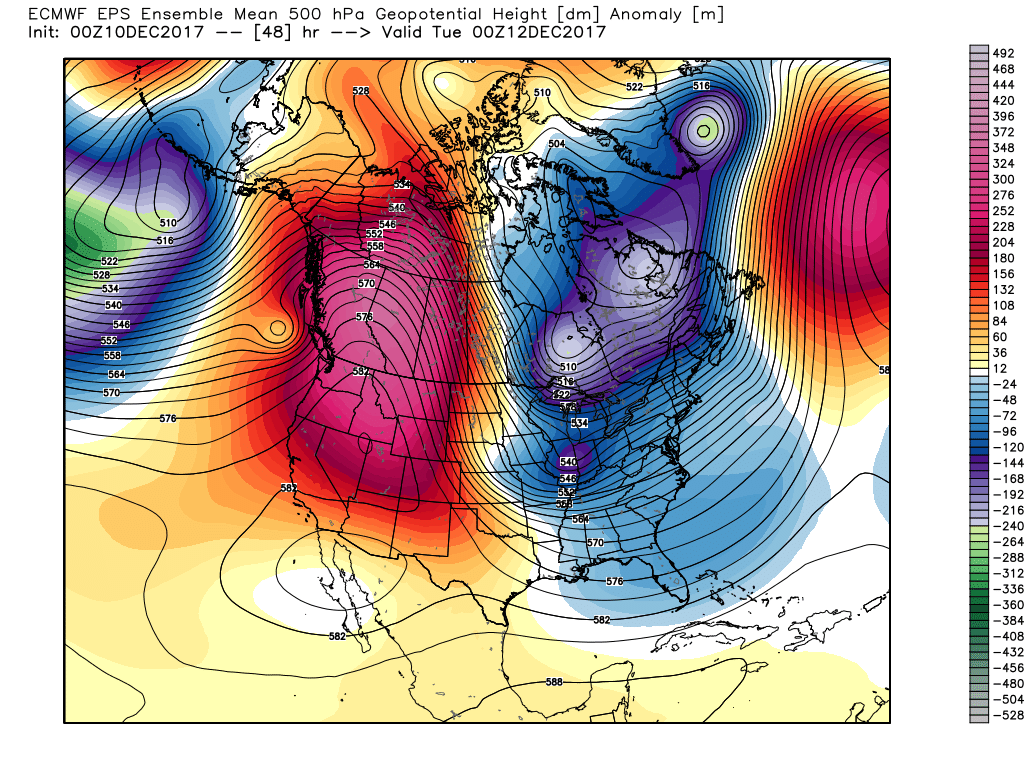
As it is, both the GEFS and EPS “mean” paint a bullish signal for piling snow up over the next couple weeks…
 Hang in there as we continue to sort through the data over the next few days. Once confidence increases (for or against an event), you’ll be the first to know! 🙂
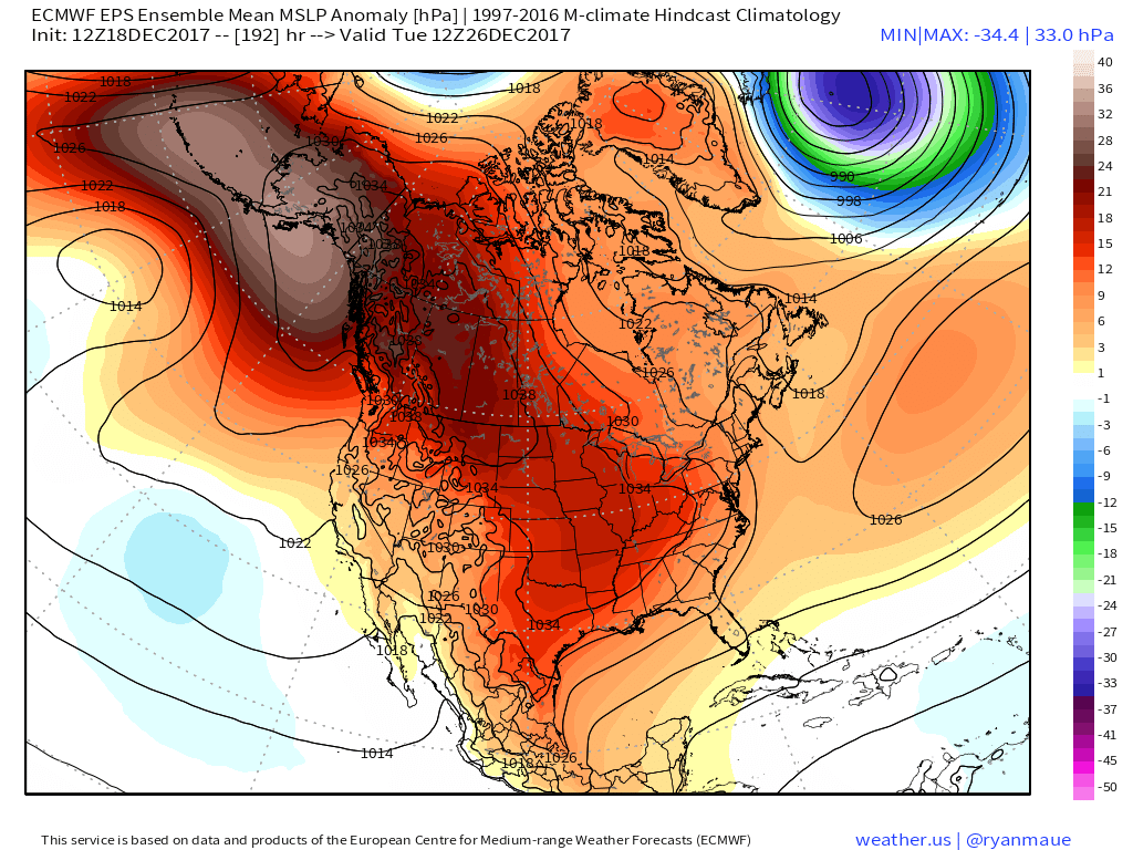 Recent operational data (GFS and Canadian included) has suggested a sprawling high in the range of 1050mb+ descending into the eastern slopes of the northern Rockies. Such a regime would be plenty capable of spreading sub-zero temperatures east into the Ohio Valley (with or without snow on the ground). Add in a biting north wind and wind chill values would drop to levels of dangerous and deadly levels if any length of time was spent outdoors. Some of the latest data paints a picture similar to shades of the famous ’13-14 winter (20° to 30° below zero chill factor). If you have travel plans over the Christmas holiday, please plan in advance to have a winter survival kit packed and loaded. It absolutely never hurts to be prepared.
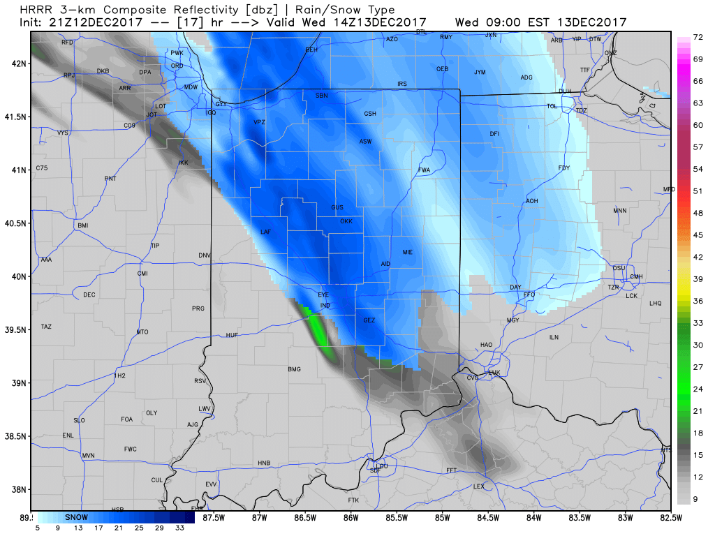
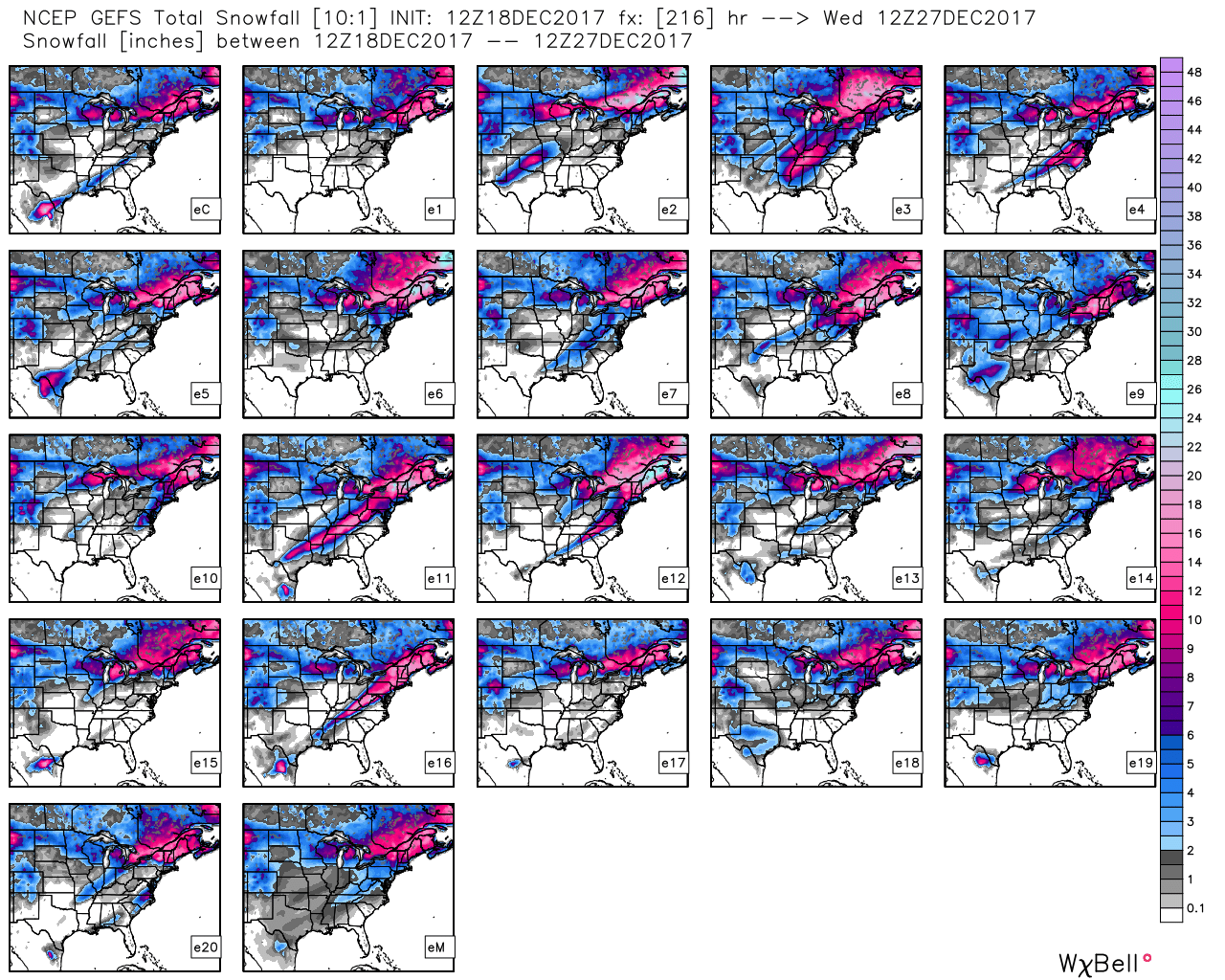
 III. A period of brief moderation will come in this pattern early Christmas week, but all eyes continue to focus on the period between December 22nd through December 26th for the potential of impactful weather across our region. For model “worshipers” out there, we suggest paying more attention to overall trends, and a blend of ensemble data, as opposed to specifics associated with operational runs. It’s a “jailbreak” pattern of sorts as true arctic air will be pouring down the Plains while the southeastern ridge tries to fight for a time. The resistance from the southeastern ridge and associated tight thermal gradient should promote a very stormy regime for the interior (Ohio Valley into the interior northeast) as we head into the true holiday/ Christmas stretch. As of now, we favor the idea of multiple waves along the pressing arctic boundary, as opposed to one big storm. Looking back through the records shows some of the heaviest snows at IND have come from similar set-ups. Understanding each set-up is unique, the overall pattern does have to raise an eye brow for potential of wintry weather in, or around, our region as Christmas approaches…
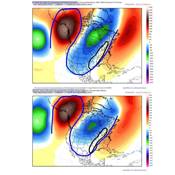
 This will keep highs in the middle 20s Tuesday with wind chill values in the single digits and teens most of the day.
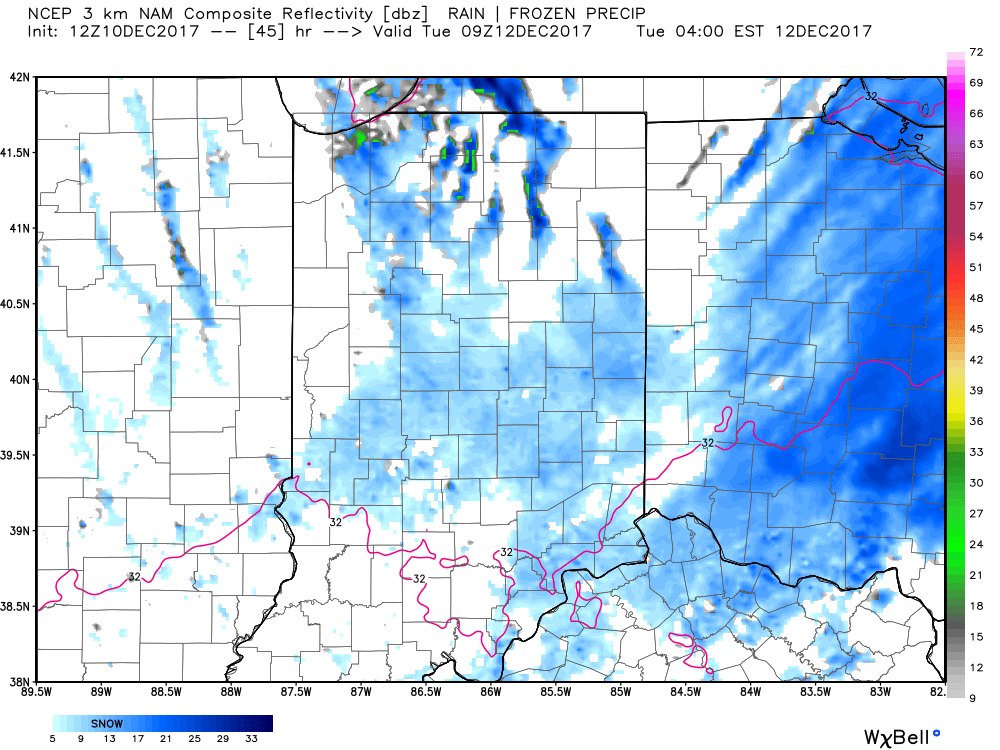
 This doesn’t last long as the pattern begins to reload as Christmas week approaches. As the evolution to a fresh cold pattern takes place, there’s a window of opportunity present for a more significant wintry system to potentially impact the Ohio Valley into the Mid Atlantic region. Notice the relatively “flat” ridge across the southern tier and associated tight thermal gradient. This look suggests we need to be on guard for the chance of a storm system to ride the thermal gradient in a west-to-east fashion, and has wintry implications for our region. Far too early for specifics; just know the possibility looms of a wintry event, locally, as Christmas week nears.
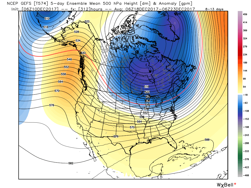
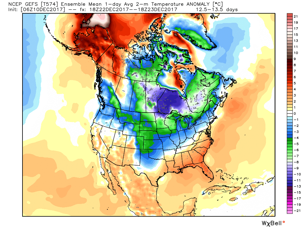 Speaking of Christmas, it sure appears as if cold will overwhelm the pattern for Christmas, itself, and the overall cold regime doesn’t show signs of letting up (with the exception of potentially a day or two) into the new year.