VIDEO: Watching For Storms Tonight Then A Quiet, Cooler Rest Of The Week…
You must be logged in to view this content. Click Here to become a member of IndyWX.com for full access. Already a member of IndyWx.com All-Access? Log-in here.
You must be logged in to view this content. Click Here to become a member of IndyWX.com for full access. Already a member of IndyWx.com All-Access? Log-in here.
You must be logged in to view this content. Click Here to become a member of IndyWX.com for full access. Already a member of IndyWx.com All-Access? Log-in here.
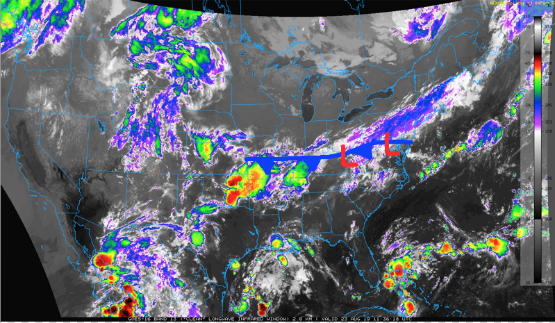
Every year is a bit different, but typically at some point between late August and early September we get that 1st cold frontal passage that serves as a reminder a new season is upon us. This year, that frontal passage is today.
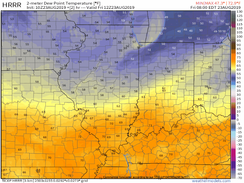
As the front continues to sink south, we’ll notice increasingly dry air building in to close the work week. Dew points will fall into the 50s by this afternoon.
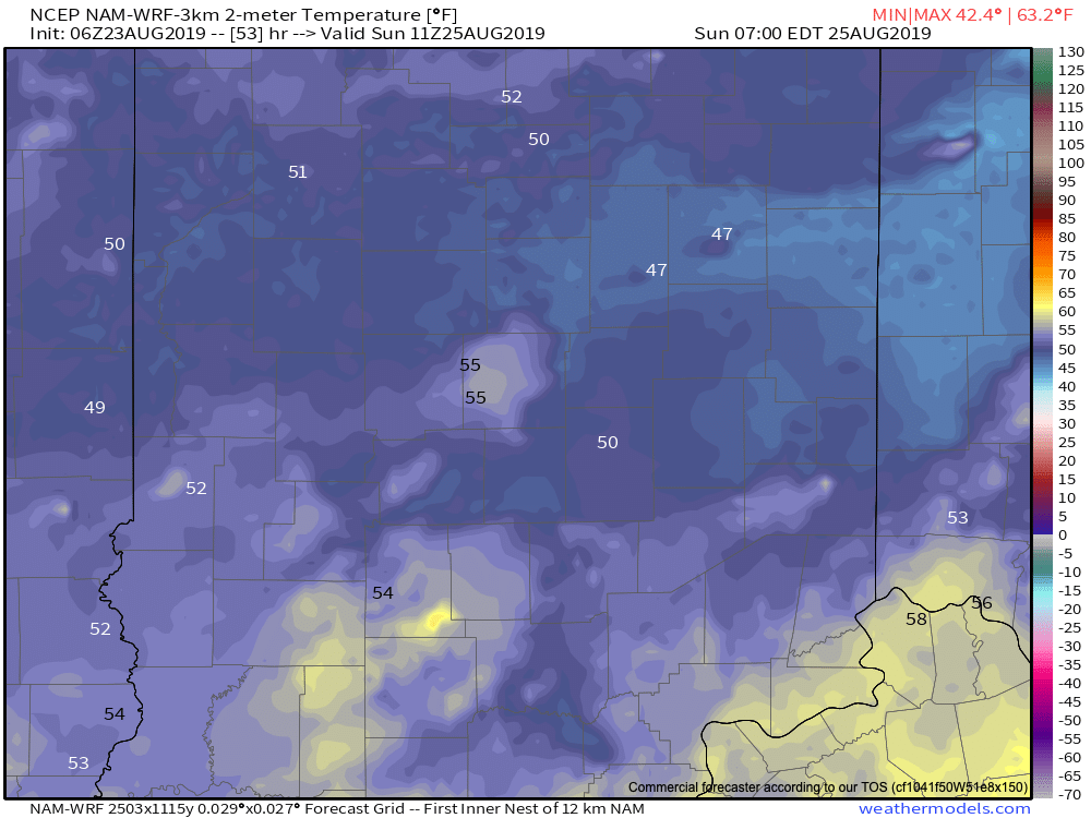
Cooler air will accommodate the drier air mass. Lows across central Indiana will fall into the lower and middle 50s (not totally out of the question a few communities fall into the 40s) both Saturday and Sunday mornings.
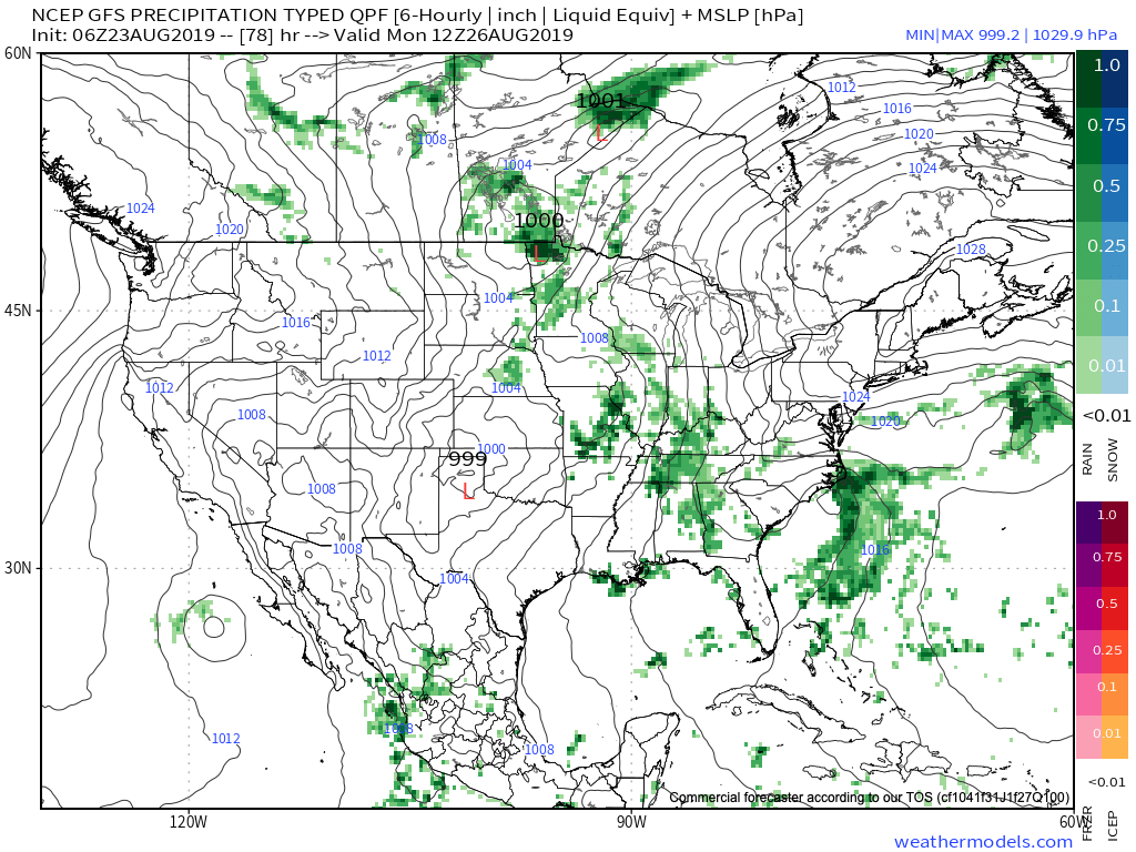
Dry conditions will prevail today and Saturday, and most of Sunday, too, for that matter. Our next storm system will lead to an increase in cloudiness Sunday PM and a couple of showers could follow. More widespread rain is anticipated to arrive Monday into Tuesday, and could be accompanied by a few storms. Early indications would suggest we’re looking at 0.50″ to 1″ with this system.
This will be ahead of a stronger trough that will serve to reinforce the unseasonably cool air as we head into the Labor Day weekend. If you’re a fan of this weekend, you’ll absolutely love what’s on tap next weekend (shave off a few more degrees both for lows and highs)!

With only (11) days left in meteorological summer, thoughts continue to focus more on the upcoming fall season.
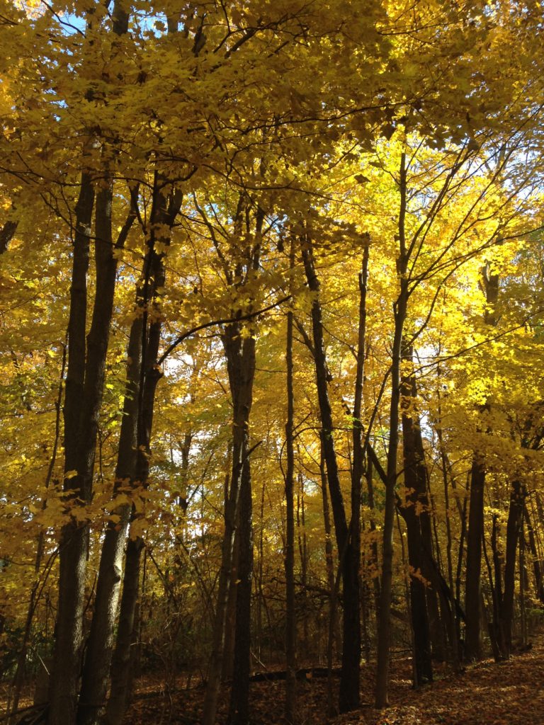
While fall foliage is still 5-6 weeks away from “prime time,” medium range computer models continue to suggest the new season will kick off on an unseasonably cool note.
Meteorological fall begins Sept. 1st and runs through the end of November. With that said, you don’t need me to tell you that Labor Day can still produce “summer-like” heat around these parts. On average across central Indiana, we’d expect Labor Day weekend to produce highs in the lower 80s and lows in the lower 60s.
That might be a different story this year as a negative EPO pattern dominates. The end result will likely feature a rather anomalous trough digging into our portion of the country to open up the new season. This is supported with solid agreement between the GEFS and EPS as shown below:

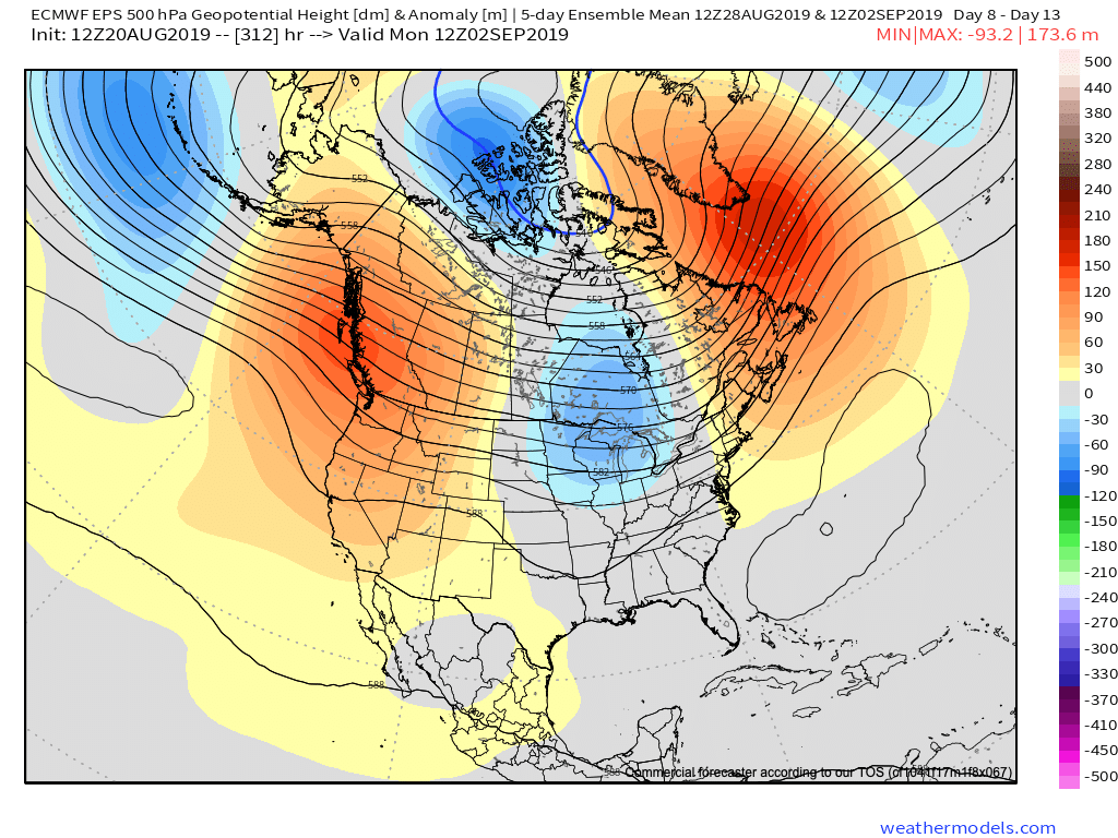
This will likely result in temperatures around 10 degrees (F) below average and most certainly serve as notice that a new season is upon us.
Now will this be an official end to summer-like warmth? Likely not, as there are reasons to believe unseasonably warm weather will build back into the region behind this cool blast. While we don’t want to use this post as our official fall outlook, despite it likely feeling very much like fall as the 1st full weekend of college football kicks off, we think there’s likely more warmth in the tank before we can signal the “all clear” on Summer ’19…
You must be logged in to view this content. Click Here to become a member of IndyWX.com for full access. Already a member of IndyWx.com All-Access? Log-in here.