VIDEO: Extended Period Of Excessive Heat Awaits…
You must be logged in to view this content. Click Here to become a member of IndyWX.com for full access. Already a member of IndyWx.com All-Access? Log-in here.
You must be logged in to view this content. Click Here to become a member of IndyWX.com for full access. Already a member of IndyWx.com All-Access? Log-in here.
You must be logged in to view this content. Click Here to become a member of IndyWX.com for full access. Already a member of IndyWx.com All-Access? Log-in here.
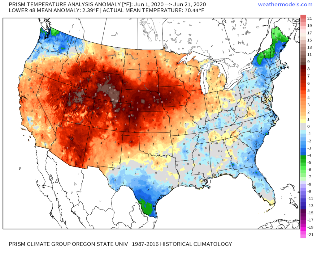
As we near the midpoint of meteorological summer (June, July, and August), we wanted to take a look at the season so far. Specifically for Indianapolis, summer 2020 thus far is running 2° above normal with rainfall (through June 21st) running below normal to the tune of 1.84″.

We’ve covered the shorter-term and increased chances of rain within that should bring the month closer to average when all is said and done, but we wanted to spend a little more time this afternoon looking ahead to the Independence Day holiday and 1st half of July, overall. As a reminder, our official July Outlook will be posted next week.
Similar to June, the first half of July is likely to promote a transitional upper air pattern. Part of this can be thanked to the EPO and recent SOI activity. In this transitional pattern, the expectation is that an upper level ridge will temporarily setup shop over the Ohio Valley and Great Lakes during the first few days of the month (Independence Day weekend included) which will support drier and hotter conditions. With such a pattern, temperatures should climb to the hottest levels of the season thus far (a couple days in the lower to middle 90s aren’t out of the question). While an isolated to widely scattered storm is possible, organized rain will be hard to come by during the medium range (July 2-6) time frame.
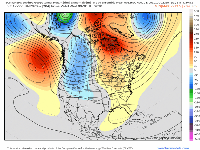
Thereafter, notice how the upper ridge begins to retrograde west. Ultimately, this is likely signaling the predominant upper pattern through mid and late summer (still think the most persistent heat and dryness takes up shop across the West into the Plains at times). More important to central Indiana with such a pattern is that this will likely put us in play for more organized rain and storm events as disturbances ride the periphery around the ‘mean’ upper ridge position. After a dry, hot first few days of the month, wetter and cooler times would likely ensue in the longer range (post July 6).
We’ll continue to keep close tabs on things and have our complete monthly outlook up next week. Just wanted to give you an idea this evening on some early thinking as the holiday weekend looms…
You must be logged in to view this content. Click Here to become a member of IndyWX.com for full access. Already a member of IndyWx.com All-Access? Log-in here.
You must be logged in to view this content. Click Here to become a member of IndyWX.com for full access. Already a member of IndyWx.com All-Access? Log-in here.