Updated 12.01.23 @ 7:44a
Though far from a blowtorch, the pattern over the next couple weeks (1st half of December) will feature milder than normal temperatures.
The pattern drivers, starting first and foremost with the MJO (more on the impacts late December in a moment), suggest milder than normal times should hold through the first half of December overall.
The EPO is also forecast predominantly positive with an erratic PNA pattern. Bottom line, all combined, this should promote an overall mild open to the month with a lack of any sort of significant winter weather threats.
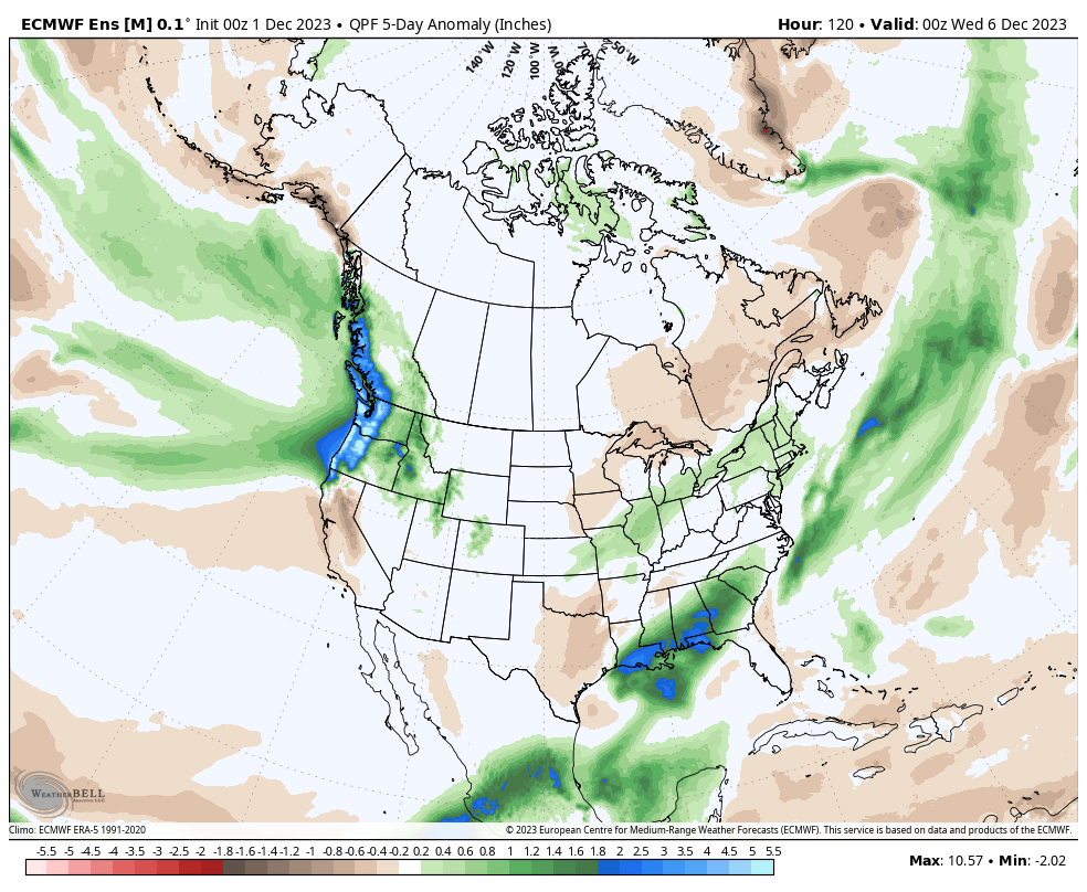
The period opens wet and finishes (mid-month) that way with dryness in between.
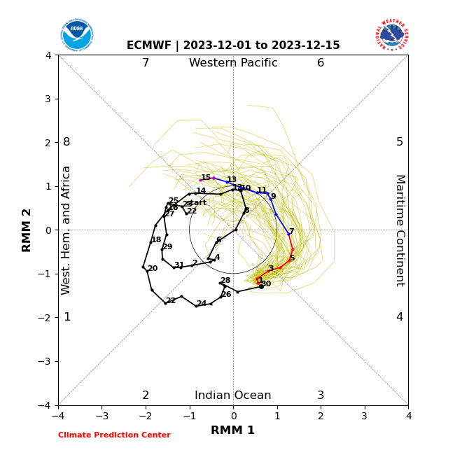
Focusing in more on the MJO helps illustrate the story we’re telling not only over the next couple weeks, but into early 2024.
We’re currently in the warmest phases of the MJO this time of year (3, 4, and 5 in particular), but things start to change once to Phase 6 and beyond.
Many times, cold, arctic air begins to build on our side of the pole in Phase 6 and then busts loose in Phases 7 and 8. I think that’s on the table for us this year given where it appears the MJO wants to head and this is backed by long range teleconnection charts (namely the EPO and PNA) seemingly wanting to also head into the traditional colder phases, respectively.
This image will show the progression and corresponding upper level pattern nicely.
To close, while the first half of the month doesn’t appear to be overly kind to winter weather enthusiasts, it continues to look like the combination of the MJO, EPO, and PNA are aligning in a manner that will deliver more of a wholesale pattern change to colder than normal times past mid month and especially after the 20th. By that timeframe, we’ll have to start monitoring storm systems to potentially have a more wintry theme to them.