[
You must be logged in to view this content. Click Here to become a member of IndyWX.com for full access. Already a member of IndyWx.com All-Access? Log-in here.

Jan 27
[
You must be logged in to view this content. Click Here to become a member of IndyWX.com for full access. Already a member of IndyWx.com All-Access? Log-in here.
Permanent link to this article: https://indywx.com/period-of-severe-cold-arrives-early-mid-week/
Jan 02
Although we’re dealing with areas of drizzle, low clouds, and fog this morning, a relatively quiet period of weather is ahead as we put a wrap on the week and head through the weekend. At one time what I thought would be a more significant storm system and associated eastern wintry threat won’t come to fruition. While the eastern seaboard will deal with rain Friday into Saturday, we should remain free of any significant precipitation here on the home front.
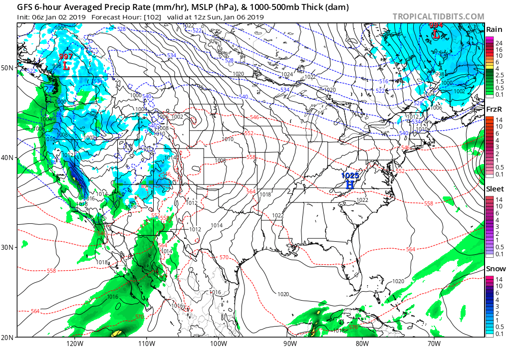
Weak high pressure will keep us dry with increasing sunshine through the weekend.
Our next storm system will arrive as we open up next week and we’ll forecast increasing rain chances next Monday. From this distance, moisture return isn’t terribly impressive and rainfall amounts should remain generally in the 0.25″ to 0.75″ range.
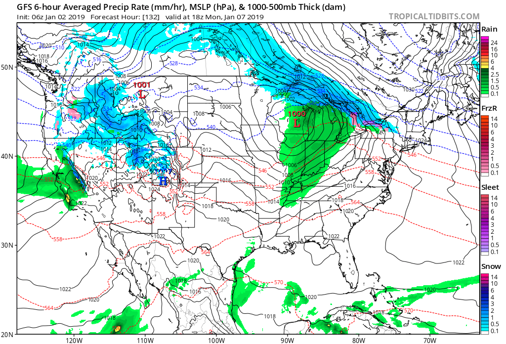
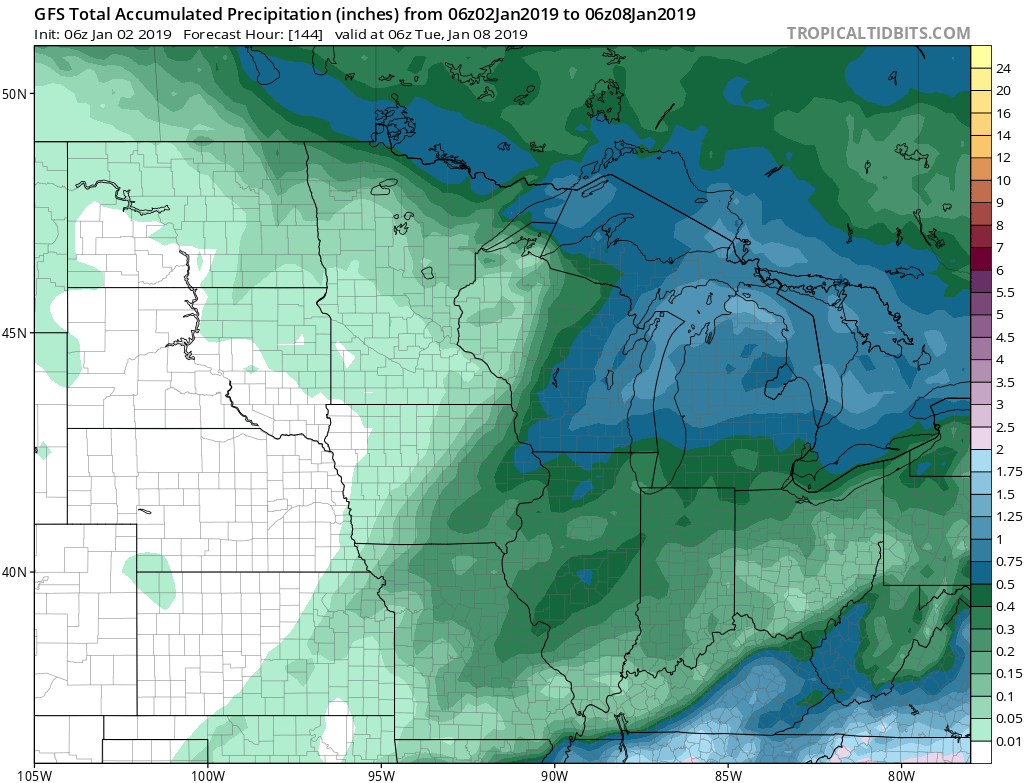 Colder air will follow behind this storm system with more authority and those wishing and hoping for legitimate wintry conditions may finally have their wish as we get closer to mid month. Speaking of cold and wintry times, we’ll have more on our updated long range thoughts later this week.
Permanent link to this article: https://indywx.com/quiet-period-of-weather-into-early-next-week/
Sep 10
You must be logged in to view this content. Click Here to become a member of IndyWX.com for full access. Already a member of IndyWx.com All-Access? Log-in here.
Permanent link to this article: https://indywx.com/improving-weather-this-week/
Aug 01
You must be logged in to view this content. Click Here to become a member of IndyWX.com for full access. Already a member of IndyWx.com All-Access? Log-in here.
Permanent link to this article: https://indywx.com/video-foggy-open-to-august-discussing-rain-chances-ahead/
Feb 23
Today will feature a continuation of gloomy conditions, including areas of fog and drizzle- especially this morning.
Thankfully, most of central Indiana will get a break from significant rainfall through the majority of our Friday, but a new batch of steady to occasionally heavy rain will build in overnight into the day Saturday.
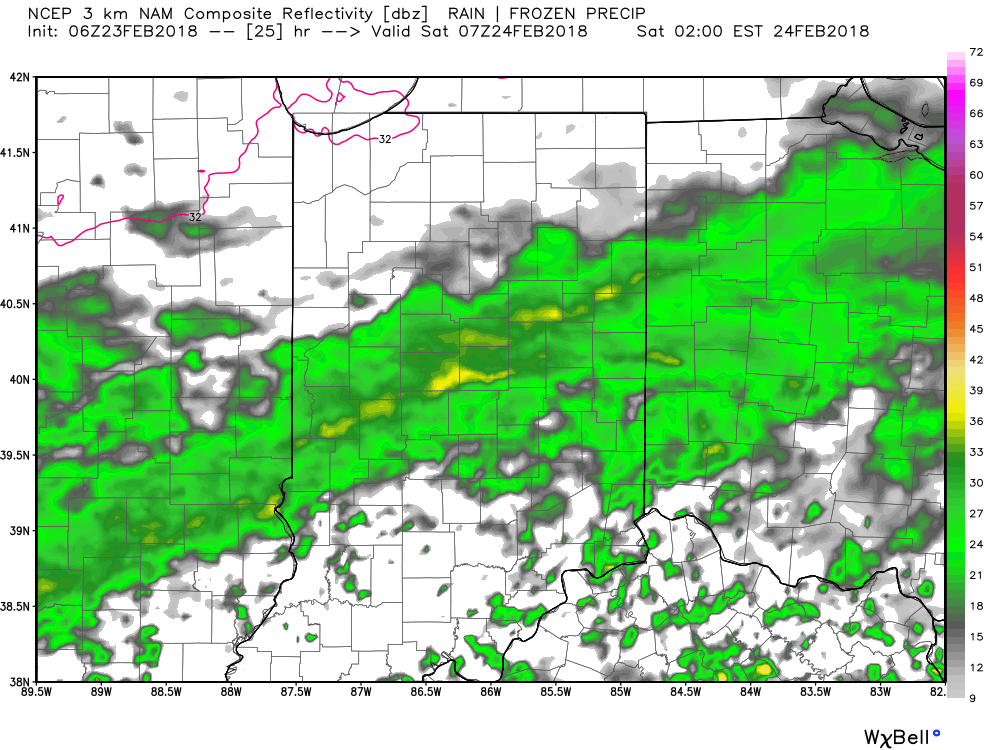
Forecast radar 2a Saturday.
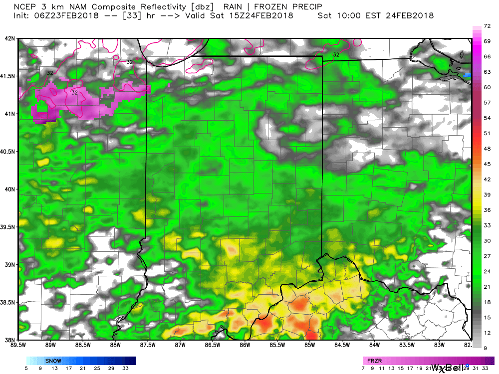
Forecast radar 10a Saturday.
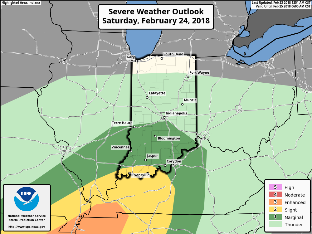
We’ll add thunderstorms into the forecast Saturday night into the predawn hours Sunday as a deepening surface low tracks into the Great Lakes and sweeps a cold front through the state Sunday morning. A couple of these storms could become strong across central Indiana and even severe downstate. As such, the Storm Prediction Center (SPC) has included the southern half of Indiana in a “marginal” risk of severe during this time period. We’ll keep a close eye on models over the next 24 hours as it’s possible this marginal and slight risk may need to be expanded further north.
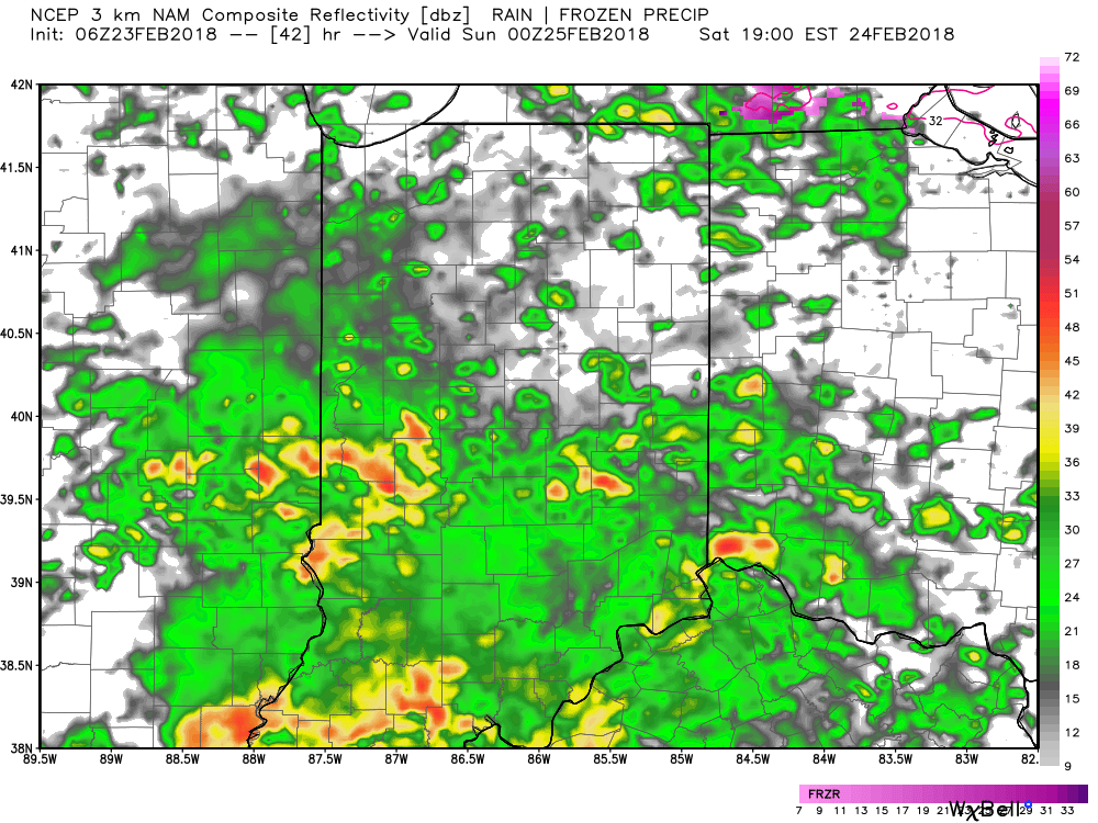
Forecast radar 7p Saturday.
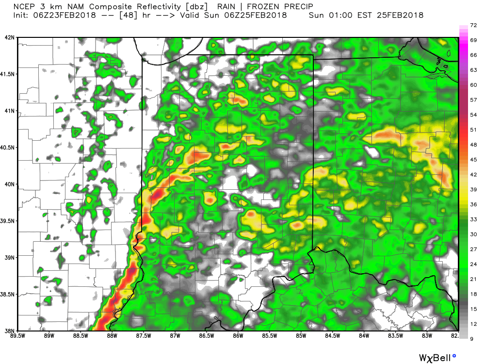
Forecast radar 1a Sunday.
Thankfully, drier air will quickly sweep into the state Sunday afternoon and this should allow sunshine to return as we close the weekend. Beforehand, additional rainfall of 1″ to 2″ will be widespread across central Indiana with locally heavier totals.
High pressure will settle overhead to open the new work week, allowing for a quieter time of things before a new active period develops by the middle of the week…

Permanent link to this article: https://indywx.com/wet-weekend-gives-way-to-a-drier-open-to-the-new-week/