
I. A weak weather system will result in light precipitation (mostly snow) overspreading central and northern portions of the state later this evening into the overnight. Moisture looks less and less impressive with each and every model run, but we’ll still go with a slushy coating to less than 1″ for the city, itself with a general 1″ to 2″ of wet snow for communities off to the north of the city. Additionally, a lake effect snow band should get going Tuesday morning and this band may make it south into east-central Indiana in a weakened state.

Light snow will overspread the region tonight. Image courtesy of Weathermodels.com.
 II. Another push of unseasonably cold air will pour south into the region behind this storm system and set the stage for a potentially interesting time of things when a new storm system approaches a bit later in the week…
 III. A very complex storm system will impact the area Thursday. While there are many details that are yet to be worked out, someone across the mid-south into the Ohio Valley will likely get a “plowable” snow out of this event. Initially, available cold air will be marginal, but with an expected strong upper level low, this storm system is likely to “manufacture” its’ own cold air and result in a swath of heavy, wet snow to the north and northwest of where the upper low tracks. Stay tuned.
 Behind this storm, you guessed it- cold air will reinforce itself across the region heading into next weekend!
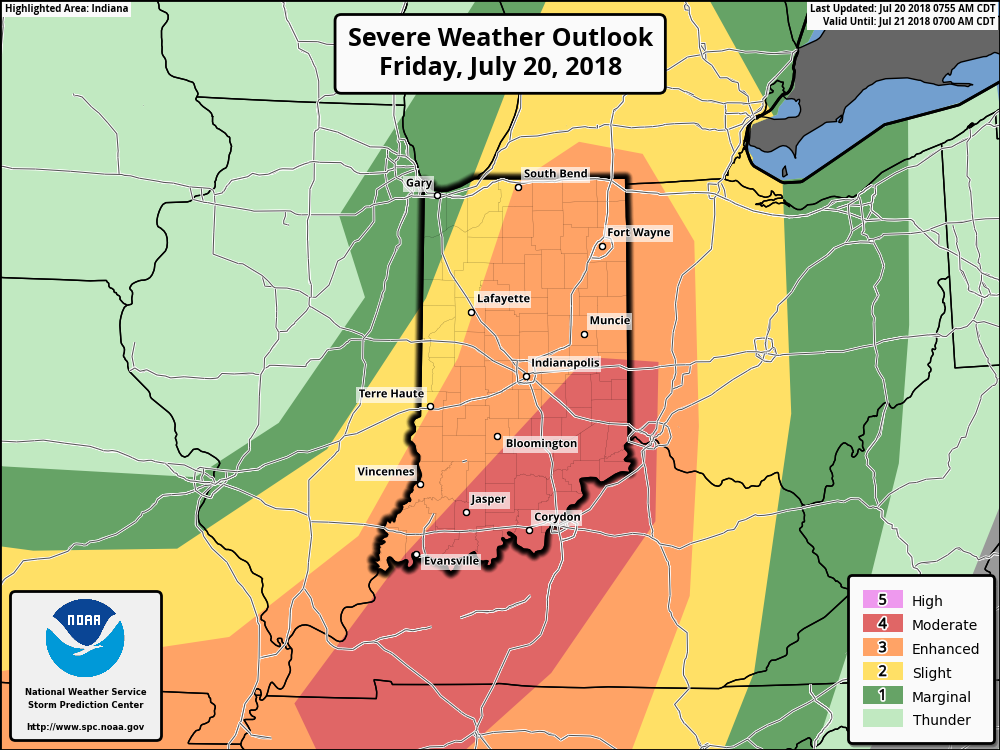
 Some of the storms across the northern third of the state may “pulse” to severe levels this evening, including the potential of large hail and damaging winds. (This complex will weaken as it surges south later tonight).
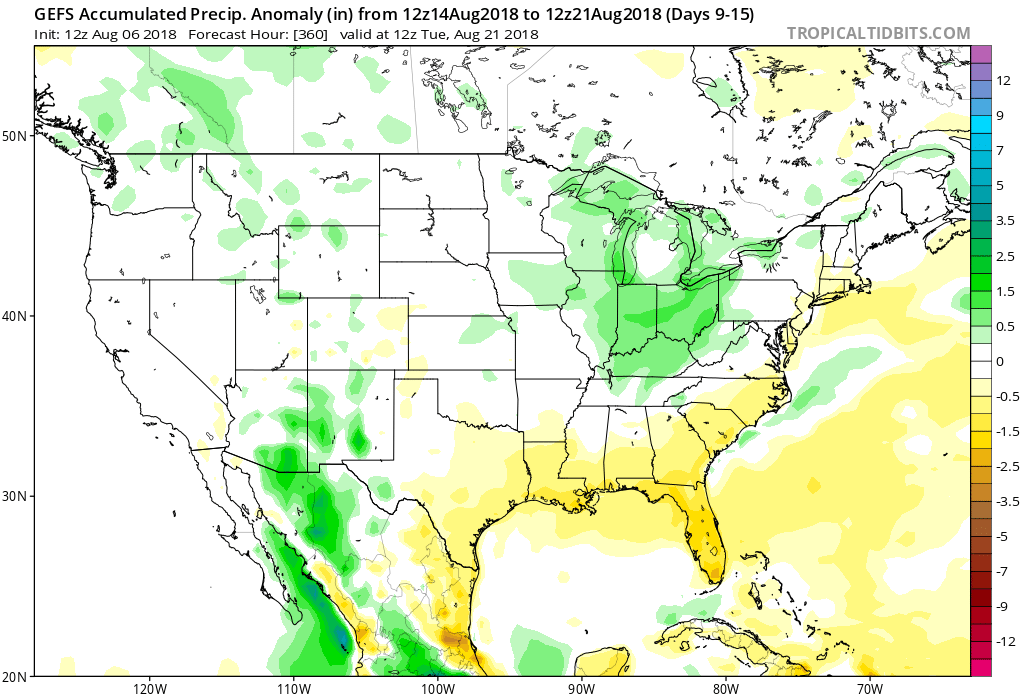
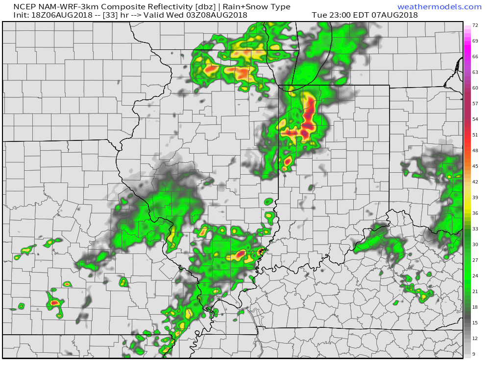 Eventually, drier times will return by mid-week. Beforehand, most central Indiana rain gauges should receive somewhere between 0.50″ to 1″ of rain. With a rich, tropical airmass in place, there will be some locally heavier totals.
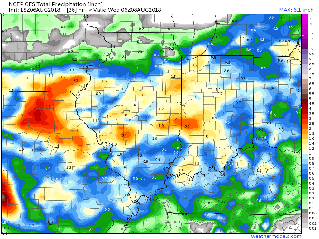
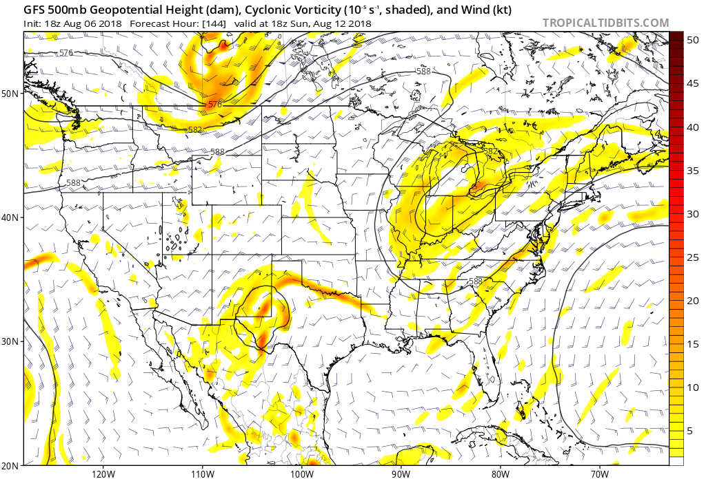
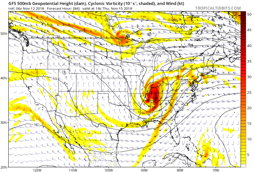
 Part of the reason behind today’s severe weather has to do with an overall pattern shift. An intense short wave trough (especially for this time of year) will dig into the Great Lakes and Ohio Valley. At the surface, an area of low pressure will track from southern WI (this morning) before “cutting off” over the Ohio Valley this weekend. Additionally, a couple of frontal boundaries will swing through the state- the most potent being the boundary that surges east this afternoon and evening. The combination of ingredients spell trouble across at least a portion of the region- especially from Indianapolis and points south and east this afternoon and evening.