You must be logged in to view this content. Click Here to become a member of IndyWX.com for full access. Already a member of IndyWx.com All-Access? Log-in here.
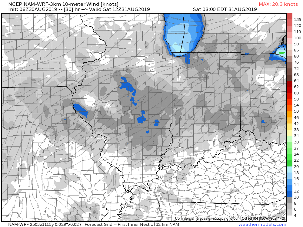
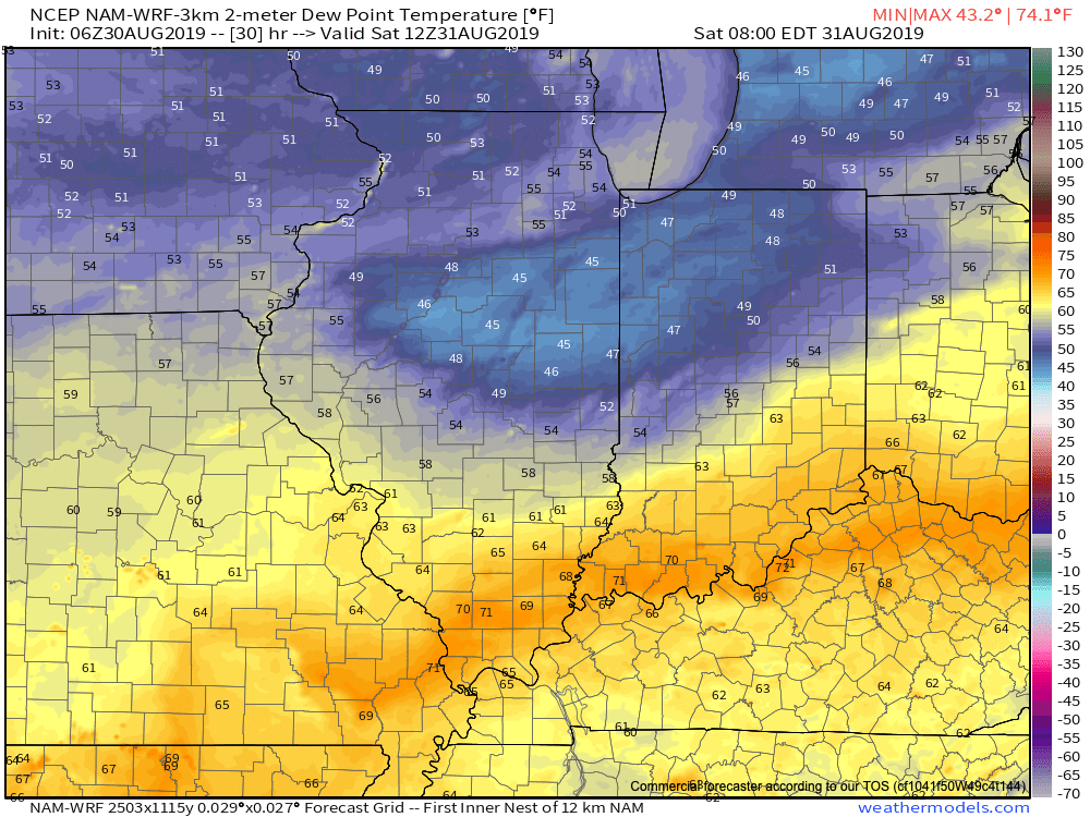
A frontal boundary will continue to settle south this morning and we’ll notice a much less humid feel tonight into Saturday morning as a northeast wind takes hold.
Dew points will fall into the 50s tonight into Saturday morning across the northern half of the state.
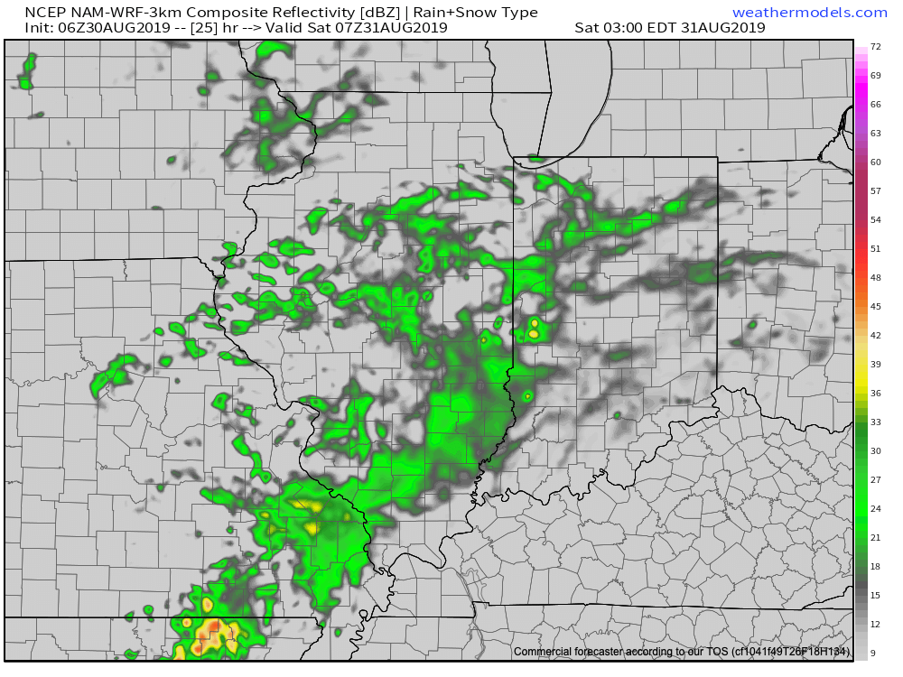
Widely scattered light showers will scoot across the state late tonight into Saturday morning.
We’re still not expecting heavy or widespread organized rain this Labor Day weekend- just widely scattered “nuisance” level showers at times. There will be many more dry hours than wet through the holiday weekend.
Most area rain gauges can expect to pick up between 0.25″ and 0.50″ by Monday afternoon.
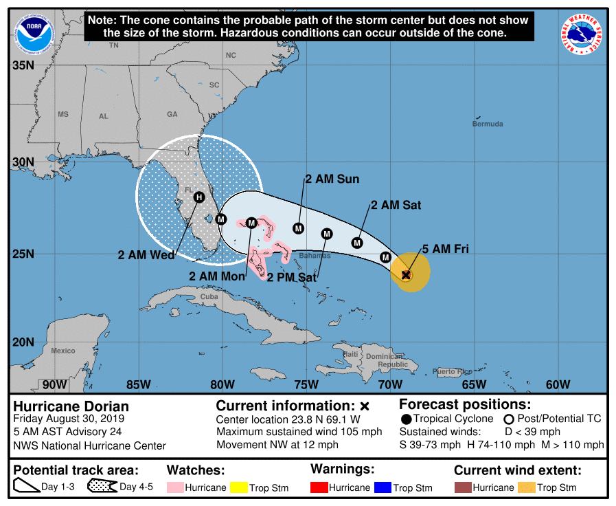
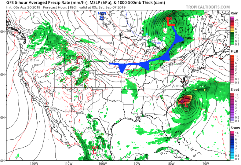
The big story this weekend will be Hurricane Dorian. We anticipate Dorian to strengthen into a major hurricane later today. The latest official National Hurricane Center forecast brings Dorian into the southeast Florida peninsula as a major hurricane late Labor Day night or Tuesday. While confidence continues to increase on an eventual landfall along the Florida peninsula (before a hard turn right that would take Dorian either north across the peninsula or perhaps wobble back off shore), timing is much more uncertain as the majority of data has slowed the forward progress of Dorian this weekend. If you have interests across the state or loved ones in the path of the storm, it’ll be important to stay tuned for future updates.
Back here on the home front, quiet weather is expected through early week. The first of 2 cold fronts will pass Tuesday night or early Wednesday (little in the way of fanfare with that frontal passage).
The second front will be a bigger deal late next week. Though still rather moisture starved, it’s the drop in temperatures expected behind the frontal passage that will be impressive. We’ll notice an October-level chill next weekend as this front sweeps off to the southeast. We note the latest European data has highs only in the 60s next weekend with lows in the 40s.
Meanwhile, it’s very possible we’ll still be dealing with Dorian this time next week along the southeast US costal region…
Much more through the weekend, including updates on Dorian, the season’s 1st strong fall frontal passage, and our September Outlook.
You must be logged in to view this content. Click Here to become a member of IndyWX.com for full access. Already a member of IndyWx.com All-Access? Log-in here.
You must be logged in to view this content. Click Here to become a member of IndyWX.com for full access. Already a member of IndyWx.com All-Access? Log-in here.
You must be logged in to view this content. Click Here to become a member of IndyWX.com for full access. Already a member of IndyWx.com All-Access? Log-in here.